Cecil-Pacolet complex, 7 to 15 percent slopes, eroded
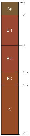
Cecil
(45%)
Acidic upland forest, moist
Typic Kanhapludults
Well drained
Hydric: No
PAWS: 26 cm
hillslopes / Shoulder
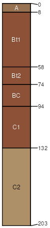
Pacolet
(35%)
Acidic upland forest, moist
Typic Kanhapludults
Well drained
Hydric: No
PAWS: 20 cm
hillslopes / Shoulder
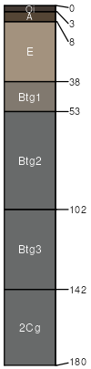
Partlow
(4%)
Typic Endoaquults
Poorly drained
Hydric: Yes
PAWS: 27 cm
drainageways / Summit
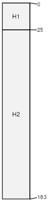
Fluvaquents
(4%)
Poorly drained
Hydric: Yes
PAWS: 26 cm
flood plains
SSA
Scale
Published
Export
va177
1:16,000
1980
2025-09-08