Official Series Description


Lab Data Summary

Aggregate lab data for the WAISKA soil series. This aggregation is based on all pedons with a current taxon name of WAISKA, and applied along 1-cm thick depth slices. Solid lines are the slice-wise median, bounded on either side by the interval defined by the slice-wise 5th and 95th percentiles. The median is the value that splits the data in half. Five percent of the data are less than the 5th percentile, and five percent of the data are greater than the 95th percentile. Values along the right hand side y-axis describe the proportion of pedon data that contribute to aggregate values at this depth. For example, a value of "90%" at 25cm means that 90% of the pedons correlated to WAISKA were used in the calculation. Source: KSSL snapshot . Methods used to assemble the KSSL snapshot used by SoilWeb / SDE

Click the image to view it full size.

Pedons used in the lab summary:

MLRALab IDPedon IDTaxonnameCINSSL / NASIS ReportsLink To SoilWeb GMap
93B07N0010U06MI083-019Waiska6Primary | Supplementary | Taxonomy | Pedon | Water Retention | Correlation | Andic Soil Properties47.8504982,-89.1853867

Water Balance

Monthly water balance estimated using a leaky-bucket style model for the WAISKA soil series. Monthly precipitation (PPT) and potential evapotranspiration (PET) have been estimated from the 50th percentile of gridded values (PRISM 1981-2010) overlapping with the extent of SSURGO map units containing each series as a major component. Monthly PET values were estimated using the method of Thornthwaite (1948). These (and other) climatic parameters are calculated with each SSURGO refresh and provided by the fetchOSD function of the soilDB package. Representative water storage values (“AWC” in the figures) were derived from SSURGO by taking the 50th percentile of profile-total water storage (sum[awc_r * horizon thickness]) for each soil series. Note that this representation of “water storage” is based on the average ability of most plants to extract soil water between 15 bar (“permanent wilting point”) and 1/3 bar (“field capacity”) matric potential. Soil moisture state can be roughly interpreted as “dry” when storage is depleted, “moist” when storage is between 0mm and AWC, and “wet” when there is a surplus. Clearly there are a lot of assumptions baked into this kind of monthly water balance. This is still a work in progress.

Click the image to view it full size.


Click the image to view it full size.

Sibling Summary

Siblings are those soil series that occur together in map units, in this case with the WAISKA series. Sketches are arranged according to their subgroup-level taxonomic structure. Source: SSURGO snapshot , parsed OSD records and snapshot of SC database .

Click the image to view it full size.

Select annual climate data summaries for the WAISKA series and siblings. Series are sorted according to hierarchical clustering of median values. Source: SSURGO map unit geometry and 1981-2010, 800m PRISM data .

Click the image to view it full size.

Geomorphic description summaries for the WAISKA series and siblings. Series are sorted according to hierarchical clustering of proportions and relative hydrologic position within an idealized landform (e.g. top to bottom). Most soil series (SSURGO components) are associated with a hillslope position and one or more landform-specific positions: hills, mountain slopes, terraces, and/or flats. Proportions can be interpreted as an aggregate representation of geomorphic membership. The values printed to the left (number of component records) and right (Shannon entropy) of stacked bars can be used to judge the reliability of trends. Small Shannon entropy values suggest relatively consistent geomorphic association, while larger values suggest lack thereof. Source: SSURGO component records .

Click the image to view it full size.

Click the image to view it full size.

There are insufficient data to create the 3D mountains figure.

Click the image to view it full size.

Click the image to view it full size.

Competing Series

Soil series competing with WAISKA share the same family level classification in Soil Taxonomy. Source: parsed OSD records and snapshot of the SC database .

Click the image to view it full size.

Select annual climate data summaries for the WAISKA series and competing. Series are sorted according to hierarchical clustering of median values. Source: SSURGO map unit geometry and 1981-2010, 800m PRISM data .

Click the image to view it full size.

Geomorphic description summaries for the WAISKA series and competing. Series are sorted according to hierarchical clustering of proportions and relative hydrologic position within an idealized landform (e.g. top to bottom). Proportions can be interpreted as an aggregate representation of geomorphic membership. Most soil series (SSURGO components) are associated with a hillslope position and one or more landform-specific positions: hills, mountain slopes, terraces, and/or flats. The values printed to the left (number of component records) and right (Shannon entropy) of stacked bars can be used to judge the reliability of trends. Shannon entropy values close to 0 represent soil series with relatively consistent geomorphic association, while values close to 1 suggest lack thereof. Source: SSURGO component records .

Click the image to view it full size.

Click the image to view it full size.

There are insufficient data to create the 3D mountains figure.

Click the image to view it full size.

Click the image to view it full size.

Soil series sharing subgroup-level classification with WAISKA, arranged according to family differentiae. Hovering over a series name will print full classification and a small sketch from the OSD. Source: snapshot of SC database .

Block Diagrams

Click a link below to display the diagram. Note that these diagrams may be from multiple survey areas.

  1. MI-2010-09-10-06 | Keweenaw County Area - 2006

    Typical pattern of soils and parent material in the Deer Park-Rubicon-Croswell association (Soil Survey of Keweenaw County Area, Michigan; 2006).

  2. MI-2010-09-10-07 | Keweenaw County Area - 2006

    Typical pattern of soils and parent material in the Garlic-Waiska-Alcona association (Soil Survey of Keweenaw County Area, Michigan; 2006).

  3. MI-2010-09-10-09 | Keweenaw County Area - 2006

    Typical pattern of soils and parent material in the Arcadian-Michigamme-Rock outcrop association (Soil Survey of Keweenaw County Area, Michigan; 2006).

  4. MI-2010-09-10-10 | Keweenaw County Area - 2006

    Typical pattern of soils and parent material in the Montreal-Paavola-Arcadian association (Soil Survey of Keweenaw County Area, Michigan; 2006).

  5. MI-2010-09-10-12 | Keweenaw County Area - 2006

    Typical pattern of soils and parent material in the Arcadian-Nipissing-Rock outcrop association (Soil Survey of Keweenaw County Area, Michigan; 2006).

  6. MI-2010-09-10-13 | Keweenaw County Area - 2006

    Typical pattern of soils and parent material in the Munising-Yalmer-Garlic association (Soil Survey of Keweenaw County Area, Michigan; 2006).

  7. MI-2012-02-06-20 | Houghton County Area - October 1991

    Typical pattern of soils and parent material in the Trimountain-Paavola-Net association (Soil Survey of Houghton County Area, Michigan; October 1991).

  8. MI-2012-02-06-22 | Houghton County Area - October 1991

    Typical pattern of soils and parent material in the Kalkaska-Liminga-Waiska association (Soil Survey of Houghton County Area, Michigan; October 1991).

Map Units

Map units containing WAISKA as a major component. Limited to 250 records.

Map Unit Name Symbol Map Unit Area (ac) Map Unit Key National Map Unit Symbol Soil Survey Area Publication Date Map Scale
Waiska cobbly loamy sand, 0 to 6 percent slopes, very stony40B110514552691kvb5mi00320071:24000
Waiska stony sandy loam, 1 to 6 percent slopes, extremely bouldery236B79014553761kvfmmi00320071:24000
Waiska stony sandy loam, 6 to 15 percent slopes, extremely bouldery236D44214553771kvfnmi00320071:24000
Chocolay-Waiska complex, 1 to 6 percent slopes, very stony165B40614553301kvd4mi00320071:24000
Waiska sand, 0 to 8 percent slopes54B2513414993fxtwmi01319841:20000
Waiska sand, 8 to 15 percent slopes54D408414994fxtxmi01319841:20000
Waiska-Sundog complex, esker, 6 to 55 percent slopes8092E24324507912n87smi01319841:20000
Waiska sandy loam, 0 to 6 percent slopes78B1272415167fy0hmi03319891:15840
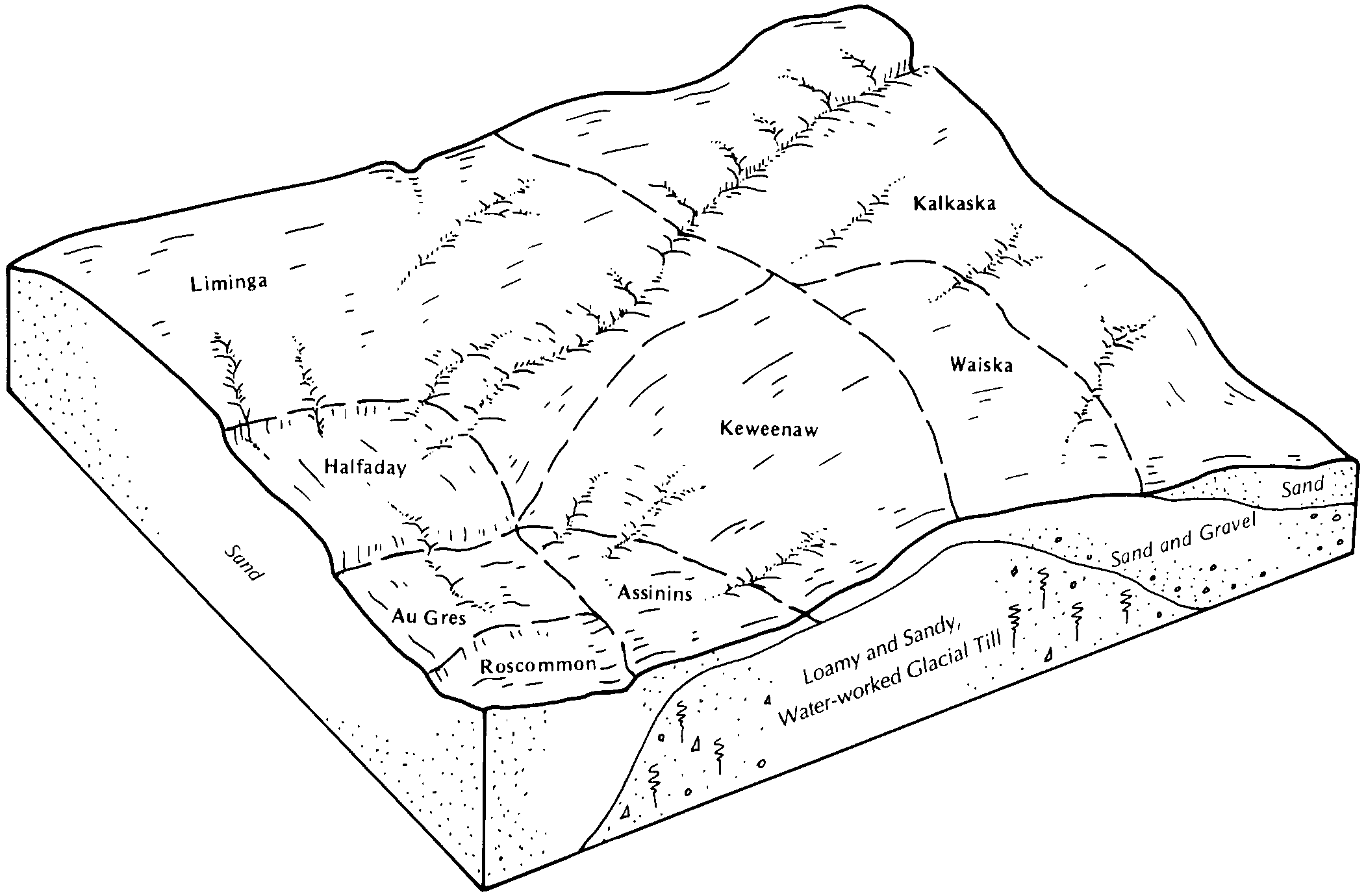
Kalkaska-Waiska complex, 2 to 18 percent slopes435C46114561481kw7jmi05320071:24000
Waiska-Amasa complex, esker, 18 to 35 percent slopes524D39114563111kwdsmi05320071:24000
Waiska-Amasa complex, esker, 6 to 18 percent slopes524C6314563101kwdrmi05320071:24000
Kalkaska-Waiska complex, 18 to 35 percent slopes435D4414561491kw7kmi05320071:24000
Kalkaska-Waiska complex, 35 to 55 percent slopes435E1814561501kw7lmi05320071:24000
Waiska-Amasa complex, esker, 35 to 50 percent slopes524E1714563121kwdtmi05320071:24000
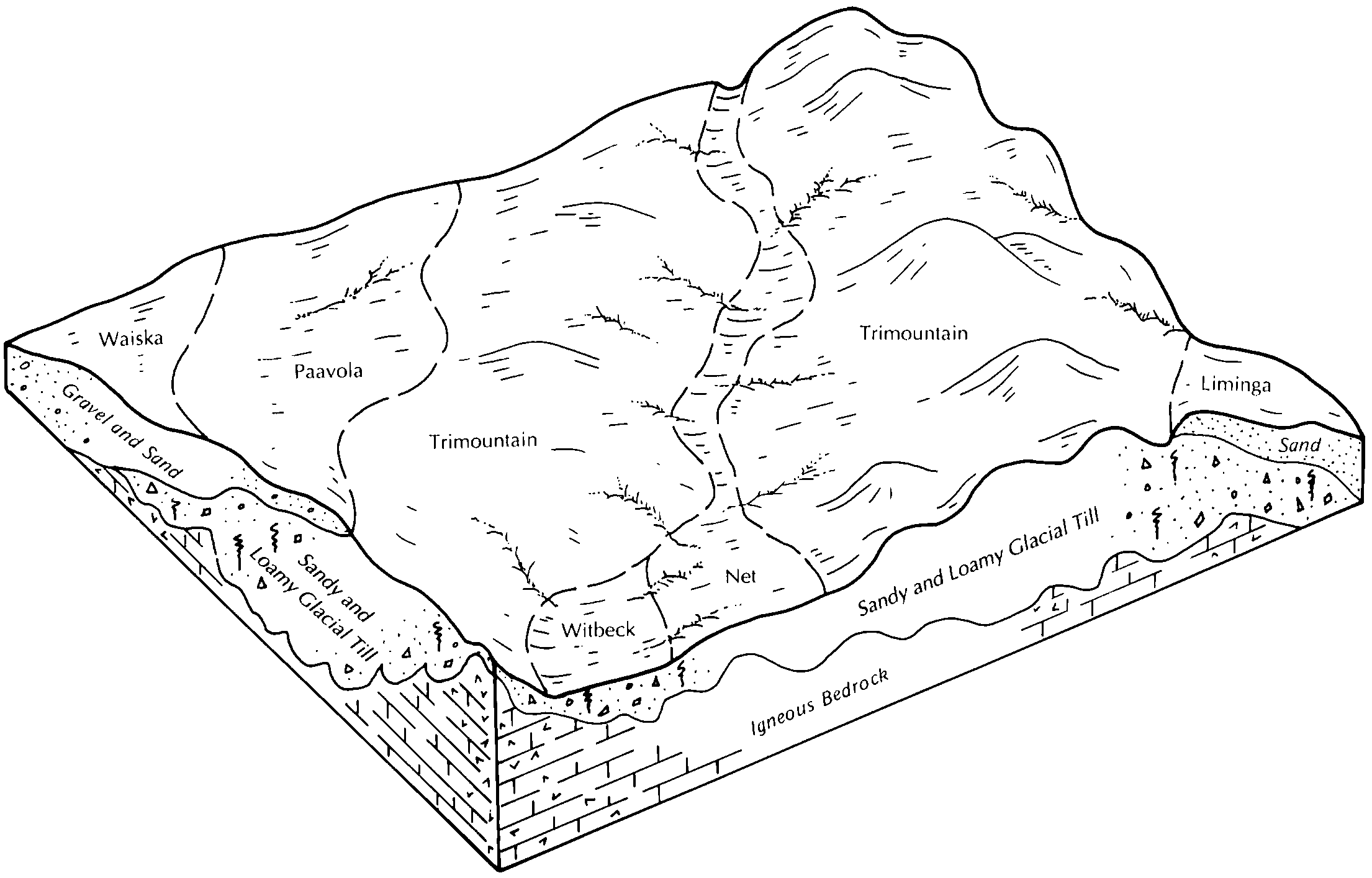
Montreal-Paavola-Waiska complex, 1 to 8 percent slopes139B11210416078fyywmi06119891:20000
Kalkaska-Waiska sands, 0 to 8 percent slopes107B7952416041fyxpmi06119891:20000
Montreal-Paavola-Waiska complex, dissected, 1 to 12 percent slopes140B3691416081fyyzmi06119891:20000
Kalkaska-Waiska sands, 15 to 35 percent slopes107E2881416043fyxrmi06119891:20000
Kalkaska-Waiska sands, 8 to 15 percent slopes107D1768416042fyxqmi06119891:20000
Keweenaw-Kalkaska-Waiska complex, dissected, 15 to 70 percent slopes142F1402416084fyz2mi06119891:20000
Montreal-Paavola-Waiska complex, 8 to 15 percent slopes139D1232416079fyyxmi06119891:20000
Trimountain-Paavola-Waiska complex, dissected, 15 to 60 percent slopes140E1221416083fyz1mi06119891:20000
Waiska sand, 0 to 8 percent slopes29B981416115fz02mi06119891:20000
Trimountain-Paavola-Waiska complex, dissected, 8 to 35 percent slopes140D664416082fyz0mi06119891:20000
Kalkaska-Waiska sands, dissected, 15 to 60 percent slopes110E607416049fyxymi06119891:20000
Trimountain-Paavola-Waiska complex, 15 to 35 percent slopes139E406416080fyyymi06119891:20000
Kalkaska-Waiska sands, dissected, 8 to 35 percent slopes110D191416048fyxxmi06119891:20000
Waiska-Sundog complex, esker, 6 to 55 percent slopes8092E3724786112p666mi07119921:20000
Kalkaska-Waiska complex, 1 to 6 percent slopes128B5931395024f81qmi10319991:24000
Waiska cobbly loamy sand, 0 to 6 percent slopes40B2844395207f87mmi10319991:24000
Kalkaska-Waiska complex, 6 to 18 percent slopes128D1800395025f81rmi10319991:24000
Kalkaska-Waiska complex, 15 to 70 percent slopes, dissected175F1162395128f852mi10319991:24000
Chocolay-Waiska complex, 1 to 6 percent slopes, stony165B970395112f84kmi10319991:24000
Kalkaska-Waiska complex, 18 to 35 percent slopes128E782395026f81smi10319991:24000
Kalkaska-Waiska complex, 8 to 35 percent slopes, dissected175E569395127f851mi10319991:24000
Waiska cobbly loamy sand, 6 to 18 percent slopes40D357395208f87nmi10319991:24000
Waiska loamy sand, 1 to 8 percent slopes, stony97B40915294081nbgrmi13120071:24000
Montreal-Paavola-Waiska complex, dissected, 8 to 35 percent slopes, rocky, very bouldery155E17974801612vx4gmi60520041:24000
Montreal-Paavola-Waiska complex, dissected, 1 to 12 percent slopes, rocky, very bouldery155C8832435388gm1smi60520041:24000
Trimountain-Lac La Belle-Waiska complex, dissected, 15 to 60 percent slopes, rocky, very bouldery161F1947801611vx4fmi60520041:24000
Waiska-Garlic complex, dissected, 8 to 35 percent slopes, very bouldery102E1506800742vw7dmi60520041:24000
Waiska-Garlic complex, dissected, 1 to 12 percent slopes, very bouldery102C619800744vw7gmi60520041:24000
Waiska-Garlic complex, dissected, 15 to 60 percent slopes, very bouldery102F569800743vw7fmi60520041:24000
Waiska cobbly loamy sand, 0 to 8 percent slopes100B322435354gm0pmi60520041:24000
Waiska cobbly loamy sand, 8 to 15 percent slopes100D163435355gm0qmi60520041:24000
Waiska-Minocqua complex, 2 to 12 percent slopes, rocky, very stony29C66317179701vnpdmi6061:12000
Waiska-Feldtmann complex, 2 to 16 percent slopes43D65323781912ktpvmi6061:12000
Waiska very gravelly coarse sandy loam, 3 to 13 percent slopes, rocky60D62323782512ktrsmi6061:12000
Paavola-Waiska complex, 2 to 10 percent slopes, very stony48C54923782062ktqbmi6061:12000
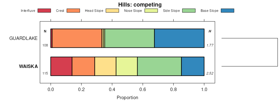
Waiska-Copper Harbor complex, 0 to 10 percent slopes, very stony27C28117179601vnp2mi6061:12000
Waiska-Feldtmann-Copper Harbor complex, 1 to 9 percent slopes43C21823781872ktpqmi6061:12000

Map of Series Extent

Approximate geographic distribution of the WAISKA soil series. To learn more about how this distribution was mapped, or to compare this soil series extent to others, use the Series Extent Explorer (SEE) application. Source: generalization of SSURGO geometry .