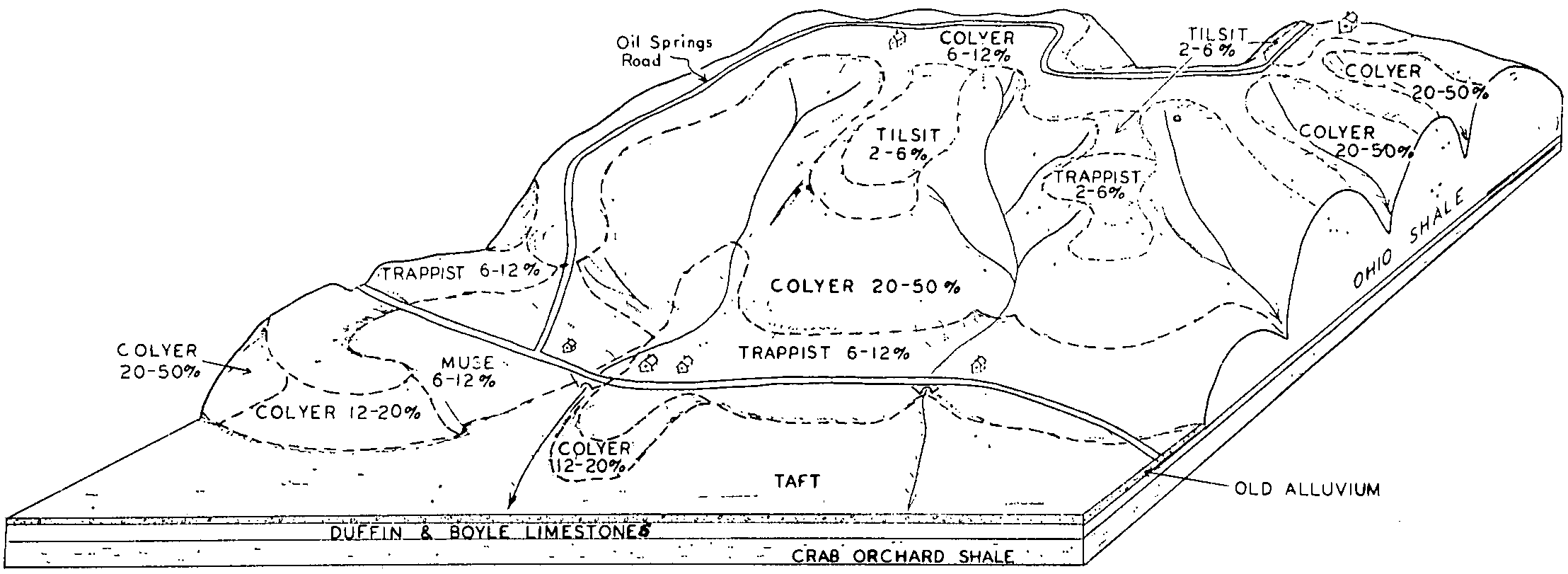
Official Series Description


Lab Data Summary

Aggregate lab data for the TAFT soil series. This aggregation is based on all pedons with a current taxon name of TAFT, and applied along 1-cm thick depth slices. Solid lines are the slice-wise median, bounded on either side by the interval defined by the slice-wise 5th and 95th percentiles. The median is the value that splits the data in half. Five percent of the data are less than the 5th percentile, and five percent of the data are greater than the 95th percentile. Values along the right hand side y-axis describe the proportion of pedon data that contribute to aggregate values at this depth. For example, a value of "90%" at 25cm means that 90% of the pedons correlated to TAFT were used in the calculation. Source: KSSL snapshot . Methods used to assemble the KSSL snapshot used by SoilWeb / SDE

Click the image to view it full size.

Pedons used in the lab summary:

MLRALab IDPedon IDTaxonnameCINSSL / NASIS ReportsLink To SoilWeb GMap
11981SC081981AR12708Taft2Primary | Supplementary | Taxonomy | Pedon | Water Retention | Correlation | Andic Soil Properties34.7649574,-94.4396561
11981SC091981AR12709Taft2Primary | Supplementary | Taxonomy | Pedon | Water Retention | Correlation | Andic Soil Properties34.9476795,-94.1018817
12298P02591997TN127004Taft5Primary | Supplementary | Taxonomy | Pedon | Water Retention | Correlation | Andic Soil Properties35.3590279,-86.2890549
12805N0280S03AL089001Taft7Primary | Supplementary | Taxonomy | Pedon | Water Retention | Correlation | Andic Soil Properties34.7741394,-86.7387466
n/a40A54591967TN037003Taft7Primary | Supplementary | Taxonomy | Pedon | Water Retention | Correlation | Andic Soil Propertiesn/a

Water Balance

Monthly water balance estimated using a leaky-bucket style model for the TAFT soil series. Monthly precipitation (PPT) and potential evapotranspiration (PET) have been estimated from the 50th percentile of gridded values (PRISM 1981-2010) overlapping with the extent of SSURGO map units containing each series as a major component. Monthly PET values were estimated using the method of Thornthwaite (1948). These (and other) climatic parameters are calculated with each SSURGO refresh and provided by the fetchOSD function of the soilDB package. Representative water storage values (“AWC” in the figures) were derived from SSURGO by taking the 50th percentile of profile-total water storage (sum[awc_r * horizon thickness]) for each soil series. Note that this representation of “water storage” is based on the average ability of most plants to extract soil water between 15 bar (“permanent wilting point”) and 1/3 bar (“field capacity”) matric potential. Soil moisture state can be roughly interpreted as “dry” when storage is depleted, “moist” when storage is between 0mm and AWC, and “wet” when there is a surplus. Clearly there are a lot of assumptions baked into this kind of monthly water balance. This is still a work in progress.

Click the image to view it full size.


Click the image to view it full size.

Sibling Summary

Siblings are those soil series that occur together in map units, in this case with the TAFT series. Sketches are arranged according to their subgroup-level taxonomic structure. Source: SSURGO snapshot , parsed OSD records and snapshot of SC database .

Click the image to view it full size.

Select annual climate data summaries for the TAFT series and siblings. Series are sorted according to hierarchical clustering of median values. Source: SSURGO map unit geometry and 1981-2010, 800m PRISM data .

Click the image to view it full size.

Geomorphic description summaries for the TAFT series and siblings. Series are sorted according to hierarchical clustering of proportions and relative hydrologic position within an idealized landform (e.g. top to bottom). Most soil series (SSURGO components) are associated with a hillslope position and one or more landform-specific positions: hills, mountain slopes, terraces, and/or flats. Proportions can be interpreted as an aggregate representation of geomorphic membership. The values printed to the left (number of component records) and right (Shannon entropy) of stacked bars can be used to judge the reliability of trends. Small Shannon entropy values suggest relatively consistent geomorphic association, while larger values suggest lack thereof. Source: SSURGO component records .

Click the image to view it full size.

Click the image to view it full size.

There are insufficient data to create the 3D mountains figure.

Click the image to view it full size.

Click the image to view it full size.

Competing Series

Soil series competing with TAFT share the same family level classification in Soil Taxonomy. Source: parsed OSD records and snapshot of the SC database .

Click the image to view it full size.

Select annual climate data summaries for the TAFT series and competing. Series are sorted according to hierarchical clustering of median values. Source: SSURGO map unit geometry and 1981-2010, 800m PRISM data .

There are insufficient data to create the annual climate figure.

Geomorphic description summaries for the TAFT series and competing. Series are sorted according to hierarchical clustering of proportions and relative hydrologic position within an idealized landform (e.g. top to bottom). Proportions can be interpreted as an aggregate representation of geomorphic membership. Most soil series (SSURGO components) are associated with a hillslope position and one or more landform-specific positions: hills, mountain slopes, terraces, and/or flats. The values printed to the left (number of component records) and right (Shannon entropy) of stacked bars can be used to judge the reliability of trends. Shannon entropy values close to 0 represent soil series with relatively consistent geomorphic association, while values close to 1 suggest lack thereof. Source: SSURGO component records .

There are insufficient data to create the 2D hillslope position figure.

There are insufficient data to create the 3D hills figure.

There are insufficient data to create the 3D mountains figure.

There are insufficient data to create the 3D terrace figure.

There are insufficient data to create the 3D flats position figure.

Soil series sharing subgroup-level classification with TAFT, arranged according to family differentiae. Hovering over a series name will print full classification and a small sketch from the OSD. Source: snapshot of SC database .

Block Diagrams

Click a link below to display the diagram. Note that these diagrams may be from multiple survey areas.

  1. KY-2012-01-26-01 | Adair County - April 1964

    Diagram of the Westmoreland-Caneyville-Baxter association in Adair County (Soil Survey of Adair County, Kentucky; April 1964).

  2. KY-2012-01-26-02 | Adair County - April 1964

    Diagram of the Baxter-Christian-Bewleyville association (Soil Survey of Adair County (Soil Survey of Adair County, Kentucky; April 1964).

  3. KY-2012-01-26-03 | Adair County - April 1964

    Pattern of soils in the Frankstown-Bodine-Westmoreland association (Soil Survey of Adair County (Soil Survey of Adair County, Kentucky; April 1964).

  4. KY-2012-01-26-05 | Adair County - April 1964

    Diagram of the Staser-Taft-Landisburg association on flood plains, terraces, and foot slopes (Soil Survey of Adair County (Soil Survey of Adair County, Kentucky; April 1964).

  5. KY-2012-01-26-06 | Adair County - April 1964

    Geological cross section of Adair County showing the relationship of the soils to the underlying rocks (Soil Survey of Adair County (Soil Survey of Adair County, Kentucky; April 1964).

  6. KY-2012-01-26-23 | Bath County - September 1963

    Typical landscape showing the relative position of the principal soils in a limestone valley in association 9 (Soil Survey of Bath County, Kentucky; September 1963).

  7. KY-2012-01-27-43 | Clark County - 1964

    Major soil series in soil association 10, their relationship to the landscape, and the parent rocks from which the soils formed (Soil Survey of Clark County, Kentucky; 1964).

  8. KY-2012-01-30-09 | Green and Taylor Counties - July 1982

    Pattern of soils and underlying material in the Frederick-Mountview-Frankstown general soil map unit (Soil Survey of Green and Taylor Counties, Kentucky; July 1982).

  9. TN-2010-11-02-01 | Cannon County - 2003

    Typical pattern of soils and parent material in the Dickson-Mountview general soil map unit (Soil Survey of Cannon County, Tennessee; 2003).

  10. TN-2010-11-02-17 | Lewis County - 2006

    Typical pattern of soils and parent material in the Dickson-Ironcity-Taft general soil map unit (Soil Survey of Lewis County, Tennessee; 2006).

  11. TN-2010-11-02-23 | Moore County - 2006

    Typical pattern of soils and parent material in the Mountview-Dickson-Taft general soil map unit (Soil Survey of Moore County, Tennessee; 2006).

  12. TN-2012-03-16-01 | Cheatham County - 2002

    Relationship of soils to topography and the underlying material in the Sengtown-Mountview-Dickson general soil map unit (Soil Survey of Cheatham County, TN; 2002).

Map Units

Map units containing TAFT as a major component. Limited to 250 records.

Map Unit Name Symbol Map Unit Area (ac) Map Unit Key National Map Unit Symbol Soil Survey Area Publication Date Map Scale
Taft silt loamTa490328397c0qgal00919741:24000
Taft silt loam, 0 to 2 percent slopesTaA516523391kkmlal01519591:20000
Taft silt loamTs1346522966kk5wal07119431:24000
Taft silt loam, 0 to 2 percent slopesTs383252280430v93al08319531:20000
Taft silt loam, 0 to 2 percent slopesTa62152319230v93al08919581:24000
Taft silt loam, eroded, gently slopingTaB22220330750c35cal09519561:20000
Taft silt loam, levelTaA361330749c35bal09519561:20000
Taft silt loam, 0 to 2 percent slopesTa109733115630v93al10319491:15840
Taft silt loam, 0 to 2 percent slopes34150830860572t5ygar02319831:20000
Taft silt loam, 0 to 2 percent slopes3498275654022t5ygar02919771:20000
Taft silt loam, 0 to 2 percent slopes32466585655092t5ygar04519751:20000
Taft silt loam, 0 to 1 percent slopesTfA41335655892t5yfar04719671:20000
Taft silt loam, 1 to 3 percent slopesTfB3638565590lzjvar04719671:20000
Taft complex, moundedTc917565588lzjsar04719671:20000
Taft silt loam, 0 to 2 percent slopes60159565784lzr3ar06319801:20000
Taft silt loam, 0 to 1 percent slopesTa45115658692t5yfar07119731:24000
Taft silt loam, 0 to 2 percent slopes34188555658992t5ygar08319771:20000
Taft silt loam, 0 to 1 percent slopes3040805661032t5yfar10519801:20000
Taft silt loam, 0 to 2 percent slopes4665515661532t5ygar11519781:20000
Taft silt loam, 0 to 2 percent slopesTa94105663652t5ygar12719931:20000
Taft silt loam, moundedTf5346566366m0bwar12719931:20000
Taft silt loam, 0 to 1 percent slopesTf278855663952t5yfar13119711:20000
Taft silt loam, 0 to 2 percent slopes34127830862042t5ygar14119831:20000
Taft silt loam, 0 to 2 percent slopes35137915666632t5ygar14519801:20000
Taft silt loam, 0 to 2 percent slopes51217365650122t5ygar14919851:20000
Taft silt loam, 0 to 2 percent slopes3772185643212t5ygar68019801:20000
Taft silt loamTa660548770lf18ky00319861:20000
Taft silt loamTa3086549786lg31ky16919651:15840
Taft silt loamTa1640552503ljxpky20719791:20000
Taft silt loamTa2750552581lk06ky62019791:20000
Taft silt loamTa488424530112nbkdky64619661:15840
Taft silt loam, 0 to 2 percent slopesTa32015244642v59mtn01519991:24000
Taft silt loam, 0 to 2 percent slopesTa11345270332v59mtn02119911:24000
Taft silt loam, 0 to 2 percent slopesTa7735249922v59mtn03119561:20000
Taft silt loam overwash phaseTb293524993km98tn03119561:20000
Taft silt loam, 0 to 2 percent slopesTa4565234432v59mtn03719771:15840
Taft silt loam, 0 to 2 percent slopesTa11163273712v59mtn03920081:24000
Taft silt loam, 0 to 2 percent slopesTa27625270882v59mtn04119681:15840
Tyler silt loamTb3140527263kpnhtn05119501:20000
Taft silt loam, 0 to 2 percent slopesTa19505272622zpqjtn05119501:20000
Taft silt loam, 0 to 2 percent slopesTa5755273662zpqjtn05519651:15840
Taft silt loam, 0 to 2 percent slopesTa16773276502zpqjtn07119611:15840
Taft silt loam, 0 to 2 percent slopesTa3445275512v59mtn08319521:20000
Taft silt loam, 0 to 2 percent slopesTs3405275892v59mtn08519431:20000
Taft silt loam, 0 to 2 percent slopesTa11645276872zpqjtn09919551:20000
Taft silt loam, 0 to 2 percent slopesTa7555308842v59mtn10119991:24000
Taft silt loam, 0 to 2 percent slopesTa138645258512zpqjtn10319991:24000
Taft silt loamTa144526005knbxtn10519581:15840
Taft silt loamTa858526313knnvtn11519511:20000
Taft silt loam, 0 to 2 percent slopesTa43945280042v59mtn12519721:15840
Taft silt loam, 0 to 2 percent slopesTa13636257562v59mtn12720021:24000
Taft silt loam, 0 to 2 percent slopesTa45385281932v59mtn14719651:15840
Taft silt loam, 0 to 2 percent slopesTa526923969722v59mtn16119531:20000
Taft silt loam, 0 to 2 percent slopesTa38145283892v59mtn16519931:20000
Taft silt loam, 0 to 2 percent slopesTa7913280512zpqjtn18119961:24000
Taft silt loam, 0 to 2 percent slopesTaB13329877752v59mtn18719611:15840
Taft silt loamTa1375528612kr20tn60219731:15840
Taft silt loam, 0 to 2 percent slopesTa24125286782v59mtn60419741:20000

Map of Series Extent

Approximate geographic distribution of the TAFT soil series. To learn more about how this distribution was mapped, or to compare this soil series extent to others, use the Series Extent Explorer (SEE) application. Source: generalization of SSURGO geometry .