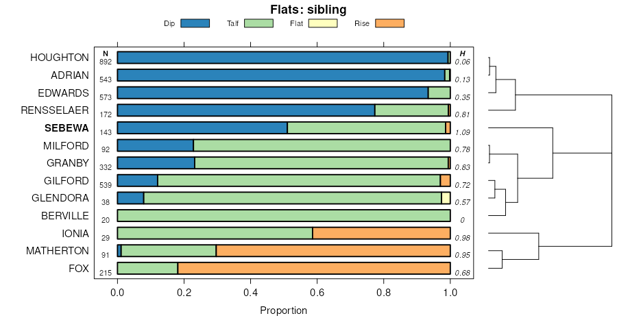
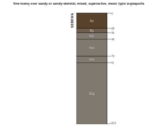
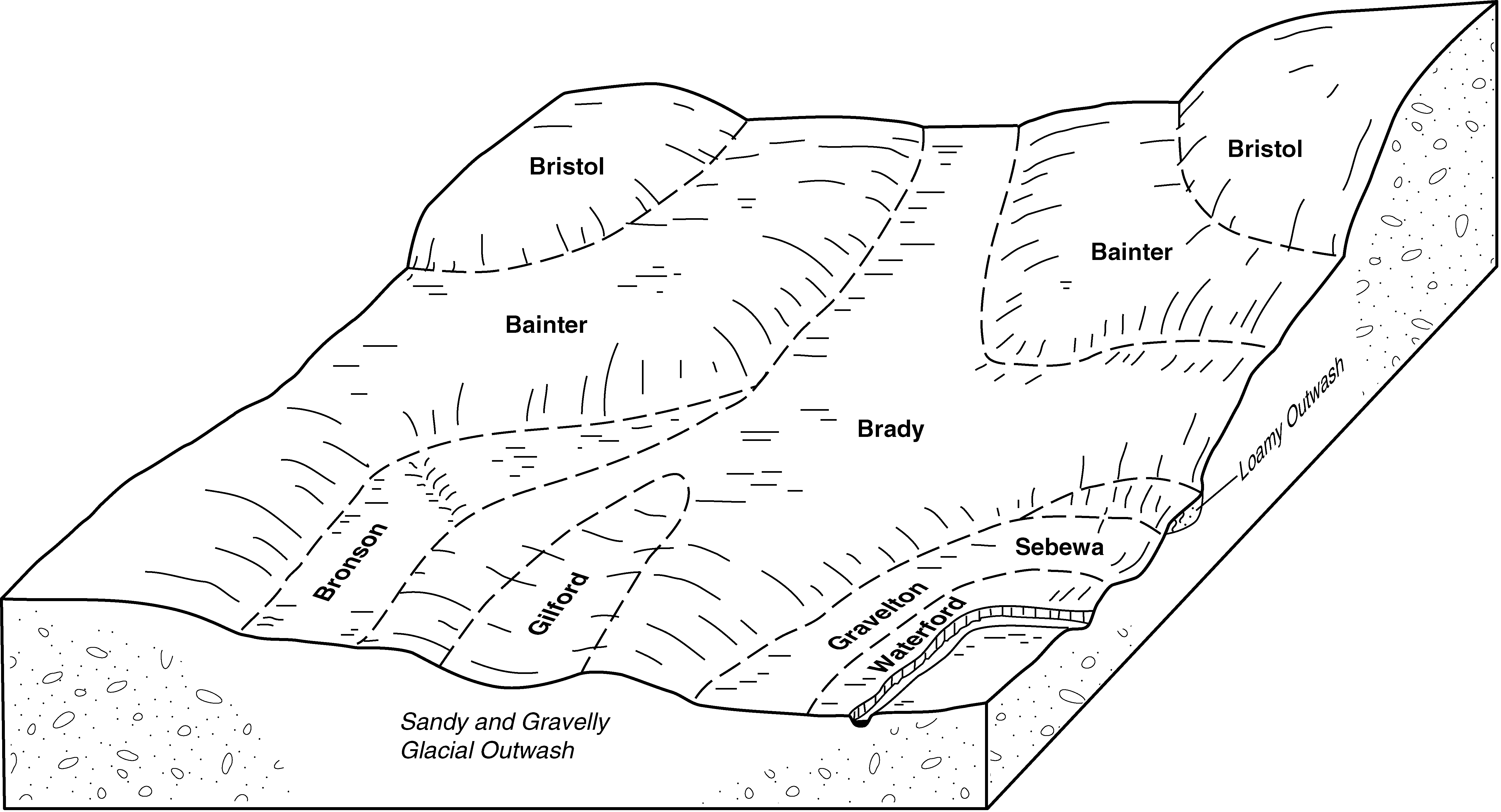
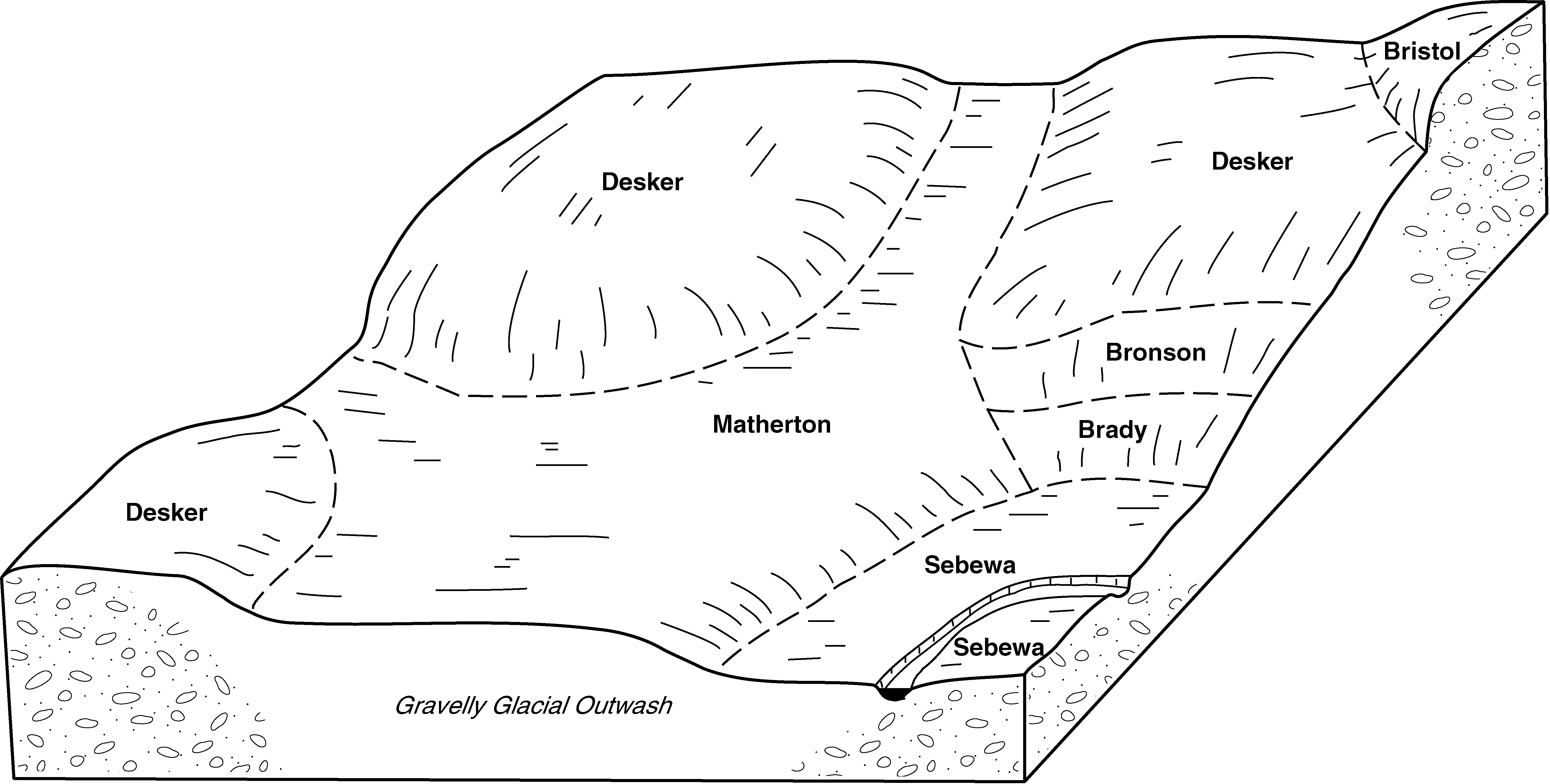
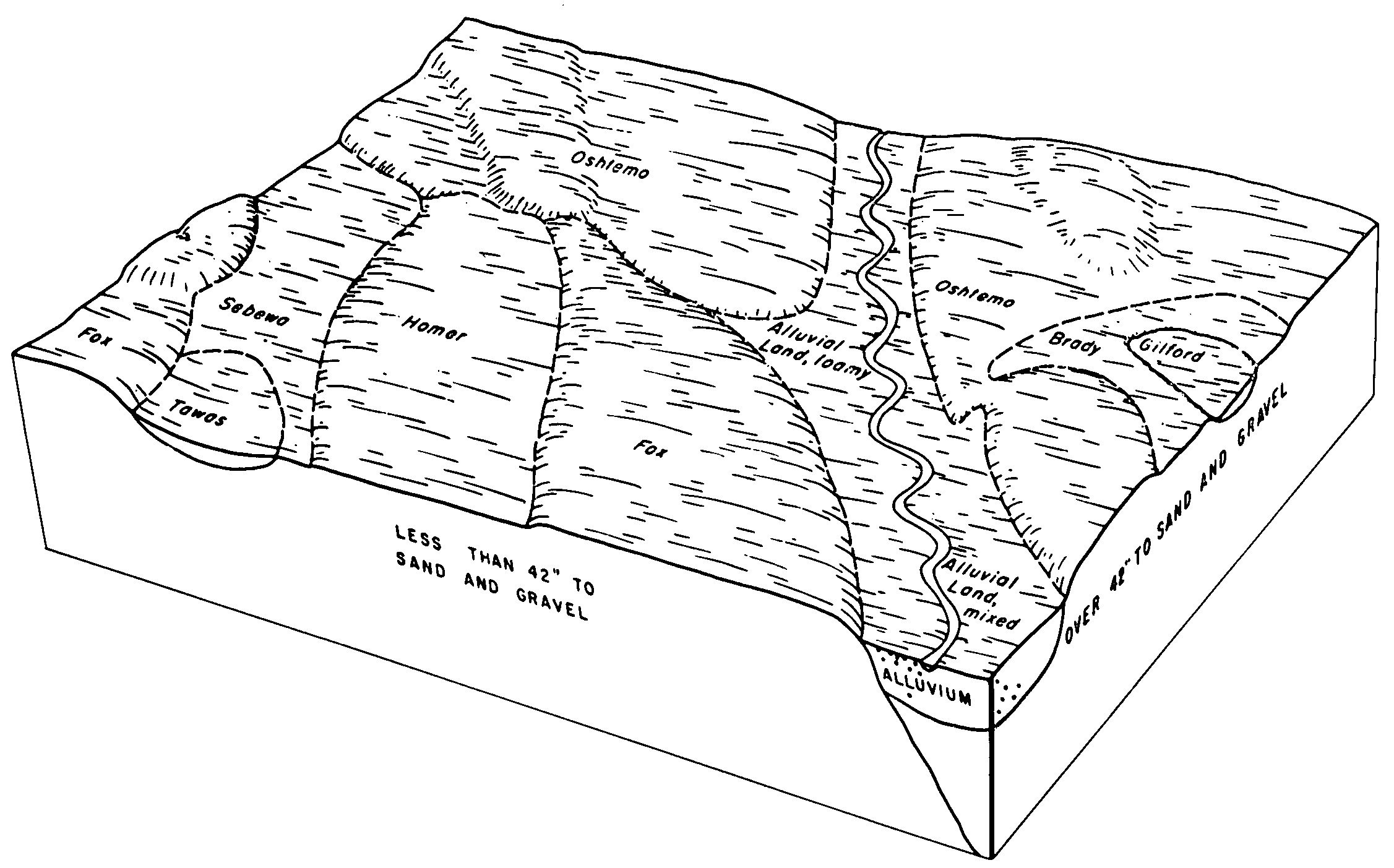
| Sebewa loam, disintegration moraine, 0 to 1 percent slopes | Se | 4518 | 160341 | 2v4bv | in033 | 1980 | 1:15840 |
Sebewa loam, drained, 0 to 1 percent slopes | ScuA | 4755 | 165466 | 2v2cb | in039 | 1997 | 1:12000 |
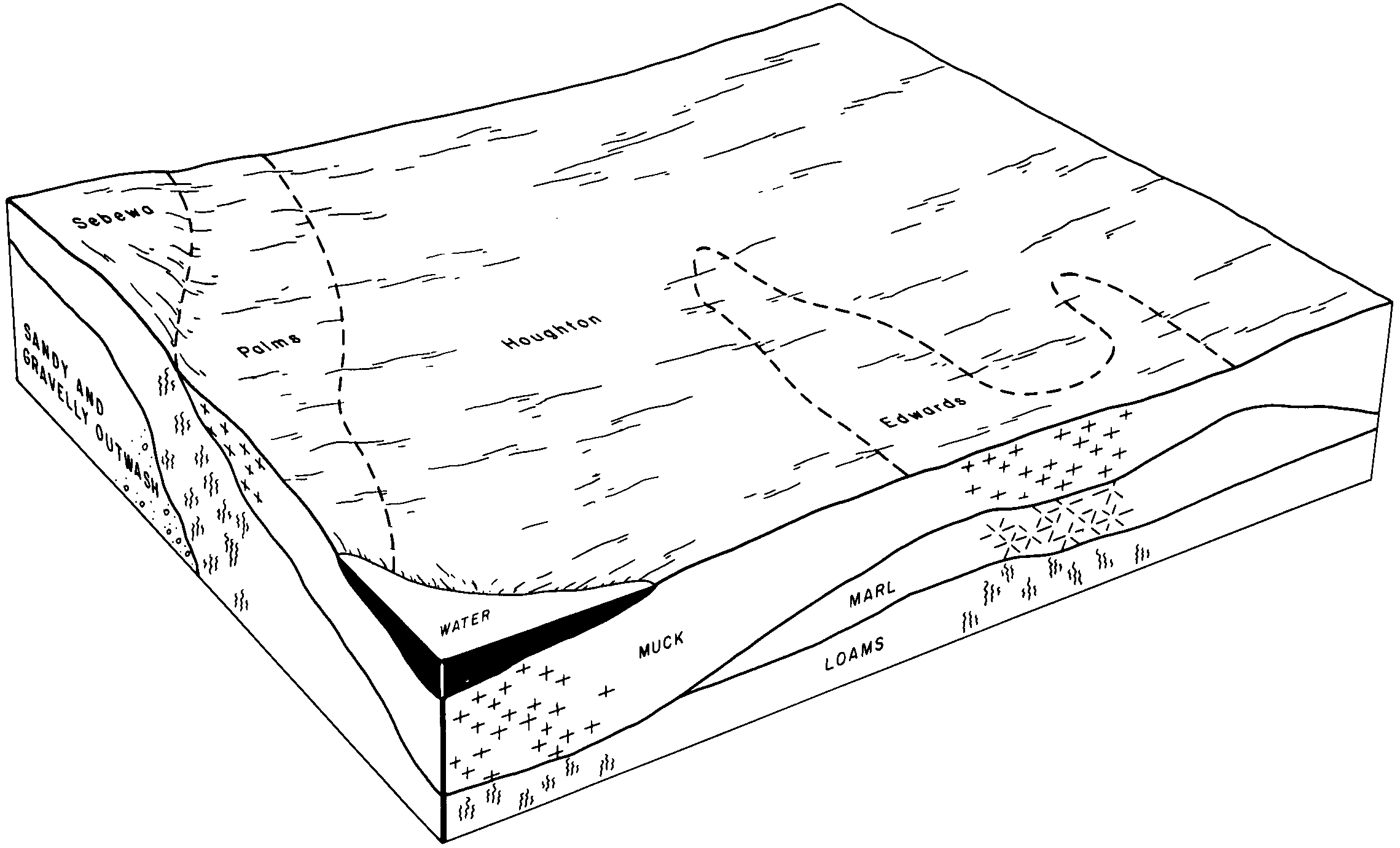
Sebewa mucky loam, 0 to 1 percent slopes | SdnA | 30 | 165467 | 5k5n | in039 | 1997 | 1:12000 |
Sebewa sandy clay loam | Se | 8779 | 162595 | 5g60 | in049 | 1984 | 1:15840 |
Sebewa loam, drained, 0 to 1 percent slopes | Se | 12613 | 160916 | 2v2cb | in085 | 1985 | 1:20000 |
Sebewa mucky loam | Sf | 4349 | 160917 | 5dfw | in085 | 1985 | 1:20000 |
Sebewa loam, drained, 0 to 1 percent slopes | Se | 14000 | 272632 | 2v2cb | in087 | 1978 | 1:20000 |
Sebewa loam, shaly sand substratum | Sb | 13862 | 272690 | 94rg | in091 | 1979 | 1:15840 |
Sebewa loam, disintegration moraine, 0 to 1 percent slopes | Se | 978 | 161990 | 2v4bv | in103 | 1977 | 1:20000 |
Sebewa loam, drained, 0 to 1 percent slopes | Se | 8341 | 272577 | 2v2cb | in113 | 1974 | 1:15840 |
Sebewa loam, shaly sand substratum | Sb | 19683 | 160684 | 5d6c | in127 | 1978 | 1:15840 |
Sebewa loam, drained, 0 to 1 percent slopes | ScuA | 1784 | 184989 | 2v2cb | in131 | 2001 | 1:12000 |
Sebewa clay loam | Se | 785 | 160755 | 5d8n | in145 | 1968 | 1:15840 |
Sebewa-Milford complex | Sf | 1513 | 161234 | 5ds3 | in169 | 1980 | 1:15840 |
Sebewa loam, disintegration moraine, 0 to 1 percent slopes | Se | 1223 | 161233 | 2v4bv | in169 | 1980 | 1:15840 |
Sebewa loam, disintegration moraine, 0 to 1 percent slopes | Se | 747 | 161818 | 2v4bv | in183 | 1985 | 1:15840 |
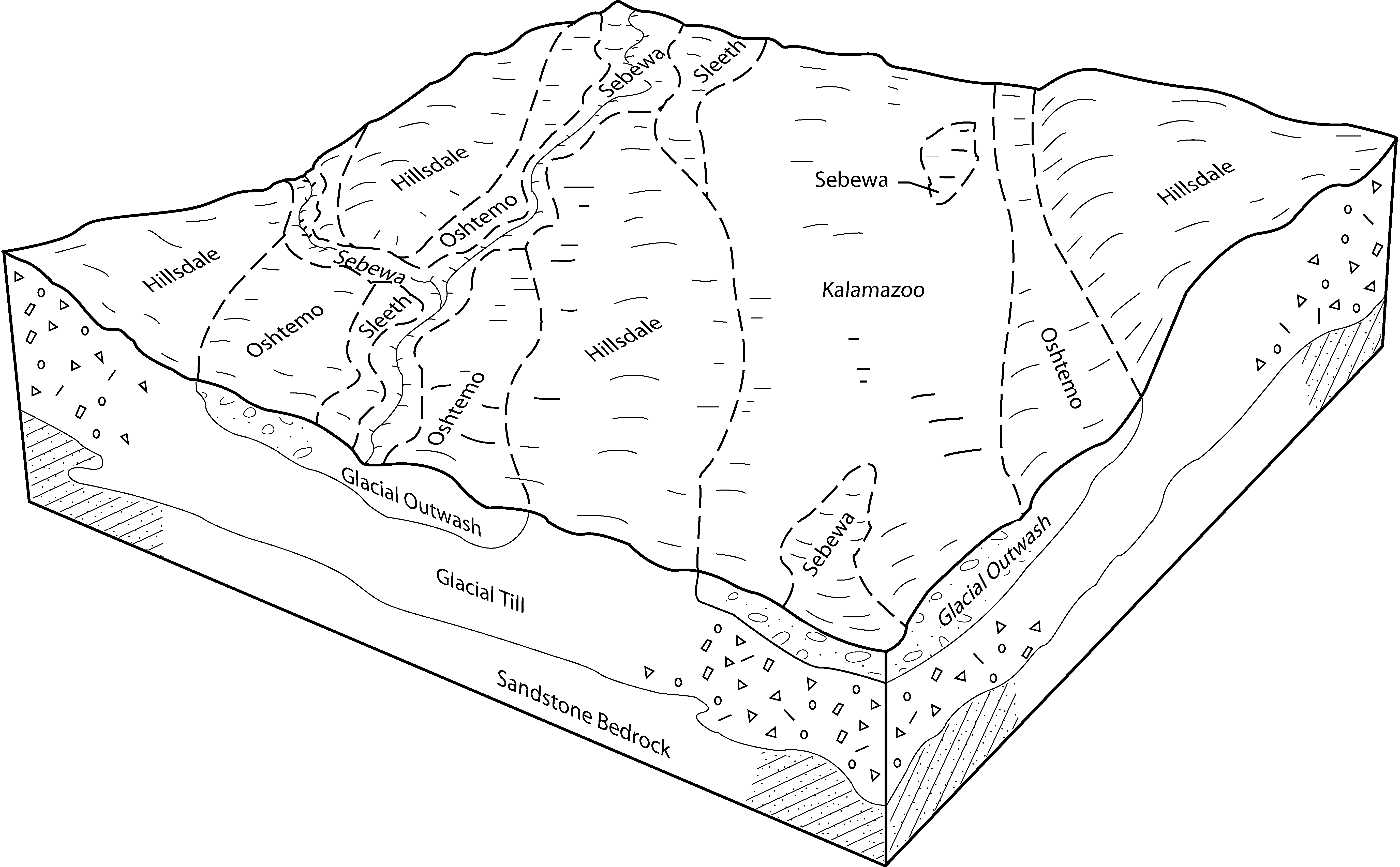
Sebewa loam, 0 to 2 percent slopes | 23 | 5236 | 212446 | 2v2c9 | mi005 | 1984 | 1:15840 |
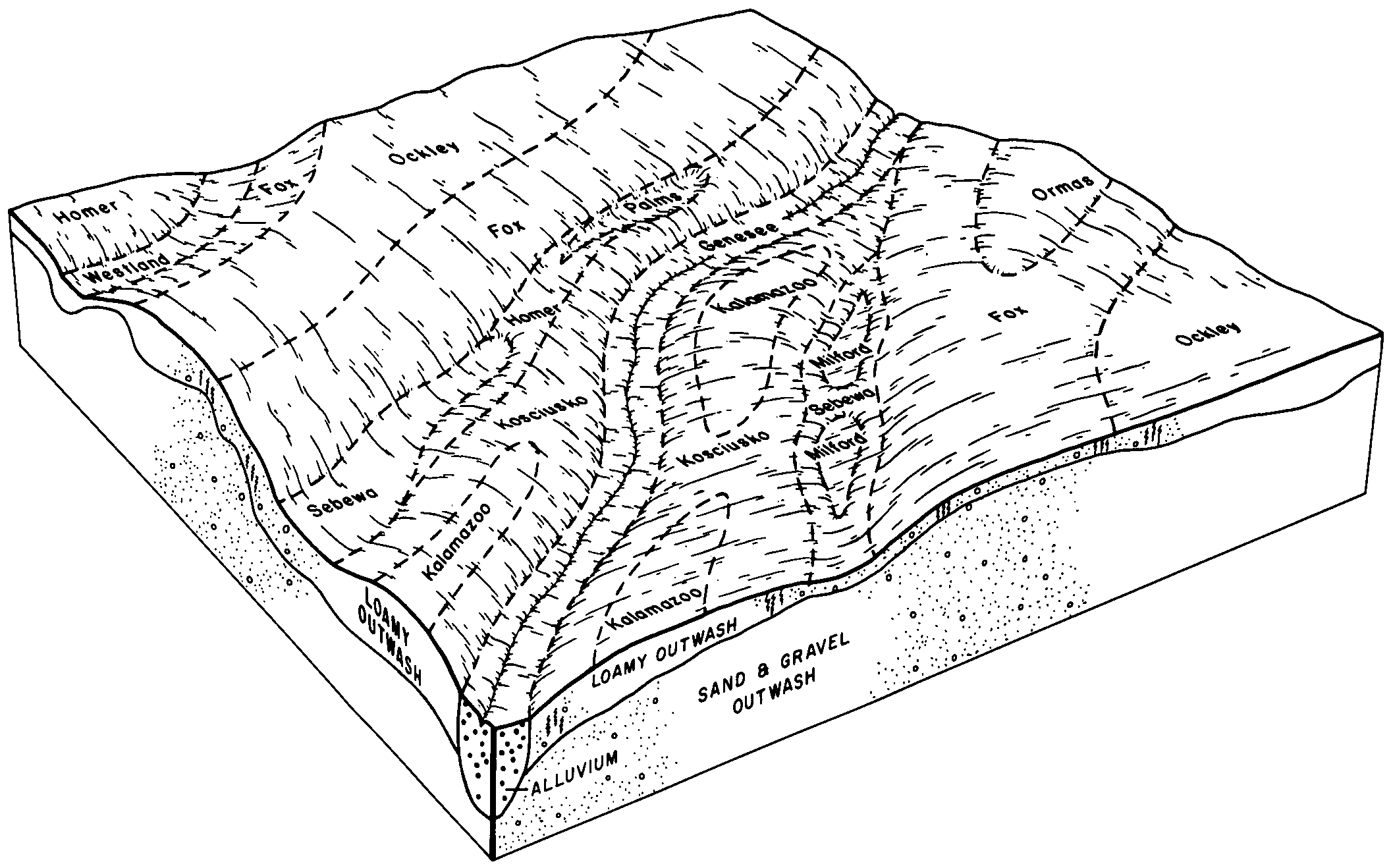
Sebewa loam, loamy substratum | 36 | 707 | 186093 | 67n0 | mi015 | 1988 | 1:15840 |
Sebewa loam, 0 to 2 percent slopes | 23 | 3543 | 186161 | 2v2c9 | mi021 | 1979 | 1:15840 |
Sebewa loam, 0 to 2 percent slopes | 24 | 17602 | 186968 | 2v2c9 | mi023 | 1984 | 1:15840 |
Sebewa loam, 0 to 2 percent slopes | 65 | 23694 | 188722 | 2v2c9 | mi025 | 1993 | 1:15840 |
Sebewa loam, 0 to 2 percent slopes | Sb | 7837 | 186396 | 2v2c9 | mi037 | 1974 | 1:15840 |
Sebewa loam, 0 to 2 percent slopes | Sb | 9864 | 186250 | 2v2c9 | mi045 | 1974 | 1:15840 |
Sebewa loam, 0 to 2 percent slopes | Se | 1645 | 186894 | 2v2c9 | mi049 | 1967 | 1:20000 |
Sebewa loam, disintegration moraine, 0 to 2 percent slopes | 17 | 3823 | 188629 | 2v4bw | mi059 | 1991 | 1:15840 |
Sebewa loam, 0 to 2 percent slopes | Sb | 8517 | 186754 | 2v2c9 | mi065 | 1977 | 1:15840 |
Sebewa loam, 0 to 2 percent slopes | Sd | 7804 | 188184 | 2v2c9 | mi067 | 1965 | 1:15840 |
Sebewa loam, 0 to 2 percent slopes | 46 | 4021 | 188777 | 2v2c9 | mi075 | 1979 | 1:15840 |
Houghton and Sebewa soils, ponded | Hs | 10163 | 187067 | 68nf | mi077 | 1978 | 1:15840 |
Sebewa loam, 0 to 2 percent slopes | Sb | 9306 | 187081 | 2v2c9 | mi077 | 1978 | 1:15840 |
Sebewa loam, 0 to 2 percent slopes | 73 | 645 | 187197 | 2v2c9 | mi081 | 1984 | 1:15840 |
Sebewa loam, disintegration moraine, 0 to 2 percent slopes | Se | 2473 | 192145 | 2v4bw | mi087 | 1966 | 1:15840 |
Sebewa loam, disintegration moraine, 0 to 2 percent slopes | Sf | 1081 | 2509150 | 2v4bw | mi091 | 1957 | 1:20000 |
Sebewa sandy loam, 0 to 3 percent slopes | SbA | 598 | 188563 | 6b6p | mi091 | 1957 | 1:20000 |
Sebewa loam, 0 to 2 percent slopes | Se | 2530 | 187601 | 2v2c9 | mi093 | 1968 | 1:20000 |
Sebewa sandy loam, 0 to 3 percent slopes | 111A | 2 | 2509170 | 6b6p | mi115 | 1980 | 1:15840 |
Sebewa loam, disintegration moraine, 0 to 2 percent slopes | 19 | 2888 | 188825 | 2v4bw | mi125 | 1980 | 1:15840 |
Sebewa loam | 123 | 4 | 2441689 | 2mys5 | mi145 | 1991 | 1:15840 |
Sebewa loam, 0 to 2 percent slopes | 14 | 5360 | 186267 | 2v2c9 | mi149 | 1980 | 1:15840 |
Sebewa loam, 0 to 2 percent slopes | Sd | 7217 | 187849 | 2v2c9 | mi155 | 1967 | 1:12000 |
Sebewa loam, disintegration moraine, 0 to 2 percent slopes | Sb | 9703 | 191668 | 2v4bw | mi161 | 1974 | 1:20000 |
Sebewa silt loam, 0 to 2 percent slopes | 7111A | 1449 | 426242 | 2szfk | wi009 | 1970 | 1:20000 |
Sebewa silt loam, 0 to 2 percent slopes | 7111A | 1253 | 423648 | 2szfk | wi027 | 1976 | 1:15840 |
Sebewa silt loam, 0 to 2 percent slopes | 7111A | 4944 | 425561 | 2szfk | wi039 | 1967 | 1:15840 |
Sebewa silt loam, deep, 0 to 2 percent slopes | 7411A | 1951 | 425563 | g8tv | wi039 | 1967 | 1:15840 |
Sebewa silt loam, 2 to 6 percent slopes | 7111B | 285 | 425562 | g8tt | wi039 | 1967 | 1:15840 |
Sebewa silt loam, loamy subsoil variant, 0 to 3 percent slopes | 7311A | 77 | 425564 | g8tw | wi039 | 1967 | 1:15840 |
Sebewa silt loam, 0 to 2 percent slopes | 7111A | 4078 | 425366 | 2szfk | wi045 | 1969 | 1:12000 |
Sebewa silt loam, 0 to 2 percent slopes | 7111A | 8336 | 423829 | 2szfk | wi055 | 1976 | 1:15840 |
Sebewa silt loam, clayey substratum | 7211A | 6377 | 423830 | g70y | wi055 | 1976 | 1:15840 |
Sebewa silt loam, 0 to 2 percent slopes | 7111A | 2211 | 3268714 | 2szfk | wi059 | 2023 | 1:15840 |
Sebewa silt loam, clayey substratum | 7211A | 923 | 3268715 | g79x | wi059 | 2023 | 1:15840 |
Sebewa silt loam, 0 to 2 percent slopes | 7111A | 860 | 3403371 | 2szfk | wi079 | 2023 | 1:15840 |
Sebewa silt loam, 0 to 2 percent slopes | 7111A | 1311 | 426021 | 2szfk | wi089 | 1967 | 1:15840 |
Sebewa silt loam, 0 to 2 percent slopes | 7111A | 2028 | 3403248 | 2szfk | wi101 | 2023 | 1:15840 |
Sebewa silt loam, clayey substratum | 7211A | 975 | 3268822 | g79x | wi101 | 2023 | 1:15840 |
Sebewa silt loam, 0 to 2 percent slopes | 7111A | 14320 | 426387 | 2szfk | wi105 | 1970 | 1:20000 |
Sebewa silt loam, 0 to 2 percent slopes | 7111A | 3309 | 423930 | 2szfk | wi117 | 1974 | 1:15840 |
Sebewa silt loam, 0 to 2 percent slopes | 7111A | 5574 | 425681 | 2szfk | wi127 | 1967 | 1:15840 |
Sebewa silt loam, 0 to 2 percent slopes | 7111A | 1798 | 425776 | 2szfk | wi131 | 1967 | 1:15840 |
Sebewa silt loam, 0 to 2 percent slopes | 7111A | 7301 | 3403491 | 2szfk | wi133 | 2023 | 1:15840 |