| Gateview-Sawpit-Eyre families complex, 40 to 65 percent slopes | 346C | 80716 | 1414965 | 1jhd1 | co654 | | 1:24000 |
Sawpit-Eyre families complex, dry, 40 to 65 percent slopes | 315C | 22062 | 1414922 | 1jhbn | co654 | | 1:24000 |
Sawpit-Eyre families-Rock outcrop complex, 40 to 75 percent slopes | 932D | 15982 | 1415067 | 1jhhb | co654 | | 1:24000 |
Sawpit family, till substratum, 40 to 60 percent slopes | 203C | 15009 | 1414864 | 1jh8s | co654 | | 1:24000 |
Sawpit-Gateview families complex, 5 to 40 percent slopes | 203B | 14551 | 1414863 | 1jh8r | co654 | | 1:24000 |
Sawpit-Eyre families complex, 40 to 65 percent slopes | 446C | 12785 | 1415026 | 1jhg0 | co654 | | 1:24000 |
Sawpit-Eyre families-Rubble land complex, 5 to 40 percent slopes | 932B | 10507 | 1415066 | 1jhh9 | co654 | | 1:24000 |
Gateview-Sawpit families complex, aspen, 5 to 40 percent slopes | 346B | 6767 | 1414964 | 1jhd0 | co654 | | 1:24000 |
Sawpit-Eyre families complex, 5 to 40 percent slopes | 446B | 5173 | 3243230 | 2zsc4 | co654 | | 1:24000 |
Anvik-Skylick-Sawpit families complex, 5 to 40 percent slopes | 452B | 3861 | 1415030 | 1jhg4 | co654 | | 1:24000 |
Gateview-Sawpit families complex, fescue, 5 to 25 percent slopes | 393B | 3606 | 1415014 | 1jhfm | co654 | | 1:24000 |
Scout-Sawpit families complex, 5 to 40 percent slopes | 356B | 3295 | 1414984 | 1jhdn | co654 | | 1:24000 |
Sawpit family, 40 to 60 percent slopes | 602C | 657 | 1415033 | 1jhg7 | co654 | | 1:24000 |
Sawpit-Eyre families-Rock outcrop complex, 40 to 75 percent slopes | 932D | 14824 | 3177061 | 1jhhb | co657 | | 1:24000 |
Sawpit family, till substratum, 40 to 60 percent slopes | 203C | 13864 | 3177002 | 1jh8s | co657 | | 1:24000 |
Sawpit-Gateview families complex, 5 to 40 percent slopes | 203B | 13479 | 3177001 | 1jh8r | co657 | | 1:24000 |
Sawpit-Eyre families-Rubble land complex, 5 to 40 percent slopes | 932B | 9707 | 3177060 | 1jhh9 | co657 | | 1:24000 |
Sawpit family, 40 to 60 percent slopes | 602C | 606 | 3177045 | 1jhg7 | co657 | | 1:24000 |
Sawpit-Eyre families-Rock outcrop complex, 40 to 75 percent slopes | 932D | 2704 | 3176922 | 1jhhb | co661 | 1968 | 1:31680 |
Sawpit-Gateview families complex, 5 to 40 percent slopes | 203B | 2653 | 3176930 | 1jh8r | co661 | 1968 | 1:31680 |
Gateview-Sawpit-Eyre families complex, 40 to 65 percent slopes | 346C | 998 | 3176954 | 1jhd1 | co661 | 1968 | 1:31680 |
Sawpit family, till substratum, 40 to 60 percent slopes | 203C | 662 | 3176964 | 1jh8s | co661 | 1968 | 1:31680 |
Sawpit-Eyre families-Rubble land complex, 5 to 40 percent slopes | 932B | 431 | 3176929 | 1jhh9 | co661 | 1968 | 1:31680 |
Sawpit family, 40 to 60 percent slopes | 602C | 352 | 3176945 | 1jhg7 | co661 | 1968 | 1:31680 |
Sawpit-Eyre families complex, 40 to 65 percent slopes | 446C | 318 | 3176942 | 1jhg0 | co661 | 1968 | 1:31680 |
Sawpit-Eyre families complex, dry, 40 to 65 percent slopes | 315C | 108 | 3176951 | 1jhbn | co661 | 1968 | 1:31680 |
Gateview-Sawpit families complex, aspen, 5 to 40 percent slopes | 346B | 27 | 3176953 | 1jhd0 | co661 | 1968 | 1:31680 |
Sawpit-Ohbejoyful complex, 0 to 25 percent slopes | 154 | 950 | 505211 | jyq4 | co674 | 1998 | 1:24000 |
Sawpit-Como-Rogert, families, complex, 1 to 35 percent slopes | 43B7DW | 1069 | 3458640 | 31wm2 | id720 | | 1:24000 |
Kegsprings, extremely stony-Sawpit, very stony-Drywolf, very rubbly families, complex, 20 to 60 percent slopes | 2268F | 204 | 3039657 | 2qbz5 | mt602 | 1963 | 1:20000 |
Kegsprings, extremely stony-Sawpit, very stony-Drywolf, very rubbly families, complex, 20 to 60 percent slopes | 2268F | 292 | 3039707 | 2qbz5 | mt613 | 1975 | 1:24000 |
Kegsprings, extremely stony-Sawpit, very stony-Drywolf, very rubbly families, complex, 20 to 60 percent slopes | 2268F | 115 | 3044831 | 2qbz5 | mt615 | 1992 | 1:24000 |
Kegsprings, extremely stony-Sawpit, very stony-Drywolf, very rubbly families, complex, 20 to 60 percent slopes | 2268F | 9753 | 2512886 | 2qbz5 | mt632 | | 1:24000 |
Rubble land-Sawpit family, very rubbly-Rock outcrop complex, 20 to 70 percent slopes | 5200G | 7802 | 2609833 | 2r88d | mt632 | | 1:24000 |
Kegsprings family, extremely stony-Sawpit family, very stony-Drywolf, very rubbly, complex, 20 to 60 percent slopes, moist | 1368F | 5612 | 2484340 | 2pd50 | mt632 | | 1:24000 |
Kegsprings, extremely stony-Sawpit, very stony-Worock, stony families, complex, 8 to 35 percent slopes | 1368E | 5078 | 2632230 | 2qbzb | mt632 | | 1:24000 |
Sawpit, stony-Adel families-Rubble land complex, 30 to 65 percent slopes | 1260G | 2503 | 2832443 | 2v10v | mt632 | | 1:24000 |
Sawpit family gravely loam, 15 to 40 percent slopes | 182 | 1580 | 2770075 | 2sdmf | nm672 | | 1:24000 |
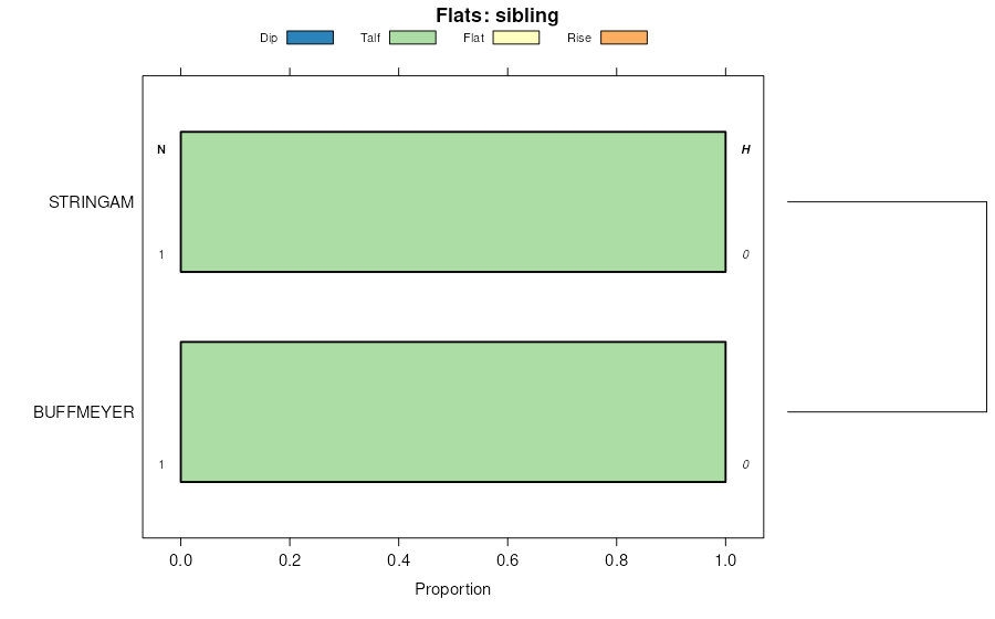
Buffmeyer family-Rogert family-Sawpit family complex, 30 to 60 percent slopes | 236 | 15657 | 512449 | k67m | ut646 | | 1:24000 |
Cuberant family, extremely stony-Sawpit family, rubbly-Hotterfamily, extremely stony complex, 15 to 60 percent slopes | 215C | 5043 | 791283 | vkd8 | ut651 | | 1:24000 |
Cheadle-Sawpit-Gany families, complex, 15 to 35 percent slopes | 612 | 221 | 1857234 | 20bls | wy647 | | 1:24000 |
Cheadle-Sawpit-Gany families, complex, 15 to 35 percent slopes | 505 | 8837 | 157894 | 599c | wy656 | 2008 | 1:24000 |
Kamack-Sawpit-Presa families, complex, 20 to 50 percent slopes | 293 | 2205 | 157804 | 596g | wy656 | 2008 | 1:24000 |
Wesdy family-Mollic Haplocryalfs-Goldflint family, complex, 5 to 60 percent slopes | 404 | 7886 | 152028 | 5364 | wy663 | 2012 | 1:24000 |
Ezbin-Sawpit-Gateview families, complex, 0 to 30 percent slopes -- draft | 102 | 5616 | 151942 | 533c | wy663 | 2012 | 1:24000 |
Shook, Sawpit and Kegsprings families, soils | 2216 | 13108 | 3056524 | 2xts7 | wy665 | 1996 | 1:62500 |
Ducktail-Doct-Sawpit families, complex | 2226 | 3881 | 3056525 | 2xts9 | wy665 | 1996 | 1:62500 |
Ducktail-Sawpit, very stony families, complex, 0 to 4 percent slopes, rarely flooded | 12 | 755 | 2980434 | 2wqqj | wy667 | | 1:24000 |
Ezbin-Sawpit-Gateview families, complex, 0 to 30 percent slopes -- draft | 102 | 599 | 2611977 | 533c | wy723 | | 1:24000 |