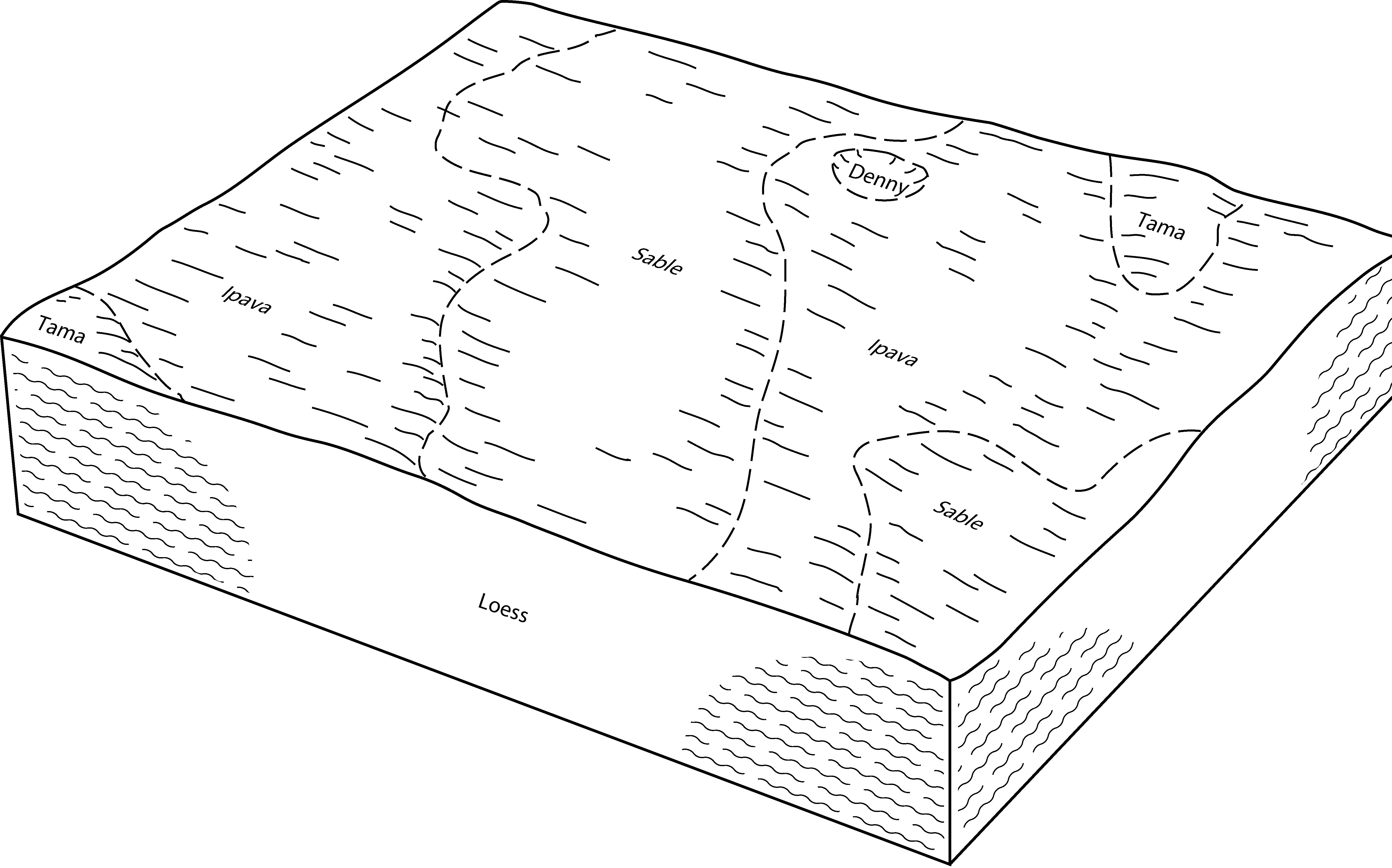
| Sable silty clay loam, 0 to 2 percent slopes | 68A | 8362 | 1015758 | 2tjpl | il007 | 2006 | 1:12000 |
Sable silt loam, 0 to 2 percent slopes, overwash | 68A+ | 206 | 1606832 | 2tjpm | il007 | 2006 | 1:12000 |
Sable silty clay loam, terrace, 0 to 2 percent slopes | 9068A | 43 | 1483305 | 2tjpp | il007 | 2006 | 1:12000 |
Sable silty clay loam, 0 to 2 percent slopes | 68A | 19574 | 1862669 | 2tjpl | il011 | 2007 | 1:12000 |
Sable silt loam, 0 to 2 percent slopes, overwash | 68A+ | 13762 | 1862670 | 2tjpm | il011 | 2007 | 1:12000 |
Sable silt loam, 0 to 2 percent slopes, overwash | 68A+ | 204 | 796014 | 2tjpm | il015 | 2005 | 1:12000 |
Sable silty clay loam, 0 to 2 percent slopes | 68A | 199 | 796013 | 2tjpl | il015 | 2005 | 1:12000 |
Sable silty clay loam, 0 to 2 percent slopes | 68A | 4502 | 262791 | 2tjpl | il017 | 2003 | 1:12000 |
Sable silty clay loam, 0 to 2 percent slopes | 68A | 41672 | 261773 | 2tjpl | il021 | 1999 | 1:12000 |
Sable silty clay loam, 0 to 2 percent slopes | 68A | 623 | 183885 | 2tjpl | il037 | 1998 | 1:12000 |
Sable silty clay loam, 0 to 2 percent slopes | 68A | 75113 | 1530240 | 2tjpl | il039 | 2005 | 1:12000 |
Sable silty clay loam, 0 to 2 percent slopes | 68A | 15852 | 615628 | 2tjpl | il057 | 1997 | 1:12000 |
Sable silty clay loam, terrace, 0 to 2 percent slopes | 9068A | 190 | 615711 | 2tjpp | il057 | 1997 | 1:12000 |
Sable silty clay loam, 0 to 2 percent slopes | 68A | 6103 | 211773 | 2tjpl | il061 | 1968 | 1:15840 |
Sable silty clay loam, 0 to 2 percent slopes | 68A | 10417 | 175211 | 2tjpl | il067 | 1993 | 1:15840 |
Sable silty clay loam, 0 to 2 percent slopes | 68A | 6311 | 201267 | 2tjpl | il071 | 2005 | 1:12000 |
Sable silty clay loam, 0 to 2 percent slopes | 68A | 5468 | 244636 | 2tjpl | il073 | 2001 | 1:12000 |
Sable silty clay loam, 0 to 2 percent slopes | 68A | 2724 | 728382 | 2tjpl | il083 | 2002 | 1:12000 |
Sable silty clay loam, 0 to 2 percent slopes | 68A | 1035 | 1949622 | 2tjpl | il085 | 1990 | 1:12000 |
Sable silty clay loam, 0 to 2 percent slopes | 68A | 15644 | 680868 | 2tjpl | il095 | 2002 | 1:12000 |
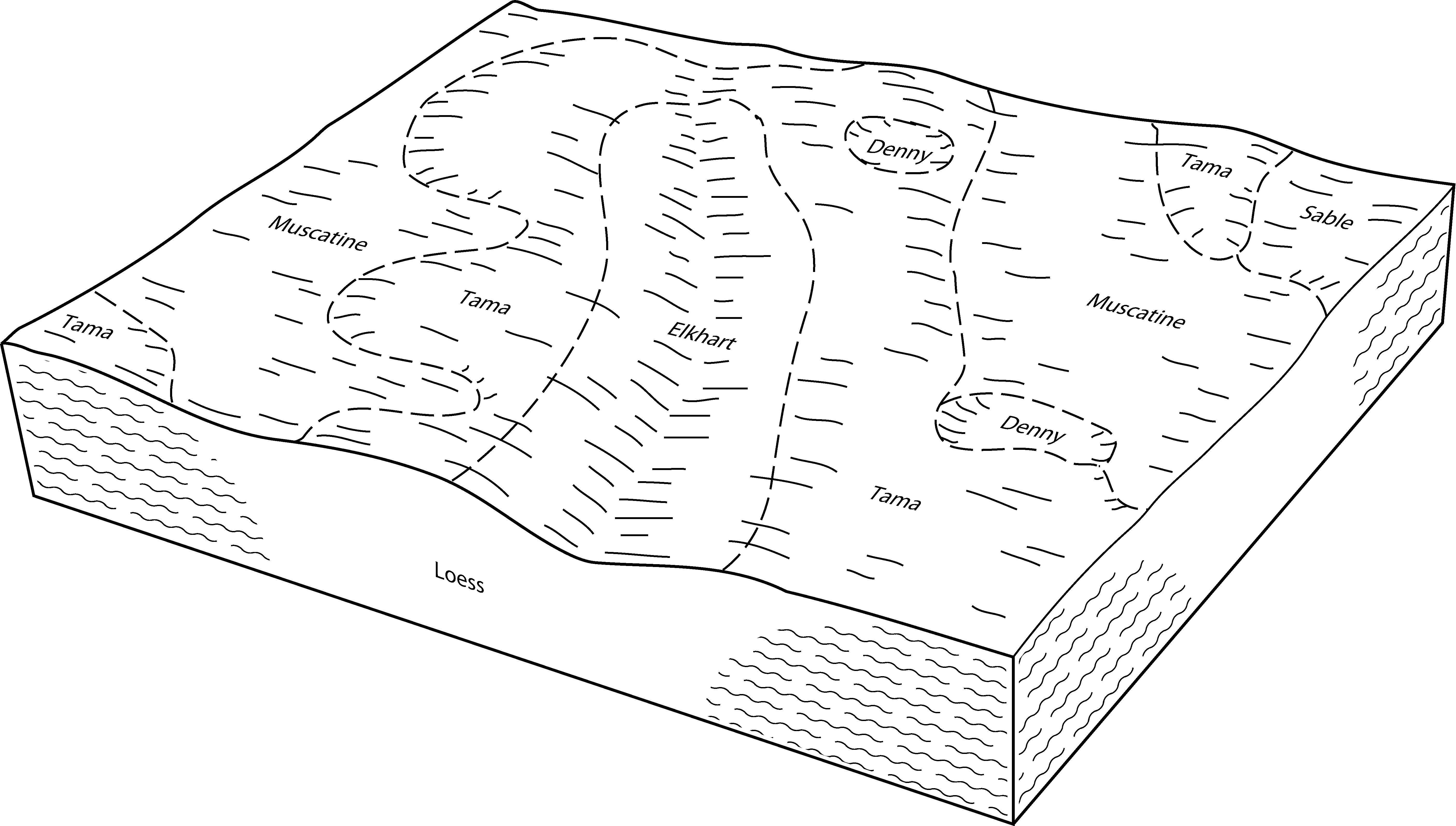
Ipava-Sable complex, 0 to 2 percent slopes | 902A | 2513 | 681036 | 2tjpn | il095 | 2002 | 1:12000 |
Sable silty clay loam, 0 to 2 percent slopes | 68A | 51804 | 1030108 | 2tjpl | il099 | 2006 | 1:12000 |
Sable silty clay loam, 0 to 2 percent slopes | 68A | 12540 | 921569 | 2tjpl | il103 | 2004 | 1:12000 |
Sable silty clay loam, 0 to 2 percent slopes | 68A | 79331 | 1595762 | 2tjpl | il107 | 2006 | 1:12000 |
Sable silty clay loam, 0 to 2 percent slopes | 68A | 49705 | 634080 | 2tjpl | il109 | 2002 | 1:12000 |
Sable silty clay loam, 0 to 2 percent slopes | 68A | 106265 | 199064 | 2tjpl | il113 | 2000 | 1:12000 |
Ipava-Sable complex, 0 to 2 percent slopes | 902A | 2359 | 195764 | 2tjpn | il113 | 2000 | 1:12000 |
Sable silty clay loam, 0 to 2 percent slopes | 68A | 38892 | 1913927 | 2tjpl | il115 | 2007 | 1:12000 |
Sable silty clay loam, 0 to 2 percent slopes | 68A | 17441 | 182231 | 2tjpl | il123 | 1997 | 1:15840 |
Sable silty clay loam, 0 to 2 percent slopes | 68A | 1362 | 177808 | 2tjpl | il125 | 1989 | 1:15840 |
Sable silty clay loam, 0 to 2 percent slopes | 68A | 18844 | 638900 | 2tjpl | il129 | 2005 | 1:12000 |
Sable silty clay loam, 0 to 2 percent slopes | 68A | 3127 | 244950 | 2tjpl | il131 | 2000 | 1:12000 |
Sable silty clay loam, 0 to 2 percent slopes | 68A | 33365 | 1672171 | 2tjpl | il137 | 1984 | 1:15840 |
Sable silty clay loam, 0 to 2 percent slopes | 68A | 2098 | 1144334 | 2tjpl | il141 | 2005 | 1:12000 |
Sable silty clay loam, 0 to 2 percent slopes | 68A | 15484 | 208944 | 2tjpl | il143 | 1986 | 1:15840 |
Sable silty clay loam, 0 to 2 percent slopes | 68A | 37069 | 1722811 | 2tjpl | il147 | 2009 | 1:12000 |
Sable silty clay loam, 0 to 2 percent slopes | 68A | 8294 | 172857 | 2tjpl | il155 | 1987 | 1:15840 |
Sable silty clay loam, 0 to 2 percent slopes | 68A | 1541 | 198684 | 2tjpl | il161 | 2002 | 1:12000 |
Sable silty clay loam, 0 to 2 percent slopes | 68A | 62059 | 199290 | 2tjpl | il167 | 1999 | 1:12000 |
Sable silty clay loam, 0 to 2 percent slopes | 68A | 1 | 193492 | 2tjpl | il169 | 2000 | 1:12000 |
Sable silty clay loam, 0 to 2 percent slopes | 68A | 1581 | 2542061 | 2tjpl | il171 | 1984 | 1:12000 |
Sable silty clay loam, 0 to 2 percent slopes | 68A | 1700 | 179116 | 2tjpl | il175 | 1992 | 1:15840 |
Sable silt loam, 0 to 2 percent slopes, overwash | 68A+ | 261 | 179117 | 2tjpm | il175 | 1992 | 1:15840 |
Sable silty clay loam, 0 to 2 percent slopes | 68A | 3203 | 1591906 | 2tjpl | il177 | 2006 | 1:12000 |
Sable silty clay loam, 0 to 2 percent slopes | 68A | 45229 | 179420 | 2tjpl | il179 | 1991 | 1:15840 |
Sable silty clay loam, 0 to 2 percent slopes | 68A | 5306 | 1601108 | 1qr2n | il183 | 2006 | 1:12000 |
Sable silty clay loam, 0 to 2 percent slopes | 68A | 41208 | 244915 | 2tjpl | il187 | 2002 | 1:12000 |
Sable silt loam, 0 to 2 percent slopes, overwash | 68A+ | 340 | 244914 | 2tjpm | il187 | 2002 | 1:12000 |
Sable silty clay loam, 0 to 2 percent slopes | 68A | 659 | 793023 | 2tjpl | il195 | 2003 | 1:12000 |
Sable silty clay loam, 0 to 2 percent slopes | 68A | 2670 | 173921 | 2tjpl | il201 | 1997 | 1:12000 |
Sable silty clay loam, terrace, 0 to 2 percent slopes | 9068A | 683 | 174229 | 2tjpp | il201 | 1997 | 1:12000 |
Sable silty clay loam, 0 to 2 percent slopes | 68A | 29179 | 1913184 | 2tjpl | il203 | 2008 | 1:12000 |
Sable-Drummer silty clay loams | Sc | 9925 | 162357 | 5fyb | in023 | 1978 | 1:20000 |
Sable silty clay loam | Sa | 478 | 162356 | 5fy9 | in023 | 1978 | 1:20000 |
Sable-Drummer silty clay loams | Sc | 13 | 3291334 | 5fyb | in067 | 1967 | 1:20000 |
Sable-Drummer silty clay loams | Sc | 51 | 3291365 | 5fyb | in159 | 1985 | 1:15840 |
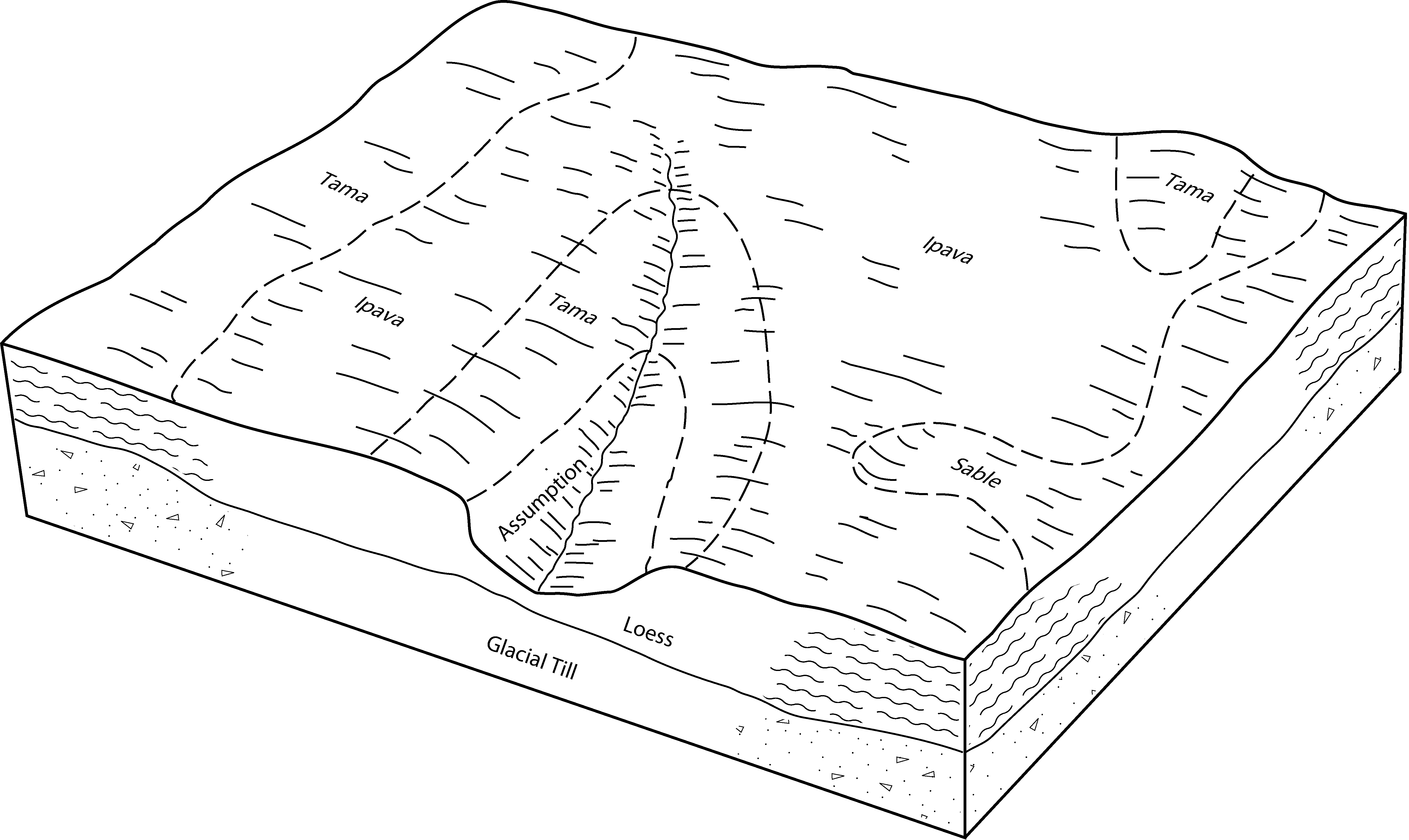
Sable silty clay loam, loamy till substratum | Sb | 9122 | 160466 | 5czb | in165 | 1977 | 1:20000 |
Sable silty clay loam | Sa | 6526 | 160465 | 5cz9 | in165 | 1977 | 1:20000 |
Sable silty clay loam | Sb | 1331 | 163167 | 5gsg | in171 | 1987 | 1:15840 |
Sable silty clay loam, 0 to 2 percent slopes | 7139A | 19938 | 753571 | 2tjpl | wi025 | 1972 | 1:15840 |
Sable silt loam, benches | 339A | 3021 | 424889 | g843 | wi065 | 1964 | 1:15840 |
Sable silt loam | 139A | 265 | 424888 | g842 | wi065 | 1964 | 1:15840 |


