| Pembroke silt loam, 3 to 6 percent slopes, eroded | PeC2 | 4015 | 566607 | m0ln | ar143 | 1966 | 1:20000 |
Pembroke silt loam, 1 to 3 percent slopes | PeB | 1986 | 566606 | m0lm | ar143 | 1966 | 1:20000 |
Pembroke gravelly silt loam, 3 to 8 percent slopes, eroded | PgC2 | 1772 | 566608 | m0lp | ar143 | 1966 | 1:20000 |
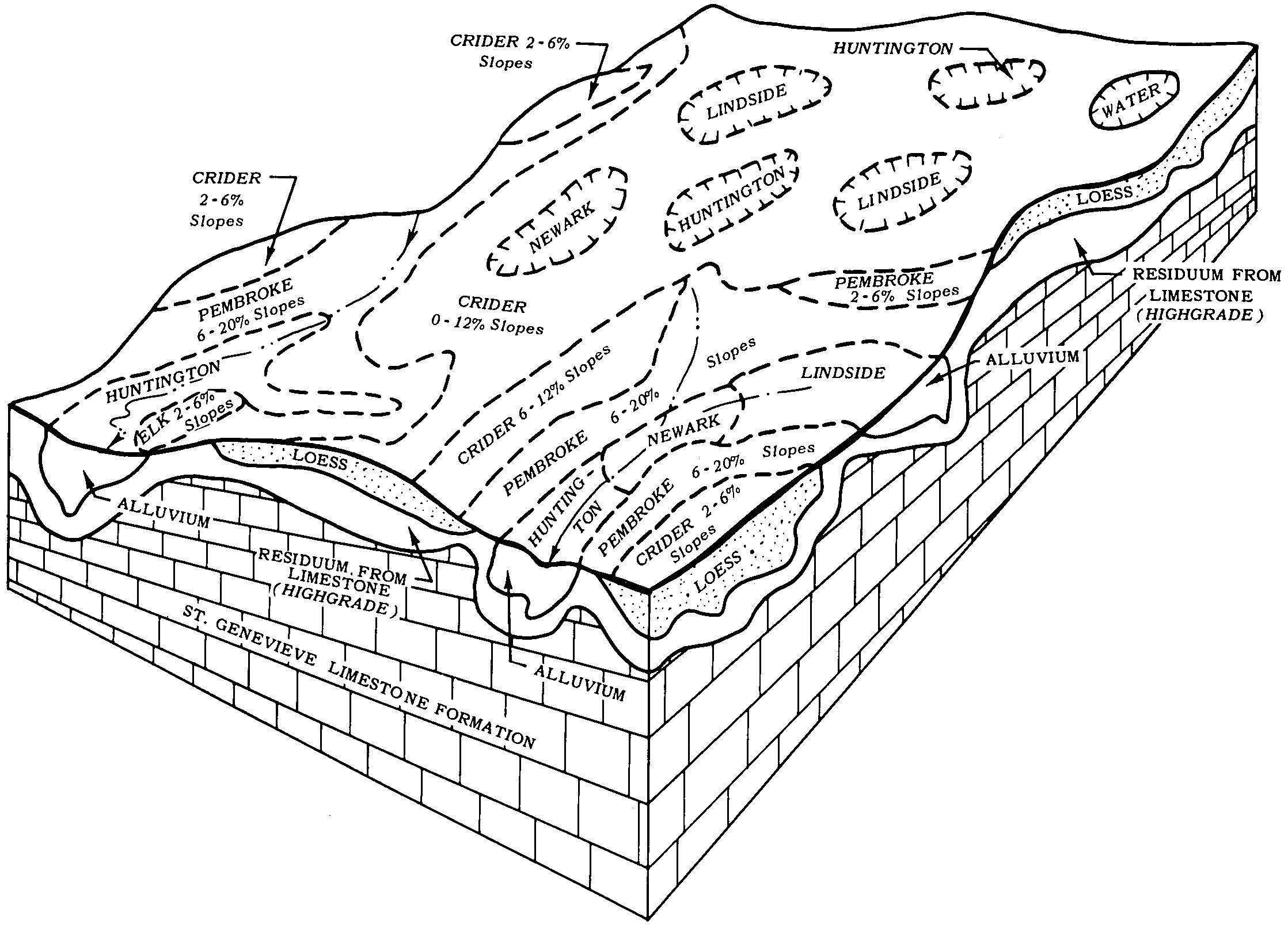
Pembroke silt loam, 2 to 6 percent slopes | PmB | 64195 | 549071 | 2v5c1 | ky047 | 1977 | 1:20000 |
Pembroke silt loam, 6 to 12 percent slopes | PmC | 9201 | 549072 | 2v5bz | ky047 | 1977 | 1:20000 |
Pembroke silt loam, 0 to 2 percent slopes | PmA | 3045 | 549070 | 2v5c2 | ky047 | 1977 | 1:20000 |
Pembroke silt loam, 2 to 6 percent slopes | PeB | 61587 | 548728 | 2v5c1 | ky141 | 1972 | 1:20000 |
Pembroke silt loam, 6 to 12 percent slopes | PeC | 11598 | 548729 | 2v5bz | ky141 | 1972 | 1:20000 |
Pembroke silt loam, 0 to 2 percent slopes | PeA | 9455 | 548727 | 2v5c2 | ky141 | 1972 | 1:20000 |
Pembroke silty clay loam, 6 to 12 percent slopes, severely eroded | PfC3 | 1817 | 548730 | 2v5by | ky141 | 1972 | 1:20000 |
Pembroke silt loam, 2 to 6 percent slopes | PmB | 573 | 549778 | 2v5c1 | ky169 | 1965 | 1:15840 |
Pembroke silt loam, 6 to 12 percent slopes, eroded | PmC2 | 189 | 549779 | 2v5c0 | ky169 | 1965 | 1:15840 |
Pembroke silt loam, 2 to 6 percent slopes | PbB | 16515 | 549989 | lg9l | ky179 | 1967 | 1:15840 |
Pembroke silt loam, 6 to 12 percent slopes | PbC | 4100 | 549990 | lg9m | ky179 | 1967 | 1:15840 |
Pembroke silt loam, 0 to 2 percent slopes | PbA | 2440 | 549988 | lg9k | ky179 | 1967 | 1:15840 |
Pembroke silty clay loam, 6 to 12 percent slopes, severely eroded | PeC3 | 630 | 549991 | lg9n | ky179 | 1967 | 1:15840 |
Pembroke silt loam, 2 to 6 percent slopes | PeB | 3698 | 552447 | 2v5c1 | ky199 | 1969 | 1:12000 |
Pembroke silt loam, 6 to 12 percent slopes | PeC | 1420 | 552448 | 2v5bz | ky199 | 1969 | 1:12000 |
Pembroke silt loam, 2 to 6 percent slopes | PeB | 25920 | 549809 | lg3s | ky213 | 1982 | 1:20000 |
Pembroke silt loam, 6 to 12 percent slopes | PeC | 5095 | 549810 | lg3t | ky213 | 1982 | 1:20000 |
Pembroke silt loam, 0 to 2 percent slopes | PeA | 2435 | 549808 | 2v5c2 | ky213 | 1982 | 1:20000 |
Pembroke silty clay loam, 6 to 12 percent slopes, severely eroded | PfC3 | 440 | 549811 | 2v5by | ky213 | 1982 | 1:20000 |
Pembroke silt loam, 2 to 6 percent slopes | PmB | 42565 | 551174 | 2v5c1 | ky219 | 1984 | 1:20000 |
Pembroke silt loam, 6 to 12 percent slopes, eroded | PmC2 | 6240 | 551175 | 2v5c0 | ky219 | 1984 | 1:20000 |
Pembroke silt loam, 0 to 2 percent slopes | PmA | 1100 | 551173 | 2v5c2 | ky219 | 1984 | 1:20000 |
Pembroke silt loam, 0 to 2 percent slopes | PbA | 4696 | 553870 | 2v5c2 | ky227 | 2004 | 1:12000 |
Pembroke-Urban land complex, 0 to 2 percent slopes | PeA | 107 | 553832 | 2v5c9 | ky227 | 2004 | 1:12000 |
Pembroke silt loam, 2 to 6 percent slopes | PmB | 13190 | 551060 | lhf4 | ky621 | 1975 | 1:20000 |
Pembroke silt loam, 6 to 12 percent slopes | PmC | 8970 | 551061 | lhf5 | ky621 | 1975 | 1:20000 |
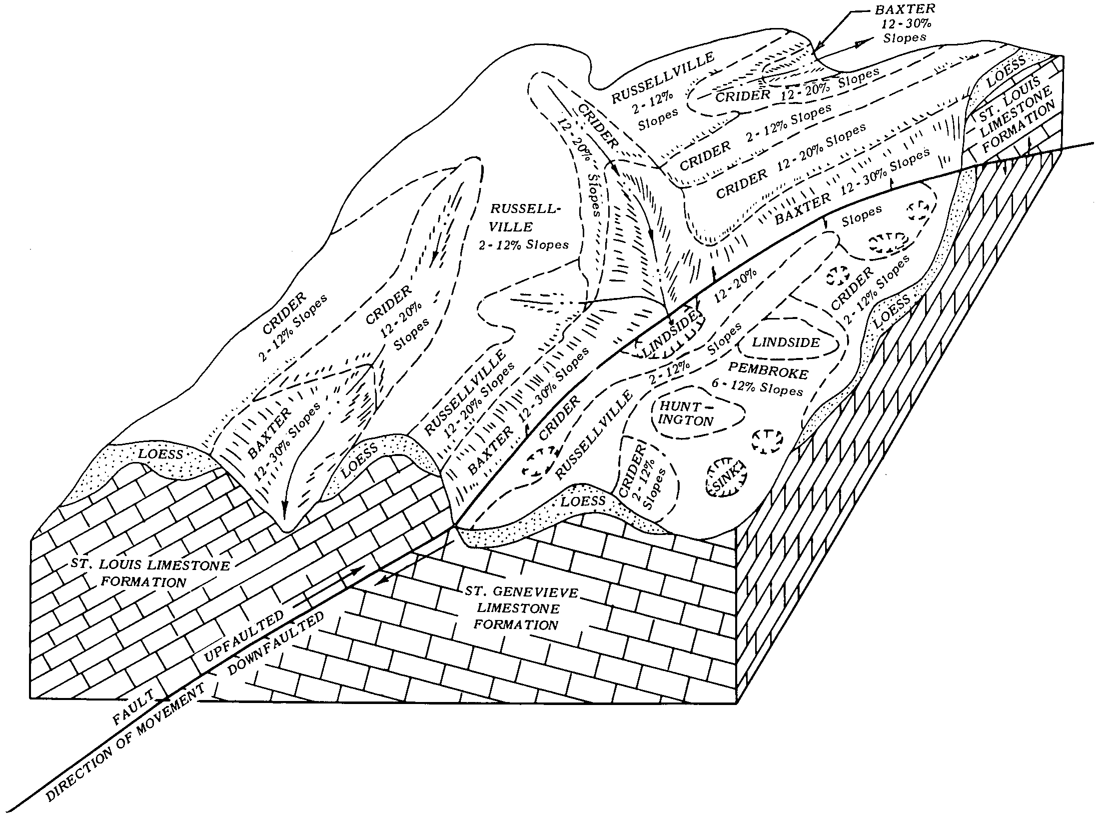
Crider-Pembroke silt loams, 6 to 12 percent slopes | CsC | 11320 | 549455 | 2v5c8 | ky629 | 1979 | 1:20000 |
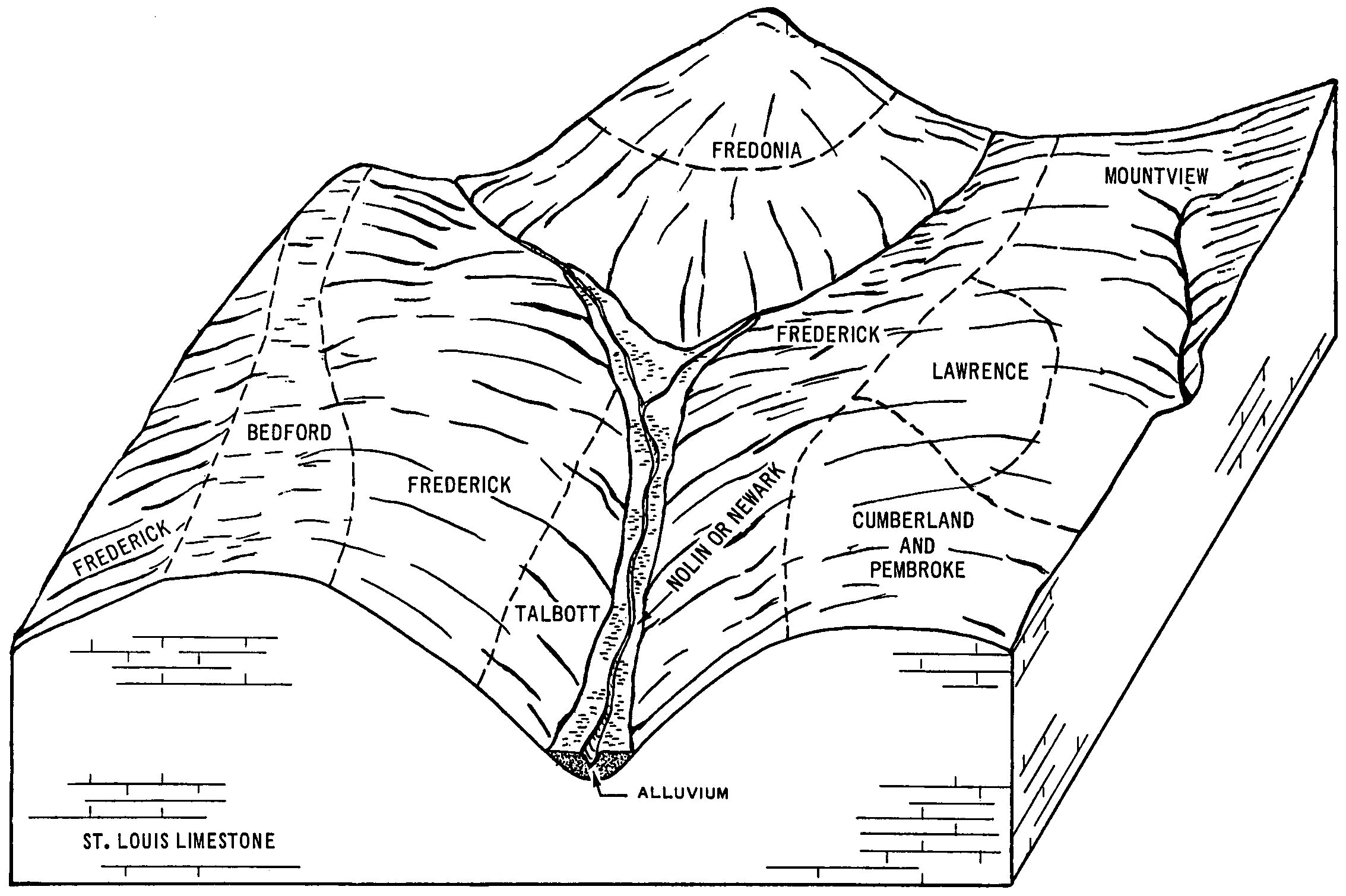
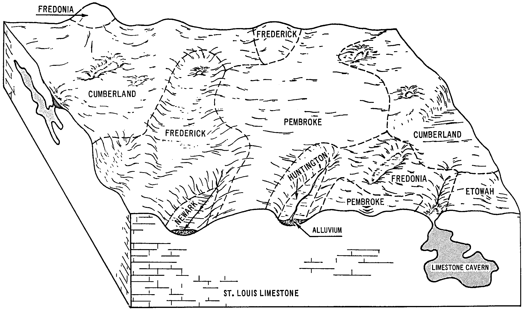
Fredonia-Pembroke silt loams, rocky, 2 to 12 percent slopes | FdB | 2570 | 549458 | lfrg | ky629 | 1979 | 1:20000 |
Pembroke-Crider complex, 6 to 12 percent slopes, severely eroded | PcC3 | 1190 | 549488 | 2v5bx | ky629 | 1979 | 1:20000 |
Pembroke silt loam, 2 to 6 percent slopes | PbB | 5156 | 2453002 | 2v5c1 | ky646 | 1966 | 1:15840 |
Pembroke silt loam, 6 to 12 percent slopes, eroded | PbC2 | 1968 | 2453003 | 2v5c0 | ky646 | 1966 | 1:15840 |
Pembroke silty clay loam, 6 to 12 percent slopes, severely eroded | PeC3 | 586 | 2453004 | 2v5by | ky646 | 1966 | 1:15840 |
Pembroke silty clay loam, 6 to 12 percent slopes, severely eroded | PeC3 | 8 | 2379493 | 2kw1v | ky648 | 2009 | 1:12000 |
Pembroke silt loam, 6 to 12 percent slopes, eroded | PbC2 | 3 | 2379492 | 2kw1t | ky648 | 2009 | 1:12000 |
Pembroke silt loam, 2 to 6 percent slopes | PbB | 1 | 2379491 | 2kw1s | ky648 | 2009 | 1:12000 |
Pembroke silt loam, 2 to 6 percent slopes | PeB | 1913 | 2452891 | 2v5c1 | ky709 | 1995 | 1:20000 |
Pembroke silt loam, 6 to 12 percent slopes, eroded | PeC2 | 228 | 2452892 | 2v5c0 | ky709 | 1995 | 1:20000 |
Pembroke silt loam, frequently ponded, karst, 1 to 3 percent slopes | 70067 | 441 | 576651 | mc1n | mo119 | 2004 | 1:24000 |
Pembroke silt loam, eroded gently sloping phase | Pe | 664 | 524973 | km8m | tn031 | 1956 | 1:20000 |
Pembroke silt loam, eroded gently sloping | Pk | 2538 | 527678 | kq2w | tn099 | 1955 | 1:20000 |
Pembroke silt loam, level | Ph | 481 | 527677 | kq2v | tn099 | 1955 | 1:20000 |
Pembroke silt loam, 2 to 6 percent slopes | PeB | 16179 | 527995 | 2v5c1 | tn125 | 1972 | 1:15840 |
Pembroke silt loam, 6 to 12 percent slopes | PeC | 10215 | 527996 | 2v5bz | tn125 | 1972 | 1:15840 |
Udarents-Urban land-Pembroke complex, 0 to 6 percent slopes | UdB | 110 | 3436765 | 31pmh | tn125 | 1972 | 1:15840 |
Pembroke silt loam, 2 to 6 percent slopes | PeB | 21819 | 528186 | 2v5c1 | tn147 | 1965 | 1:15840 |
Pembroke silt loam, 6 to 12 percent slopes, eroded | PeC2 | 15650 | 528187 | 2v5c0 | tn147 | 1965 | 1:15840 |