| Patent loam, 2 to 8 percent slopes | 64 | 7398 | 496503 | jnn7 | co627 | 1980 | 1:24000 |
Patent loam, 3 to 10 percent slopes | 26 | 1080 | 498390 | jqm3 | co635 | 1979 | 1:24000 |
Patent loam, 2 to 8 percent slopes | 104F | 282 | 509811 | k3hj | co636 | 2011 | 1:24000 |
Patent loam, 3 to 8 percent slopes | 61 | 12794 | 497014 | jp5q | co685 | 1979 | 1:24000 |
Patent loam, 8 to 15 percent slopes | 62 | 3115 | 497015 | jp5r | co685 | 1979 | 1:24000 |
Patent loam, 0 to 3 percent slopes | 60 | 1611 | 497013 | jp5p | co685 | 1979 | 1:24000 |
Patent loam, 15 to 25 percent slopes | 63 | 1066 | 497016 | jp5s | co685 | 1979 | 1:24000 |
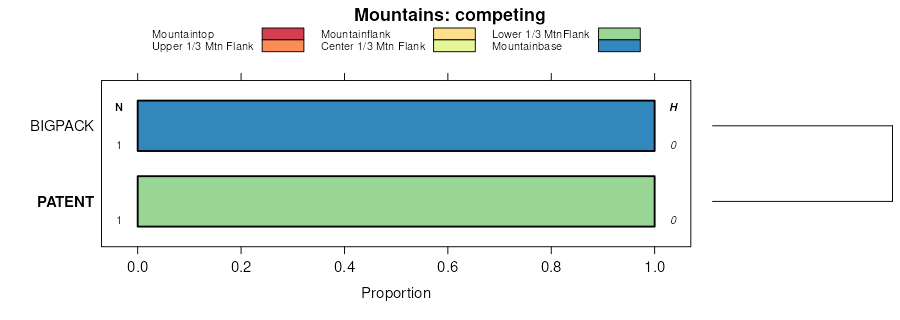
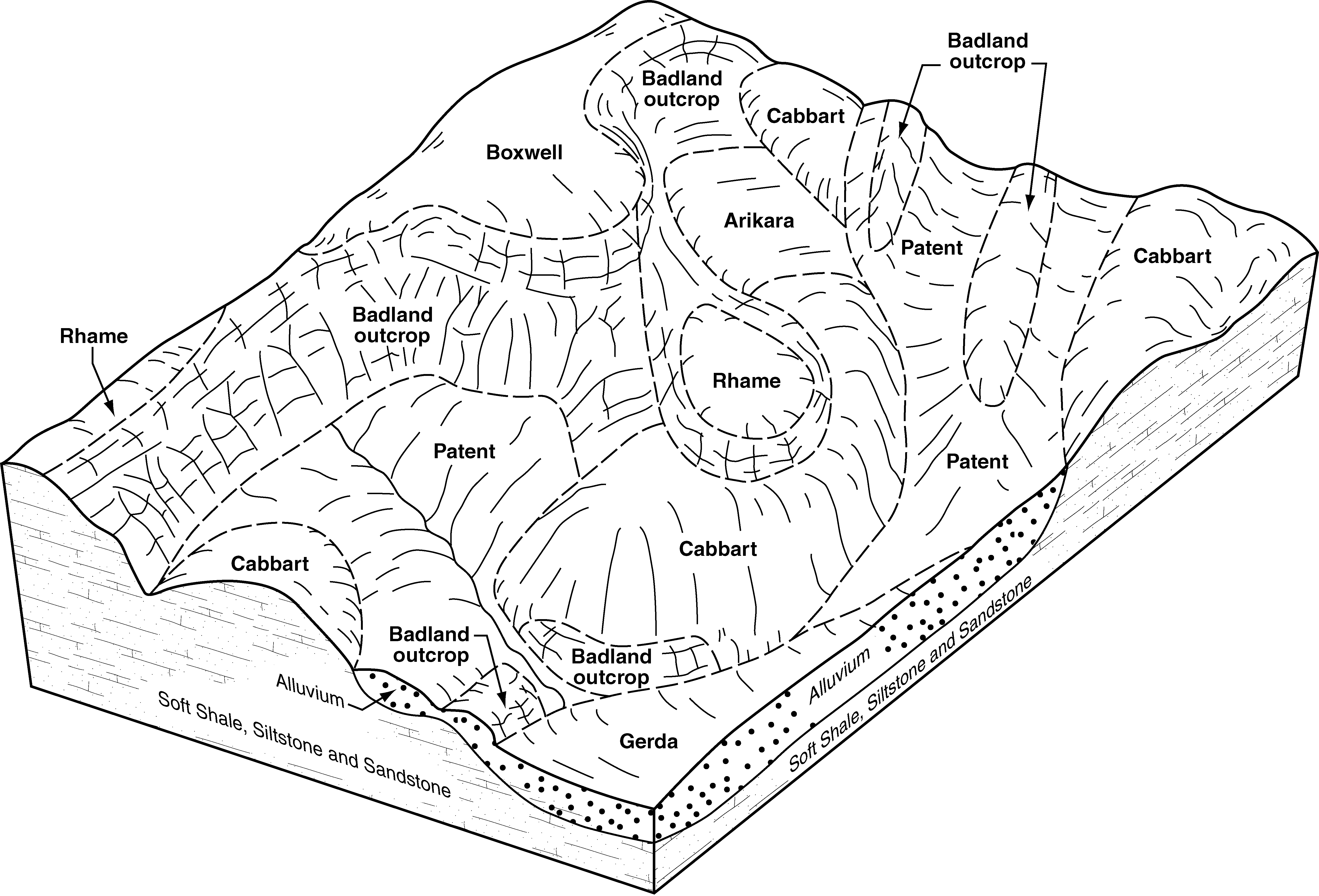
Badland-Patent complex, 6 to 25 percent slopes | L3105E | 7835 | 2837974 | 2q1xc | mt025 | 1991 | 1:24000 |
Patent, gullied, frequently flooded-Sham-Patent complex, 2 to 15 percent slopes | L3237D | 734 | 3256718 | 2q2n9 | mt025 | 1991 | 1:24000 |
Kirby-Badland-Patent complex, 9 to 70 percent slopes | L3007F | 605 | 3223493 | 2q2mw | mt025 | 1991 | 1:24000 |
Patent-Badland-Cabbart complex, 6 to 50 percent slopes | L3185F | 105619 | 2707061 | 2q385 | nd007 | 1998 | 1:24000 |
Badland-Patent complex, 6 to 25 percent slopes | L3105E | 22265 | 2707058 | 2q1xc | nd007 | 1998 | 1:24000 |
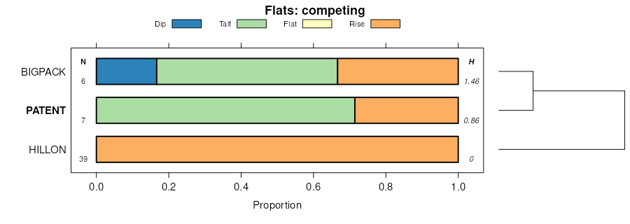
Patent, occasionally flooded-Vanda-Gerda, barren complex, 0 to 9 percent slopes | L3247C | 13540 | 2707068 | 2q2n3 | nd007 | 1998 | 1:24000 |
Kirby-Badland-Patent complex, 9 to 70 percent slopes | L3007F | 11930 | 2707053 | 2q2mw | nd007 | 1998 | 1:24000 |
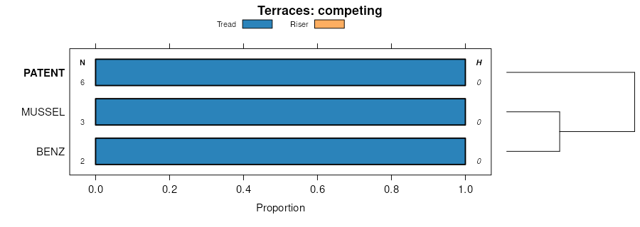
Patent-Patent, gullied, occasionally flooded-Glendive, frequently flooded complex, 0 to 9 percent slopes | L3235C | 7579 | 2707066 | 2q388 | nd007 | 1998 | 1:24000 |
Patent loam, 0 to 6 percent slopes | L3241B | 3211 | 2707067 | 2qz6p | nd007 | 1998 | 1:24000 |
Patent loam, 6 to 15 percent slopes | L3241D | 3 | 2758441 | 2q2n2 | nd007 | 1998 | 1:24000 |
Patent, gullied, frequently flooded-Sham-Patent complex, 2 to 15 percent slopes | L3237D | 4247 | 2563490 | 2q2n9 | nd011 | 1969 | 1:20000 |
Patent-Badland-Cabbart complex, 6 to 50 percent slopes | L3185F | 1832 | 2758464 | 2q385 | nd011 | 1969 | 1:20000 |
Patent loam, 0 to 6 percent slopes | L3241B | 696 | 2563491 | 2qz6p | nd011 | 1969 | 1:20000 |
Patent loam, 6 to 15 percent slopes | L3241D | 614 | 2563492 | 2q2n2 | nd011 | 1969 | 1:20000 |
Patent loam, 0 to 6 percent slopes | PeB | 468 | 992874 | 12b56 | nd011 | 1969 | 1:20000 |
Patent loam, 6 to 15 percent slopes | PeC | 68 | 992875 | 12b57 | nd011 | 1969 | 1:20000 |
Patent, occasionally flooded-Vanda-Gerda, barren complex, 0 to 9 percent slopes | L3247C | 15 | 2758465 | 2q2n3 | nd011 | 1969 | 1:20000 |
Patent, occasionally flooded-Vanda-Gerda, barren complex, 0 to 9 percent slopes | L3247C | 1279 | 2707130 | 2q2n3 | nd025 | 1981 | 1:20000 |
Lonna-Patent, gullied-Havre, occasionally flooded complex, 0 to 6 percent slopes | L3235B | 937 | 2707161 | 2qz6n | nd025 | 1981 | 1:20000 |
Patent-Badland-Cabbart complex, 6 to 50 percent slopes | L3185F | 343 | 2758501 | 2q385 | nd025 | 1981 | 1:20000 |
Kirby-Badland-Patent complex, 9 to 70 percent slopes | L3007F | 73 | 2758498 | 2q2mw | nd025 | 1981 | 1:20000 |
Patent-Badland-Cabbart complex, 6 to 50 percent slopes | L3185F | 86070 | 2707339 | 2q385 | nd033 | 1985 | 1:24000 |
Badland-Patent complex, 6 to 25 percent slopes | L3105E | 55370 | 2707337 | 2q1xc | nd033 | 1985 | 1:24000 |
Patent, occasionally flooded-Vanda-Gerda, barren complex, 0 to 9 percent slopes | L3247C | 1351 | 2707342 | 2q2n3 | nd033 | 1985 | 1:24000 |
Patent-Patent, gullied, occasionally flooded-Glendive, frequently flooded complex, 0 to 9 percent slopes | L3235C | 451 | 2759772 | 2q388 | nd033 | 1985 | 1:24000 |
Kirby-Badland-Patent complex, 9 to 70 percent slopes | L3007F | 35 | 2759765 | 2q2mw | nd033 | 1985 | 1:24000 |
Patent loam, 0 to 6 percent slopes | L3241B | 7 | 2759774 | 2qz6p | nd033 | 1985 | 1:24000 |
Patent-Badland-Cabbart complex, 6 to 50 percent slopes | L3185F | 30545 | 2715155 | 2q385 | nd053 | 2003 | 1:24000 |
Kirby-Badland-Patent complex, 9 to 70 percent slopes | L3007F | 16035 | 2715133 | 2q2mw | nd053 | 2003 | 1:24000 |
Badland-Patent complex, 6 to 25 percent slopes | L3105E | 15392 | 2715128 | 2q1xc | nd053 | 2003 | 1:24000 |
Patent, occasionally flooded-Vanda-Gerda, barren complex, 0 to 9 percent slopes | L3247C | 5399 | 2715137 | 2q2n3 | nd053 | 2003 | 1:24000 |
Patent loam, 6 to 15 percent slopes | L3241D | 2929 | 2715161 | 2q2n2 | nd053 | 2003 | 1:24000 |
Patent-Patent, gullied, occasionally flooded-Glendive, frequently flooded complex, 0 to 9 percent slopes | L3235C | 1720 | 2715160 | 2q388 | nd053 | 2003 | 1:24000 |
Patent loam, 0 to 6 percent slopes | L3241B | 278 | 3256715 | 2qz6p | nd053 | 2003 | 1:24000 |
Lonna-Patent, gullied-Havre, occasionally flooded complex, 0 to 6 percent slopes | L3235B | 7 | 2759727 | 2qz6n | nd053 | 2003 | 1:24000 |
Patent-Badland-Cabbart complex, 6 to 50 percent slopes | L3185F | 64891 | 2715934 | 2q385 | nd087 | 1974 | 1:20000 |
Patent, gullied, frequently flooded-Sham-Patent complex, 2 to 15 percent slopes | L3237D | 11695 | 2715938 | 2q2n9 | nd087 | 1974 | 1:20000 |
Badland-Patent complex, 6 to 25 percent slopes | L3105E | 8836 | 2758539 | 2q1xc | nd087 | 1974 | 1:20000 |
Patent, occasionally flooded-Vanda-Gerda, barren complex, 0 to 9 percent slopes | L3247C | 5089 | 2715941 | 2q2n3 | nd087 | 1974 | 1:20000 |
Patent loam, 6 to 15 percent slopes | L3241D | 4542 | 2715940 | 2q2n2 | nd087 | 1974 | 1:20000 |
Patent loam, 0 to 6 percent slopes | L3241B | 1267 | 2715939 | 2qz6p | nd087 | 1974 | 1:20000 |
Patent-Patent, gullied, occasionally flooded-Glendive, frequently flooded complex, 0 to 9 percent slopes | L3235C | 132 | 2758541 | 2q388 | nd087 | 1974 | 1:20000 |
Kirby-Badland-Patent complex, 9 to 70 percent slopes | L3007F | 71 | 2758536 | 2q2mw | nd087 | 1974 | 1:20000 |
Havre, frequently flooded-Patent, occasionally flooded complex, 0 to 8 percent slopes | 800 | 2862 | 2828478 | 2tz50 | wy630 | | 1:24000 |
Patent variant-Hagga complex, 0 to 3 percent slopes -- draft | 342 | 2841 | 2378101 | 2ktly | wy630 | | 1:24000 |
Patent variant very fine sandy loam, 0 to 3 percent slopes -- draft | 324W | 2694 | 2378277 | 2ktsm | wy630 | | 1:24000 |
Patent-Forelle association | 39 | 45400 | 159093 | 5bk1 | wy677 | 1975 | 1:24000 |
Blazon-Patent association | 3 | 3699 | 159058 | 5bhx | wy677 | 1975 | 1:24000 |
Elkol-Patent association | 14 | 1915 | 159047 | 5bhk | wy677 | 1975 | 1:24000 |
Patent clay loam, 0 to 6 percent slopes | 36 | 1200 | 159072 | 5bjc | wy677 | 1975 | 1:24000 |
Patent clay loam, saline | 38 | 844 | 159094 | 5bk2 | wy677 | 1975 | 1:24000 |
Patent clay loam, 6 to 10 percent slopes | 37 | 622 | 159095 | 5bk3 | wy677 | 1975 | 1:24000 |
Delpoint-Joegale-Patent families, complex, 20 to 45 percent slopes | 4127 | 3246 | 3406430 | 31d7w | wy737 | | 1:24000 |
Patent family-Blacksheep family-Rock outcrop complex, 30 to 60 percent slopes | 4130 | 466 | 3406561 | 31d8b | wy737 | | 1:24000 |