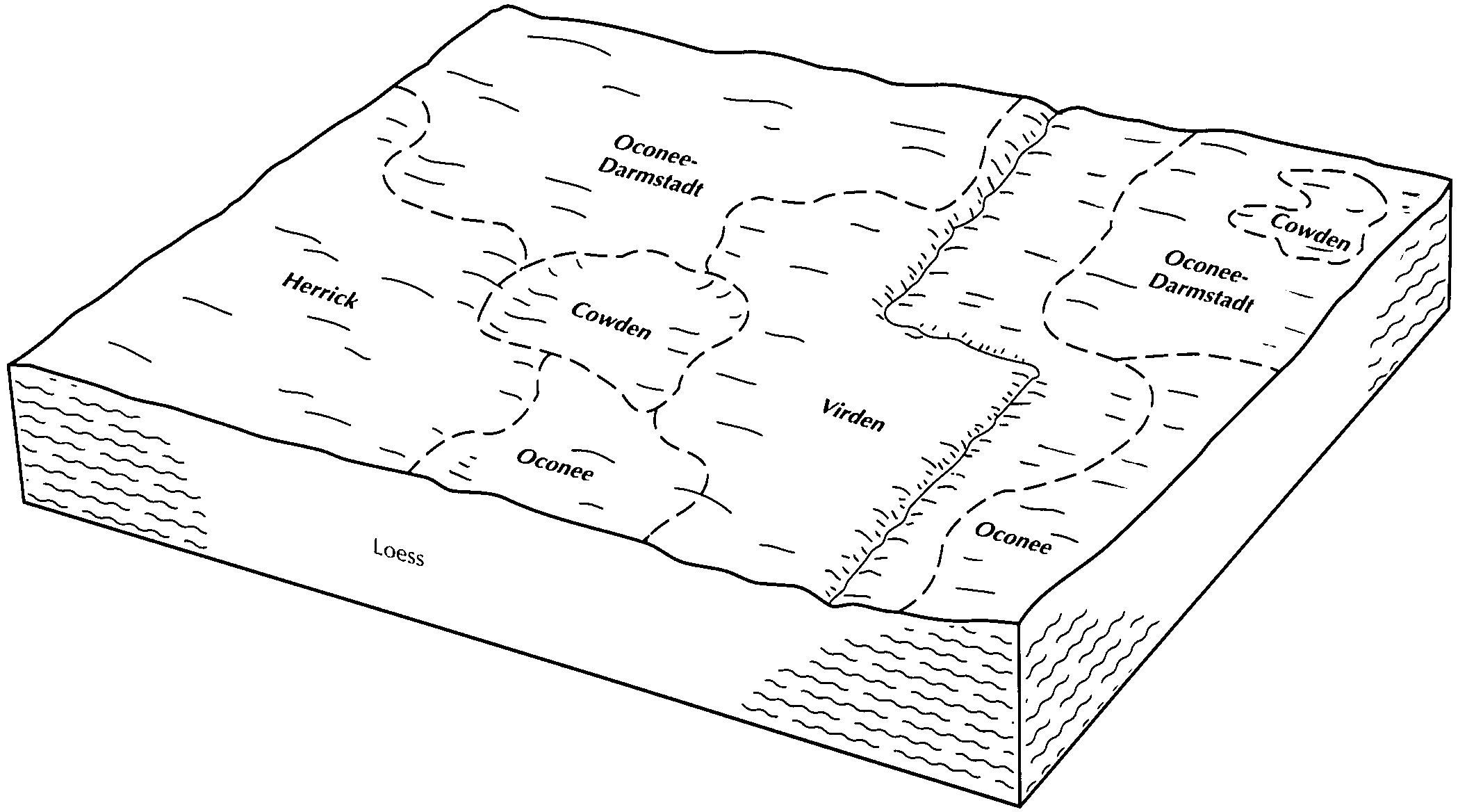
| Oconee-Darmstadt silt loams, 0 to 2 percent slopes | 916A | 15996 | 173889 | 2ytt0 | il005 | 1981 | 1:12000 |
Oconee-Darmstadt silt loams, 2 to 5 percent slopes, eroded | 916B2 | 8083 | 173890 | 5tyc | il005 | 1981 | 1:12000 |
Oconee silt loam, 2 to 5 percent slopes | 113B | 3584 | 173834 | 2tp7z | il005 | 1981 | 1:12000 |
Oconee silt loam, 0 to 2 percent slopes | 113A | 3389 | 173833 | 2tp7w | il005 | 1981 | 1:12000 |
Oconee silt loam, 2 to 5 percent slopes, eroded | 113B2 | 1654 | 173835 | 2wk1k | il005 | 1981 | 1:12000 |
Oconee silt loam, 0 to 2 percent slopes | 113A | 11808 | 261671 | 2tp7w | il021 | 1999 | 1:12000 |
Oconee silt loam, 2 to 5 percent slopes | 113B | 7175 | 261672 | 2tp7z | il021 | 1999 | 1:12000 |
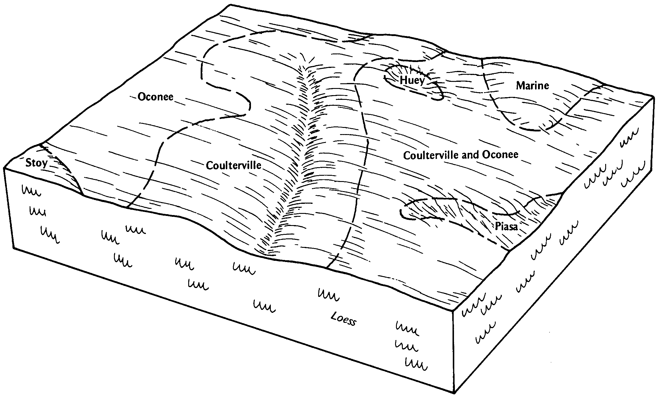
Oconee-Darmstadt-Coulterville silt loams, 0 to 2 percent slopes | 882A | 5469 | 261772 | 2ytt1 | il021 | 1999 | 1:12000 |
Oconee silt loam, 2 to 5 percent slopes | 113B | 1441 | 1607448 | 2tp7z | il023 | 2006 | 1:12000 |
Oconee silt loam, 0 to 2 percent slopes | 113A | 853 | 1607447 | 2tp7w | il023 | 2006 | 1:12000 |
Oconee-Darmstadt silt loams, 0 to 2 percent slopes | 916A | 15425 | 174685 | 2ytt0 | il027 | 1992 | 1:15840 |
Oconee-Darmstadt complex, 2 to 5 percent slopes, eroded | 916B2 | 10095 | 174686 | 5vs1 | il027 | 1992 | 1:15840 |
Oconee silt loam, 0 to 2 percent slopes | 113A | 7720 | 174632 | 2tp7w | il027 | 1992 | 1:15840 |
Oconee silt loam, 2 to 5 percent slopes, eroded | 113B2 | 3025 | 174633 | 2wk1k | il027 | 1992 | 1:15840 |
Oconee silt loam, 0 to 2 percent slopes | 113A | 110 | 843539 | 2tp7w | il045 | 1997 | 1:12000 |
Oconee silt loam, 0 to 2 percent slopes | 113A | 3757 | 173365 | 2tp7w | il051 | 1991 | 1:15840 |
Oconee silt loam, 2 to 5 percent slopes | 113B | 1668 | 173366 | 2tp7z | il051 | 1991 | 1:15840 |
Oconee-Darmstadt silt loams, 0 to 2 percent slopes | 916A | 424 | 3088477 | 2ytt0 | il051 | 1991 | 1:15840 |
Oconee silt loam, 0 to 2 percent slopes | 113A | 5034 | 728486 | 2tp7w | il083 | 2002 | 1:12000 |
Oconee silt loam, 2 to 5 percent slopes | 113B | 36 | 728487 | 2tp7z | il083 | 2002 | 1:12000 |
Oconee silt loam, 2 to 4 percent slopes | 113B | 238 | 176628 | 5xsp | il101 | 1952 | 1:42240 |
Oconee silt loam, 0 to 2 percent slopes | 113A | 9261 | 199174 | 2tp7w | il117 | 1999 | 1:12000 |
Oconee silt loam, 2 to 5 percent slopes | 113B | 3748 | 199175 | 2tp7z | il117 | 1999 | 1:12000 |
Oconee-Darmstadt-Coulterville silt loams, 2 to 5 percent slopes | 882B | 53 | 199236 | 6p9z | il117 | 1999 | 1:12000 |
Oconee-Darmstadt-Coulterville silt loams, 2 to 5 percent slopes | 882B | 9511 | 198974 | 6p1j | il119 | 2001 | 1:12000 |
Oconee silt loam, 2 to 5 percent slopes | 113B | 8613 | 198953 | 2tp7z | il119 | 2001 | 1:12000 |
Oconee-Orthents-Urban land complex, 2 to 5 percent slopes | 2113B | 456 | 200833 | 6qzh | il119 | 2001 | 1:12000 |
Oconee silt loam, 0 to 2 percent slopes | 113A | 6 | 207594 | 2tp7w | il119 | 2001 | 1:12000 |
Oconee-Darmstadt-Coulterville silt loams, 0 to 2 percent slopes | 882A | 75 | 184150 | 2ytt1 | il133 | 1998 | 1:12000 |
Oconee-Darmstadt-Coulterville silt loams, 2 to 5 percent slopes | 882B | 16 | 184151 | 65mc | il133 | 1998 | 1:12000 |
Oconee-Darmstadt-Coulterville silt loams, 2 to 5 percent slopes, eroded | 882B2 | 21499 | 1721547 | 1vsds | il135 | 2007 | 1:12000 |
Oconee silt loam, 2 to 5 percent slopes | 113B | 17534 | 1721385 | 2tp7z | il135 | 2007 | 1:12000 |
Oconee silt loam, 0 to 2 percent slopes | 113A | 9002 | 1721382 | 2tp7w | il135 | 2007 | 1:12000 |
Oconee-Darmstadt-Coulterville silt loams, 0 to 2 percent slopes | 882A | 4570 | 1721384 | 2ytt1 | il135 | 2007 | 1:12000 |
Oconee silt loam, 2 to 5 percent slopes, eroded | 113B2 | 2365 | 1721387 | 2wk1k | il135 | 2007 | 1:12000 |
Oconee-Darmstadt-Coulterville silt loams, 2 to 5 percent slopes | 882B | 747 | 1721386 | 1vs7l | il135 | 2007 | 1:12000 |
Oconee silt loam, 0 to 2 percent slopes | 113A | 2275 | 1405435 | 2tp7w | il145 | 2005 | 1:12000 |
Oconee-Darmstadt-Coulterville silt loams, 0 to 2 percent slopes | 882A | 2089 | 1600597 | 2ytt1 | il145 | 2005 | 1:12000 |
Coulterville-Oconee silt loams, 0 to 2 percent slopes | 909A | 8276 | 200538 | 6qnz | il157 | 2001 | 1:12000 |
Coulterville-Oconee silt loams, 2 to 5 percent slopes | 909B | 4906 | 200539 | 6qp0 | il157 | 2001 | 1:12000 |
Oconee silt loam, 0 to 2 percent slopes | 113A | 1864 | 200465 | 2tp7w | il157 | 2001 | 1:12000 |
Oconee silt loam, 2 to 5 percent slopes | 113B | 1024 | 200466 | 2tp7z | il157 | 2001 | 1:12000 |
Oconee-Darmstadt-Coulterville silt loams, 0 to 2 percent slopes | 882A | 6552 | 183171 | 2ytt1 | il163 | 1997 | 1:12000 |
Oconee-Darmstadt-Coulterville silt loams, 2 to 5 percent slopes | 882B | 4436 | 183172 | 64ls | il163 | 1997 | 1:12000 |
Oconee silt loam, 0 to 2 percent slopes | 113A | 3840 | 182848 | 2tp7w | il163 | 1997 | 1:12000 |
Oconee silt loam, 2 to 5 percent slopes | 113B | 2128 | 182849 | 2tp7z | il163 | 1997 | 1:12000 |
Oconee silt loam, 0 to 2 percent slopes | 113A | 22913 | 178979 | 2tp7w | il173 | 1990 | 1:15840 |
Oconee-Darmstadt silt loams, 0 to 2 percent slopes | 916A | 11094 | 179048 | 2ytt0 | il173 | 1990 | 1:15840 |
Oconee silt loam, 2 to 5 percent slopes | 113B | 7067 | 178980 | 2tp7z | il173 | 1990 | 1:15840 |
Oconee-Darmstadt-Coulterville silt loams, 0 to 2 percent slopes | 882A | 35342 | 1542494 | 2ytt1 | il189 | 2006 | 1:12000 |
Oconee silt loam, 0 to 2 percent slopes | 113A | 6545 | 1528930 | 2tp7w | il189 | 2006 | 1:12000 |
Oconee-Darmstadt-Coulterville silt loams, 2 to 5 percent slopes | 882B | 3573 | 1542496 | 1ns2y | il189 | 2006 | 1:12000 |
Oconee silt loam, 2 to 5 percent slopes | 113B | 3518 | 1528929 | 2tp7z | il189 | 2006 | 1:12000 |


