Official Series Description


Lab Data Summary

Aggregate lab data for the NIXA soil series. This aggregation is based on all pedons with a current taxon name of NIXA, and applied along 1-cm thick depth slices. Solid lines are the slice-wise median, bounded on either side by the interval defined by the slice-wise 5th and 95th percentiles. The median is the value that splits the data in half. Five percent of the data are less than the 5th percentile, and five percent of the data are greater than the 95th percentile. Values along the right hand side y-axis describe the proportion of pedon data that contribute to aggregate values at this depth. For example, a value of "90%" at 25cm means that 90% of the pedons correlated to NIXA were used in the calculation. Source: KSSL snapshot . Methods used to assemble the KSSL snapshot used by SoilWeb / SDE

Click the image to view it full size.

Pedons used in the lab summary:

MLRALab IDPedon IDTaxonnameCINSSL / NASIS ReportsLink To SoilWeb GMap
116A59ID091959AR06309Nixa3Primary | Supplementary | Taxonomy | Pedon | Water Retention | Correlation | Andic Soil Properties35.8267,-91.7746
116A63WS231966AR143001Nixa3Primary | Supplementary | Taxonomy | Pedon | Water Retention | Correlation | Andic Soil Properties36.172,-94.0051
116A67BN031967AR007003Nixa3Primary | Supplementary | Taxonomy | Pedon | Water Retention | Correlation | Andic Soil Properties36.4808588,-94.2449296
116A68BO051968AR009005Nixa3Primary | Supplementary | Taxonomy | Pedon | Water Retention | Correlation | Andic Soil Properties36.4910881,-93.2303211
116A73WS011973AR143001Nixa3Primary | Supplementary | Taxonomy | Pedon | Water Retention | Correlation | Andic Soil Properties36.1058434,-94.3638572
116A74MR021974AR089002Nixa3Primary | Supplementary | Taxonomy | Pedon | Water Retention | Correlation | Andic Soil Properties36.2777619,-92.6805481
116A75WS011975AR143001Nixa3Primary | Supplementary | Taxonomy | Pedon | Water Retention | Correlation | Andic Soil Properties36.0793342,-94.2929648
116AM87161191987MO161019Nixa3Primary | Supplementary | Taxonomy | Pedon | Water Retention | Correlation | Andic Soil Properties37.9141804,-91.8690063
116AM91209181991MO209102Nixa4Primary | Supplementary | Taxonomy | Pedon | Water Retention | Correlation | Andic Soil Properties36.7374678,-93.4479998
116AM94613061994MO203006MNixa4Primary | Supplementary | Taxonomy | Pedon | Water Retention | Correlation | Andic Soil Properties37.1684861,-91.5470028
116AM95613911995MO203091MNixa4Primary | Supplementary | Taxonomy | Pedon | Water Retention | Correlation | Andic Soil Properties37.2674194,-91.4133361
116AM95613931995MO203093MNixa4Primary | Supplementary | Taxonomy | Pedon | Water Retention | Correlation | Andic Soil Properties37.2677139,-91.4152472
116AM96179041996MO179004MNixa4Primary | Supplementary | Taxonomy | Pedon | Water Retention | Correlation | Andic Soil Properties37.5837917,-91.2307
116AM96179051996MO179005MNixa4Primary | Supplementary | Taxonomy | Pedon | Water Retention | Correlation | Andic Soil Properties37.5853222,-91.2262806
116AM96179251996MO179025MNixa4Primary | Supplementary | Taxonomy | Pedon | Water Retention | Correlation | Andic Soil Properties37.5768194,-91.2925111
116AM98613941998MO203094MNixa4Primary | Supplementary | Taxonomy | Pedon | Water Retention | Correlation | Andic Soil Properties37.2371361,-91.1888194
116AM99017101999MO017023Nixa4Primary | Supplementary | Taxonomy | Pedon | Water Retention | Correlation | Andic Soil Properties37.5213361,-90.0695667
116AM00179232000MO179023MNixa4Primary | Supplementary | Taxonomy | Pedon | Water Retention | Correlation | Andic Soil Properties37.3131083,-91.0443722
116AM00179572000MO179057MNixa4Primary | Supplementary | Taxonomy | Pedon | Water Retention | Correlation | Andic Soil Properties37.3213528,-91.0356278
116AM00179582000MO179058MNixa4Primary | Supplementary | Taxonomy | Pedon | Water Retention | Correlation | Andic Soil Properties37.3212389,-91.0341528
116AM00179602000MO179060MNixa4Primary | Supplementary | Taxonomy | Pedon | Water Retention | Correlation | Andic Soil Properties37.3239694,-91.02495
116AM00179682000MO179068MNixa4Primary | Supplementary | Taxonomy | Pedon | Water Retention | Correlation | Andic Soil Properties37.3212083,-91.0285667
116B80P03611980MO145005Nixa7Primary | Supplementary | Taxonomy | Pedon | Water Retention | Correlation | Andic Soil Properties36.8038902,-94.3019409
116BM90209051990MO209005Nixa4Primary | Supplementary | Taxonomy | Pedon | Water Retention | Correlation | Andic Soil Properties36.8888889,-93.6352778
116BM91209651991MO209091Nixa4Primary | Supplementary | Taxonomy | Pedon | Water Retention | Correlation | Andic Soil Properties36.776727,-93.3421052
116BM92209431992MO209180Nixa4Primary | Supplementary | Taxonomy | Pedon | Water Retention | Correlation | Andic Soil Properties36.8915179,-93.5413529
116BM99145021999MO145002Nixa4Primary | Supplementary | Taxonomy | Pedon | Water Retention | Correlation | Andic Soil Properties36.8131,-94.3057833
116BM99145031999MO145003Nixa4Primary | Supplementary | Taxonomy | Pedon | Water Retention | Correlation | Andic Soil Properties36.8116583,-94.3057583
116BM99145051999MO145005Nixa4Primary | Supplementary | Taxonomy | Pedon | Water Retention | Correlation | Andic Soil Properties37.2037904,-93.4213064
116CM91123111991MO123011MNixa4Primary | Supplementary | Taxonomy | Pedon | Water Retention | Correlation | Andic Soil Properties37.4798056,-90.35675
116CM99017241999MO017035Nixa4Primary | Supplementary | Taxonomy | Pedon | Water Retention | Correlation | Andic Soil Properties37.364575,-90.1289639
11774WS021974AR143002Nixa3Primary | Supplementary | Taxonomy | Pedon | Water Retention | Correlation | Andic Soil Properties35.9945,-94.3838

Water Balance

Monthly water balance estimated using a leaky-bucket style model for the NIXA soil series. Monthly precipitation (PPT) and potential evapotranspiration (PET) have been estimated from the 50th percentile of gridded values (PRISM 1981-2010) overlapping with the extent of SSURGO map units containing each series as a major component. Monthly PET values were estimated using the method of Thornthwaite (1948). These (and other) climatic parameters are calculated with each SSURGO refresh and provided by the fetchOSD function of the soilDB package. Representative water storage values (“AWC” in the figures) were derived from SSURGO by taking the 50th percentile of profile-total water storage (sum[awc_r * horizon thickness]) for each soil series. Note that this representation of “water storage” is based on the average ability of most plants to extract soil water between 15 bar (“permanent wilting point”) and 1/3 bar (“field capacity”) matric potential. Soil moisture state can be roughly interpreted as “dry” when storage is depleted, “moist” when storage is between 0mm and AWC, and “wet” when there is a surplus. Clearly there are a lot of assumptions baked into this kind of monthly water balance. This is still a work in progress.

Click the image to view it full size.


Click the image to view it full size.

Sibling Summary

Siblings are those soil series that occur together in map units, in this case with the NIXA series. Sketches are arranged according to their subgroup-level taxonomic structure. Source: SSURGO snapshot , parsed OSD records and snapshot of SC database .

Click the image to view it full size.

Select annual climate data summaries for the NIXA series and siblings. Series are sorted according to hierarchical clustering of median values. Source: SSURGO map unit geometry and 1981-2010, 800m PRISM data .

Click the image to view it full size.

Geomorphic description summaries for the NIXA series and siblings. Series are sorted according to hierarchical clustering of proportions and relative hydrologic position within an idealized landform (e.g. top to bottom). Most soil series (SSURGO components) are associated with a hillslope position and one or more landform-specific positions: hills, mountain slopes, terraces, and/or flats. Proportions can be interpreted as an aggregate representation of geomorphic membership. The values printed to the left (number of component records) and right (Shannon entropy) of stacked bars can be used to judge the reliability of trends. Small Shannon entropy values suggest relatively consistent geomorphic association, while larger values suggest lack thereof. Source: SSURGO component records .

Click the image to view it full size.

Click the image to view it full size.

Click the image to view it full size.

Click the image to view it full size.

There are insufficient data to create the 3D flats position figure.

Competing Series

Soil series competing with NIXA share the same family level classification in Soil Taxonomy. Source: parsed OSD records and snapshot of the SC database .

Click the image to view it full size.

Select annual climate data summaries for the NIXA series and competing. Series are sorted according to hierarchical clustering of median values. Source: SSURGO map unit geometry and 1981-2010, 800m PRISM data .

There are insufficient data to create the annual climate figure.

Geomorphic description summaries for the NIXA series and competing. Series are sorted according to hierarchical clustering of proportions and relative hydrologic position within an idealized landform (e.g. top to bottom). Proportions can be interpreted as an aggregate representation of geomorphic membership. Most soil series (SSURGO components) are associated with a hillslope position and one or more landform-specific positions: hills, mountain slopes, terraces, and/or flats. The values printed to the left (number of component records) and right (Shannon entropy) of stacked bars can be used to judge the reliability of trends. Shannon entropy values close to 0 represent soil series with relatively consistent geomorphic association, while values close to 1 suggest lack thereof. Source: SSURGO component records .

There are insufficient data to create the 2D hillslope position figure.

There are insufficient data to create the 3D hills figure.

There are insufficient data to create the 3D mountains figure.

There are insufficient data to create the 3D terrace figure.

There are insufficient data to create the 3D flats position figure.

Soil series sharing subgroup-level classification with NIXA, arranged according to family differentiae. Hovering over a series name will print full classification and a small sketch from the OSD. Source: snapshot of SC database .

Block Diagrams

Click a link below to display the diagram. Note that these diagrams may be from multiple survey areas.

  1. AR-2011-05-27-02 | Boone County - 1981

    Pattern of soils and parent material in Clarksville-Nixa-Noark unit (Soil Survey of Boone County, Arkansas; 1981).

  2. AR-2012-05-08-02 | Boone County - June 1981

    Pattern of soils and parent material in Clarksville-Nixa-Noark unit (Soil Survey of Boone County, Arkansas; June 1981).

  3. KS-2012-01-20-17 | Cherokee County - August 1985

    Typical pattern of soils and underlying material in the Clarksville-Nixa-Tonti association (Soil Survey of Cherokee County, Kansas; 1985).

Map Units

Map units containing NIXA as a major component. Limited to 250 records.

Map Unit Name Symbol Map Unit Area (ac) Map Unit Key National Map Unit Symbol Soil Survey Area Publication Date Map Scale
Nixa-Noark complex, 3 to 8 percent slopes301638528045072t7dmar00519781:20000
Nixa very gravelly silt loam, 3 to 8 percent slopes26755228044762rk3tar00519781:20000
Nixa very gravelly silt loam, 8 to 12 percent slopes27672128044772rk3var00519781:20000
Nixa-Noark complex, 8 to 20 percent slopes31613028045082t7dlar00519781:20000
Nixa very gravelly silt loam, 3 to 8 percent slopesNfC871555650422rk3tar00719731:20000
Nixa very gravelly silt loam, 8 to 12 percent slopesNfD401345650432rk3var00719731:20000
Nixa very gravelly silt loam, 3 to 8 percent slopes32340215651192rk3tar00919771:20000
Nixa very gravelly silt loam, 8 to 12 percent slopes33258205651202rk3var00919771:20000
Nixa very gravelly silt loam, 8 to 12 percent slopes26213995652312rk3var01519811:20000
Nixa very gravelly silt loam, 3 to 8 percent slopes25132005652302rk3tar01519811:20000
Nixa very gravelly silt loam, 8 to 12 percent slopes36194915659372rk3var08719821:20000
Nixa very gravelly silt loam, 3 to 8 percent slopes35189545659362rk3tar08719821:20000
Nixa-Noark complex, 8 to 20 percent slopes311951728045652t7dlar08919781:20000
Nixa very gravelly silt loam, 8 to 12 percent slopes271883028045342rk3var08919781:20000
Nixa very gravelly silt loam, 3 to 8 percent slopes261076028045332rk3tar08919781:20000
Nixa-Noark complex, 3 to 8 percent slopes30701428045642t7dmar08919781:20000
Nixa very gravelly silt loam, 8 to 12 percent slopes4123205660242rk3var10119841:20000
Nixa very gravelly silt loam, 3 to 8 percent slopes4013275660232rk3tar10119841:20000
Nixa very gravelly silt loam, 8 to 12 percent slopes58C9905664862rk3var12919871:20000
Noark-Nixa complex, 8 to 20 percent slopes3611257566429m0dxar13719811:20000
Clarksville-Nixa complex, 8 to 20 percent slopes55206566444m0fdar13719811:20000
Nixa-Noark complex, 3 to 8 percent slopes3228595664252t7dmar13719811:20000
Nixa very gravelly silt loam, 3 to 8 percent slopes3124355664242rk3tar13719811:20000
Nixa very gravelly silt loam, 3 to 8 percent slopesNaC330465666042rk3tar14319661:20000
Nixa very gravelly silt loam, 8 to 12 percent slopesNaD52415666052rk3var14319661:20000
Nixa very gravelly silt loam, 3 to 8 percent slopes9270657514269052rk3tks02119831:24000
Hailey-Nixa complex, 3 to 15 percent slopes734521745896454811cpgmo00919901:24000
Nixa-Clarksville complex, 3 to 20 percent slopes734851506425361572qpyhmo00919901:24000
Nixa very gravelly silt loam, 3 to 8 percent slopes73480416225361522rk3tmo00919901:24000
Nixa very gravelly silt loam, 3 to 8 percent slopes73480146125361532rk3tmo01119691:24000
Nixa-Clarksville complex, 3 to 8 percent slopes734836228410083482w25jmo06519711:24000
Nixa-Clarksville complex, 8 to 15 percent slopes734842651310083492t7g8mo06519711:24000
Nixa-Clarksville complex, 1 to 3 percent slopes734821232510083472t7g6mo06519711:24000
Nixa-Clarksville complex, 15 to 20 percent slopes73481413810083502t7g9mo06519711:24000
Nixa very gravelly silt loam, 3 to 8 percent slopes73480168825361552rk3tmo07719791:24000
Nixa-Clarksville complex, 3 to 20 percent slopes7348542125361592qpyhmo07719791:24000
Nixa-Clarksville complex, 3 to 20 percent slopes734852200525361562qpyhmo10919791:24000
Nixa very gravelly silt loam, 3 to 8 percent slopes734801179225361512rk3tmo10919791:24000
Nixa very gravelly silt loam, 3 to 8 percent slopes734808594525361542rk3tmo14519841:24000
Nixa-Clarksville complex, 3 to 20 percent slopes734851400225361582qpyhmo14519841:24000
Nixa gravelly silt loam, 0 to 3 percent slopesNixB1246234862rk3sok02119671:24000
Nixa gravelly silt loam, 0 to 3 percent slopesNcB4831065182rk3sok03519681:20000
Nixa gravelly silt loam, 0 to 3 percent slopesNxB131741065642rk3sok09719721:24000
Nixa cherty silt loam, 5 to 12 percent slopesNxC309528185kqm7tn14719651:15840
Nixa cherty silt loam, 2 to 5 percent slopesNxB187528184kqm6tn14719651:15840
Nixa very cherty silt loam, 2 to 15 percent slopes64C1956518015kd15va01519781:15840
Frederick-Nixa complex, 2 to 7 percent slopes46B1119517825kcv1va01519781:15840
Frederick-Nixa complex, 7 to 15 percent slopes46C1060517826kcv2va01519781:15840
Nixa very cherty silt loam, 15 to 25 percent slopes64D299518016kd16va01519781:15840
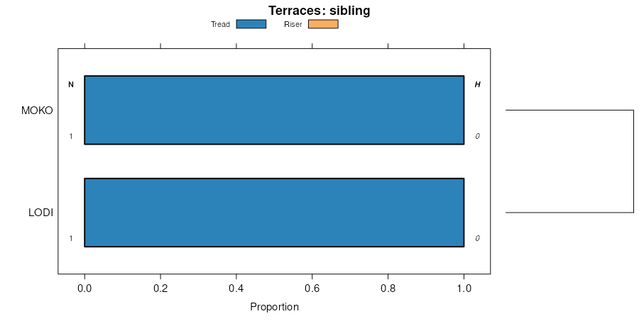
Nixa-Frederick-Lodi gravelly loams, 7 to 15 percent slopes50C747518432kdgmva16519801:20000
Nixa-Frederick-Lodi gravelly loams, 2 to 7 percent slopes50B230518431kdglva16519801:20000
Nixa very gravelly silt loam, 2 to 15 percent slopes64C730985122y9qqva7901:12000

Map of Series Extent

Approximate geographic distribution of the NIXA soil series. To learn more about how this distribution was mapped, or to compare this soil series extent to others, use the Series Extent Explorer (SEE) application. Source: generalization of SSURGO geometry .