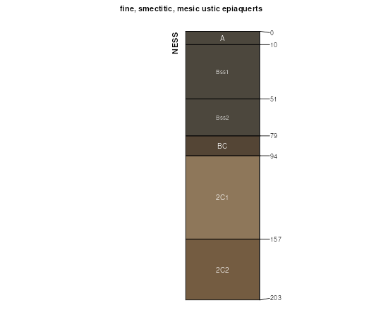
| Ness silty clay loam, 0 to 1 percent slopes, occasionally ponded | 69 | 8213 | 96861 | 2zwln | co063 | 1996 | 1:24000 |
Ness silty clay loam, 0 to 1 percent slopes, occasionally ponded | 174 | 892 | 105255 | 2zwln | co073 | 2001 | 1:24000 |
Ness silty clay loam, 0 to 1 percent slopes, occasionally ponded | 57 | 10091 | 95020 | 2zwln | co121 | 1982 | 1:24000 |
Ness silty clay loam, 0 to 1 percent slopes, occasionally ponded | 2714 | 894 | 1440465 | 307pl | ks009 | 1979 | 1:24000 |
Ness silty clay loam, 0 to 1 percent slopes, occasionally ponded | 2714 | 3016 | 1149574 | 307pl | ks023 | 1987 | 1:24000 |
Ness silty clay loam, 0 to 1 percent slopes, occasionally ponded | 2714 | 3049 | 1381728 | 307pl | ks025 | 1980 | 1:24000 |
Ness silty clay loam, 0 to 1 percent slopes, occasionally ponded | 2714 | 260 | 1150583 | 307pl | ks039 | 1985 | 1:24000 |
Ness silty clay loam, 0 to 1 percent slopes, occasionally ponded | 2714 | 855 | 1380382 | 307pl | ks047 | 1967 | 1:24000 |
Ness silty clay loam, 0 to 1 percent slopes, occasionally ponded | 2714 | 10643 | 1152327 | 307pl | ks055 | 1962 | 1:24000 |
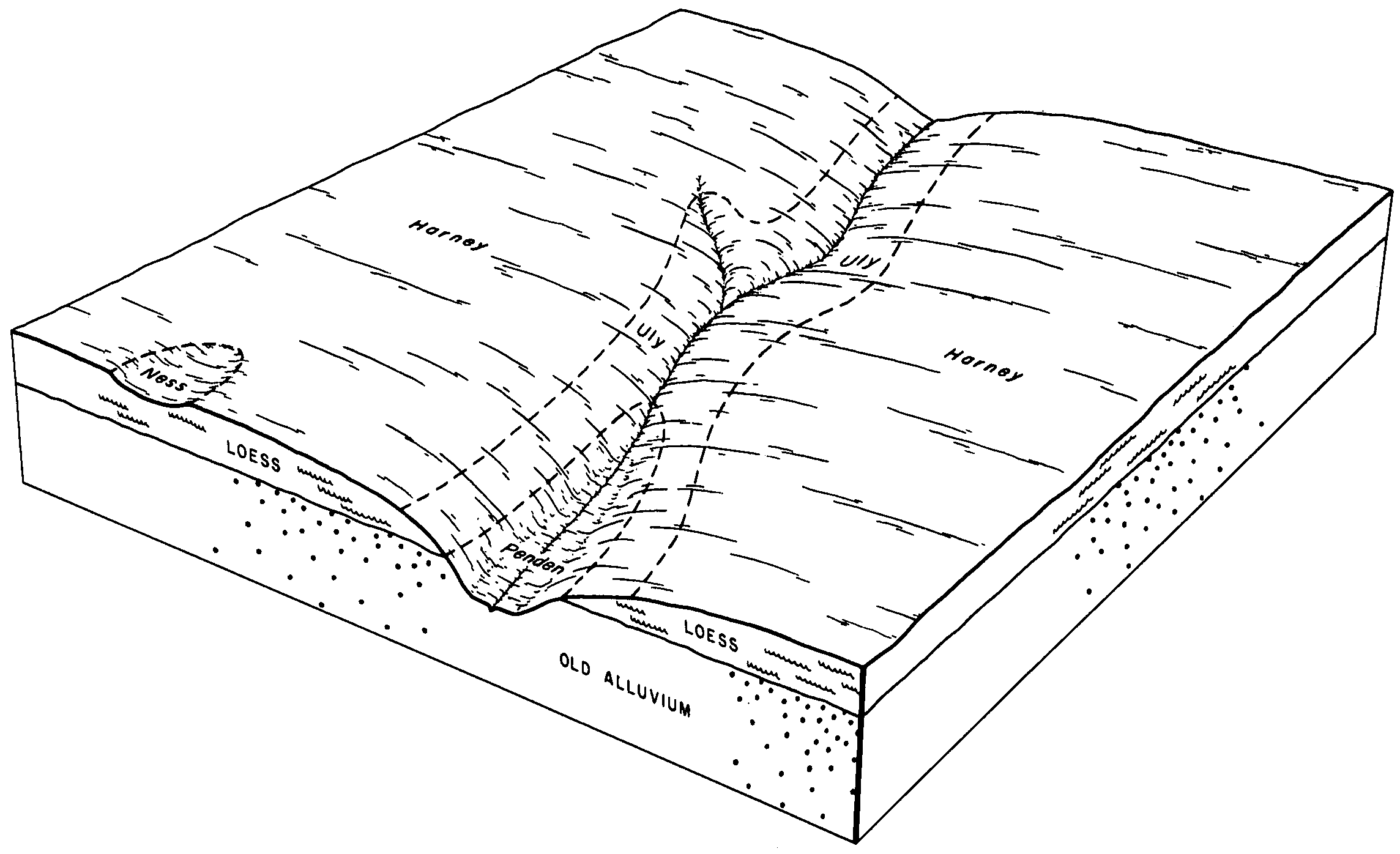
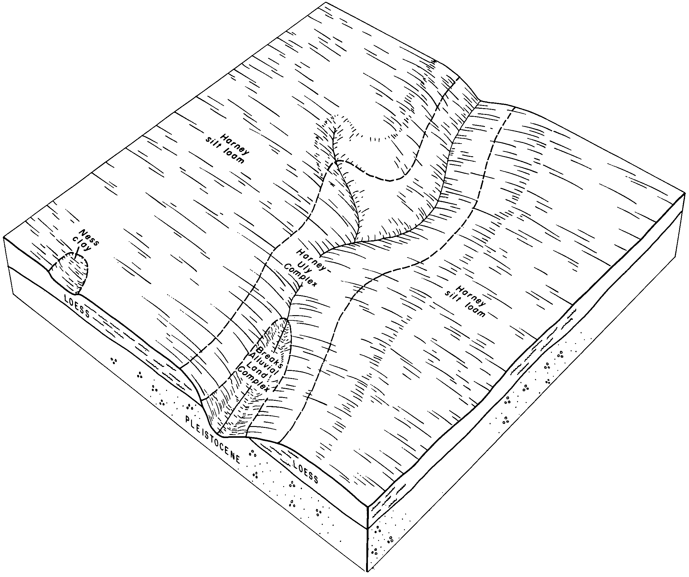
Ness-Pleasant complex, 0 to 3 percent slopes | 1665 | 1014 | 1152321 | 2zwlk | ks055 | 1962 | 1:24000 |
Ness silty clay loam, 0 to 1 percent slopes, occasionally ponded | 2714 | 5874 | 1380445 | 307pl | ks057 | 1962 | 1:24000 |
Ness silty clay loam, 0 to 1 percent slopes, occasionally ponded | 2714 | 403 | 1150696 | 307pl | ks063 | 1974 | 1:24000 |
Ness silty clay loam, 0 to 1 percent slopes, occasionally ponded | 2714 | 2543 | 1380666 | 307pl | ks067 | 1965 | 1:24000 |
Ness silty clay loam, 0 to 1 percent slopes, occasionally ponded | 2714 | 10833 | 1380583 | 307pl | ks069 | 1965 | 1:24000 |
Ness-Pleasant complex, 0 to 3 percent slopes | 1665 | 1615 | 1380576 | 2zwlk | ks069 | 1965 | 1:24000 |
Ness silty clay loam, 0 to 1 percent slopes, occasionally ponded | 2714 | 3641 | 1151836 | 307pl | ks071 | 1959 | 1:24000 |
Ness silty clay loam, 0 to 1 percent slopes, occasionally ponded | 2714 | 1293 | 1152233 | 307pl | ks075 | 1959 | 1:24000 |
Ness silty clay loam, 0 to 1 percent slopes, occasionally ponded | 2714 | 6898 | 1380624 | 307pl | ks081 | 1965 | 1:24000 |
Ness-Pleasant complex, 0 to 3 percent slopes | 1665 | 692 | 1380620 | 2zwlk | ks081 | 1965 | 1:24000 |
Ness silty clay loam, 0 to 1 percent slopes, occasionally ponded | 2714 | 2056 | 1152412 | 307pl | ks083 | 1966 | 1:24000 |
Ness silty clay loam, 0 to 1 percent slopes, occasionally ponded | 2714 | 1706 | 1152280 | 307pl | ks093 | 1961 | 1:24000 |
Ness silty clay loam, 0 to 1 percent slopes, occasionally ponded | 2714 | 735 | 1380532 | 307pl | ks097 | 1983 | 1:24000 |
Ness silty clay loam, 0 to 1 percent slopes, occasionally ponded | 2714 | 5056 | 1152029 | 307pl | ks101 | 1966 | 1:24000 |
Ness silty clay loam, 0 to 1 percent slopes, occasionally ponded | 2714 | 1356 | 1150538 | 307pl | ks109 | 1962 | 1:24000 |
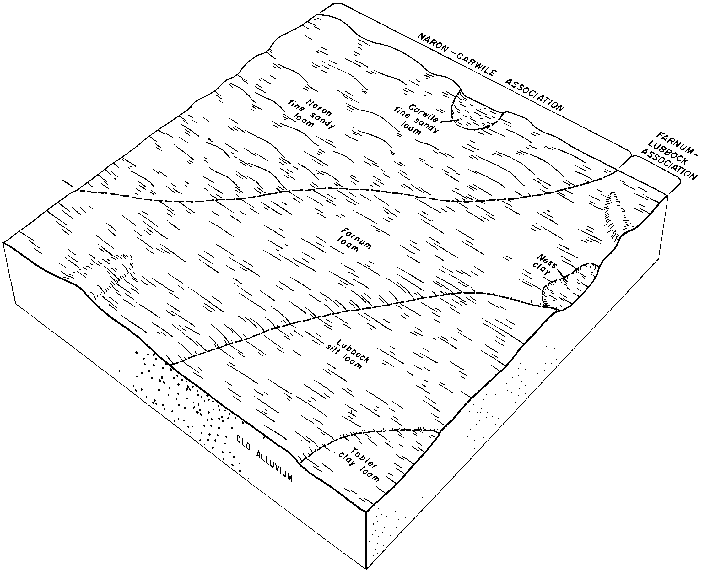
Ness silty clay | 2715 | 604 | 1429201 | 2zt7d | ks113 | 1980 | 1:24000 |
Ness silty clay loam, 0 to 1 percent slopes, occasionally ponded | 2714 | 11148 | 1381798 | 307pl | ks119 | 1973 | 1:24000 |
Ness silty clay loam, 0 to 1 percent slopes, occasionally ponded | 2714 | 551 | 1152082 | 307pl | ks135 | 1971 | 1:24000 |
Ness silty clay loam, 0 to 1 percent slopes, occasionally ponded | 2714 | 769 | 1380134 | 307pl | ks145 | 1976 | 1:24000 |
Ness silty clay loam, 0 to 1 percent slopes, occasionally ponded | 2714 | 407 | 772986 | 307pl | ks153 | 1979 | 1:24000 |
Ness silty clay loam, 0 to 1 percent slopes, occasionally ponded | 2714 | 6997 | 1151988 | 307pl | ks171 | 1963 | 1:24000 |
Ness silty clay loam, 0 to 1 percent slopes, occasionally ponded | 2714 | 3991 | 1382648 | 307pl | ks175 | 1963 | 1:24000 |
Ness silty clay loam, 0 to 1 percent slopes, occasionally ponded | 2714 | 1393 | 1150008 | 307pl | ks179 | 1982 | 1:24000 |
Ness silty clay loam, 0 to 1 percent slopes, occasionally ponded | 2714 | 3818 | 1149625 | 307pl | ks181 | 1967 | 1:24000 |
Ness silty clay loam, 0 to 1 percent slopes, occasionally ponded | 2714 | 1409 | 1382568 | 307pl | ks187 | 1959 | 1:24000 |
Ness silty clay loam, 0 to 1 percent slopes, occasionally ponded | 2714 | 3454 | 1150463 | 307pl | ks193 | 1978 | 1:24000 |
Ness silty clay loam, 0 to 1 percent slopes, occasionally ponded | 2714 | 1840 | 1150205 | 307pl | ks199 | 1984 | 1:24000 |
Ness silty clay loam, 0 to 1 percent slopes, occasionally ponded | 2714 | 2940 | 1151950 | 307pl | ks203 | 1963 | 1:24000 |
Ness clay, 0 to 1 percent slopes, frequently ponded | Ra | 3471 | 382070 | 2rgf9 | ok025 | 1958 | 1:20000 |
Ness clay, 0 to 1 percent slopes, frequently ponded | Ra | 5050 | 384918 | 2rgf9 | ok139 | 1959 | 1:24000 |
Ness clay, 0 to 1 percent slopes, frequently ponded | Ne | 4087 | 364769 | 2rgf9 | tx111 | 1970 | 1:24000 |
Ness clay, 0 to 1 percent slopes, frequently ponded | Ne | 3782 | 367448 | 2rgf9 | tx205 | 1973 | 1:24000 |
Ness clay, 0 to 1 percent slopes, frequently ponded | Ne | 3273 | 367930 | 2rgf9 | tx233 | 1972 | 1:24000 |
Ness clay, 0 to 1 percent slopes, frequently ponded | Ra | 232 | 369475 | 2rgf9 | tx295 | 1971 | 1:24000 |
Ness clay, 0 to 1 percent slopes, frequently ponded | Nc | 4407 | 370827 | 2rgf9 | tx341 | 1968 | 1:24000 |
Ness clay, 0 to 1 percent slopes, frequently ponded | Ra | 15277 | 371095 | 2rgf9 | tx357 | 1966 | 1:20000 |
Ness clay, 0 to 1 percent slopes, frequently ponded | Ne | 4496 | 372107 | 2rgf9 | tx421 | 1970 | 1:24000 |
