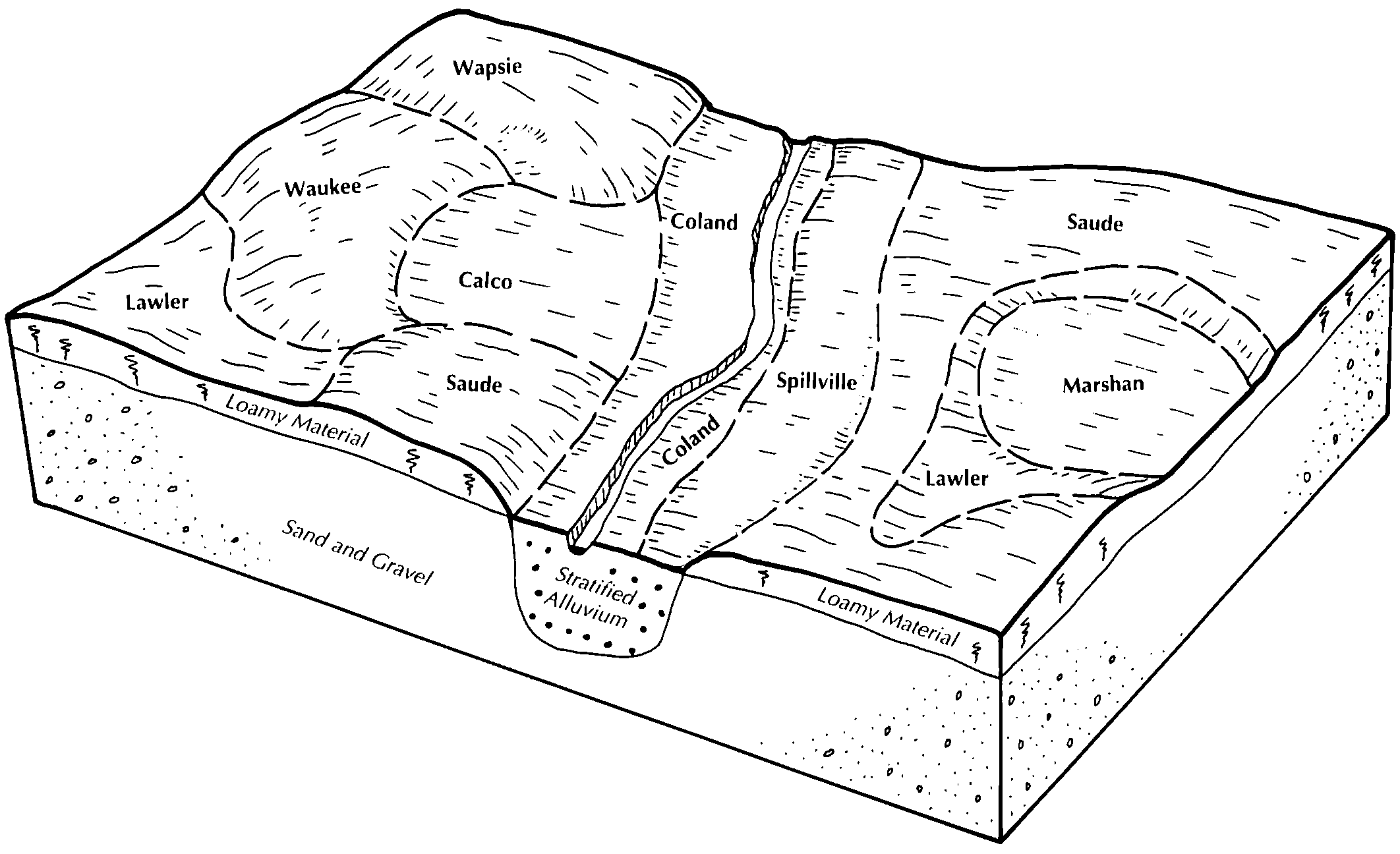
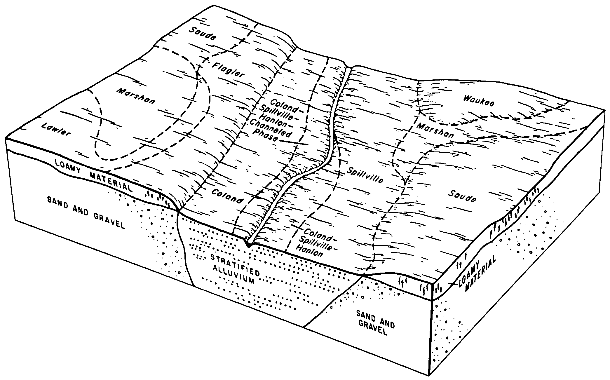
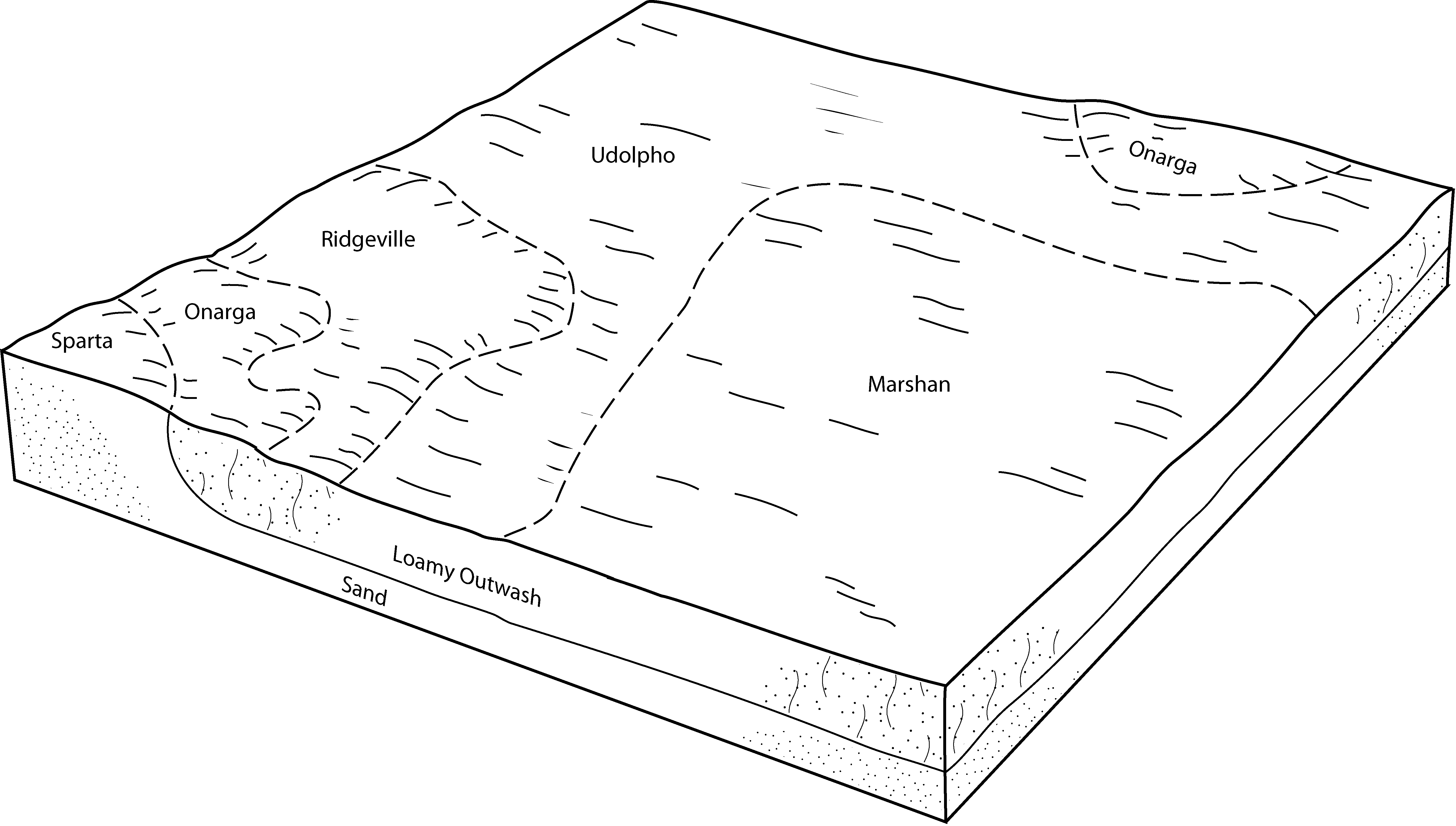
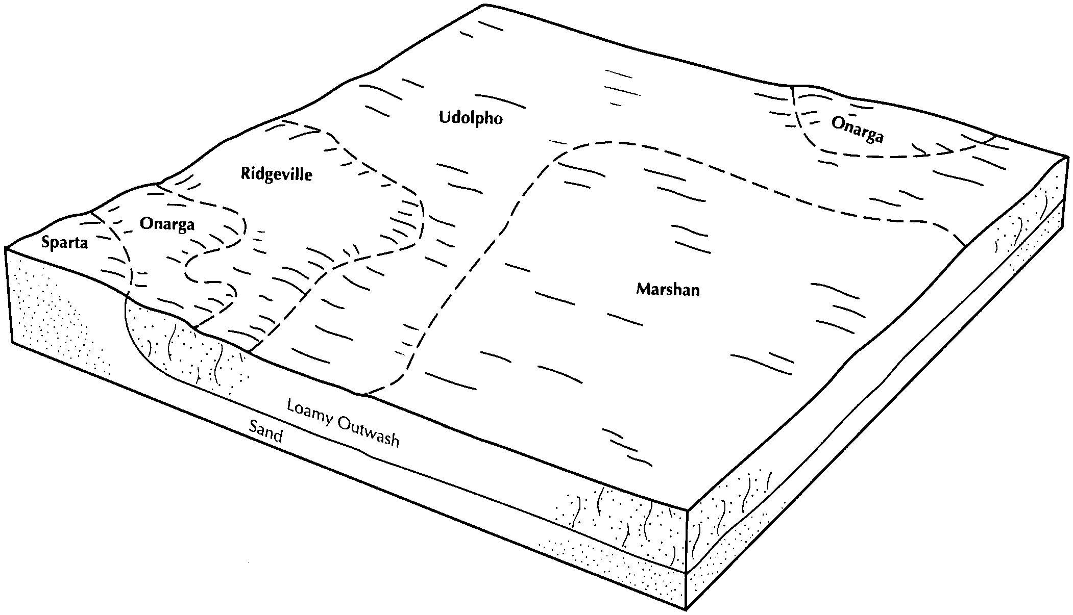
| Marshan clay loam, 0 to 2 percent slopes, rarely flooded | 1152 | 9415 | 611916 | 2tgsb | ia013 | 2001 | 1:12000 |
Marshan-Urban land complex, 0 to 2 percent slopes | 4152 | 550 | 413223 | fvzs | ia013 | 2001 | 1:12000 |
Marshan clay loam, 0 to 2 percent slopes, rarely flooded | 1152 | 7737 | 1586028 | 2tgsb | ia017 | 2008 | 1:12000 |
Marshan clay loam, 0 to 2 percent slopes, rarely flooded | 1152 | 6482 | 2377836 | 2tgsb | ia019 | 1978 | 1:15840 |
Marshan clay loam, 0 to 2 percent slopes, rarely flooded | 1152 | 16700 | 2377844 | 2tgsb | ia023 | 1978 | 1:15840 |
Marshan clay loam, 0 to 2 percent slopes, rarely flooded | 1152 | 12152 | 2377846 | 2tgsb | ia033 | 1978 | 1:15840 |
Marshan clay loam, 0 to 2 percent slopes, rarely flooded | 1152 | 5286 | 2377847 | 2tgsb | ia037 | 1989 | 1:15840 |
Marshan clay loam, 0 to 2 percent slopes, rarely flooded | 1152 | 8606 | 2377851 | 2tgsb | ia045 | 1978 | 1:15840 |
Marshan clay loam, 0 to 2 percent slopes, rarely flooded | 1152 | 5936 | 2377852 | 2tgsb | ia055 | 1984 | 1:15840 |
Marshan silty clay loam, depressional, 0 to 1 percent slopes | 153 | 317 | 404984 | flf0 | ia055 | 1984 | 1:15840 |
Marshan clay loam, 0 to 2 percent slopes, rarely flooded | 1152 | 332 | 2377853 | 2tgsb | ia061 | 1983 | 1:15840 |
Marshan clay loam, 0 to 2 percent slopes, rarely flooded | 1152 | 3527 | 2377857 | 2tgsb | ia065 | 1975 | 1:15840 |
Marshan clay loam, 0 to 2 percent slopes, rarely flooded | 1152 | 2419 | 2377858 | 2tgsb | ia067 | 1989 | 1:15840 |
Marshan clay loam, 0 to 2 percent slopes, rarely flooded | 1152 | 8616 | 2377861 | 2tgsb | ia069 | 1977 | 1:15840 |
Marshan clay loam, 0 to 2 percent slopes, rarely flooded | 1152 | 4201 | 2377863 | 2tgsb | ia075 | 1973 | 1:15840 |
Marshan clay loam, 0 to 2 percent slopes, rarely flooded | 1152 | 1619 | 2377864 | 2tgsb | ia083 | 1982 | 1:15840 |
Marshan clay loam, 0 to 2 percent slopes, rarely flooded | 1152 | 4722 | 2377866 | 2tgsb | ia089 | 1969 | 1:15840 |
Marshan clay loam, depressional | 153 | 331 | 407014 | fnjh | ia089 | 1969 | 1:15840 |
Marshan clay loam, 0 to 2 percent slopes, rarely flooded | 1152 | 1078 | 2377868 | 2tgsb | ia103 | 1979 | 1:15840 |
Marshan clay loam, 0 to 2 percent slopes, rarely flooded | 1152 | 1423 | 2377870 | 2tgsb | ia105 | 1988 | 1:15840 |
Marshan clay loam, 0 to 2 percent slopes, rarely flooded | 1152 | 825 | 2377871 | 2tgsb | ia111 | 1976 | 1:15840 |
Marshan clay loam, 0 to 2 percent slopes, rarely flooded | 1152 | 6334 | 2377873 | 2tgsb | ia113 | 1970 | 1:15840 |
Marshan clay loam, 0 to 2 percent slopes, rarely flooded | 1152 | 1713 | 2377876 | 2tgsb | ia115 | 1984 | 1:15840 |
Marshan clay loam, 0 to 2 percent slopes, rarely flooded | 1152 | 4525 | 2377877 | 2tgsb | ia131 | 1971 | 1:15840 |
Marshan clay loam, 0 to 2 percent slopes, rarely flooded | 1152 | 597 | 2377879 | 2tgsb | ia139 | 1986 | 1:15840 |
Marshan clay loam, 0 to 2 percent slopes, rarely flooded | 1152 | 603 | 2377880 | 2tgsb | ia163 | 1989 | 1:15840 |
Marshan loam, 0 to 2 percent slopes, rarely flooded | 1152 | 1574 | 756308 | td01 | ia191 | 2005 | 1:12000 |
Marshan clay loam, 0 to 2 percent slopes, rarely flooded | 1152 | 11329 | 2398762 | 2tgsb | ia195 | 2012 | 1:12000 |
Marshan loam, 0 to 2 percent slopes | 772A | 741 | 1407221 | 1j7b7 | il007 | 2006 | 1:12000 |
Marshan loam, 0 to 2 percent slopes | 772A | 14277 | 177815 | 5z0z | il125 | 1989 | 1:15840 |
Marshan loam, sandy subsratum, 0 to 2 percent slopes | 760A | 17352 | 793089 | vm8j | il195 | 2003 | 1:12000 |
Marshan loam, 0 to 2 percent slopes | 772A | 1546 | 174176 | 5v7l | il201 | 1997 | 1:12000 |
Marshan silty clay loam | 252 | 8998 | 396814 | f9xg | mn037 | 1980 | 1:15840 |
Marshan clay loam, 0 to 2 percent slopes, rarely flooded | M504A | 8246 | 784813 | 2tgsb | mn039 | 2005 | 1:12000 |
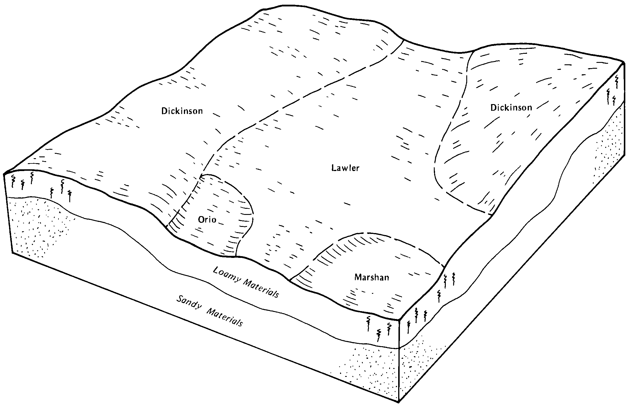
Lawler-Marshan complex, 0 to 2 percent slopes | M514A | 1684 | 1384958 | 1hh52 | mn039 | 2005 | 1:12000 |
Marshan clay loam, depressional, 0 to 1 percent slopes | M533A | 829 | 1542528 | 1ns3z | mn039 | 2005 | 1:12000 |
Marshan silty clay loam | Ma | 35 | 2216757 | 2ddq9 | mn045 | 2008 | 1:12000 |
Marshan silt loam | 252 | 4594 | 397835 | fbzd | mn047 | 1977 | 1:15840 |
Marshan clay loam, 0 to 2 percent slopes, rarely flooded | 252 | 9081 | 400442 | 2tgsb | mn099 | 1986 | 1:15840 |
Marshan silt loam | 252 | 1773 | 400735 | ffzy | mn109 | 1977 | 1:15840 |
Marshan silt loam, depressional | 486 | 876 | 400799 | fg20 | mn109 | 1977 | 1:15840 |
Marshan silt loam, loamy substratum | 1953 | 388 | 429009 | gdf0 | mn169 | 1987 | 1:20000 |
Marshan loam | 7772A | 3612 | 423300 | g6gv | wi021 | 1972 | 1:15840 |
Marshan silt loam | 489A | 8546 | 753535 | t93l | wi025 | 1972 | 1:15840 |
Marshan loam | 7772A | 427 | 421797 | g4xc | wi035 | 1974 | 1:12000 |
Marshan silt loam, rarely flooded | 7489A | 3788 | 425297 | g8k8 | wi045 | 1969 | 1:12000 |
Marshan loam, rarely flooded | 7772A | 1268 | 425296 | g8k7 | wi045 | 1969 | 1:12000 |
Marshan silt loam | 489A | 4086 | 423721 | g6xf | wi047 | 1974 | 1:20000 |
Marshan silt loam | 489A | 146 | 424845 | g82p | wi065 | 1964 | 1:15840 |
Marshan silt loam, 0 to 2 percent slopes | 489A | 144 | 1698616 | 1v0k2 | wi093 | 2006 | 1:12000 |
Marshan loam | 7772A | 5101 | 426340 | g9mx | wi105 | 1970 | 1:20000 |
Marshan loam | 7772A | 3177 | 423175 | g6bt | wi111 | 1977 | 1:15840 |