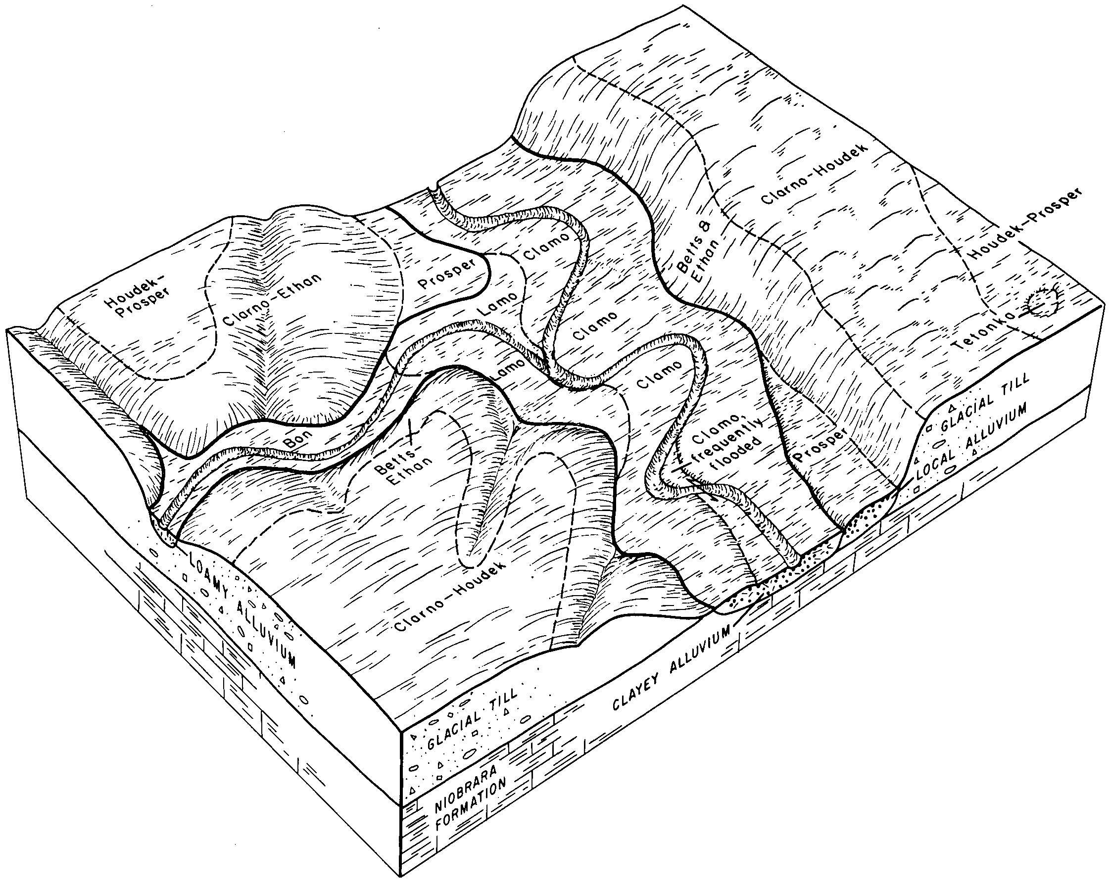
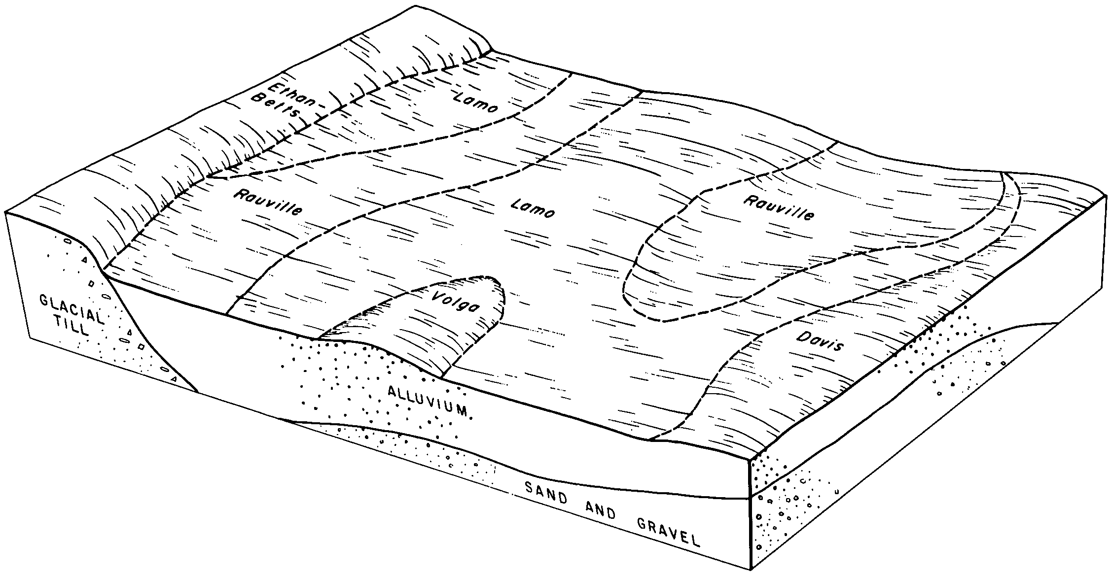
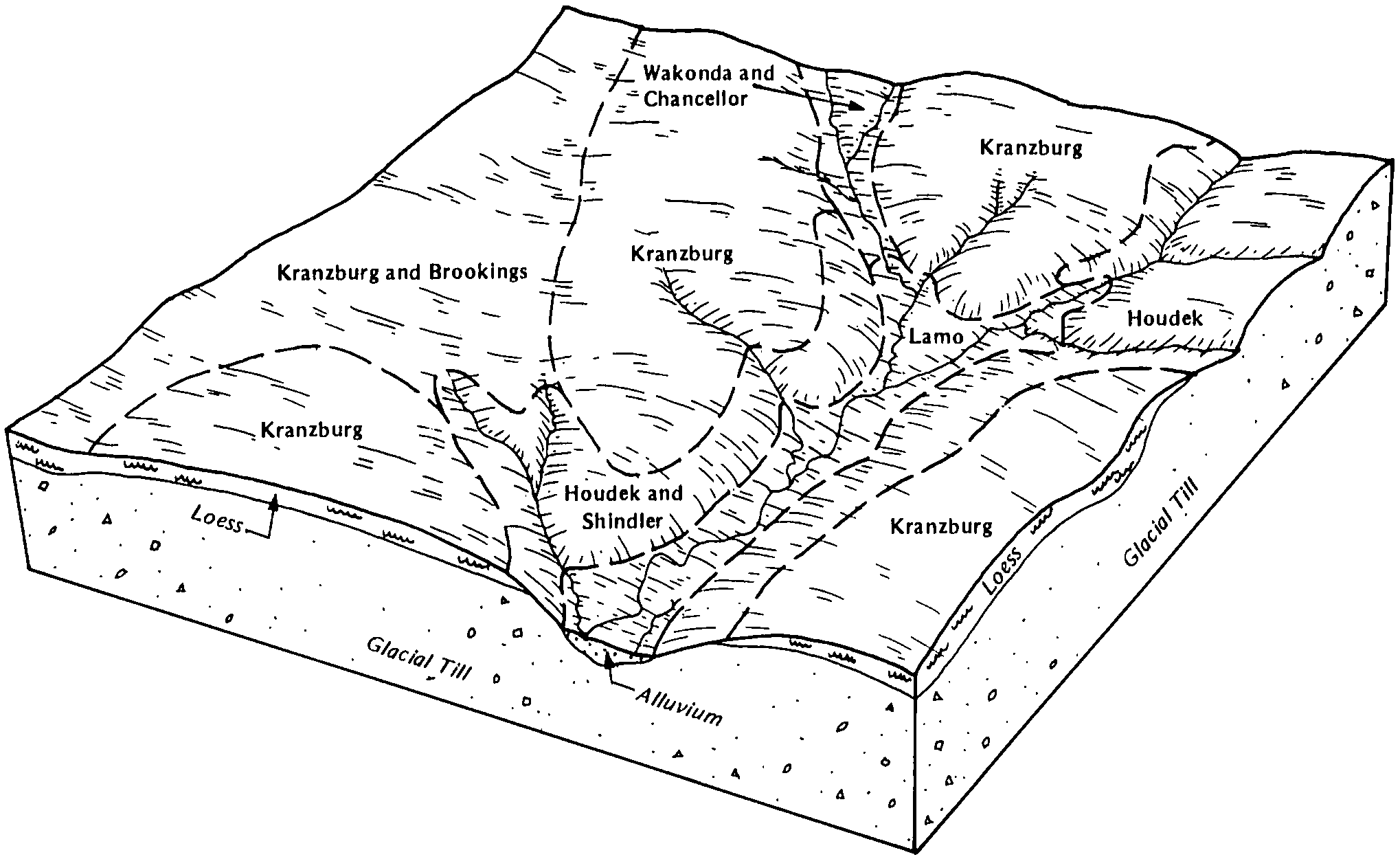
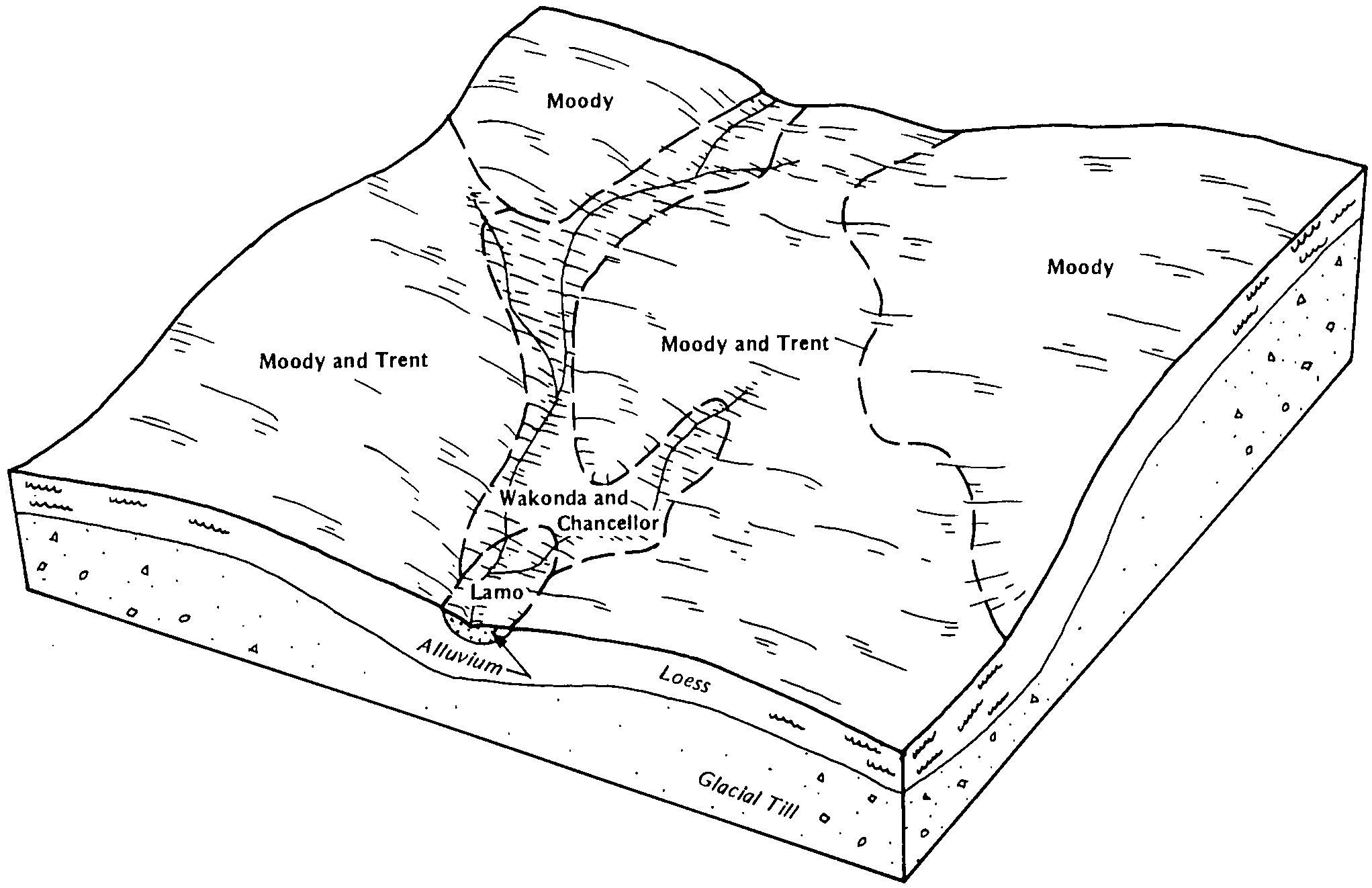
| Lamo clay loam | La | 1437 | 94951 | 35sy | co115 | 1969 | 1:15840 |
Lamo silty clay loam, 0 to 2 percent slopes, occasionally flooded | 3518 | 2446 | 427047 | 2vwbv | ne011 | 1966 | 1:20000 |
Lamo variant loam, 0 to 1 percent slopes | 3522 | 895 | 357805 | d0b3 | ne013 | 1980 | 1:20000 |
Lamo silt loam, sand substratum, 0 to 1 percent slope | 3515 | 478 | 2228197 | 2dsmb | ne019 | 1967 | 1:20000 |
Lamo silty clay loam, 0 to 2 percent slopes, occasionally flooded | 3518 | 1209 | 1691296 | 2vwbv | ne023 | 1979 | 1:20000 |
Lamo silty clay loam, 0 to 2 percent slopes, occasionally flooded | 3518 | 6936 | 427110 | 2vwbv | ne027 | 1982 | 1:20000 |
Lamo silty clay loam, 0 to 2 percent slopes, occasionally flooded | 3518 | 2963 | 427772 | 2vwbv | ne039 | 1973 | 1:20000 |
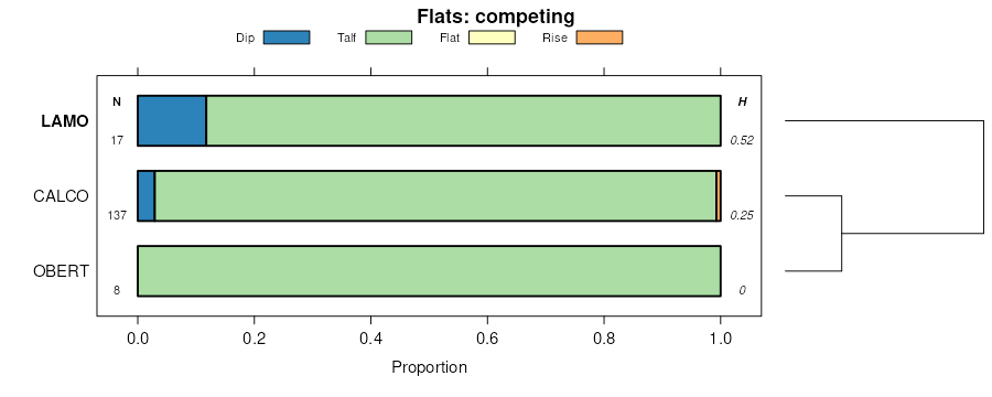
Lamo-Saltine complex, occasionally flooded | 3524 | 773 | 427774 | gc45 | ne039 | 1973 | 1:20000 |
Lamo silty clay loam, 0 to 2 percent slopes, occasionally flooded | 3518 | 9 | 2217044 | 2vwbv | ne043 | 1972 | 1:20000 |
Lamo silty clay loam, 0 to 2 percent slopes, occasionally flooded | 3518 | 3064 | 2217053 | 2vwbv | ne051 | 1975 | 1:20000 |
Lamo silt loam, overwash, 0 to 2 percent slopes, occasionally flooded | 3514 | 976 | 2217074 | 2vwbw | ne051 | 1975 | 1:20000 |
Lamo silt loam, sand substratum, 0 to 1 percent slope | 3515 | 1685 | 1700158 | 1v24t | ne079 | 2003 | 1:12000 |
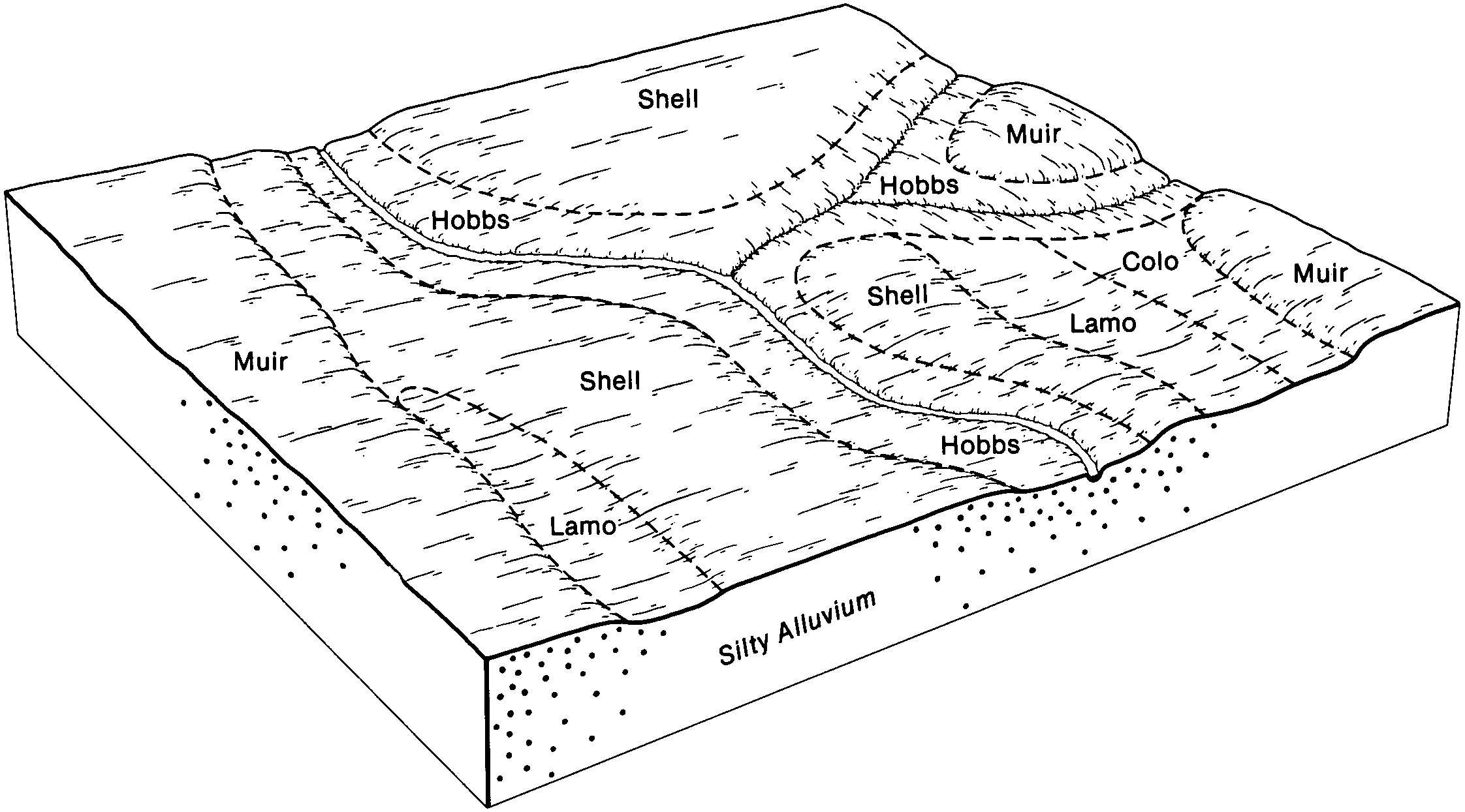
Lamo-Lute loams, 0 to 2 percent slopes | 3523 | 700 | 100117 | 3c5l | ne089 | 1981 | 1:20000 |
Lamo silt loam, occasionally flooded | 3513 | 277 | 99728 | 3bs1 | ne093 | 1968 | 1:12000 |
Lamo silty clay loam, occasionally flooded | 3518 | 1553 | 1691363 | 1ts03 | ne109 | 1977 | 1:20000 |
Lamo silty clay loam, 0 to 2 percent slopes, occasionally flooded | 3518 | 3494 | 427409 | 2vwbv | ne119 | 1981 | 1:20000 |
Lamo silt loam, overwash, 0 to 2 percent slopes, occasionally flooded | 3514 | 408 | 427411 | 2vwbw | ne119 | 1981 | 1:20000 |
Lamo-Saltine complex, occasionally flooded | 3524 | 6371 | 1709657 | 1vd17 | ne121 | 1978 | 1:20000 |
Lamo clay loam, sandy substratum, 0 to 1 percent slopes | 3512 | 4166 | 1709656 | 1vd16 | ne121 | 1978 | 1:20000 |
Lamo silt loam, moderately saline, occasionally flooded | 3525 | 3022 | 427447 | gbsm | ne125 | 1958 | 1:20000 |
Lamo silty clay loam, occasionally flooded | 3518 | 1094 | 427481 | gbtq | ne125 | 1958 | 1:20000 |
Lamo-Saltine complex, occasionally flooded | 3524 | 715 | 2228997 | 2dtg4 | ne125 | 1958 | 1:20000 |
Lamo clay loam, sandy substratum, 0 to 1 percent slopes | 3512 | 190 | 2228996 | 2dtg3 | ne125 | 1958 | 1:20000 |
Lamo silty clay loam, 0 to 2 percent slopes, occasionally flooded | 3518 | 3237 | 2217132 | 2vwbv | ne139 | 1970 | 1:20000 |
Lamo silty clay loam, 0 to 2 percent slopes, occasionally flooded | 3518 | 3477 | 427650 | 2vwbv | ne141 | 1984 | 1:20000 |
Lamo silty clay loam, sandy substratum | 3519 | 4390 | 1692272 | 1tsyf | ne143 | 1967 | 1:20000 |
Lamo silty clay loam, occasionally flooded | 3518 | 3269 | 1691428 | 1ts26 | ne155 | 1995 | 1:12000 |
Lamo silty clay loam, occasionally flooded | 3518 | 2363 | 1691225 | 1trvn | ne159 | 1967 | 1:20000 |
Lamo silty clay loam, 0 to 2 percent slopes, occasionally flooded | 3518 | 973 | 426835 | 2vwbv | ne167 | 1980 | 1:20000 |
Lamo silty clay loam, occasionally flooded | 3518 | 1478 | 1692430 | 1tt3j | ne169 | 1965 | 1:20000 |
Lamo silt loam, overwash, 0 to 2 percent slopes, occasionally flooded | 3514 | 3246 | 427691 | 2vwbw | ne173 | 1966 | 1:20000 |
Lamo silty clay loam, 0 to 2 percent slopes, occasionally flooded | 3518 | 2849 | 427717 | 2vwbv | ne173 | 1966 | 1:20000 |
Coleridge and Lamo silty clay loam, 0 to 2 percent slopes, occasionally flooded | 7772 | 346 | 2217299 | 2zp2v | ne173 | 1966 | 1:20000 |
Lamo silty clay loam, 0 to 2 percent slopes, occasionally flooded | 3518 | 6398 | 426788 | 2vwbv | ne179 | 1970 | 1:20000 |
Coleridge and Lamo silty clay loam, 0 to 2 percent slopes, occasionally flooded | 7772 | 2910 | 426779 | 2zp2v | ne179 | 1970 | 1:20000 |
Lamo silt loam, overwash, 0 to 2 percent slopes, occasionally flooded | 3514 | 2088 | 426787 | 2vwbw | ne179 | 1970 | 1:20000 |
Lamo silt loam | Lm | 5748 | 354590 | cwzd | sd005 | 1976 | 1:20000 |
Lamo silt loam, 0 to 2 percent slopes | La | 5216 | 352751 | cv22 | sd007 | 2004 | 1:20000 |
Lamo silt loam | La | 599 | 418282 | g17z | sd009 | 1981 | 1:20000 |
Lamo silty clay loam, cool, 0 to 2 percent slopes, occasionally flooded | Le | 220 | 418772 | 2vwbx | sd011 | 1995 | 1:24000 |
Lamo silty clay loam | Lm | 173 | 417753 | g0px | sd025 | 1992 | 1:20000 |
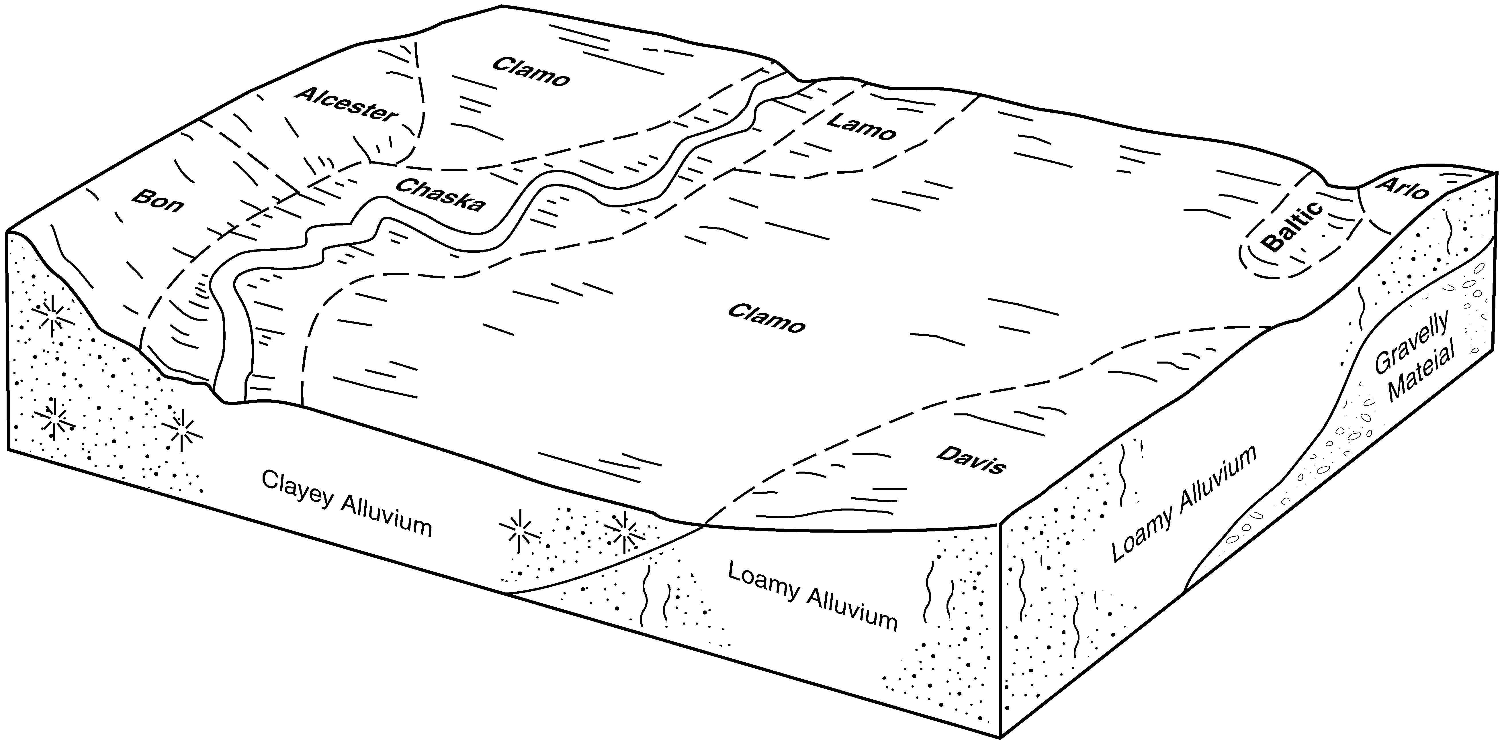
Lamo-Baltic silty clay loams, 0 to 2 percent slopes | Ld | 2690 | 445584 | gynp | sd027 | 1995 | 1:24000 |
Lamo silty clay loam, cool, 0 to 2 percent slopes, occasionally flooded | Lb | 428 | 445582 | 2vwbx | sd027 | 1995 | 1:24000 |
Lamo silty clay loam, 0 to 2 percent slopes, sandy substratum | Lc | 415 | 445583 | gynn | sd027 | 1995 | 1:24000 |
Lamo silt loam | La | 3105 | 352927 | cv7r | sd035 | 1966 | 1:20000 |
Lamo and Prosper soils, 0 to 3 percent slopes | LpA | 1938 | 352928 | cv7s | sd035 | 1966 | 1:20000 |
Lamo silty clay loam, nearly level | LmA | 228 | 352637 | ctyd | sd059 | 1959 | 1:20000 |
Lamo silty clay loam, cool, 0 to 2 percent slopes, occasionally flooded | La | 9435 | 416505 | 2vwbx | sd079 | 1967 | 1:20000 |
Lamo silty clay loam, cool, 0 to 2 percent slopes, occasionally flooded | La | 7299 | 416646 | 2vwbx | sd083 | 1971 | 1:20000 |
Alcester and Lamo silty clay loams | Ah | 3001 | 416623 | fzjg | sd083 | 1971 | 1:20000 |
Lamo silty clay loam | La | 1777 | 418032 | g0zx | sd087 | 1976 | 1:20000 |
Lamo silty clay loam | La | 3251 | 355408 | cxts | sd097 | 1983 | 1:20000 |
Lamo silty clay loam, channeled | Lb | 9706 | 446060 | gz51 | sd099 | 1995 | 1:24000 |
Lamo silty clay loam, cool, 0 to 2 percent slopes, occasionally flooded | La | 6240 | 446059 | 2vwbx | sd099 | 1995 | 1:24000 |
Lamo silty clay loam, frequently flooded | Lb | 11678 | 418343 | g19y | sd101 | 1985 | 1:20000 |
Lamo silty clay loam, cool, 0 to 2 percent slopes, occasionally flooded | La | 4420 | 418342 | 2vwbx | sd101 | 1985 | 1:20000 |
Wann-Lamo complex | Wb | 1821 | 354817 | cx6q | sd111 | 1978 | 1:20000 |
Lamo silty clay loam | La | 817 | 354802 | cx67 | sd111 | 1978 | 1:20000 |
Lamo silty clay loam, 0 to 1 percent slopes | Lk | 250 | 356673 | cz4l | sd115 | 1997 | 1:24000 |
Lamo silty clay loam, cool, 0 to 2 percent slopes, occasionally flooded | La | 6984 | 418236 | 2vwbx | sd125 | 1980 | 1:20000 |
Lamo silty clay loam, cool, 0 to 2 percent slopes, occasionally flooded | Lb | 2809 | 453705 | 2vwbx | sd127 | 1974 | 1:20000 |
Lamo silty clay loam | Lb | 1952 | 418093 | g11w | sd135 | 1977 | 1:20000 |
Lamo silty clay loam | La | 2382 | 417986 | g0yf | sd602 | 1975 | 1:20000 |
Lamo-Wann complex, frequently flooded | Lm | 1931 | 417987 | g0yg | sd602 | 1975 | 1:20000 |
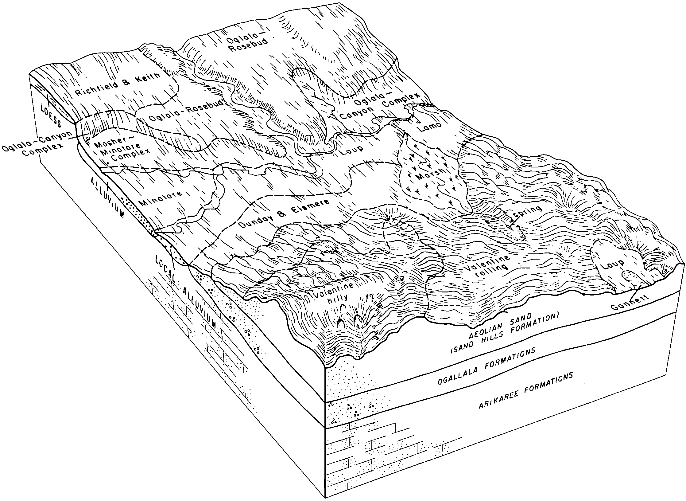
Loup-Lamo complex, 0 to 3 percent slopes | We | 1494 | 2925524 | cv6p | sd610 | 1965 | 1:20000 |
Lamo-Elsmere complex, 0 to 3 percent slopes | Le | 479 | 2582715 | cv3x | sd613 | 2011 | 1:24000 |
