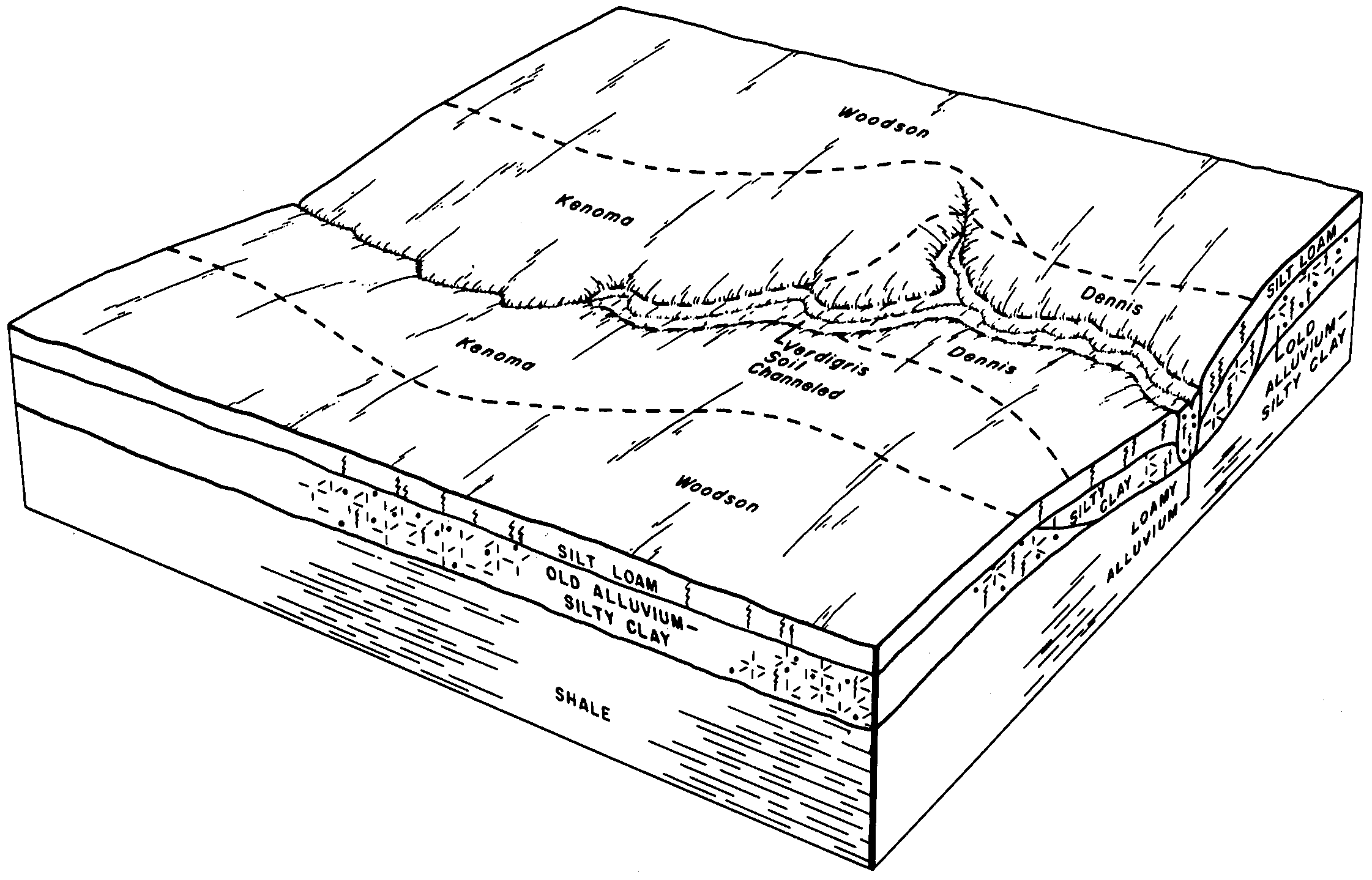
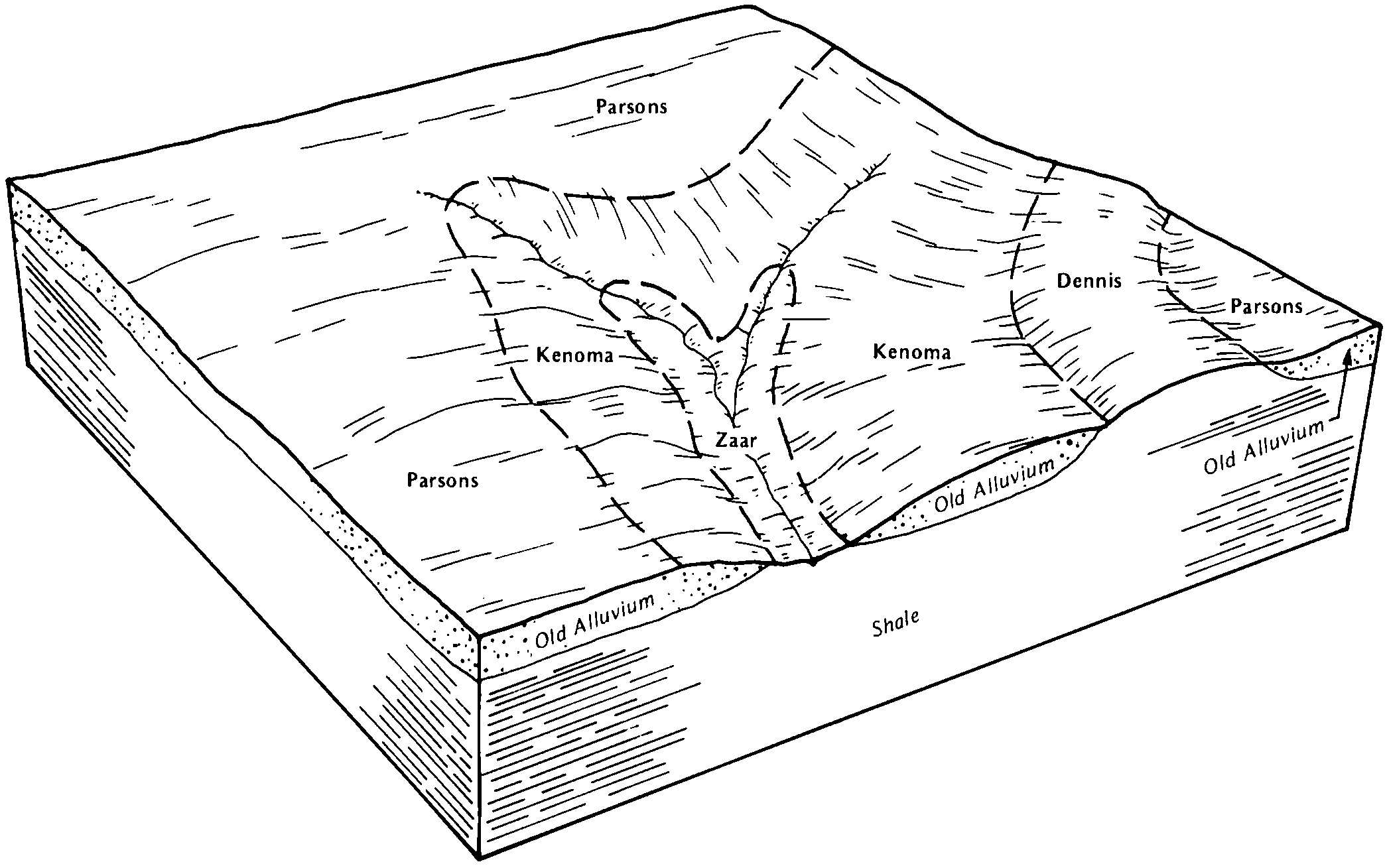
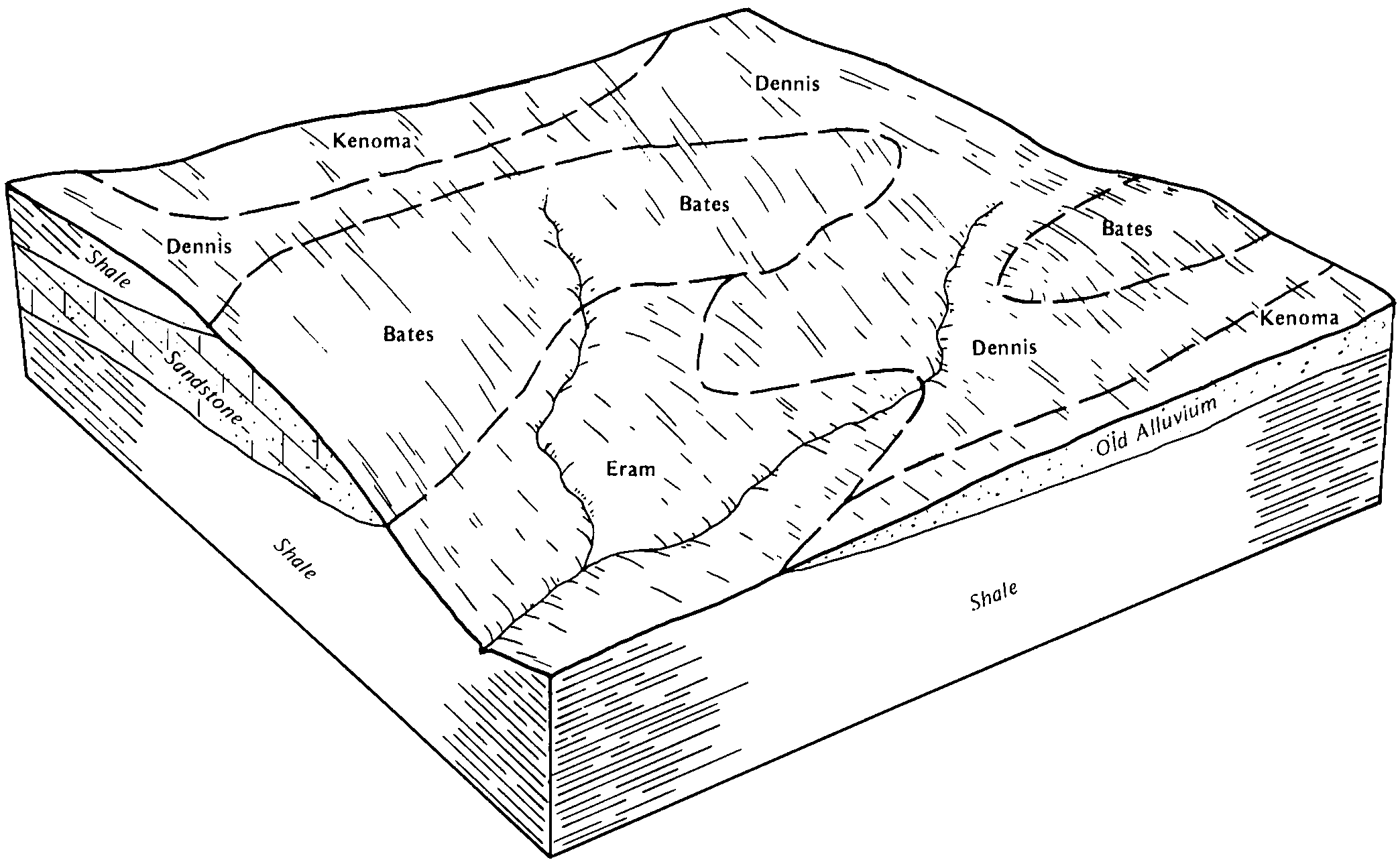
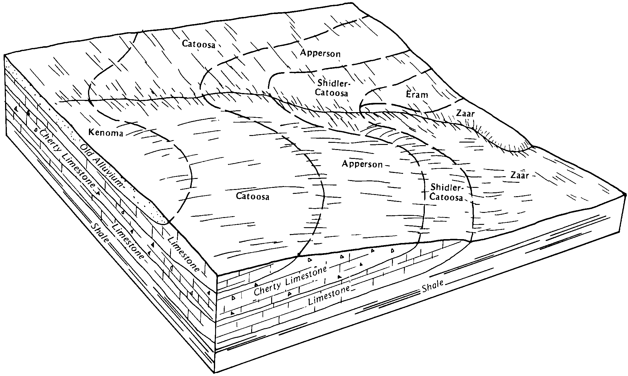
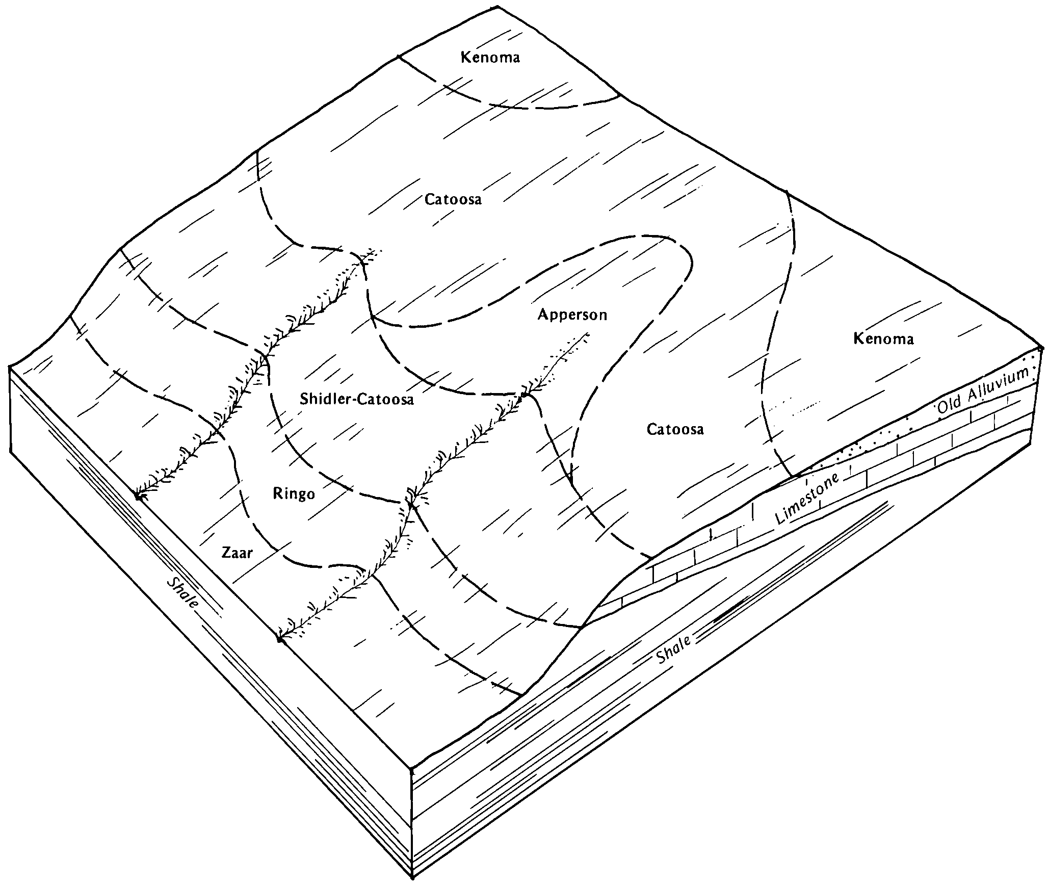
| Kenoma silt loam, 1 to 3 percent slopes | 8775 | 74463 | 1427128 | 2r2n5 | ks001 | 1975 | 1:24000 |
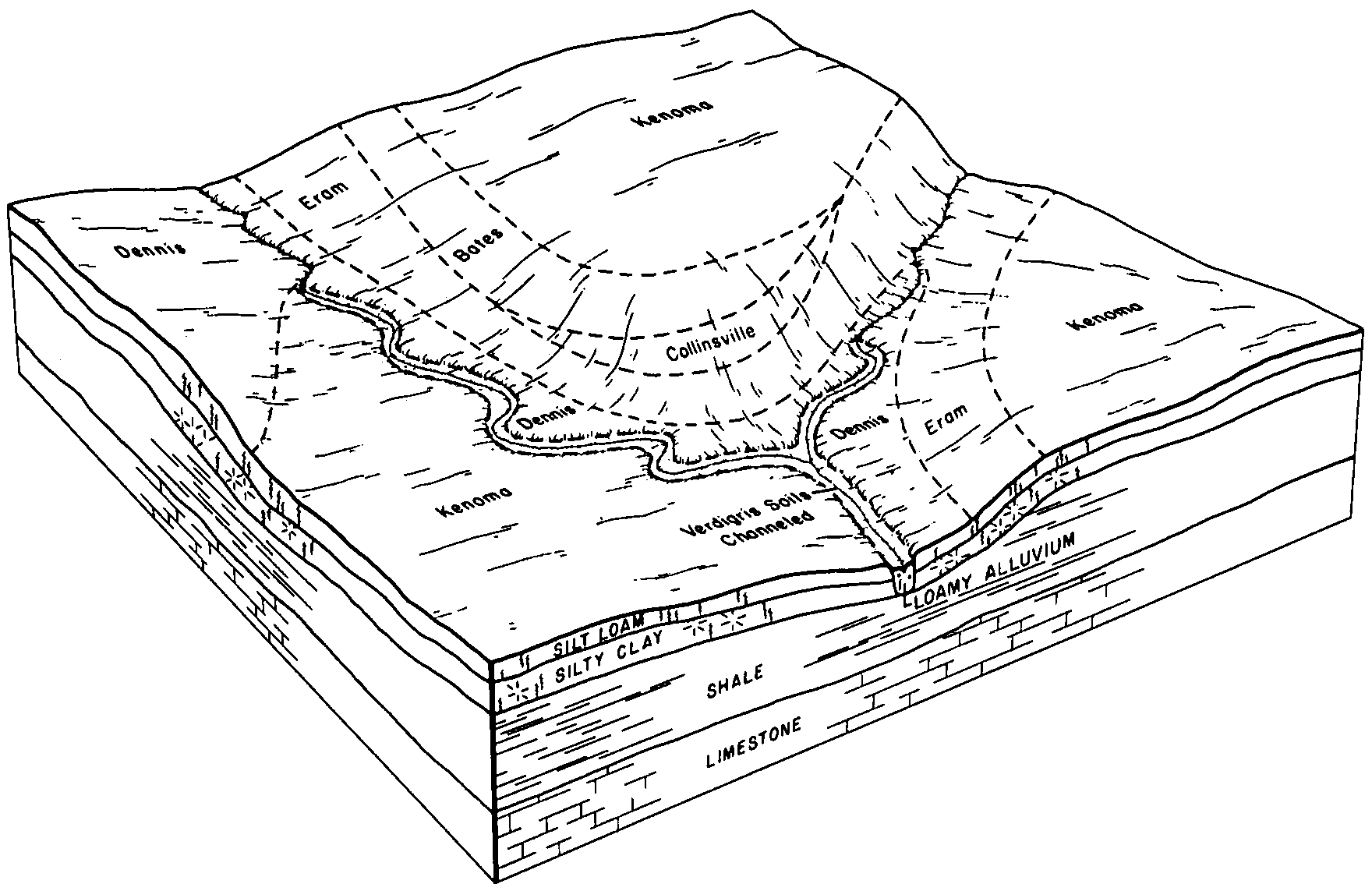
Dennis-Kenoma complex, 1 to 3 percent slopes | 8701 | 1249 | 1427121 | 2wqf3 | ks001 | 1975 | 1:24000 |
Kenoma silt loam, 1 to 3 percent slopes | 8775 | 46908 | 1427978 | 2r2n5 | ks003 | 1974 | 1:24000 |
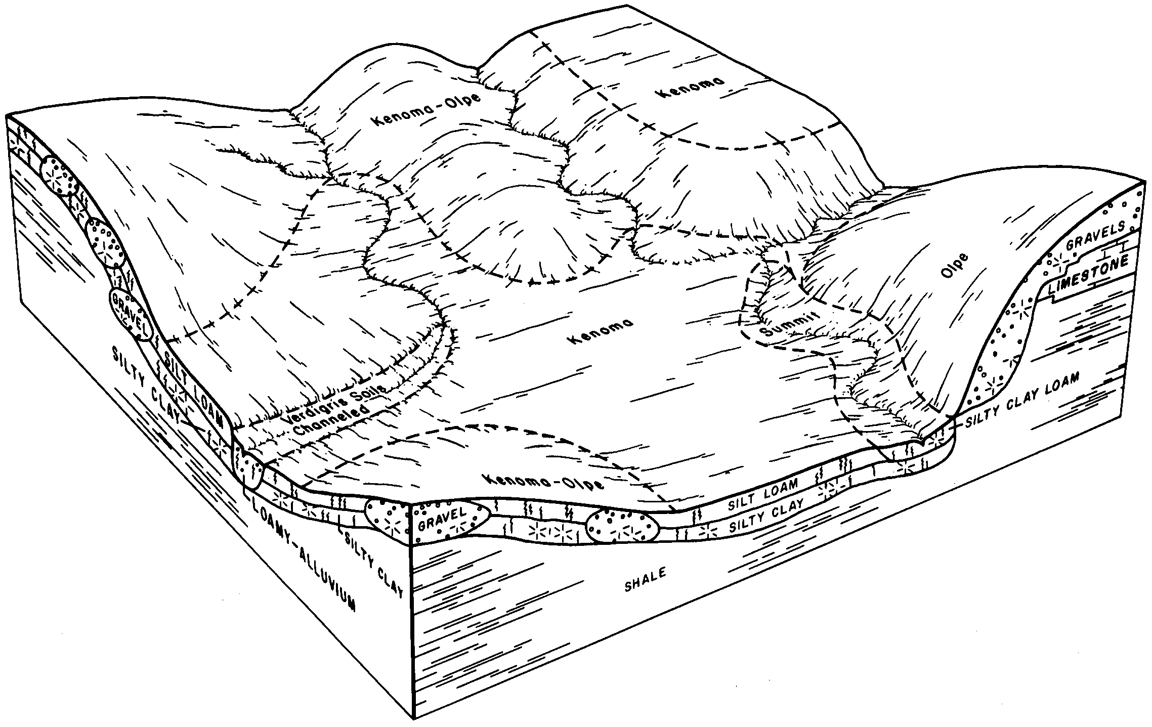
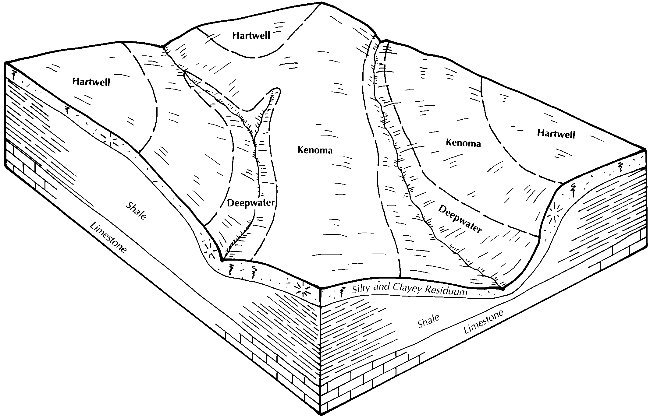
Kenoma-Olpe complex, 3 to 7 percent slopes | 8780 | 7254 | 1427980 | 2r2n9 | ks003 | 1974 | 1:24000 |
Kenoma silty clay loam, 1 to 3 percent slopes, eroded | 8779 | 3640 | 1427979 | 2r2n7 | ks003 | 1974 | 1:24000 |
Kenoma silt loam, 1 to 3 percent slopes | 8775 | 49660 | 1427070 | 2r2n5 | ks011 | 1979 | 1:24000 |
Olpe-Kenoma complex, 3 to 15 percent slopes | 8857 | 18 | 1382843 | 2wqdm | ks017 | 1967 | 1:24000 |
Kenoma silt loam, 0 to 1 percent slopes | 8774 | 2895 | 1453409 | 2r2n6 | ks019 | 1972 | 1:24000 |
Kenoma silt loam, 1 to 3 percent slopes | 8775 | 77 | 1453410 | 2r2n5 | ks019 | 1972 | 1:24000 |
Kenoma silt loam, 1 to 3 percent slopes | 8775 | 89977 | 1454614 | 2r2n5 | ks031 | 1980 | 1:24000 |
Kenoma-Olpe complex, 3 to 7 percent slopes | 8780 | 9175 | 1454617 | 2r2n9 | ks031 | 1980 | 1:24000 |
Kenoma silty clay loam, 1 to 3 percent slopes, eroded | 8777 | 1215 | 1454616 | 2r2n7 | ks031 | 1980 | 1:24000 |
Olpe-Kenoma complex, 3 to 15 percent slopes | 8857 | 301 | 1454621 | 2wqdm | ks031 | 1980 | 1:24000 |
Kenoma silt loam, 3 to 5 percent slopes | 8776 | 124 | 1454615 | 2tgtt | ks031 | 1980 | 1:24000 |
Kenoma silt loam, 1 to 3 percent slopes | 8775 | 4033 | 1387008 | 2r2n5 | ks037 | 1969 | 1:24000 |
Kenoma silt loam, 1 to 3 percent slopes | 8775 | 509 | 1468874 | 2r2n5 | ks045 | 1974 | 1:24000 |
Kenoma silt loam, 1 to 3 percent slopes | 8775 | 17949 | 1453341 | 2r2n5 | ks049 | 1984 | 1:24000 |
Kenoma silt loam, 1 to 3 percent slopes | 8775 | 60842 | 1460731 | 2r2n5 | ks059 | 1979 | 1:24000 |
Olpe-Kenoma complex, 1 to 3 percent slopes | 8855 | 2062 | 1460735 | 2wqdl | ks059 | 1979 | 1:24000 |
Kenoma silt loam, 1 to 3 percent slopes | 8775 | 55200 | 1453679 | 2r2n5 | ks073 | 1981 | 1:24000 |
Kenoma silty clay loam, 3 to 5 percent slopes, eroded | 8778 | 491 | 1453680 | 2r2n8 | ks073 | 1981 | 1:24000 |
Olpe-Kenoma complex, 3 to 15 percent slopes | 8857 | 81 | 1453685 | 2wqdm | ks073 | 1981 | 1:24000 |
Kenoma-Olpe complex, 3 to 7 percent slopes | 8780 | 3 | 1453681 | 2r2n9 | ks073 | 1981 | 1:24000 |
Kenoma silt loam, 1 to 3 percent slopes | 8775 | 41726 | 1426866 | 2r2n5 | ks099 | 1987 | 1:24000 |
Kenoma silt loam, 1 to 3 percent slopes | 8775 | 47293 | 1427482 | 2r2n5 | ks107 | 1979 | 1:24000 |
Kenoma silt loam, 1 to 3 percent slopes | 8775 | 105644 | 1453744 | 2r2n5 | ks111 | 1977 | 1:24000 |
Kenoma silty clay loam, 1 to 3 percent slopes, eroded | 8777 | 25144 | 1453746 | 2r2n7 | ks111 | 1977 | 1:24000 |
Olpe-Kenoma complex, 3 to 15 percent slopes | 8857 | 10052 | 1453751 | 2wqdm | ks111 | 1977 | 1:24000 |
Kenoma silt loam, 3 to 5 percent slopes | 8776 | 5445 | 1453745 | 2tgtt | ks111 | 1977 | 1:24000 |
Kenoma silty clay loam, 3 to 5 percent slopes, eroded | 8778 | 5114 | 1453747 | 2r2n8 | ks111 | 1977 | 1:24000 |
Kenoma silt loam, 1 to 3 percent slopes | 8775 | 34310 | 1468962 | 2r2n5 | ks121 | 1979 | 1:24000 |
Kenoma silt loam, 0 to 1 percent slopes | 8774 | 42309 | 1426941 | 2r2n6 | ks125 | 1978 | 1:24000 |
Kenoma silt loam, 1 to 3 percent slopes | 8775 | 6758 | 1426942 | 2r2n5 | ks125 | 1978 | 1:24000 |
Kenoma silt loam, 1 to 3 percent slopes | 8775 | 67397 | 1427024 | 2r2n5 | ks133 | 1980 | 1:20000 |
Kenoma-Olpe complex, 3 to 7 percent slopes | 8780 | 39 | 1427025 | 2r2n9 | ks133 | 1980 | 1:20000 |
Kenoma silt loam, 1 to 3 percent slopes | 8775 | 78924 | 1454796 | 2r2n5 | ks139 | 1983 | 1:24000 |
Olpe-Kenoma complex, 1 to 3 percent slopes | 8855 | 4032 | 1454800 | 2wqdl | ks139 | 1983 | 1:24000 |
Kenoma silt loam, 1 to 3 percent slopes | 8775 | 435 | 1472189 | 2r2n5 | ks197 | 1988 | 1:24000 |
Kenoma silty clay loam, 1 to 3 percent slopes, eroded | 8777 | 95 | 1472191 | 2r2n7 | ks197 | 1988 | 1:24000 |
Kenoma silty clay loam, 3 to 5 percent slopes, eroded | 8778 | 5 | 1472192 | 2r2n8 | ks197 | 1988 | 1:24000 |
Kenoma silt loam, 1 to 3 percent slopes | 8775 | 33856 | 1426991 | 2r2n5 | ks205 | 1985 | 1:20000 |
Kenoma-Olpe complex, 3 to 7 percent slopes | 8780 | 2446 | 1426992 | 2r2n9 | ks205 | 1985 | 1:20000 |
Kenoma silt loam, 1 to 3 percent slopes | 8775 | 46245 | 1427198 | 2r2n5 | ks207 | 1973 | 1:20000 |
Kenoma and Woodson soils, 1 to 3 percent slopes, eroded | 8773 | 1532 | 1427197 | 2xvh4 | ks207 | 1973 | 1:20000 |
Kenoma-Olpe complex, 3 to 7 percent slopes | 8780 | 1075 | 1427200 | 2r2n9 | ks207 | 1973 | 1:20000 |
Kenoma silt loam, 1 to 3 percent slopes | 40072 | 186220 | 2532444 | 2r2n5 | mo013 | 1990 | 1:24000 |
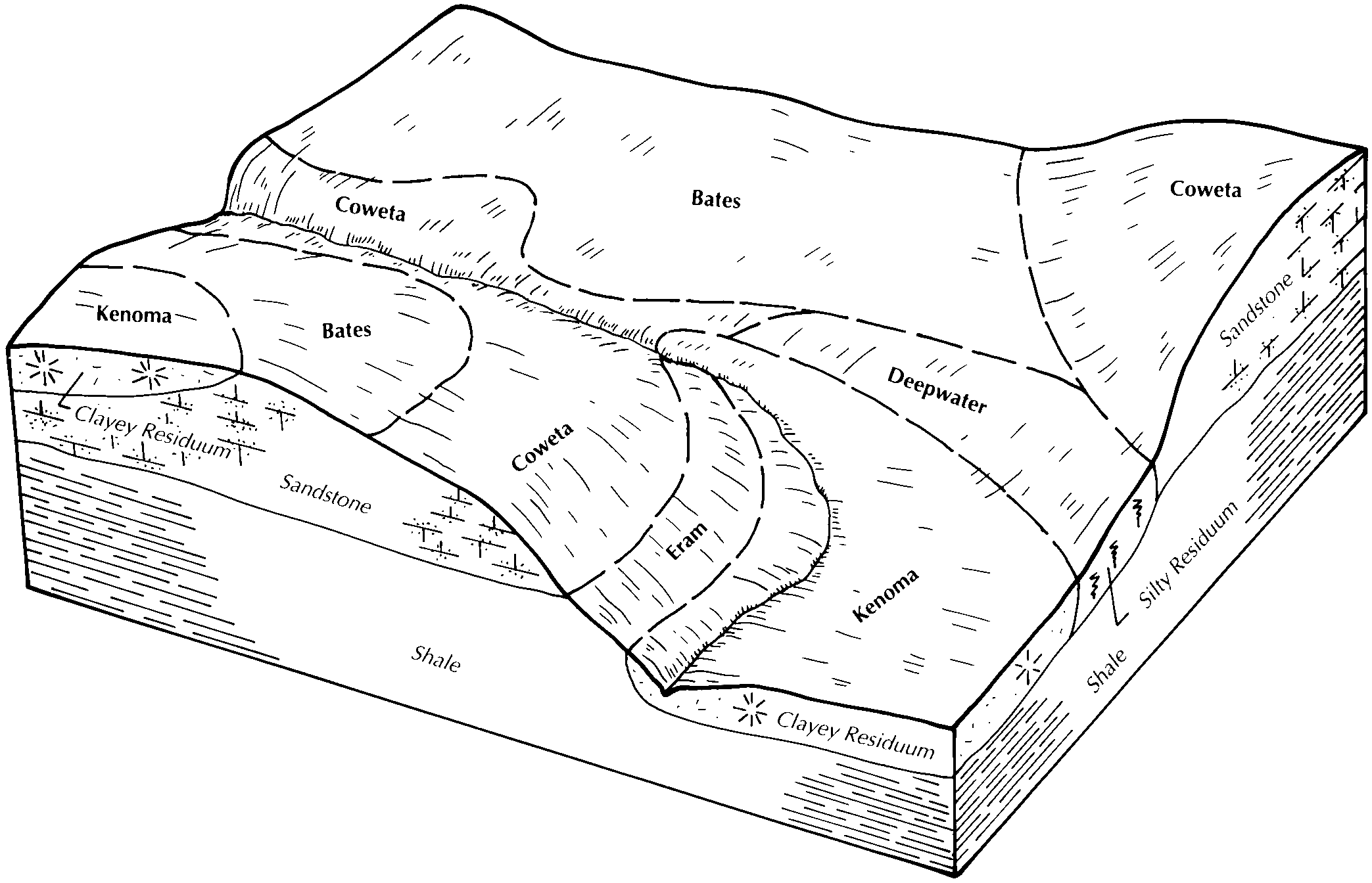
Kenoma silt loam, 4 to 7 percent slopes | 40073 | 44016 | 886702 | 2xvh3 | mo037 | 1981 | 1:24000 |
Kenoma silt loam, 1 to 3 percent slopes | 40072 | 34583 | 2532445 | 2r2n5 | mo037 | 1981 | 1:24000 |
Kenoma silt loam, 1 to 3 percent slopes | 40072 | 158 | 2532446 | 2r2n5 | mo083 | 1972 | 1:24000 |
Kenoma silt loam, 1 to 3 percent slopes | 40072 | 10190 | 2532443 | 2r2n5 | mo185 | 1984 | 1:24000 |
Kenoma silt loam, 1 to 3 percent slopes | 40072 | 1415 | 2532447 | 2r2n5 | mo217 | 1974 | 1:24000 |