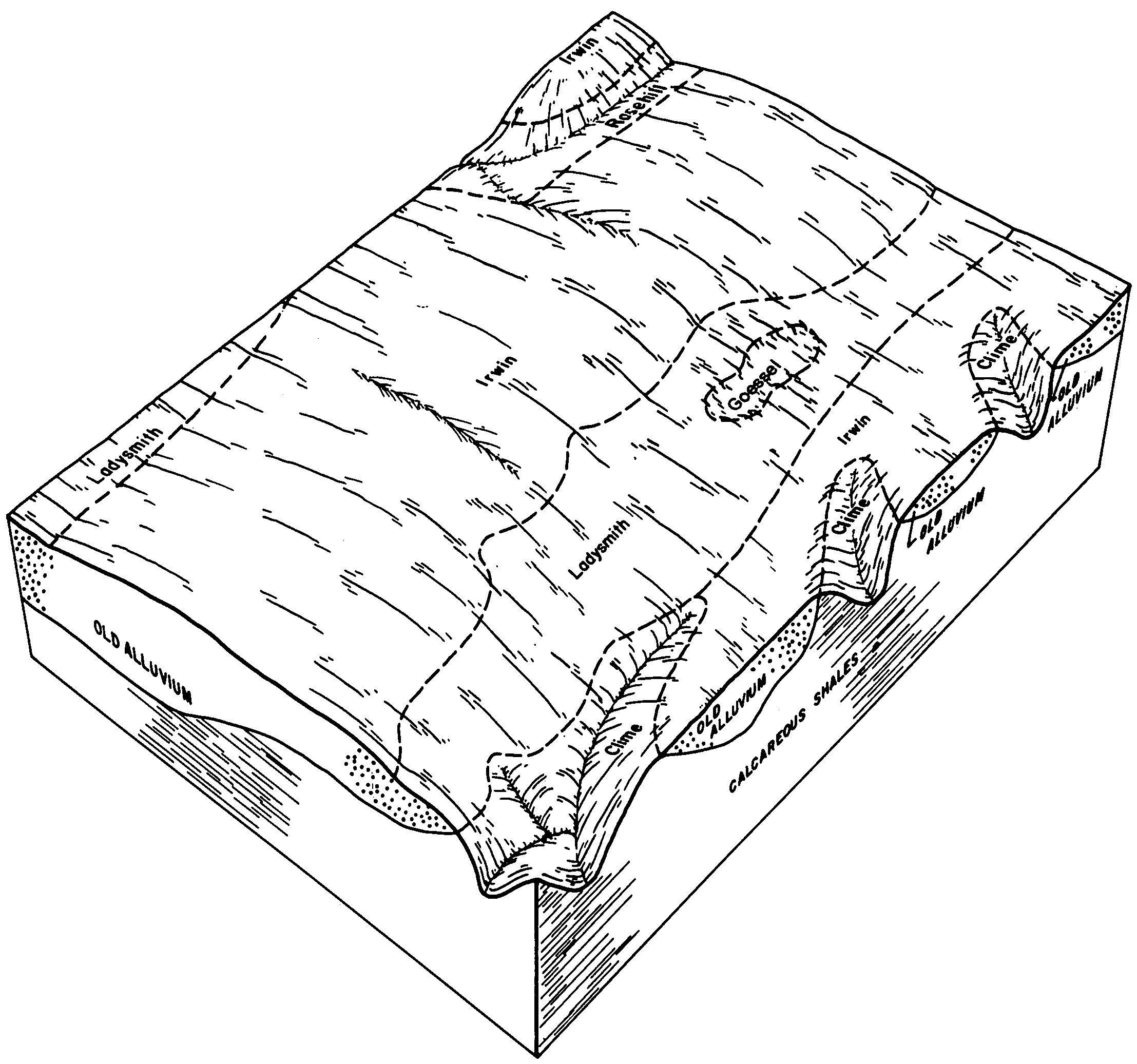
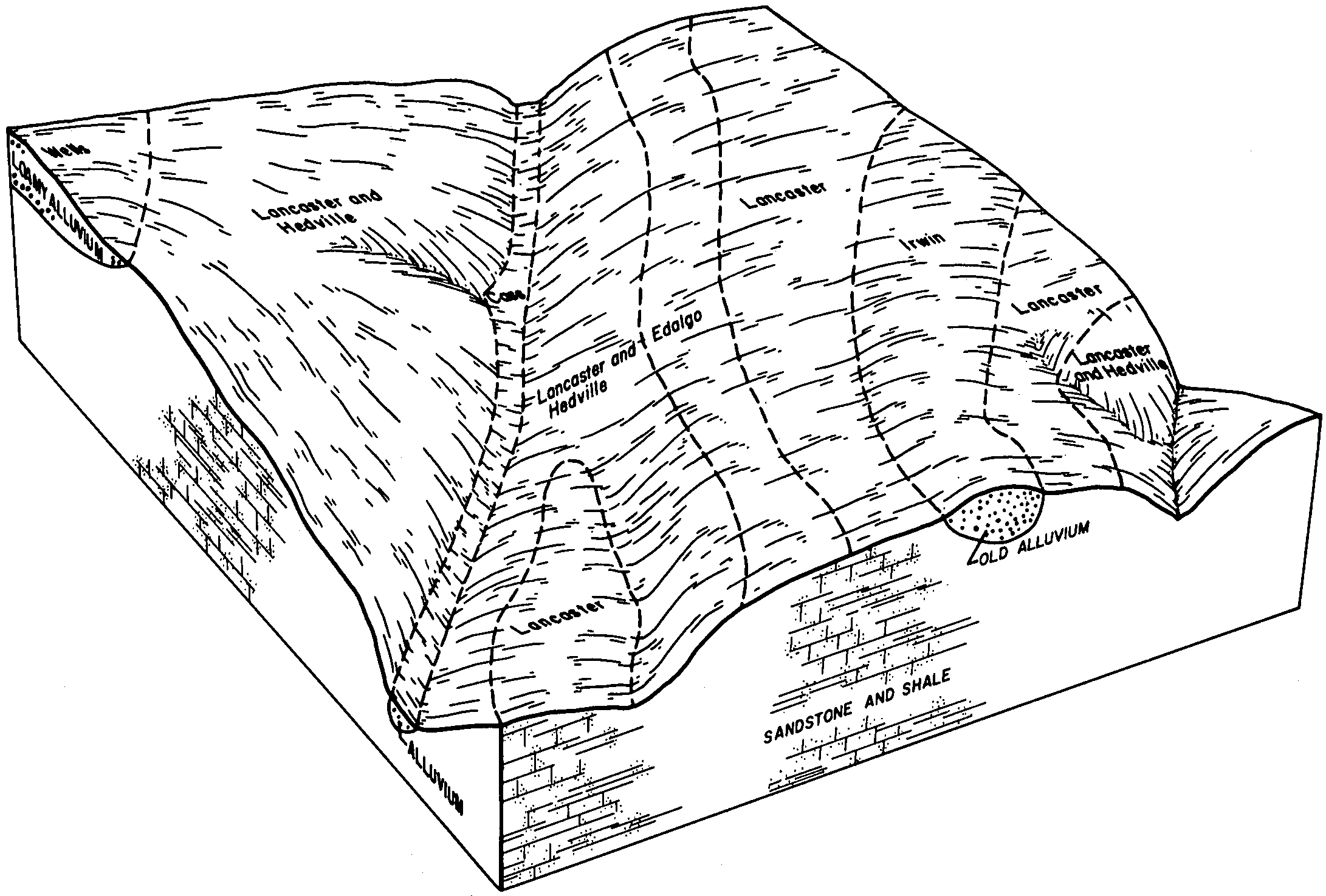
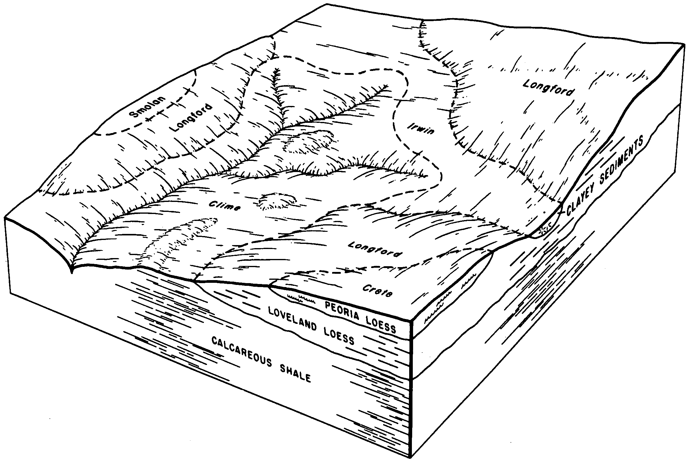
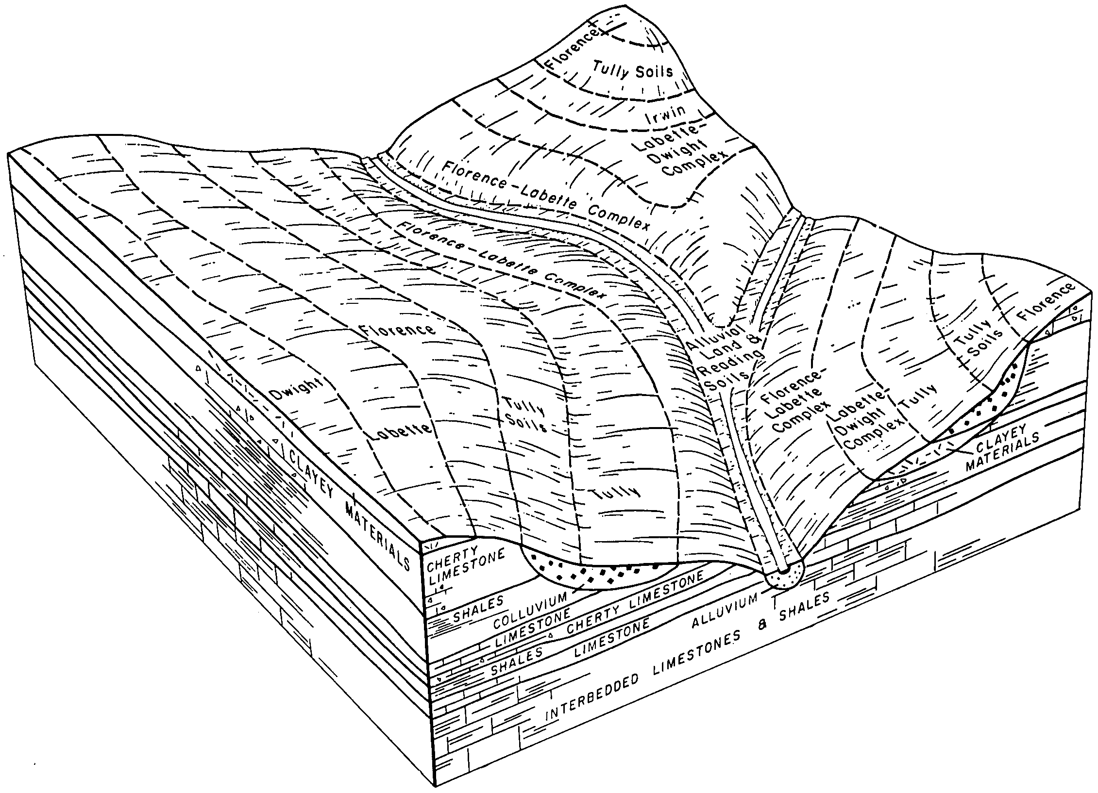
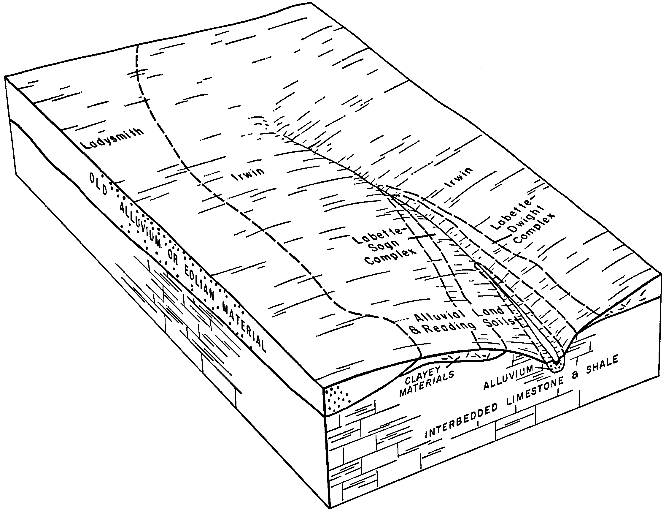
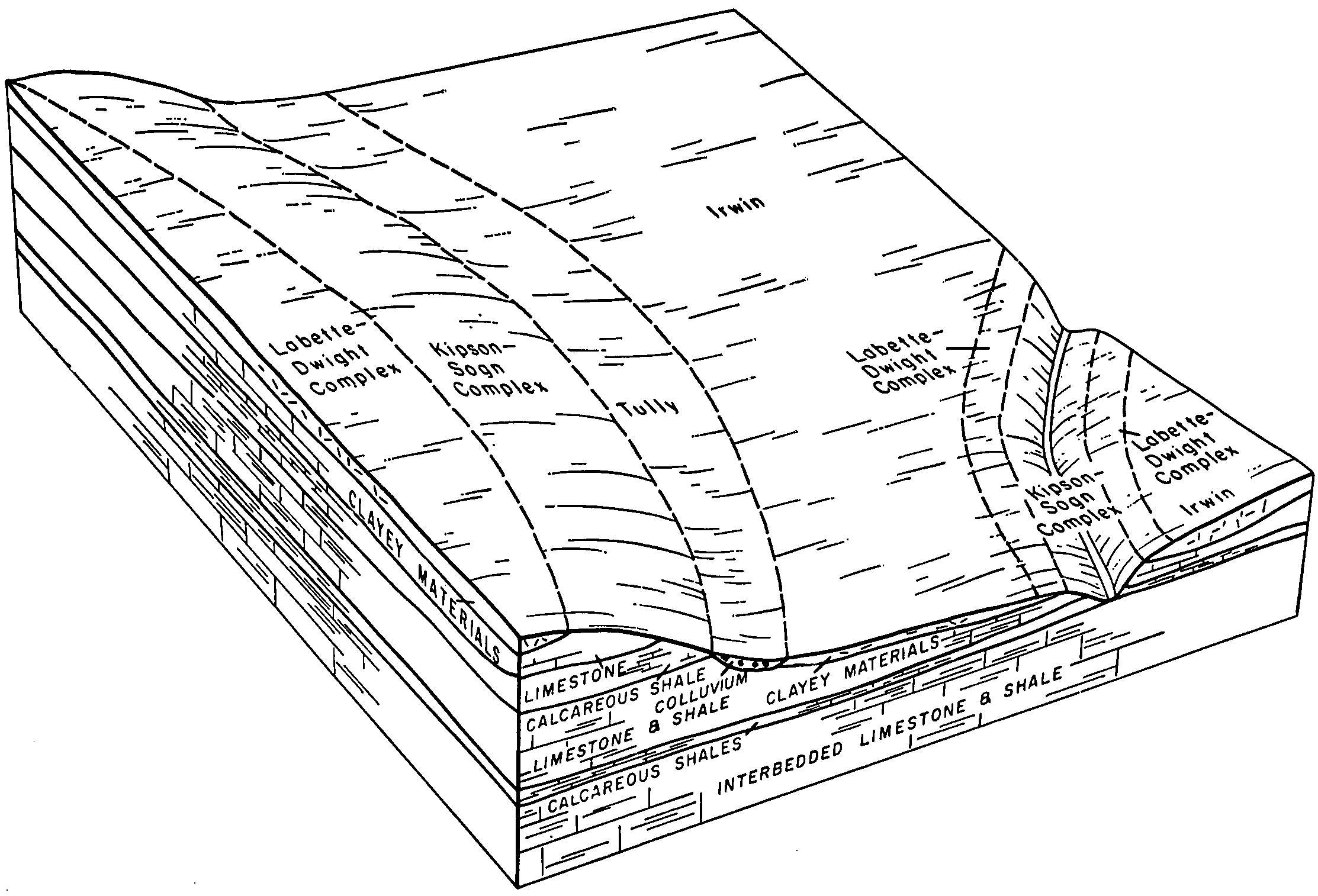
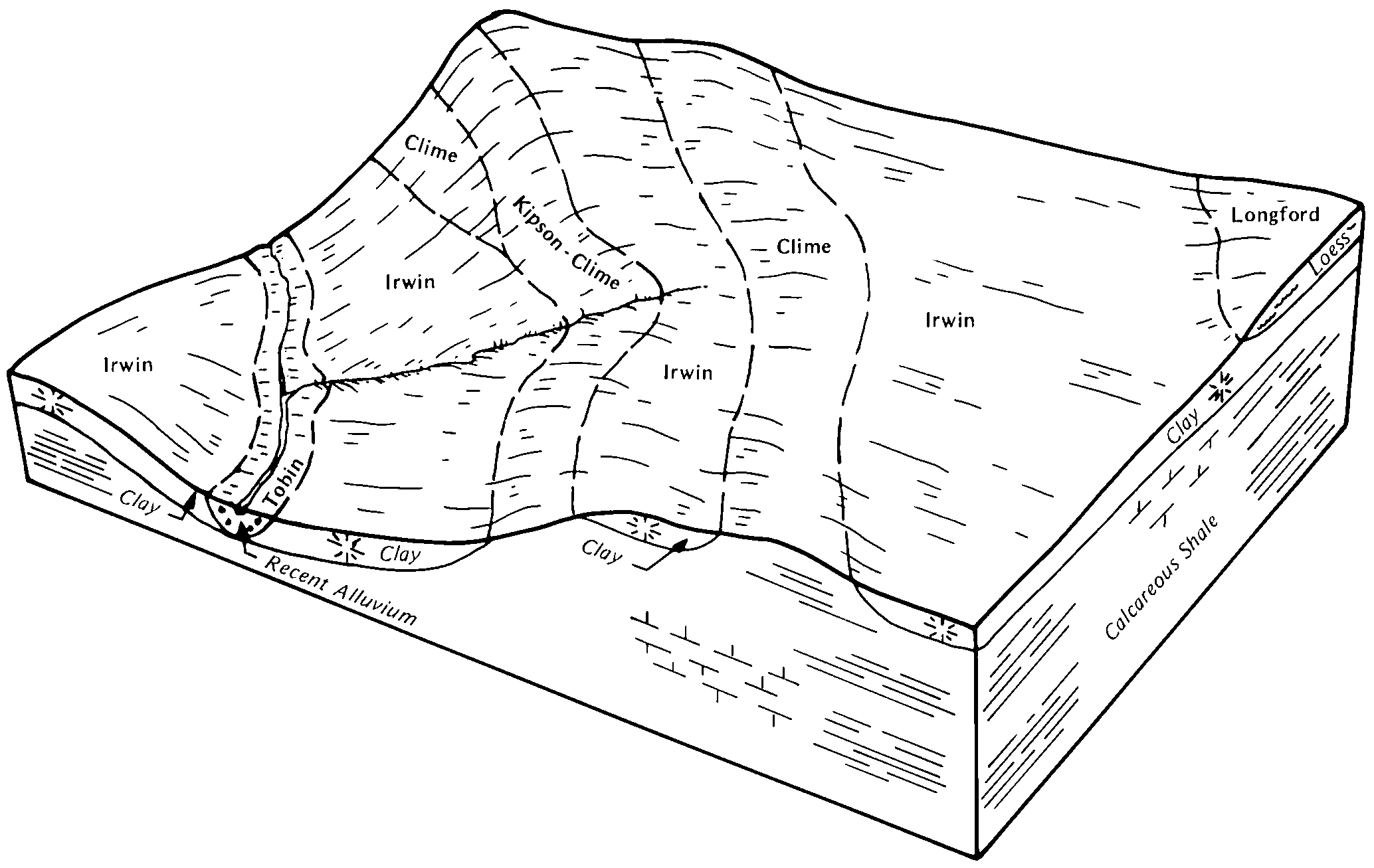
| Irwin silty clay loam, 1 to 3 percent slopes | 4671 | 182248 | 2605765 | 2r9c5 | ks015 | 1970 | 1:24000 |
Irwin silty clay loam, 3 to 7 percent slopes, eroded | 4674 | 20006 | 1382880 | 2tt67 | ks015 | 1970 | 1:24000 |
Irwin silty clay loam, 3 to 7 percent slopes | 4673 | 13852 | 2605782 | 2r8yb | ks015 | 1970 | 1:24000 |
Irwin silty clay loam, 0 to 1 percent slopes | 4670 | 8444 | 1382877 | 2tt65 | ks015 | 1970 | 1:24000 |
Irwin silty clay loam, 1 to 3 percent slopes | 4671 | 24753 | 2605766 | 2r9c5 | ks017 | 1967 | 1:24000 |
Irwin silty clay loam, 1 to 3 percent slopes, eroded | 4672 | 8733 | 1382824 | 2tt66 | ks017 | 1967 | 1:24000 |
Irwin silty clay loam, 3 to 7 percent slopes, eroded | 4674 | 3875 | 1382826 | 2tt67 | ks017 | 1967 | 1:24000 |
Irwin silty clay loam, 3 to 7 percent slopes | 4673 | 3344 | 2605783 | 2r8yb | ks017 | 1967 | 1:24000 |
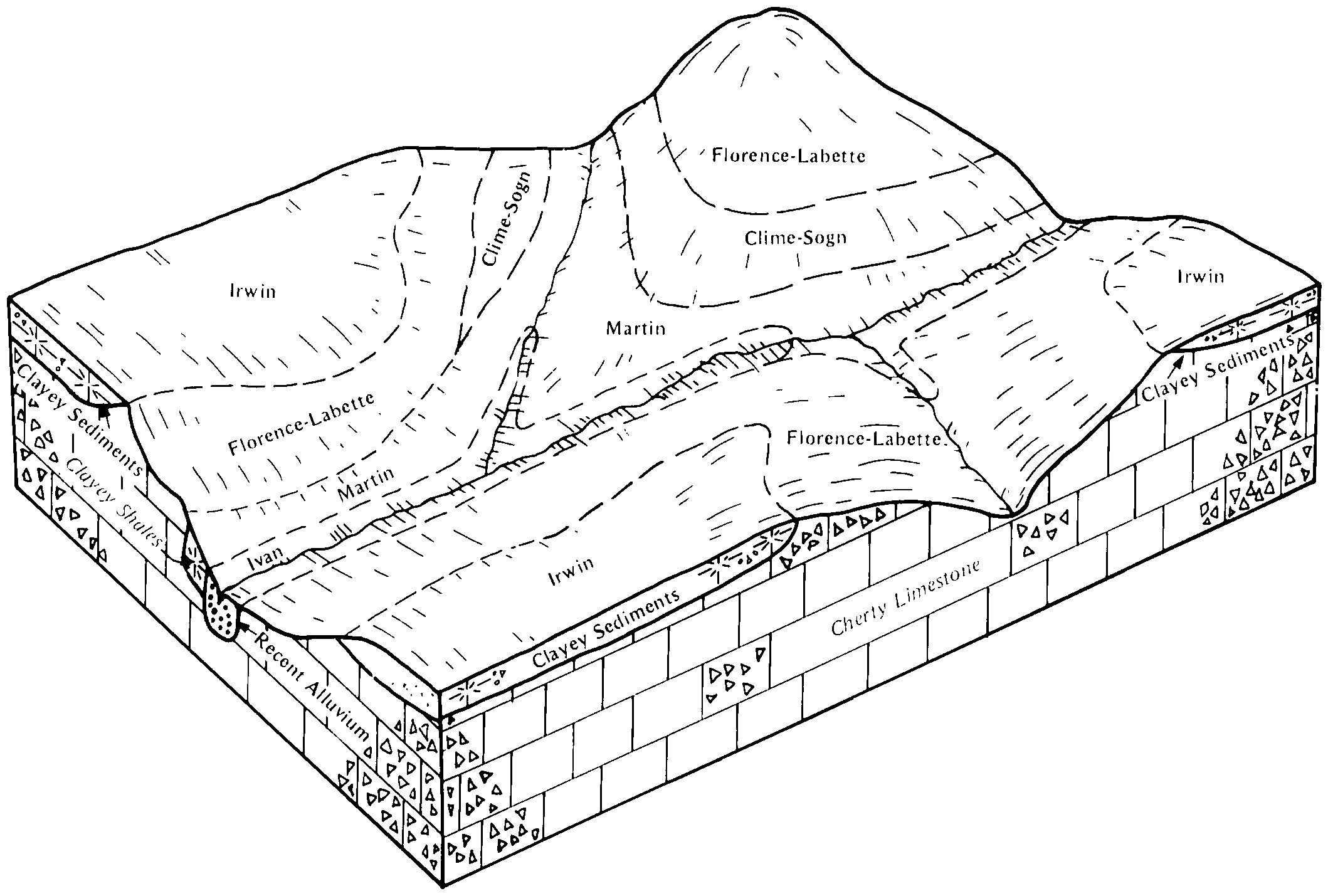
Irwin silty clay loam, 1 to 3 percent slopes | 4671 | 45220 | 2605767 | 2r9c5 | ks035 | 1977 | 1:24000 |
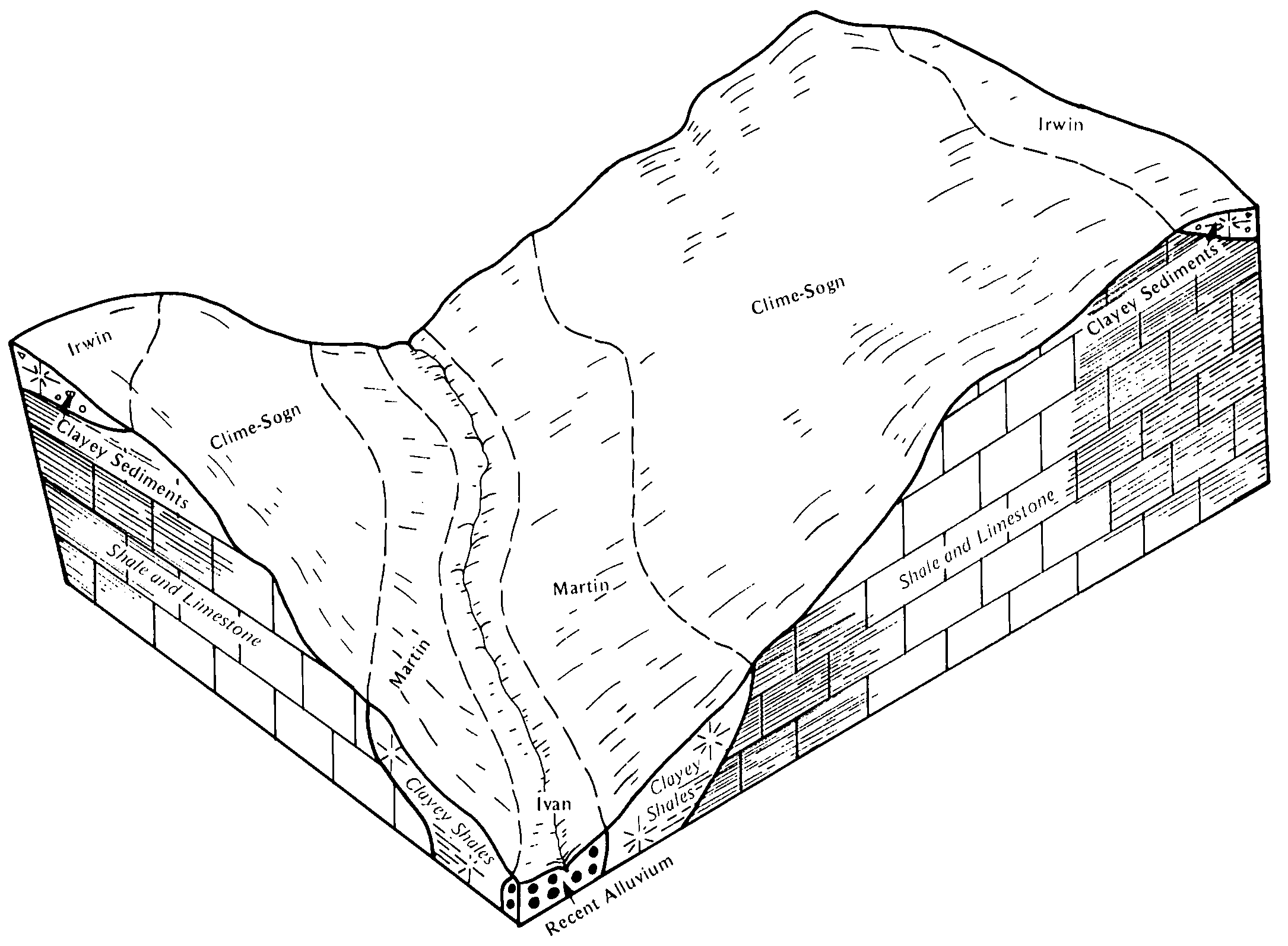
Irwin silty clay loam, 1 to 3 percent slopes | 4671 | 132255 | 2605768 | 2r9c5 | ks041 | 1977 | 1:24000 |
Irwin silty clay loam, 3 to 7 percent slopes | 4673 | 112089 | 2605784 | 2r8yb | ks041 | 1977 | 1:24000 |
Irwin-Konza silty clay loams, 1 to 3 percent slopes | 4736 | 226 | 1454558 | 2ww23 | ks041 | 1977 | 1:24000 |
Irwin-Konza silty clay loams, 1 to 3 percent slopes | 4736 | 27182 | 1387185 | 2ww23 | ks061 | 1991 | 1:24000 |
Irwin silty clay loam, 3 to 7 percent slopes | 4673 | 17081 | 2605785 | 2r8yb | ks061 | 1991 | 1:24000 |
Irwin silty clay loam, 1 to 3 percent slopes | 4671 | 663 | 2605769 | 2r9c5 | ks073 | 1981 | 1:24000 |
Irwin silty clay loam, 1 to 3 percent slopes, eroded | 4672 | 6 | 1453649 | 2tt66 | ks073 | 1981 | 1:24000 |
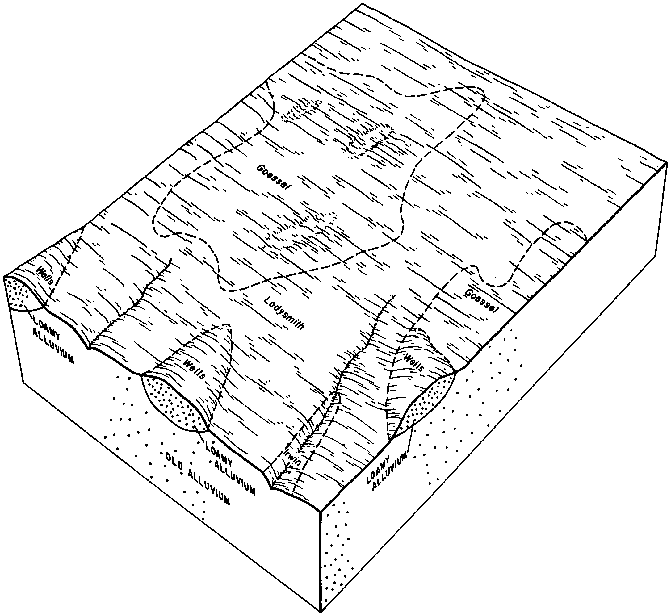
Irwin silty clay loam, 1 to 3 percent slopes | 4671 | 22964 | 2605770 | 2r9c5 | ks079 | 1970 | 1:24000 |
Irwin silty clay loam, 3 to 7 percent slopes | 4673 | 2163 | 2605786 | 2r8yb | ks079 | 1970 | 1:24000 |
Irwin silty clay loam, 3 to 7 percent slopes, eroded | 4674 | 373 | 1155428 | 2tt67 | ks079 | 1970 | 1:24000 |
Irwin silty clay loam, 1 to 3 percent slopes | 4671 | 769 | 2605771 | 2r9c5 | ks111 | 1977 | 1:24000 |
Irwin silty clay loam, 1 to 3 percent slopes, eroded | 4672 | 174 | 1453708 | 2tt66 | ks111 | 1977 | 1:24000 |
Irwin silty clay loam, 3 to 7 percent slopes | 4673 | 94 | 2605787 | 2r8yb | ks111 | 1977 | 1:24000 |
Irwin silty clay loam, 3 to 7 percent slopes, eroded | 4674 | 29 | 1453710 | 2tt67 | ks111 | 1977 | 1:24000 |
Irwin silty clay loam, 1 to 3 percent slopes | 4671 | 17014 | 2605772 | 2r9c5 | ks113 | 1980 | 1:24000 |
Irwin silty clay loam, 3 to 7 percent slopes | 4673 | 10 | 2605788 | 2r8yb | ks113 | 1980 | 1:24000 |
Irwin silty clay loam, 1 to 3 percent slopes | 4671 | 173662 | 2605773 | 2r9c5 | ks115 | 1981 | 1:24000 |
Irwin silty clay loam, 3 to 7 percent slopes | 4673 | 11882 | 2605789 | 2r8yb | ks115 | 1981 | 1:24000 |
Irwin silty clay loam, 1 to 3 percent slopes, eroded | 4672 | 50440 | 1454501 | 2tt66 | ks127 | 1970 | 1:24000 |
Irwin silty clay loam, 1 to 3 percent slopes | 4671 | 50234 | 2605774 | 2r9c5 | ks127 | 1970 | 1:24000 |
Irwin silty clay loam, 0 to 1 percent slopes | 4670 | 6956 | 1454499 | 2tt65 | ks127 | 1970 | 1:24000 |
Irwin silty clay loam, 3 to 7 percent slopes | 4673 | 6701 | 2605790 | 2r8yb | ks127 | 1970 | 1:24000 |
Irwin-Konza silty clay loams, 1 to 3 percent slopes | 4736 | 4546 | 1454505 | 2ww23 | ks127 | 1970 | 1:24000 |
Irwin silty clay loam, 3 to 7 percent slopes, eroded | 4674 | 2204 | 1454503 | 2tt67 | ks127 | 1970 | 1:24000 |
Irwin silty clay loam, 1 to 3 percent slopes | 4671 | 32 | 2605775 | 2r9c5 | ks139 | 1983 | 1:24000 |
Irwin silty clay loam, 3 to 7 percent slopes, eroded | 4674 | 28112 | 1472314 | 2tt67 | ks161 | 1970 | 1:24000 |
Irwin silty clay loam, 3 to 7 percent slopes | 4673 | 18928 | 2605791 | 2r8yb | ks161 | 1970 | 1:24000 |
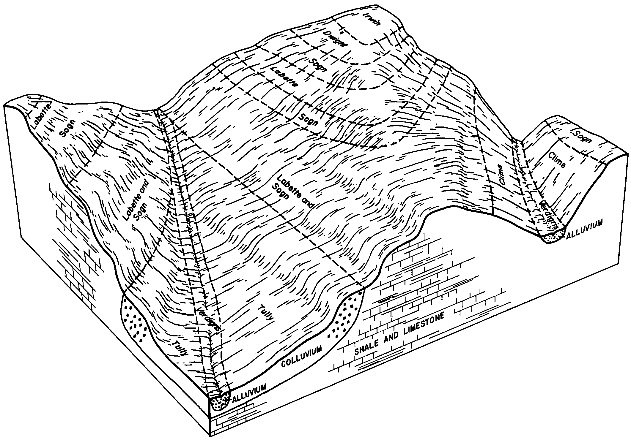
Dwight-Irwin complex, 1 to 3 percent slopes | 4625 | 16845 | 1472309 | 2wtw8 | ks161 | 1970 | 1:24000 |
Dwight-Irwin complex, 1 to 3 percent slopes, eroded | 4630 | 13417 | 1472310 | 2wtwg | ks161 | 1970 | 1:24000 |
Irwin silty clay loam, 1 to 3 percent slopes | 4671 | 943 | 2605776 | 2r9c5 | ks161 | 1970 | 1:24000 |
Irwin silty clay loam, 1 to 3 percent slopes | 4671 | 11837 | 2605777 | 2r9c5 | ks169 | 1989 | 1:24000 |
Irwin silty clay loam, 3 to 7 percent slopes | 4673 | 8829 | 2605792 | 2r8yb | ks169 | 1989 | 1:24000 |
Irwin silty clay loam, 1 to 3 percent slopes | 4671 | 39688 | 2605778 | 2r9c5 | ks173 | 1976 | 1:24000 |
Urban land-Irwin complex, 1 to 3 percent slopes | 3930 | 6282 | 1443949 | 2tt68 | ks173 | 1976 | 1:24000 |
Irwin silty clay loam, 3 to 7 percent slopes, eroded | 4674 | 1687 | 1443953 | 2tt67 | ks173 | 1976 | 1:24000 |
Irwin silty clay loam, 3 to 7 percent slopes | 4673 | 1225 | 2605793 | 2r8yb | ks173 | 1976 | 1:24000 |
Irwin silty clay loam, 1 to 3 percent slopes | 4671 | 23 | 2605779 | 2r9c5 | ks177 | 1966 | 1:24000 |
Irwin silty clay loam, 1 to 3 percent slopes | 4671 | 2339 | 2605780 | 2r9c5 | ks191 | 1974 | 1:24000 |
Irwin silty clay loam, 1 to 3 percent slopes | 4671 | 48041 | 2605781 | 2r9c5 | ks197 | 1988 | 1:24000 |
Irwin silty clay loam, 3 to 7 percent slopes | 4673 | 16971 | 2605794 | 2r8yb | ks197 | 1988 | 1:24000 |
Irwin-Konza silty clay loams, 1 to 3 percent slopes | 4736 | 2219 | 1472145 | 2ww23 | ks197 | 1988 | 1:24000 |