| Hamar loamy fine sand, Aspen Parkland, 0 to 1 percent slopes | I25A | 456 | 2798910 | prn9 | mn089 | 1994 | 1:20000 |
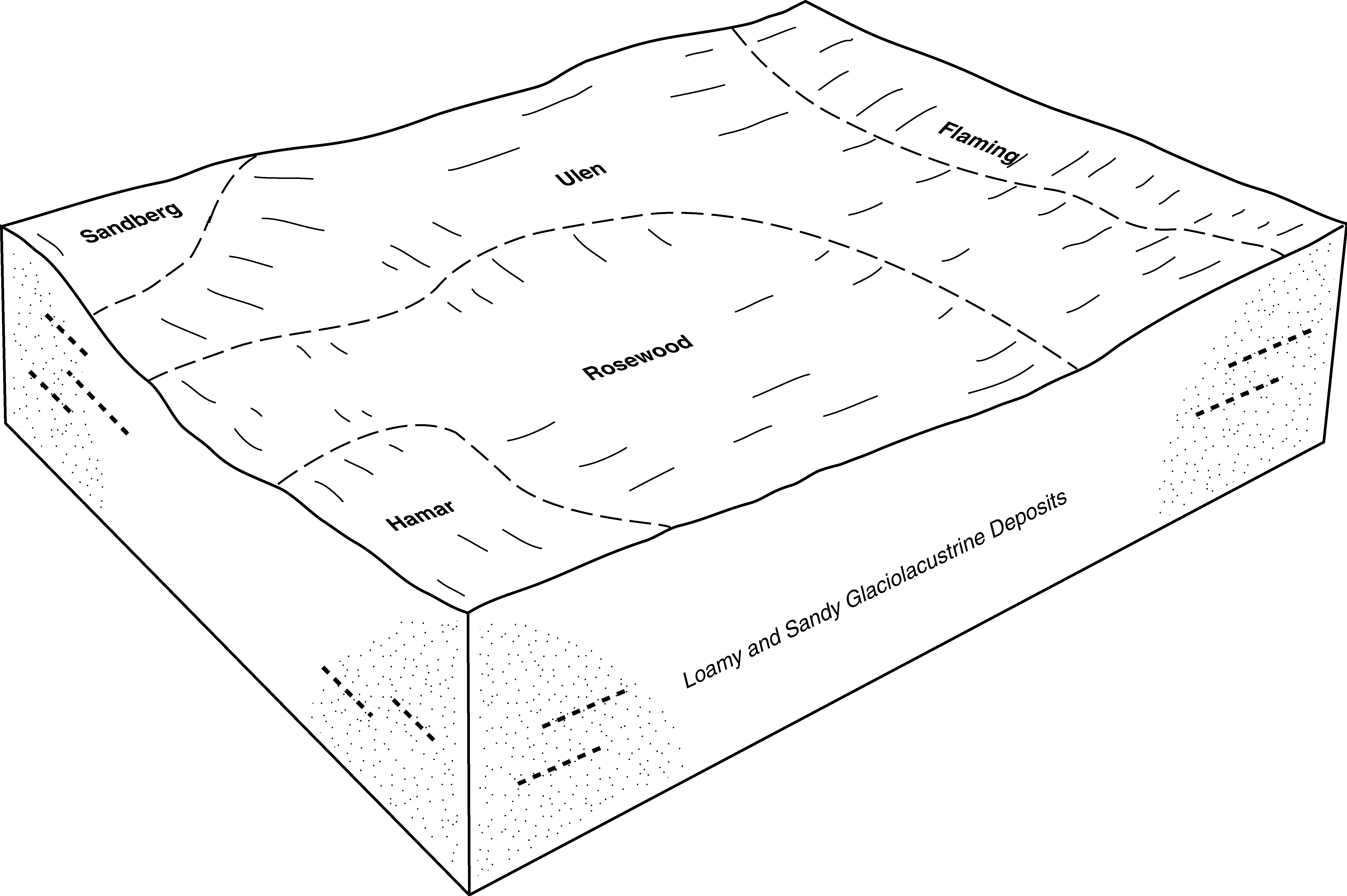
Rosewood-Hamar complex | 1966 | 144 | 357129 | czm9 | mn089 | 1994 | 1:20000 |
Hamar loamy fine sand | 372 | 63 | 357135 | czmh | mn089 | 1994 | 1:20000 |
Hamar loamy fine sand, Aspen Parkland, 0 to 1 percent slopes | I25A | 4841 | 2799040 | prn9 | mn107 | 1970 | 1:20000 |
Hamar loamy fine sand, Aspen Parkland, 0 to 1 percent slopes | I25A | 907 | 2799183 | prn9 | mn113 | 2003 | 1:12000 |
Hamar loamy fine sand, Aspen Parkland, 0 to 1 percent slopes | I25A | 2576 | 2799647 | prn9 | mn119 | 1996 | 1:20000 |
Hamar loamy fine sand | 372 | 333 | 352240 | ctjl | mn119 | 1996 | 1:20000 |
Hamar sandy loam | Hc | 252 | 401351 | fgmt | mn121 | 1968 | 1:20000 |
Hamar loamy fine sand, Aspen Parkland, 0 to 1 percent slopes | I25A | 2571 | 2799772 | prn9 | mn125 | 2001 | 1:12000 |
Hamar loamy fine sand, 0 to 2 percent slopes | J21A | 2608 | 434800 | glft | mn151 | 2000 | 1:12000 |
Hamar fine sandy loam, 0 to 1 percent slopes | I360A | 1263 | 2640849 | 1nyxn | nd017 | 1983 | 1:20000 |
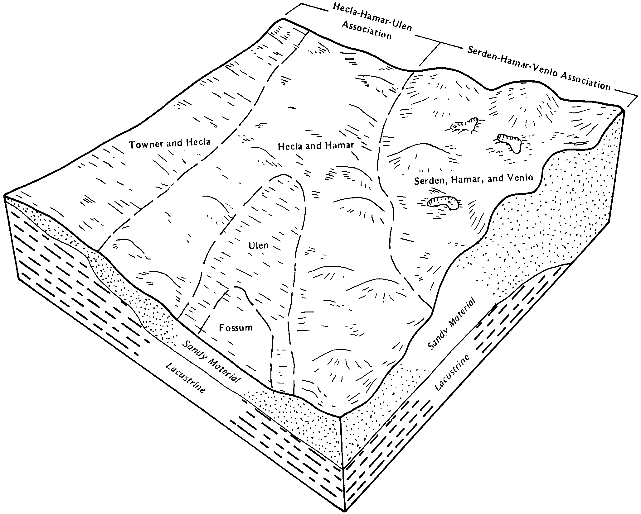
Serden-Hamar complex, 0 to 15 percent slopes | I348D | 46 | 2640872 | 1nyx7 | nd017 | 1983 | 1:20000 |
Hamar loamy fine sand, 0 to 1 percent slopes | I359A | 513 | 2643100 | 1nyxm | nd019 | 1987 | 1:20000 |
Hecla-Hamar loamy fine sands, 0 to 2 percent slopes | G389A | 3408 | 2575335 | 2q5c4 | nd021 | 1989 | 1:20000 |
Hamar loamy fine sand, 0 to 1 percent slopes | G323A | 921 | 2575311 | 2q4zs | nd021 | 1989 | 1:20000 |
Bantry-Hamar-Aylmer complex, 0 to 6 percent slopes | G337B | 620 | 2575315 | 2q504 | nd021 | 1989 | 1:20000 |
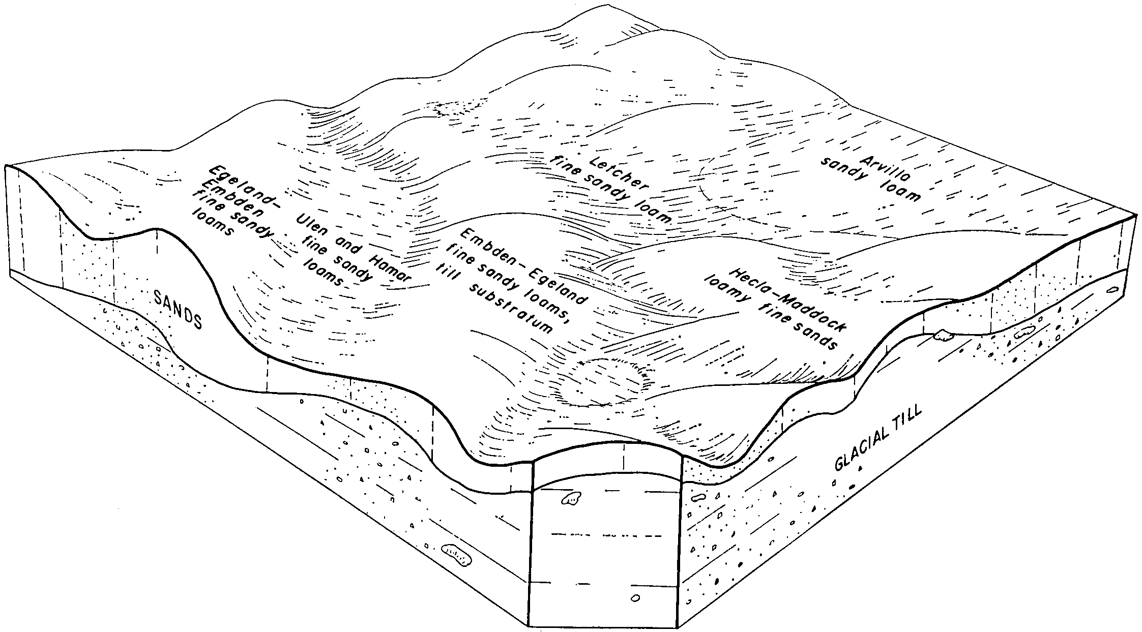
Ulen-Hamar fine sandy loams, 0 to 2 percent slopes | G350A | 534 | 2575318 | 2q50c | nd021 | 1989 | 1:20000 |
Hamar fine sandy loam, 0 to 1 percent slopes | G70A | 1 | 2575274 | 2q3vg | nd021 | 1989 | 1:20000 |
Hamar fine sandy loam, 0 to 1 percent slopes | I360A | 3505 | 2642550 | 1nyxn | nd035 | 1980 | 1:20000 |
Hamar loamy sand, loamy substratum, 0 to 1 percent slopes | G34A | 361 | 2577275 | 2q4ng | nd063 | | 1:12000 |
Hamar loamy fine sand, 0 to 1 percent slopes | I359A | 12387 | 2642969 | 1nyxm | nd067 | 1972 | 1:20000 |
Hamar fine sandy loam, 0 to 1 percent slopes | I360A | 10681 | 2642970 | 1nyxn | nd067 | 1972 | 1:20000 |
Serden-Hamar complex, 0 to 15 percent slopes | I348D | 15546 | 2641288 | 1nyx7 | nd073 | 1992 | 1:20000 |
Hamar loamy fine sand, 0 to 1 percent slopes | I359A | 1082 | 2641295 | 1nyxm | nd073 | 1992 | 1:20000 |
Hamar loamy fine sand, 0 to 1 percent slopes | G323A | 11 | 2581164 | 2q4zs | nd073 | 1992 | 1:20000 |
Serden-Hamar complex, 0 to 15 percent slopes | I348D | 13639 | 2641087 | 1nyx7 | nd077 | 2005 | 1:12000 |
Hamar fine sandy loam, 0 to 1 percent slopes | I360A | 1409 | 2641040 | 1nyxn | nd077 | 2005 | 1:12000 |
Hamar loamy fine sand, 0 to 1 percent slopes | I359A | 614 | 2641124 | 1nyxm | nd077 | 2005 | 1:12000 |
Hamar fine sandy loam, stratified substratum, 0 to 1 percent slopes | I303A | 510 | 2641074 | 1nyw3 | nd077 | 2005 | 1:12000 |
Hamar loamy fine sand, stratified substratum, 0 to 1 percent slopes | I302A | 379 | 2640968 | 1nyw2 | nd077 | 2005 | 1:12000 |
Ulen-Hamar fine sandy loams, 0 to 2 percent slopes | F350A | 3520 | 2588213 | 2q544 | nd079 | 1990 | 1:24000 |
Bantry-Hamar-Aylmer complex, 0 to 6 percent slopes | G337B | 10668 | 2579518 | 2q504 | nd081 | 1959 | 1:12000 |
Hecla-Hamar loamy fine sands, 0 to 2 percent slopes | G389A | 9792 | 2579444 | 2q5c4 | nd081 | 1959 | 1:12000 |
Hamar fine sandy loam, 0 to 1 percent slopes | G70A | 1729 | 2579494 | 2q3vg | nd081 | 1959 | 1:12000 |
Hamar fine sandy loam, 0 to 1 percent slopes | I360A | 621 | 2641221 | 1nyxn | nd081 | 1959 | 1:12000 |
Hamar loamy fine sand, 0 to 1 percent slopes | G323A | 71 | 2765552 | 2q4zs | nd081 | 1959 | 1:12000 |
Hamar loamy fine sand, 0 to 1 percent slopes | I359A | 52 | 2641220 | 1nyxm | nd081 | 1959 | 1:12000 |
Hamar loamy sand, loamy substratum, 0 to 1 percent slopes | G34A | 21 | 2579533 | 2q4ng | nd081 | 1959 | 1:12000 |
Hamar loamy fine sand, 0 to 1 percent slopes | I359A | 698 | 2641607 | 1nyxm | nd097 | 1974 | 1:20000 |
Hamar fine sandy loam, 0 to 1 percent slopes | I360A | 66 | 2641608 | 1nyxn | nd097 | 1974 | 1:20000 |
Aylmer-Hamar-Venlo complex, 0 to 6 percent slopes | G388B | 2435 | 2797766 | 2sd35 | sd013 | 1987 | 1:20000 |
Hecla-Hamar loamy fine sands, 0 to 2 percent slopes | G389A | 1534 | 2797676 | 2q5c4 | sd013 | 1987 | 1:20000 |
Hamar loamy fine sand, 0 to 1 percent slopes | G323A | 1168 | 2797662 | 2q4zs | sd013 | 1987 | 1:20000 |
Hamar fine sandy loam, 0 to 1 percent slopes | G070A | 218 | 2797643 | 2q3vg | sd013 | 1987 | 1:20000 |
Bantry-Hamar-Aylmer complex, 0 to 6 percent slopes | G337B | 1 | 2797665 | 2q504 | sd013 | 1987 | 1:20000 |
Hecla-Hamar loamy fine sands, 0 to 2 percent slopes | G389A | 3829 | 2799296 | 2q5c4 | sd091 | 1970 | 1:20000 |
Hamar fine sandy loam, 0 to 1 percent slopes | G070A | 3764 | 2799275 | 2q3vg | sd091 | 1970 | 1:20000 |
Aylmer-Hamar-Venlo complex, 0 to 6 percent slopes | G388B | 1308 | 2799339 | 2sd35 | sd091 | 1970 | 1:20000 |
Hamar loamy fine sand, 0 to 1 percent slopes | G323A | 482 | 2799284 | 2q4zs | sd091 | 1970 | 1:20000 |
Bantry-Hamar-Aylmer complex, 0 to 6 percent slopes | G337B | 5 | 2799285 | 2q504 | sd091 | 1970 | 1:20000 |
Embden-Hamar fine sandy loams | Eh | 2149 | 417817 | g0rz | sd109 | 1977 | 1:20000 |
Hecla-Hamar loamy fine sands, 0 to 3 percent slopes | HmA | 316 | 417839 | g0sp | sd109 | 1977 | 1:20000 |
Hamar fine sandy loam | Ha | 207 | 417832 | g0sg | sd109 | 1977 | 1:20000 |
Hamar fine sandy loam, 0 to 1 percent slopes | I360A | 202 | 2800176 | 1nyxn | sd109 | 1977 | 1:20000 |