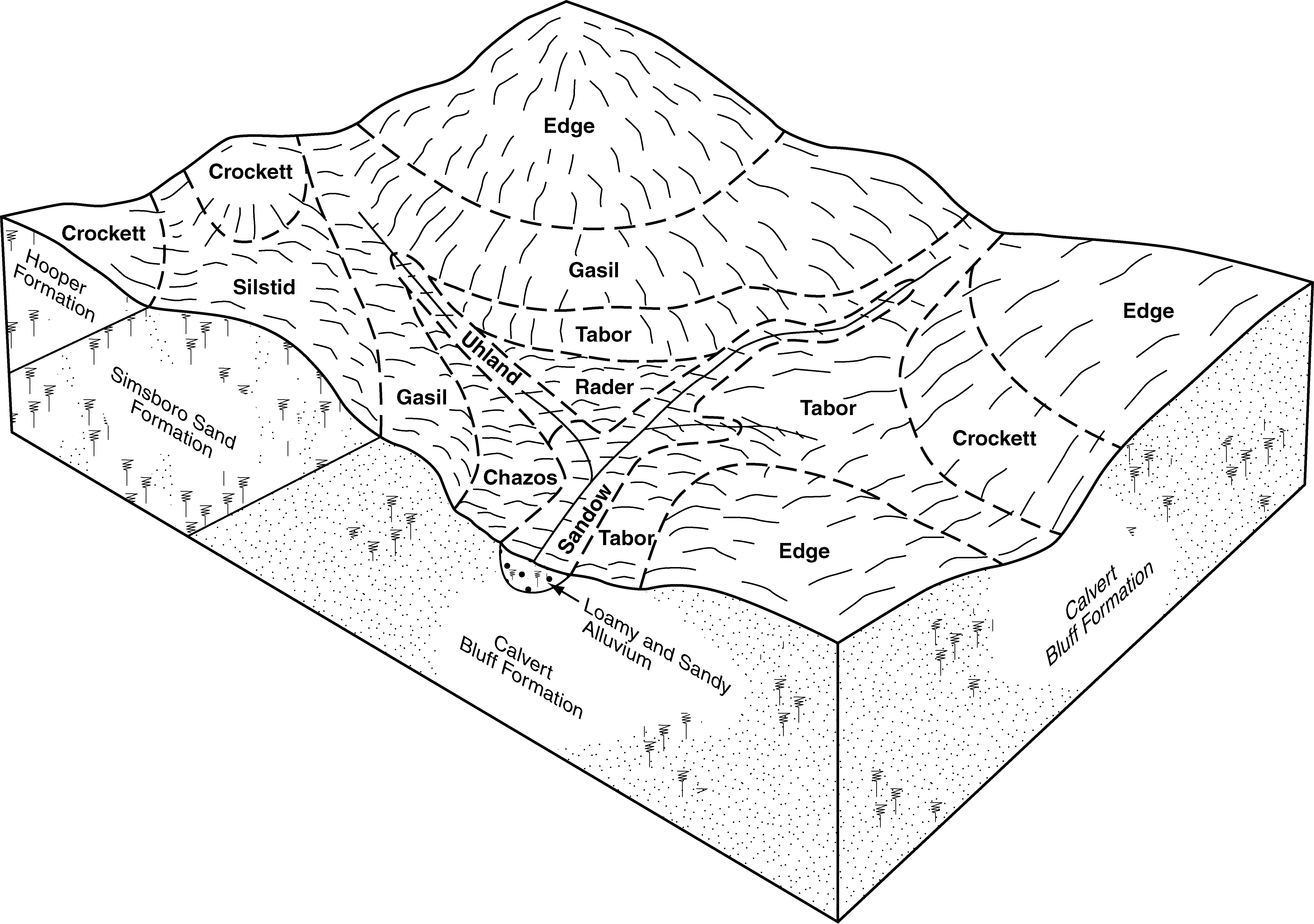
| Konawa and Gasil soils, 5 to 8 percent slopes | Dh | 7791 | 382281 | dtsn | ok037 | 1952 | 1:24000 |
Konawa and Gasil soils, 3 to 5 percent slopes | Df | 6571 | 382279 | dtsl | ok037 | 1952 | 1:24000 |
Konawa and Gasil soils, 1 to 3 percent slopes | Dg | 1108 | 382280 | dtsm | ok037 | 1952 | 1:24000 |
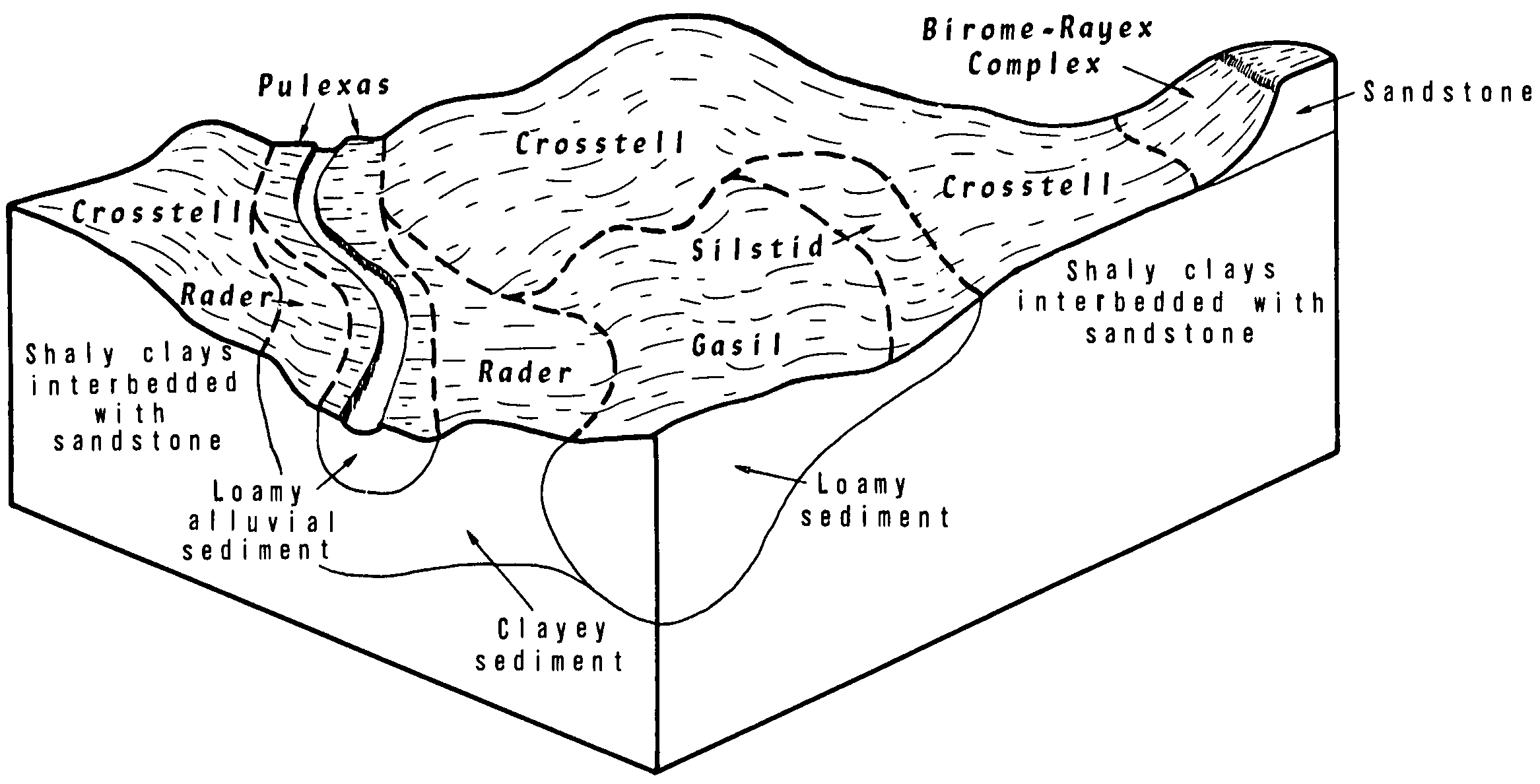
Gasil fine sandy loam, cool, 1 to 5 percent slopes, eroded | 24 | 22732 | 383287 | 2x3v2 | ok069 | 1976 | 1:24000 |
Gasil fine sandy loam, 3 to 5 percent slopes, severely eroded | 25 | 13946 | 383288 | 30c07 | ok069 | 1976 | 1:24000 |
Gasil fine sandy loam, cool, 3 to 5 percent slopes | 22 | 12546 | 383285 | 2wn9l | ok069 | 1976 | 1:24000 |
Gasil fine sandy loam, cool, 1 to 3 percent slopes | 21 | 12480 | 383284 | 2x3v1 | ok069 | 1976 | 1:24000 |
Gasil fine sandy loam, 8 to 12 percent slopes | 23 | 11983 | 383286 | dvv2 | ok069 | 1976 | 1:24000 |
Gasil fine sandy loam, cool, 1 to 3 percent slopes | 33 | 1354 | 383939 | 2x3v1 | ok099 | 1982 | 1:24000 |
Gasil fine sandy loam, cool, 1 to 5 percent slopes, eroded | 31 | 791 | 383937 | 2x3v2 | ok099 | 1982 | 1:24000 |
Gasil sandy loam, 3 to 5 percent slopes, gullied | 32 | 291 | 383938 | dwj3 | ok099 | 1982 | 1:24000 |
Gasil fine sandy loam, 0 to 3 percent slopes | GaB | 1555 | 575139 | m9gw | tx001 | 1970 | 1:20000 |
Gasil fine sandy loam, 1 to 5 percent slopes | GbC | 10661 | 363444 | 2vthc | tx051 | 1994 | 1:24000 |
Gasil fine sandy loam, 1 to 5 percent slopes, eroded | 29 | 9404 | 364477 | 2wn9k | tx097 | 1973 | 1:24000 |
Gasil loamy fine sand, 1 to 5 percent slopes | 26 | 6301 | 364474 | d787 | tx097 | 1973 | 1:24000 |
Gasil fine sandy loam, 1 to 3 percent slopes | 28 | 2897 | 364476 | 2wn8n | tx097 | 1973 | 1:24000 |
Gasil fine sandy loam, 5 to 8 percent slopes, eroded | 30 | 1867 | 364479 | d78d | tx097 | 1973 | 1:24000 |
Gasil loamy fine sand, 5 to 8 percent slopes | 27 | 764 | 364475 | d788 | tx097 | 1973 | 1:24000 |
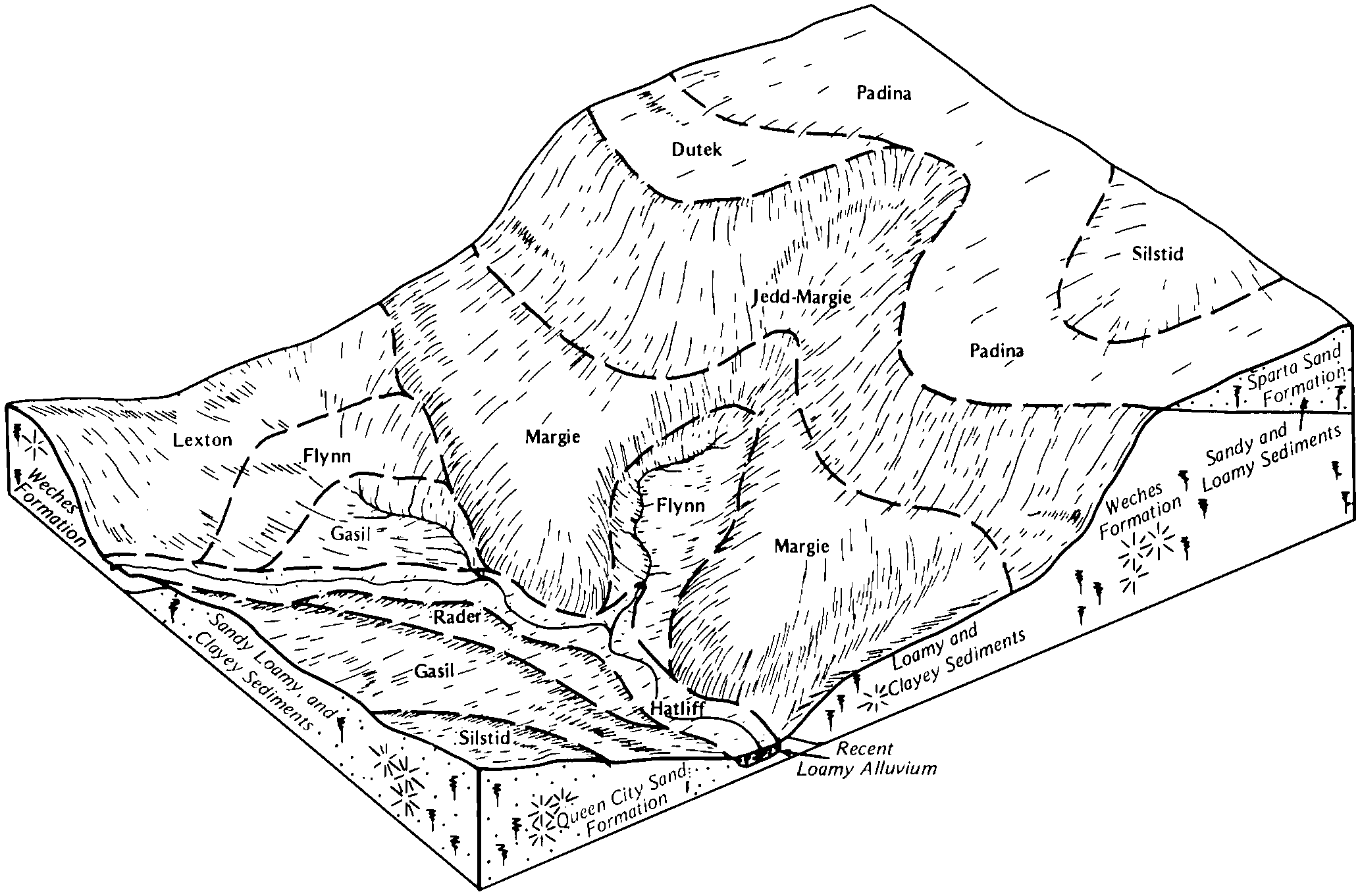
Gasil fine sandy loam, 1 to 3 percent slopes | 35 | 20361 | 364986 | 2wn8n | tx121 | 1975 | 1:24000 |
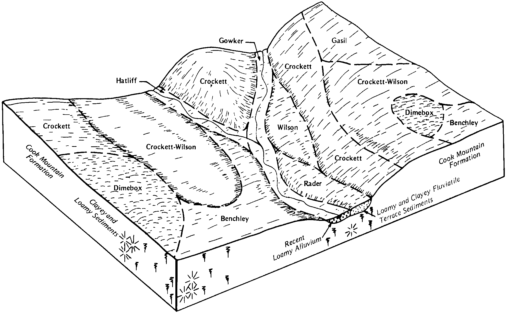
Gasil fine sandy loam, 3 to 8 percent slopes | 36 | 8410 | 364987 | 2wn8p | tx121 | 1975 | 1:24000 |
Gasil-Urban land complex, 1 to 4 percent slopes | 37 | 2465 | 364988 | d7st | tx121 | 1975 | 1:24000 |
Gasil and Konsil soils, 1 to 5 percent slopes | 38 | 430 | 364989 | d7sv | tx121 | 1975 | 1:24000 |
Gasil-Lamar complex, 5 to 12 percent slopes, eroded | BcE2 | 304 | 365279 | d836 | tx139 | 1962 | 1:20000 |
Gasil fine sandy loam, 3 to 5 percent slopes, moderately eroded | BaC2 | 106 | 365278 | 2vv50 | tx139 | 1962 | 1:20000 |
Gasil fine sandy loam, 1 to 5 percent slopes | GfB | 30753 | 375390 | 2vthc | tx161 | 1986 | 1:24000 |
Gasil loamy fine sand, 1 to 5 percent slopes | 34 | 7775 | 366670 | d9k2 | tx181 | 1977 | 1:20000 |
Gasil soils, 2 to 5 percent slopes, eroded | 37 | 4791 | 366673 | d9k5 | tx181 | 1977 | 1:20000 |
Gasil loamy fine sand, 5 to 8 percent slopes | 35 | 2155 | 366671 | d9k3 | tx181 | 1977 | 1:20000 |
Gasil-Urban land complex, 1 to 8 percent slopes | 36 | 1789 | 366672 | d9k4 | tx181 | 1977 | 1:20000 |
Gasil fine sandy loam, 1 to 5 percent slopes, eroded | 41 | 8431 | 367755 | 2wn9k | tx217 | 1975 | 1:20000 |
Gasil fine sandy loam, 1 to 3 percent slopes | 40 | 6258 | 367754 | 2wn8n | tx217 | 1975 | 1:20000 |
Gasil loamy fine sand, 8 to 12 percent slopes | 12 | 217 | 367873 | 2wg95 | tx231 | 1978 | 1:24000 |
Gasil fine sandy loam, 1 to 3 percent slopes | GfB | 7656 | 368168 | 2wn8n | tx251 | 1981 | 1:20000 |
Gasil fine sandy loam, 3 to 8 percent slopes | GfC | 6729 | 368169 | 2wn8p | tx251 | 1981 | 1:20000 |
Gasil loamy fine sand, 0 to 5 percent slopes | GaB | 4742 | 368167 | dc3c | tx251 | 1981 | 1:20000 |
Gasil fine sandy loam, 1 to 8 percent slopes, severely eroded | GfD4 | 325 | 368170 | 2wn9m | tx251 | 1981 | 1:20000 |
Gasil-Urban land complex, 1 to 8 percent slopes | GuD | 37 | 368171 | dc3h | tx251 | 1981 | 1:20000 |
Gasil fine sandy loam, 1 to 3 percent slopes | GaB | 11516 | 369137 | 2vv4z | tx287 | 2002 | 1:24000 |
Gasil loamy fine sand, 1 to 5 percent slopes | GsB | 5650 | 369089 | 2vthd | tx287 | 2002 | 1:24000 |
Gasil fine sandy loam, 3 to 8 percent slopes | GaD | 2272 | 748084 | t3fr | tx287 | 2002 | 1:24000 |
Gasil loamy fine sand, 3 to 8 percent slopes | GsD | 2110 | 369090 | dd24 | tx287 | 2002 | 1:24000 |
Gasil fine sandy loam, 1 to 5 percent slopes | GfB | 20057 | 369195 | 2vthc | tx289 | 1985 | 1:24000 |
Gasil fine sandy loam, 5 to 8 percent slopes | GfD | 284 | 369196 | dd5k | tx289 | 1985 | 1:24000 |
Gasil loamy fine sand, 1 to 5 percent slopes | GfB | 28958 | 369397 | 2vthd | tx293 | 1991 | 1:24000 |
Gasil fine sandy loam, 1 to 5 percent slopes | GaB | 4114 | 370285 | 2vthc | tx313 | 1989 | 1:24000 |
Gasil loamy fine sand, 1 to 5 percent slopes | GsB | 22392 | 371715 | 2vthd | tx395 | 1996 | 1:24000 |
Gasil loamy fine sand, 5 to 8 percent slopes | GsD | 3273 | 371716 | 2vv51 | tx395 | 1996 | 1:24000 |
Gasil-Urban land complex, 1 to 8 percent slopes | GuC | 13150 | 372378 | dhh6 | tx439 | 1979 | 1:20000 |
Gasil fine sandy loam, 1 to 3 percent slopes | GfB | 11247 | 372374 | 2wn8n | tx439 | 1979 | 1:20000 |
Gasil fine sandy loam, 3 to 8 percent slopes | GfC | 8359 | 372376 | 2wn8p | tx439 | 1979 | 1:20000 |
Gasil sandy clay loam, graded, 1 to 5 percent slopes | GgC | 1595 | 372377 | dhh5 | tx439 | 1979 | 1:20000 |


