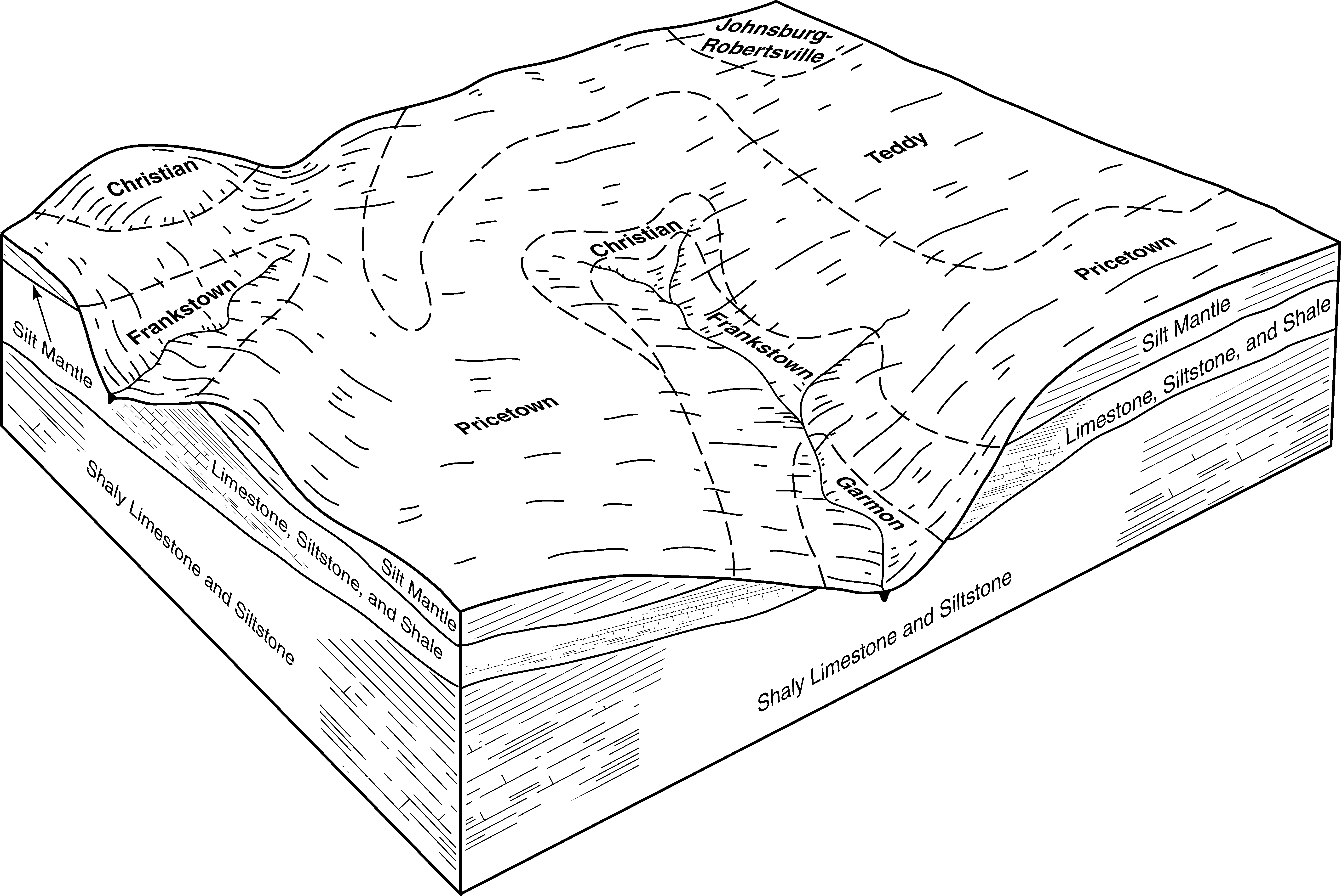
| Frankstown gravelly silt loam, 12 to 20 percent slopes, eroded | FkD2 | 12913 | 1592484 | 1qg3g | ky001 | 2006 | 1:12000 |
Frankstown gravelly silt loam, 6 to 12 percent slopes, eroded | FkC2 | 10686 | 1592482 | 1qg3d | ky001 | 2006 | 1:12000 |
Frankstown gravelly silt loam, 2 to 6 percent slopes | FkB | 1022 | 1592481 | 1qg3c | ky001 | 2006 | 1:12000 |
Frankstown silt loam, 12 to 20 percent slopes | FkD | 35120 | 548892 | lf56 | ky045 | 1989 | 1:20000 |
Frankstown silt loam, 6 to 12 percent slopes | FkC | 21370 | 548891 | lf55 | ky045 | 1989 | 1:20000 |
Frankstown silt loam, 2 to 6 percent slopes | FkB | 1360 | 548890 | lf54 | ky045 | 1989 | 1:20000 |
Frankstown gravelly silt loam, 6 to 12 percent slopes | FrC | 2495 | 552337 | ljrb | ky155 | 1986 | 1:20000 |
Frankstown gravelly silt loam, 12 to 20 percent slopes | FrD | 1115 | 552338 | ljrc | ky155 | 1986 | 1:20000 |
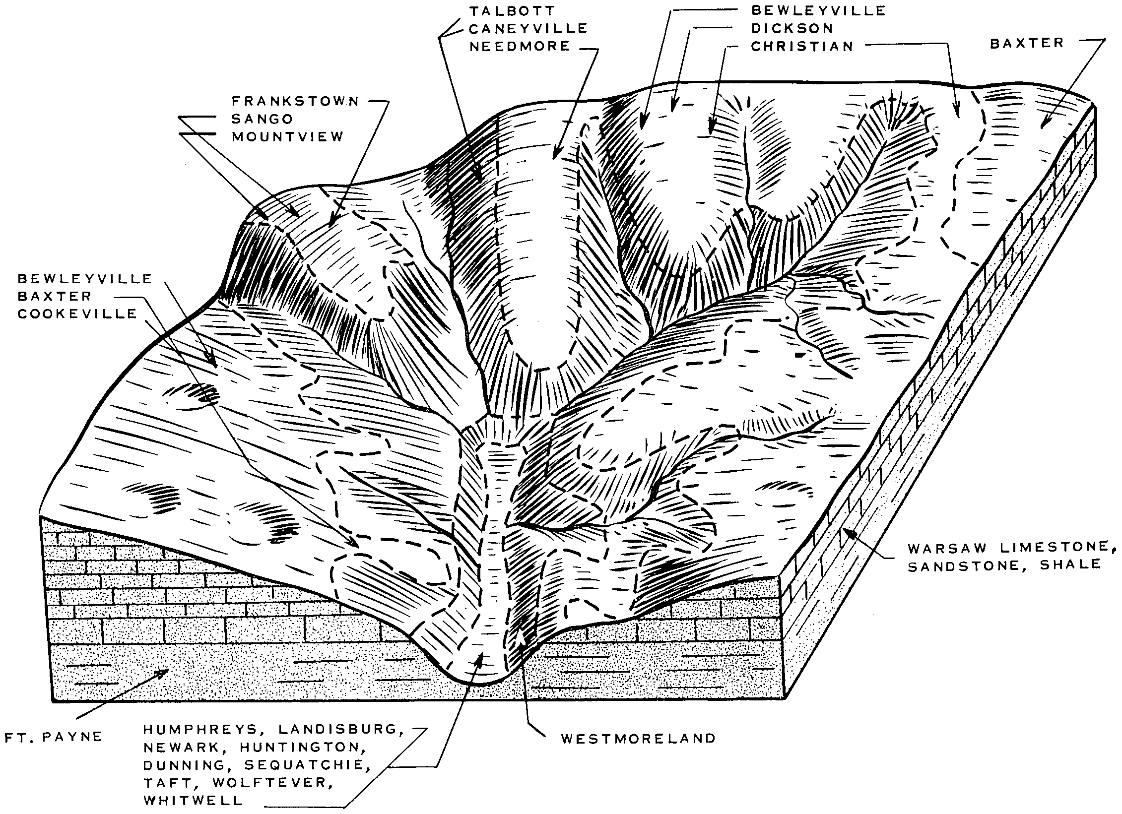
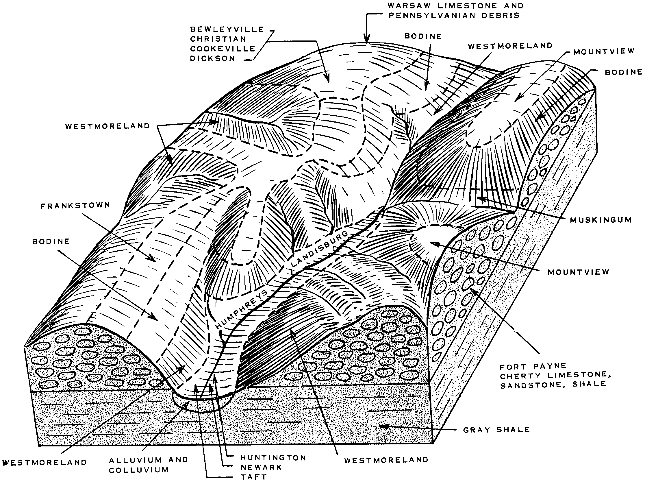
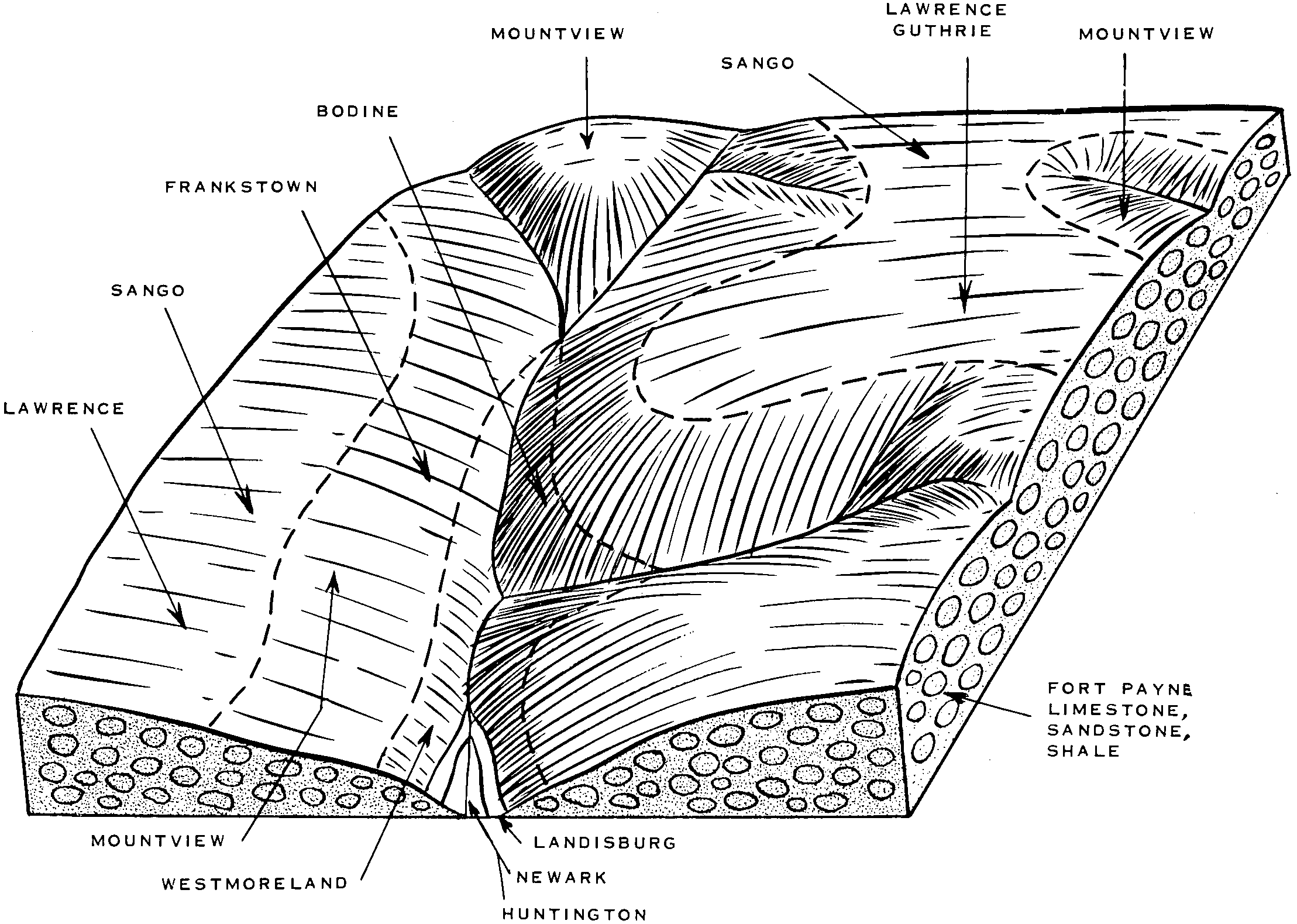
Frankstown cherty silt loam, 12 to 20 percent slopes | FcD | 12846 | 552400 | ljtc | ky199 | 1969 | 1:12000 |
Frankstown cherty silt loam, 6 to 12 percent slopes | FcC | 3250 | 552399 | ljtb | ky199 | 1969 | 1:12000 |
Frankstown cherty silt loam, 20 to 30 percent slopes | FcE | 2651 | 552401 | ljtd | ky199 | 1969 | 1:12000 |
Frankstown cherty silt loam, 2 to 6 percent slopes | FcB | 142 | 552398 | ljt9 | ky199 | 1969 | 1:12000 |
Frankstown gravelly silt loam, 12 to 25 percent slopes, eroded | FrD2 | 14369 | 552955 | lkd8 | ky618 | 1993 | 1:12000 |
Frankstown gravelly silt loam, 6 to 12 percent slopes | FrC | 9421 | 552954 | lkd7 | ky618 | 1993 | 1:12000 |
Frankstown gravelly silt loam, 2 to 6 percent slopes | FrB | 735 | 552953 | lkd6 | ky618 | 1993 | 1:12000 |
Frankstown silt loam, 6 to 12 percent slopes | FkC | 11416 | 552552 | ljz8 | ky620 | 1979 | 1:20000 |
Frankstown silt loam, 12 to 20 percent slopes | FkD | 9888 | 552553 | ljz9 | ky620 | 1979 | 1:20000 |
Frankstown silt loam, 20 to 30 percent slopes | FkE | 9886 | 552554 | ljzb | ky620 | 1979 | 1:20000 |
Frankstown silt loam, 2 to 6 percent slopes | FkB | 2069 | 552551 | ljz7 | ky620 | 1979 | 1:20000 |
Frankstown variant-Mertz complex, 2 to 6 percent slopes, very stony | FrB | 485 | 171029 | 5qz2 | oh089 | 1986 | 1:15840 |
Frankstown channery silt loam, 8 to 15 percent slopes | FrC | 810 | 544863 | l8z7 | pa057 | 1999 | 1:24000 |
Frankstown channery silt loam, 25 to 35 percent slopes | FrE | 733 | 544867 | l8zc | pa057 | 1999 | 1:24000 |
Frankstown channery silt loam, 15 to 25 percent slopes | FrD | 560 | 544865 | l8z9 | pa057 | 1999 | 1:24000 |
Frankstown channery silt loam, 3 to 8 percent slopes | FrB | 401 | 544861 | l8z5 | pa057 | 1999 | 1:24000 |
Frankstown coarse cherty silt loam, steep phase | Fh | 8841 | 527780 | kq65 | tn119 | 1955 | 1:20000 |
Frankstown coarse cherty silt loam, eroded sloping phase | Fe | 2863 | 527777 | kq62 | tn119 | 1955 | 1:20000 |
Frankstown cherty silt loam, eroded sloping phase | Fa | 2274 | 527773 | kq5y | tn119 | 1955 | 1:20000 |
Frankstown coarse cherty silt loam, eroded moderately steep phase | Fg | 646 | 527779 | kq64 | tn119 | 1955 | 1:20000 |
Frankstown coarse cherty silt loam, sloping phase | Fd | 577 | 527776 | kq61 | tn119 | 1955 | 1:20000 |
Frankstown coarse cherty silt loam, moderately steep phase | Ff | 114 | 527778 | kq63 | tn119 | 1955 | 1:20000 |
Frankstown cherty silt loam, eroded moderately steep phase | Fc | 105 | 527775 | kq60 | tn119 | 1955 | 1:20000 |
Frankstown cherty silt loam, moderately steep phase | Fb | 7 | 527774 | kq5z | tn119 | 1955 | 1:20000 |
Frankstown cherty silt loam, 5 to 12 percent slopes | FrC | 706 | 523505 | kkr8 | tn187 | 1961 | 1:15840 |
Frankstown cherty silt loam, 12 to 20 percent slopes | FrD | 667 | 523506 | kkr9 | tn187 | 1961 | 1:15840 |
Frankstown channery silt loam, 7 to 15 percent slopes | 13C | 1140 | 521060 | kh6d | va069 | 1983 | 1:15840 |
Frankstown channery silt loam, 15 to 25 percent slopes | 13D | 666 | 521061 | kh6f | va069 | 1983 | 1:15840 |
Frankstown channery silt loam, 2 to 7 percent slopes | 13B | 516 | 521059 | kh6c | va069 | 1983 | 1:15840 |
Frankstown channery silt loam, 25 to 35 percent slopes | 13E | 385 | 521062 | kh6g | va069 | 1983 | 1:15840 |
Frankstown channery silt loam, 15 to 25 percent slopes | 13D | 17 | 3025646 | 2xr82 | va840 | 2017 | 1:12000 |
Frankstown channery silt loam, 7 to 15 percent slopes | 13C | 1 | 3025648 | 2xr84 | va840 | 2017 | 1:12000 |
Frankstown channery silt loam, 25 to 35 percent slopes | 13E | 1 | 3025647 | 2xr83 | va840 | 2017 | 1:12000 |
Frankstown silt loam, karst, 8 to 15 percent slopes | FkC | 5197 | 553017 | lkg8 | wv025 | 2002 | 1:24000 |
Frankstown silt loam, karst, 3 to 8 percent slopes | FkB | 5013 | 553018 | lkg9 | wv025 | 2002 | 1:24000 |
Frankstown silt loam, karst, 15 to 35 percent slopes, very rocky | FoE | 2469 | 553115 | lkkf | wv025 | 2002 | 1:24000 |
Frankstown silt loam, karst, 15 to 25 percent slopes | FkD | 1665 | 553016 | lkg7 | wv025 | 2002 | 1:24000 |
Frankstown silt loam, karst, 3 to 15 percent slopes, very rocky | FoC | 862 | 553114 | lkkd | wv025 | 2002 | 1:24000 |
Frankstown silt loam, 8 to 15 percent slopes | FaC | 3421 | 1713099 | 1vhm8 | wv063 | 1962 | 1:24000 |
Frankstown-Rock outcrop complex, 15 to 25 percent slopes | FeD | 2354 | 1713106 | 1vhmh | wv063 | 1962 | 1:24000 |
Frankstown silt loam, 15 to 25 percent slopes | FaD | 1619 | 1713102 | 1vhmc | wv063 | 1962 | 1:24000 |
Frankstown-Rock outcrop complex, 8 to 15 percent slopes | FeC | 1463 | 1713105 | 1vhmg | wv063 | 1962 | 1:24000 |
Frankstown silt loam, 3 to 8 percent slopes | FaB | 1275 | 1713098 | 1vhm7 | wv063 | 1962 | 1:24000 |
Frankstown-Rock outcrop complex, 25 to 35 percent slopes | FeE | 1158 | 1713107 | 1vhmj | wv063 | 1962 | 1:24000 |
Frankstown silt loam, karst, 8 to 15 percent slopes | FcC | 1021 | 1713090 | 1vhlz | wv063 | 1962 | 1:24000 |
Frankstown silt loam, karst, 3 to 8 percent slopes | FcB | 824 | 1713089 | 1vhly | wv063 | 1962 | 1:24000 |
Frankstown silt loam, 25 to 35 percent slopes | FaE | 343 | 1713103 | 1vhmd | wv063 | 1962 | 1:24000 |
Frankstown silt loam, karst, 15 to 35 percent slopes, very rocky | FdE | 264 | 1713108 | 1vhmk | wv063 | 1962 | 1:24000 |
Frankstown silt loam, karst, 15 to 25 percent slopes | FcD | 122 | 1713097 | 1vhm6 | wv063 | 1962 | 1:24000 |