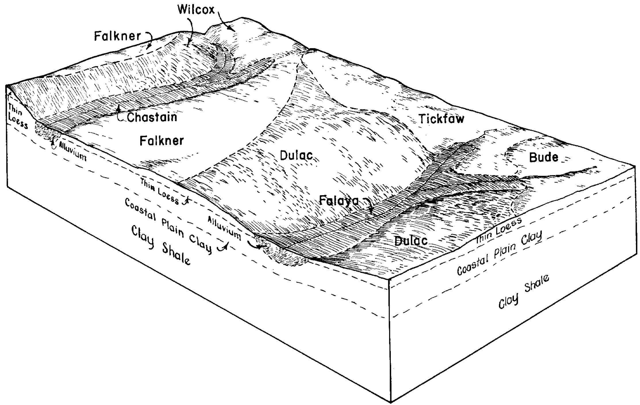
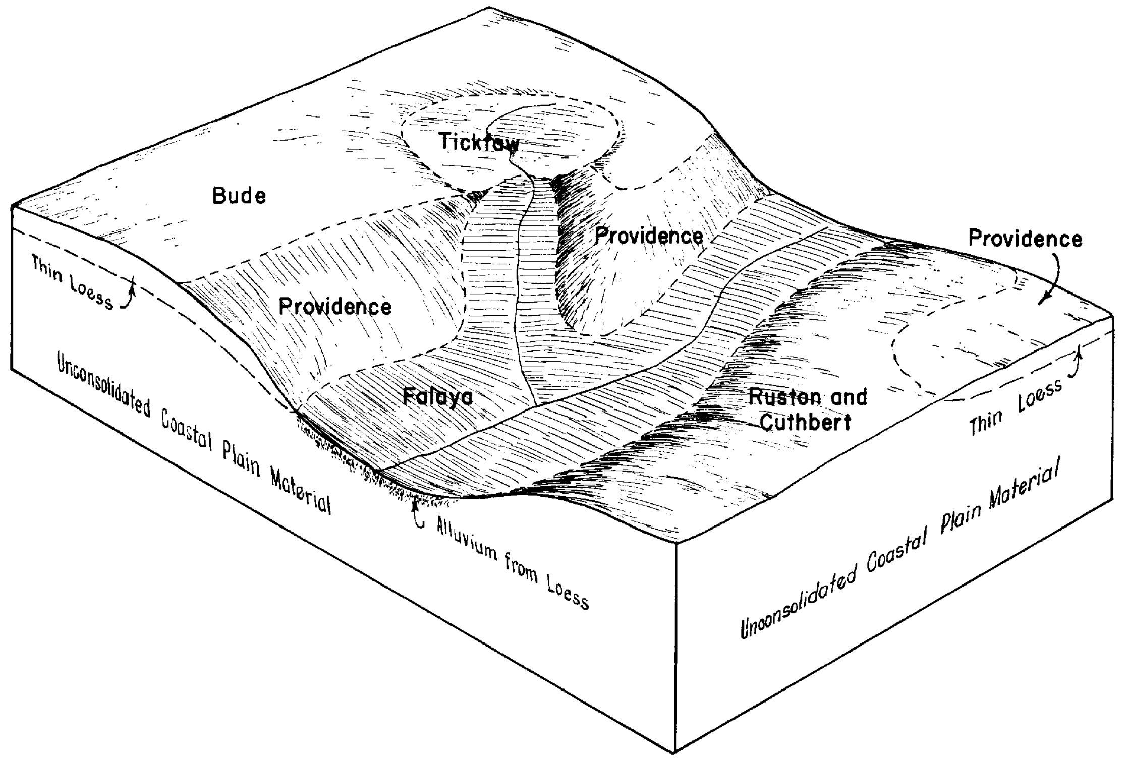
| Shubuta-Magnolia-Falaya association, hilly | SNE | 62262 | 329700 | c22h | al063 | 2013 | 1: |
Falaya fine sandy loam | Fa | 22922 | 329660 | c216 | al063 | 2013 | 1: |
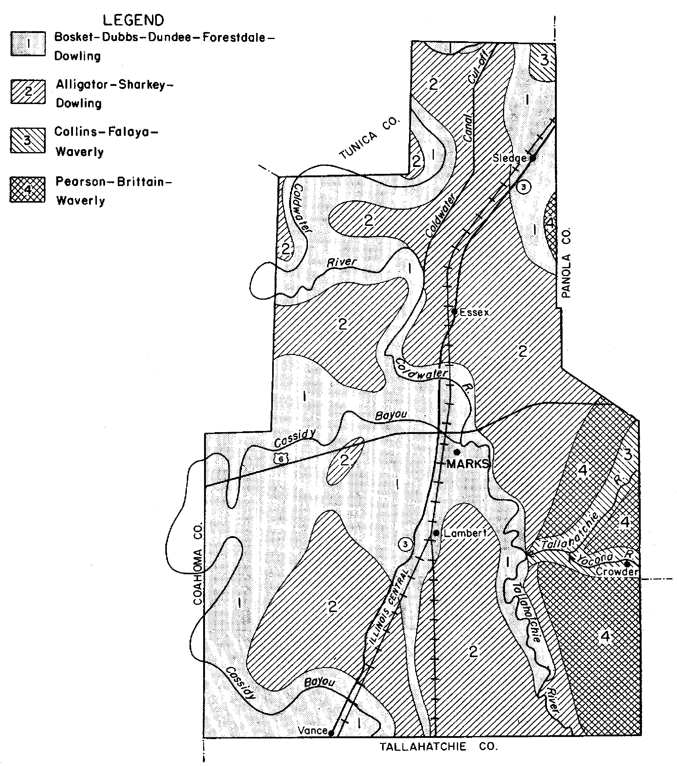
Falaya silt loam, 0 to 1 percent slopes, occasionally flooded, brief duration | 26 | 25660 | 564058 | 2t23p | ar021 | 1975 | 1:20000 |
Wehadkee-Falaya association | Wf | 18799 | 565341 | lz8t | ar025 | 1965 | 1:15840 |
Falaya silt loam | Fa | 859 | 565299 | lz7g | ar025 | 1965 | 1:15840 |
Falaya silt loam, 0 to 1 percent slopes, occasionally flooded, brief duration | 21 | 19130 | 564128 | 2t23p | ar031 | 1976 | 1:20000 |
Falaya silt loam, 0 to 1 percent slopes, occasionally flooded, brief duration | 10A | 6776 | 577962 | 2t23p | ar055 | 1995 | 1:24000 |
Falaya silt loam, 0 to 1 percent slopes, occasionally flooded, brief duration | Fa | 8680 | 564085 | 2t23p | ar077 | 1974 | 1:20000 |
Falaya silt loam | Fa | 5820 | 564230 | ly3z | ar107 | 1971 | 1:20000 |
Falaya silt loam, 0 to 1 percent slopes, occasionally flooded, brief duration | Fa | 9437 | 564272 | 2t23p | ar111 | 1973 | 1:20000 |
Falaya silt loam, 0 to 2 percent slopes, occasionally flooded, very brief duration | Fa | 2526 | 654151 | 2t23r | ky075 | 2002 | 1:12000 |
Falaya-Waverly complex, 0 to 2 percent slopes, occasionally flooded | Fc | 443 | 654157 | pypv | ky075 | 2002 | 1:12000 |
Falaya silt loam, frequently flooded | Ff | 8265 | 570628 | m4sc | ky083 | 1995 | 1:12000 |
Falaya silt loam, 0 to 2 percent slopes, occasionally flooded, very brief duration | Fa | 4656 | 570627 | 2t23r | ky083 | 1995 | 1:12000 |
Falaya-Collins complex, 0 to 2 percent slopes, occasionally flooded | Fa | 23898 | 1597328 | 1qm4q | ky602 | 1972 | 1:12000 |
Falaya-Collins complex, 0 to 2 percent slopes, frequently flooded | Fc | 3000 | 1597336 | 1qm4z | ky602 | 1972 | 1:12000 |
Falaya silt loam, 0 to 2 percent slopes, frequently flooded | Ff | 14539 | 2232329 | 2dxxm | ky610 | 1968 | 1:12000 |
Enville-Falaya complex, 0 to 2 percent slopes, occasionally flooded | Ef | 8291 | 2232231 | 2dxtg | ky610 | 1968 | 1:12000 |
Falaya silt loam, 0 to 2 percent slopes, occasionally flooded, very brief duration | Fa | 520 | 2654231 | 2t23r | ky610 | 1968 | 1:12000 |
Falaya soils, frequently flooded | FA | 3556 | 823528 | wmyf | la097 | 1983 | 1:24000 |
Falaya silt loam, 0 to 1 percent slopes, occasionally flooded | 86002 | 4557 | 2500787 | 2pzyd | mo017 | 2004 | 1:24000 |
Falaya silt loam, 0 to 1 percent slopes, rarely flooded | 82080 | 92 | 2689835 | 2r01y | mo017 | 2004 | 1:24000 |
Falaya silt loam, 0 to 1 percent slopes, frequently flooded | 86097 | 452 | 2571678 | 2q0jd | mo023 | 1982 | 1:24000 |
Falaya silt loam, 0 to 1 percent slopes, occasionally flooded | 86002 | 14901 | 2500789 | 2pzyd | mo031 | 1978 | 1:24000 |
Falaya silt loam, 0 to 1 percent slopes, frequently flooded | 86097 | 1210 | 2501097 | 2q0jd | mo031 | 1978 | 1:24000 |
Falaya silt loam, 0 to 3 percent slopes | 90310 | 642 | 2571704 | 2q2fn | mo031 | 1978 | 1:24000 |
Falaya silt loam, 0 to 3 percent slopes, occasionally flooded | 90603 | 16 | 2537563 | 2phfr | mo031 | 1978 | 1:24000 |
Falaya silt loam, 0 to 1 percent slopes, occasionally flooded | 86002 | 5447 | 2500784 | 2pzyd | mo069 | 1977 | 1:24000 |
Falaya silt loam, 0 to 1 percent slopes, frequently flooded | 86097 | 4402 | 2501095 | 2q0jd | mo069 | 1977 | 1:24000 |
Falaya silt loam, 0 to 3 percent slopes | 90310 | 3039 | 2503521 | 2q2fn | mo069 | 1977 | 1:24000 |
Falaya silt loam, 0 to 3 percent slopes, occasionally flooded | 90603 | 788 | 2689858 | 2phfr | mo069 | 1977 | 1:24000 |
Falaya silt loam, 0 to 1 percent slopes, rarely flooded | 82080 | 291 | 2571531 | 2r01y | mo069 | 1977 | 1:24000 |
Falaya silt loam, 0 to 1 percent slopes, occasionally flooded | 86002 | 2451 | 2500786 | 2pzyd | mo201 | 1978 | 1:24000 |
Falaya silt loam, 0 to 1 percent slopes, rarely flooded | 82080 | 2110 | 2689901 | 2r01y | mo201 | 1978 | 1:24000 |
Falaya silt loam, 0 to 3 percent slopes | 90310 | 1015 | 2503523 | 2q2fn | mo201 | 1978 | 1:24000 |
Falaya silt loam, 0 to 1 percent slopes, frequently flooded | 86097 | 5 | 2501096 | 2q0jd | mo201 | 1978 | 1:24000 |
Falaya silt loam, 0 to 1 percent slopes, occasionally flooded | 86002 | 34288 | 2500785 | 2pzyd | mo207 | 1983 | 1:24000 |
Falaya silt loam, 0 to 3 percent slopes | 90310 | 9672 | 2503522 | 2q2fn | mo207 | 1983 | 1:24000 |
Falaya silt loam, 0 to 3 percent slopes, occasionally flooded | 90603 | 8241 | 2689948 | 2phfr | mo207 | 1983 | 1:24000 |
Falaya silt loam, 0 to 1 percent slopes, rarely flooded | 82080 | 2288 | 2571534 | 2r01y | mo207 | 1983 | 1:24000 |
Falaya silt loam, 0 to 1 percent slopes, frequently flooded | 86097 | 975 | 2689941 | 2q0jd | mo207 | 1983 | 1:24000 |
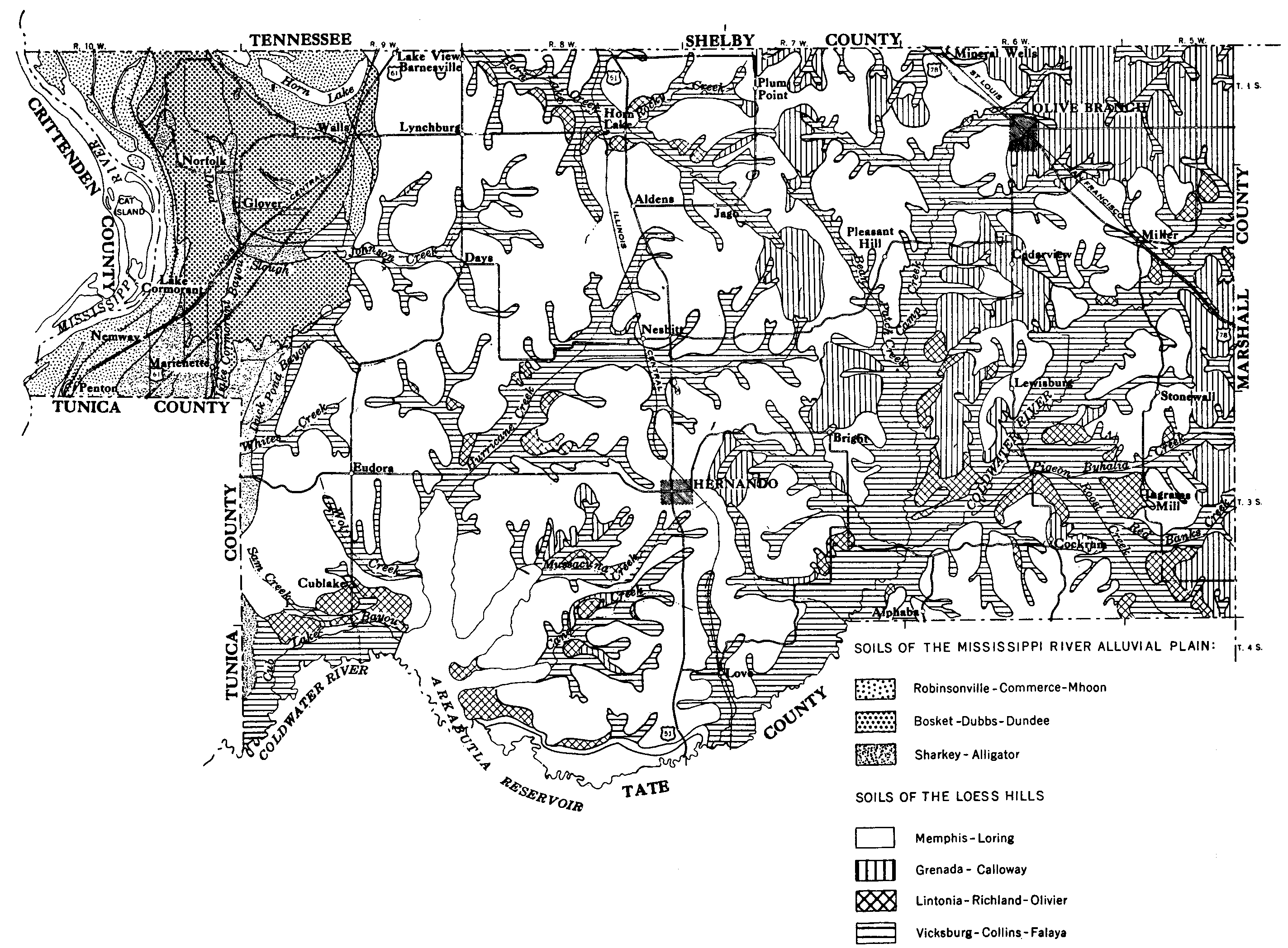
Falaya association | FF | 7695 | 567409 | m1fj | ms001 | 1966 | 1:15840 |
Falaya silt loam | Fa | 5586 | 567410 | m1fk | ms001 | 1966 | 1:15840 |
Falaya silt loam (oaklimeter) | Fa | 41630 | 331839 | c49h | ms013 | 1963 | 1:15840 |
Falaya silt loam, local alluvium (oaklimeter) | Fb | 25109 | 331840 | c49j | ms013 | 1963 | 1:15840 |
Falaya silt, occasionally flooded | 43 | 6118 | 567546 | m1ky | ms015 | 1985 | 1:20000 |
Falaya silt loam | Fa | 26300 | 567579 | m1m0 | ms021 | 1961 | 1:20000 |
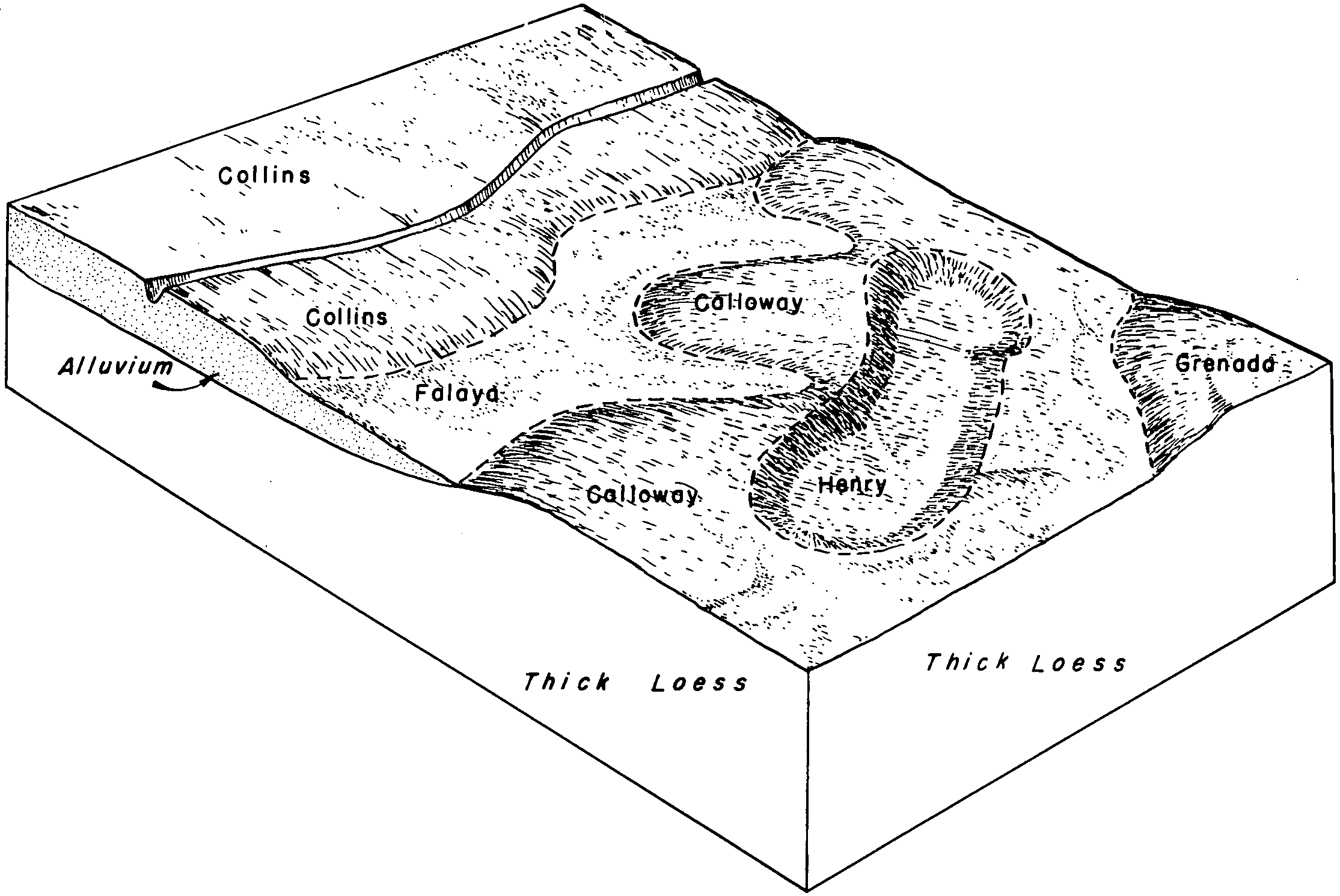
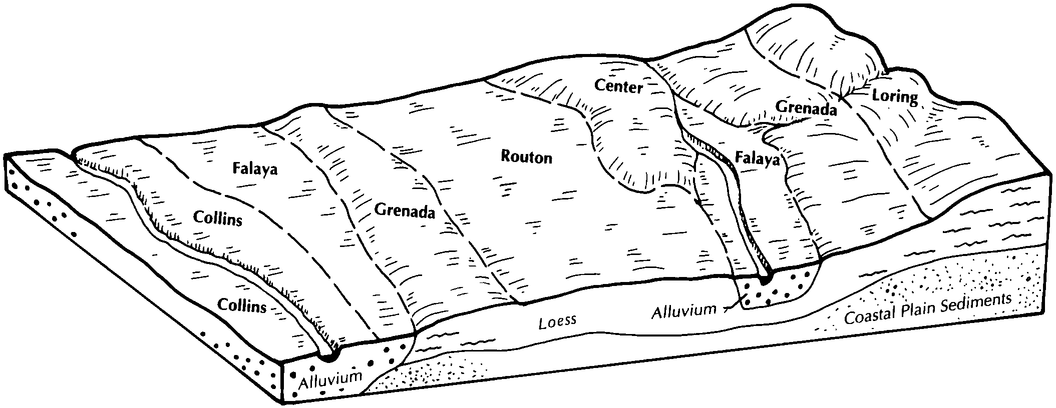
Collins and Falaya silt loams, local alluvium phases | Cl | 28816 | 567728 | m1rt | ms033 | 1955 | 1:24000 |
Falaya silt loam (arkabutla) | Fa | 10869 | 567744 | m1sb | ms033 | 1955 | 1:24000 |
Falaya silty clay loam (arkabutla) | Fb | 9094 | 567745 | m1sc | ms033 | 1955 | 1:24000 |
Falaya and Waverly silt loams, local alluvium phases (arkabutla and rosebloom) | Fc | 426 | 567746 | m1sd | ms033 | 1955 | 1:24000 |
Falaya silt loam | Ff | 30730 | 567848 | m1wp | ms043 | 1965 | 1:15840 |
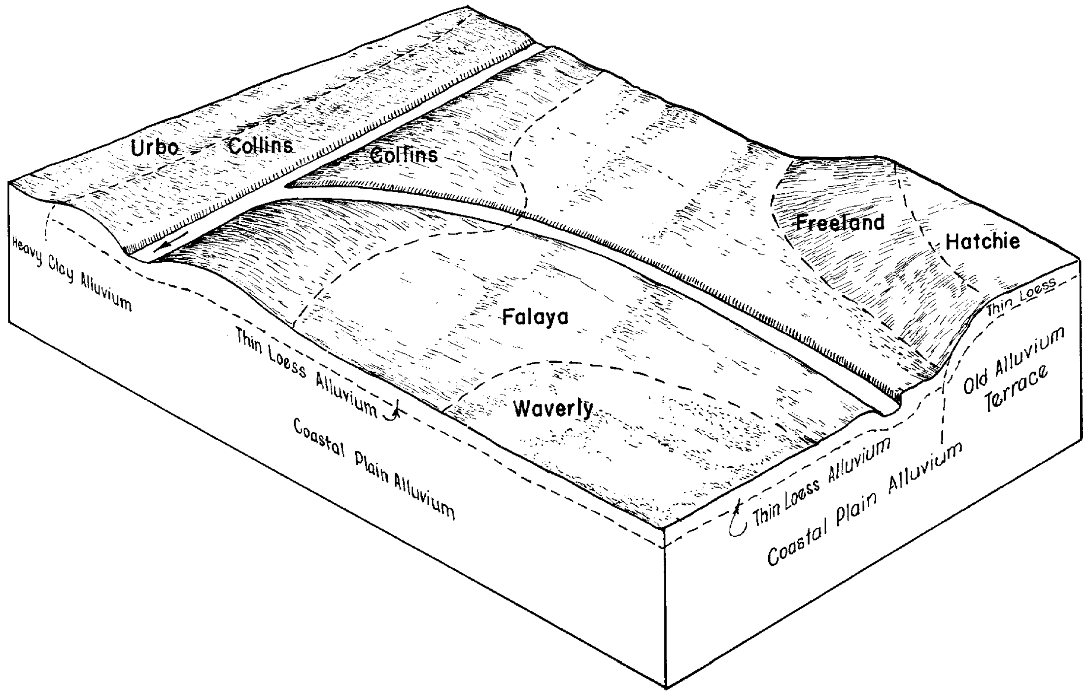
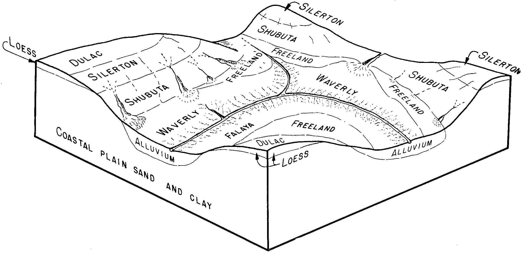
Waverly-Falaya association | Wf | 10895 | 567896 | m1y7 | ms043 | 1965 | 1:15840 |
Falaya silt loam, local alluvium | Fl | 10891 | 567849 | m1wq | ms043 | 1965 | 1:15840 |
Falaya-Collins association | Fc | 9282 | 567847 | m1wn | ms043 | 1965 | 1:15840 |
Falaya silt loam, occasionally flooded | Fa | 3148 | 567961 | m20b | ms051 | 1997 | 1:20000 |
Falaya silt | Fa | 12020 | 568077 | m242 | ms063 | 1976 | 1:20000 |
Arkabutla and Falaya soils, 0 to 5 percent slopes, frequently flooded | 10 | 8512 | 568118 | m25d | ms083 | 1997 | 1:24000 |
Falaya silt, 0 to 2 percent slopes, occasionally flooded | 22 | 2896 | 568117 | m25c | ms083 | 1997 | 1:24000 |
Falaya silt loam (oaklimeter) | Fa | 33183 | 568153 | m26j | ms085 | 1961 | 1:20000 |
Falaya silt loam, local alluvium (oaklimeter) | Fm | 10323 | 568154 | m26k | ms085 | 1961 | 1:20000 |
Collins-Arkabutla-Falaya association | CR | 10839 | 568264 | m2b3 | ms093 | 1968 | 1:20000 |
Falaya silt loam | Fa | 10232 | 568271 | m2bb | ms093 | 1968 | 1:20000 |
Falaya silt loam (occasionally flooded) | Fa | 47569 | 568313 | m2cp | ms107 | 1961 | 1:24000 |
Falaya and Waverly silt loams (frequently flooded) | Fw | 5007 | 568316 | m2cs | ms107 | 1961 | 1:24000 |
Falaya silt loam, local alluvium (occasionally flooded) | Fl | 2909 | 568314 | m2cq | ms107 | 1961 | 1:24000 |
Falaya silt loam | Fa | 21262 | 333640 | c65l | ms113 | 1965 | 1:15840 |
Falaya soils (gillsburg) | Fa | 4504 | 333690 | c676 | ms115 | 1969 | 1:20000 |
Falaya silty clay loam (arkabutla) | Fb | 922 | 568387 | m2g2 | ms119 | 1956 | 1:24000 |
Falaya silt loam (waverly) | Fa | 839 | 568386 | m2g1 | ms119 | 1956 | 1:24000 |
Collins-Falaya silt loams, nearly level phases (collins, waverly) | Cm | 272 | 568371 | m2fk | ms119 | 1956 | 1:24000 |
Collins-Falaya silt loams, gently sloping phases (collins, waverly) | Cn | 222 | 568372 | m2fl | ms119 | 1956 | 1:24000 |
Falaya silt loam | Fa | 24448 | 568522 | m2lf | ms135 | 1966 | 1:24000 |
Falaya-Waverly association | Fe | 7043 | 568521 | m2ld | ms135 | 1966 | 1:24000 |
Falaya silt loam | Fa | 22783 | 568569 | m2my | ms137 | 1964 | 1:15840 |
Falaya silt loam (gillsburg) | Fa | 20536 | 334185 | c6r5 | ms139 | 1963 | 1:15840 |
Falaya silt loam, local alluvium (gillsburg) | Fc | 9339 | 334186 | c6r6 | ms139 | 1963 | 1:15840 |
Falaya silt loam, overflow (gillsburg) | Ff | 909 | 334187 | c6r7 | ms139 | 1963 | 1:15840 |
Falaya silt loam (gillsburg) | Fa | 2800 | 334306 | c6w2 | ms147 | 1965 | 1:20000 |
Falaya silt loam (collins) | Fa | 10447 | 568686 | m2rq | ms149 | 1962 | 1:15840 |
Waverly and Falaya silt loams, frequently flooded (rosebloom and collins) | Wf | 9121 | 2693458 | 2rv55 | ms149 | 1962 | 1:15840 |
Falaya silt loam, local alluvium (collins) | Fl | 355 | 568687 | m2rr | ms149 | 1962 | 1:15840 |
Falaya-Vicksburg-Leverett association, frequently flooded | FC | 24199 | 2693468 | 2rv59 | ms163 | 1969 | 1:20000 |
Falaya silt loam, occasionally flooded | Fa | 2416 | 2693467 | 2rv5b | ms163 | 1969 | 1:20000 |
Falaya silt loam, occasionally flooded | Fa | 42048 | 327170 | bzfw | tn017 | 1980 | 1:15840 |
Falaya silt loam | Fa | 29146 | 566784 | m0sc | tn045 | 1963 | 1:15840 |
Falaya silt loam | Fm | 32830 | 566970 | m0zc | tn047 | 1961 | 1:15840 |
Falaya silt loam, 0 to 2 percent slopes, occasionally flooded, brief | Fu | 18420 | 566971 | 2t23q | tn047 | 1961 | 1:15840 |
Falaya silt loam, frequently flooded | Fa | 31133 | 567042 | m11p | tn053 | 1990 | 1:24000 |
Falaya silt loam | Fm | 3487 | 327566 | bzvn | tn071 | 1961 | 1:15840 |
Falaya silt loam | Fa | 31697 | 567199 | m16r | tn113 | 1974 | 1:20000 |
Falaya silt loam, 0 to 2 percent slopes, occasionally flooded, brief | Fa | 28978 | 567242 | 2t23q | tn131 | 1966 | 1:15840 |
Falaya silt loam, frequently flooded | Fb | 4080 | 567243 | m185 | tn131 | 1966 | 1:15840 |
Falaya silt loam, 0 to 2 percent slopes, frequently flooded, very brief | Fm | 84258 | 567289 | 30rct | tn157 | 1966 | 1:15840 |
Falaya silt loam, frequently flooded | Fa | 3260 | 567340 | m1c9 | tn167 | 1989 | 1:24000 |
Falaya silt loam, 0 to 2 percent slopes, occasionally flooded, brief | Fb | 25588 | 567370 | 2t23q | tn183 | 1986 | 1:24000 |
Falaya silt loam, rarely flooded | Fa | 3480 | 567369 | m1d7 | tn183 | 1986 | 1:24000 |