| Drake loam, cool, 1 to 9 percent slopes | DkcD | 1002 | 3156188 | 2xxws | nm021 | 1968 | 1:31680 |
Jal association | JA | 6984 | 376427 | dmpt | nm025 | 1967 | 1:20000 |
Arch-Drake association, dry, 0 to 3 percent slopes | AV | 6132 | 376398 | dmnw | nm025 | 1967 | 1:20000 |
Drake loamy fine sand, 1 to 5 percent slopes | Dr | 1121 | 376422 | dmpn | nm025 | 1967 | 1:20000 |
Drake soils, 1 to 8 percent slopes | DRC | 10736 | 1547799 | f5s8 | nm041 | 2014 | 1:24000 |
Drake soils, 8 to 20 percent slopes | DRE | 1175 | 2606860 | f5s9 | nm041 | 2014 | 1:24000 |
Drake soils, 1 to 8 percent slopes | DRC | 5167 | 1472216 | f5s8 | nm669 | 2005 | 1:24000 |
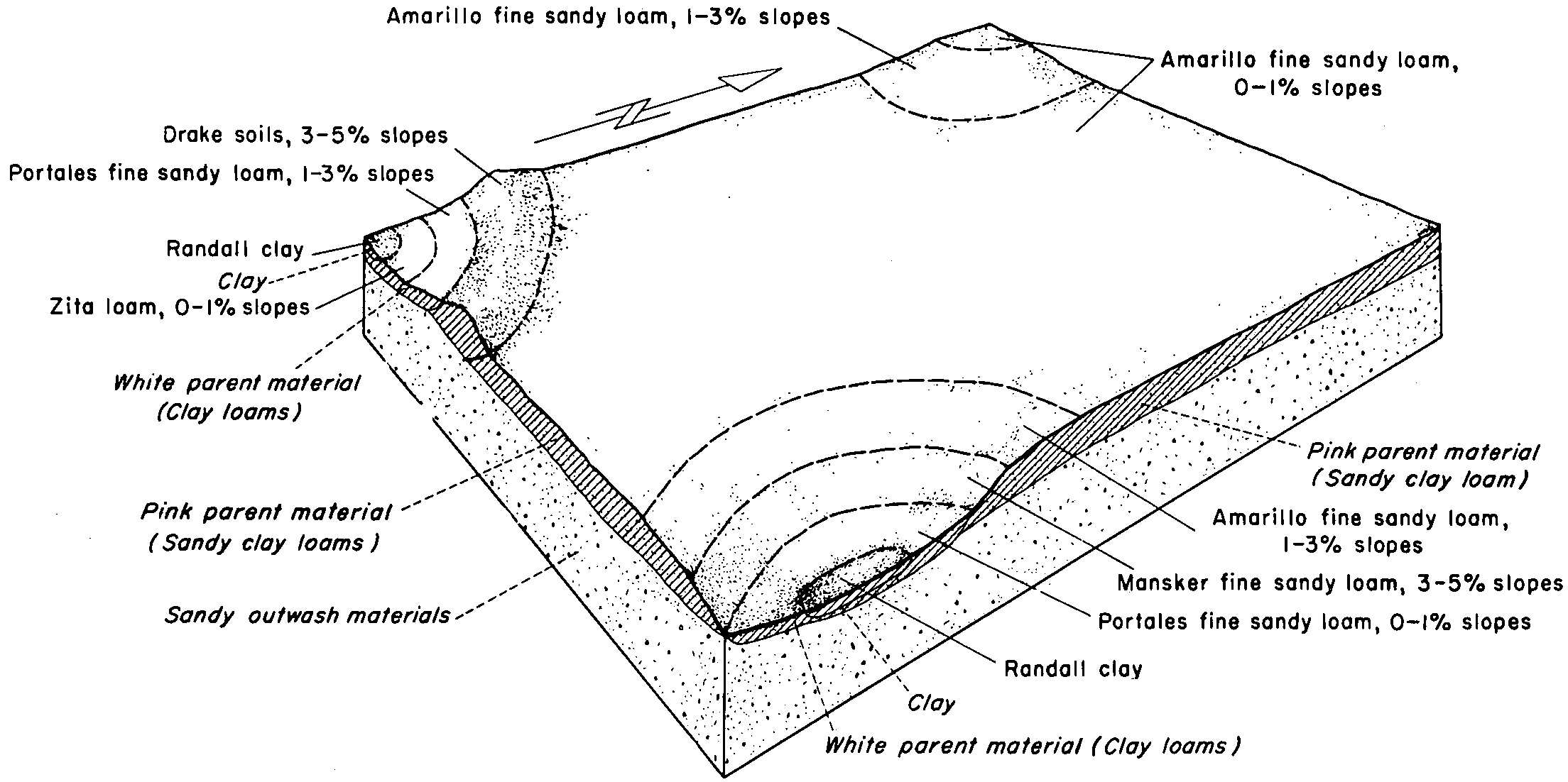
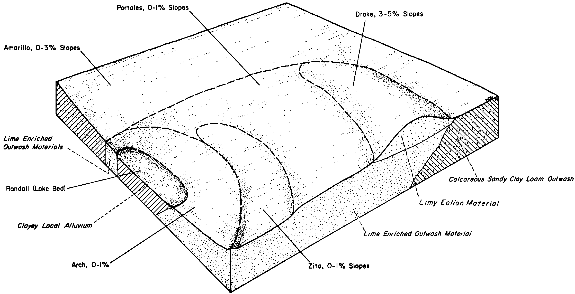
Drake soils, 1 to 3 percent slopes | DrB | 3779 | 362582 | 2tmp7 | tx017 | 1960 | 1:20000 |
Drake soils, 3 to 5 percent slopes | DrC | 3673 | 362583 | 2tmp8 | tx017 | 1960 | 1:20000 |
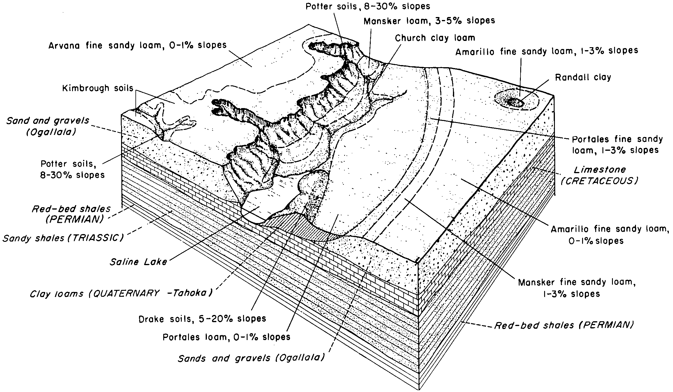
Drake soils, 5 to 20 percent slopes | DrE | 3261 | 362584 | 2tmp9 | tx017 | 1960 | 1:20000 |
Drake soils, 1 to 8 percent slopes | DRC | 4 | 2962344 | f5s8 | tx033 | 1970 | 1:24000 |
Drake soils, 1 to 8 percent slopes | DRC | 1159 | 3258059 | f5s8 | tx045 | 1972 | 1:20000 |
Drake soils, 1 to 8 percent slopes | DRC | 1576 | 2428287 | f5s8 | tx069 | 1969 | 1:20000 |
Drake soils, 1 to 8 percent slopes | DRC | 3858 | 2931513 | f5s8 | tx079 | 1962 | 1:20000 |
Drake soils, 8 to 20 percent slopes | DRE | 61 | 2931514 | f5s9 | tx079 | 1962 | 1:20000 |
Drake clay loam, 1 to 3 percent slopes | DcB | 2053 | 364708 | 2tmp5 | tx107 | 1964 | 1:20000 |
Drake clay loam, 3 to 5 percent slopes | DcC | 610 | 364709 | 2tmp6 | tx107 | 1964 | 1:20000 |
Drake soils, 1 to 8 percent slopes | DRC | 1752 | 393606 | f5s8 | tx115 | 2004 | 1:24000 |
Drake soils, 1 to 8 percent slopes | DRC | 3060 | 378047 | f5s8 | tx117 | 1999 | 1:24000 |
Drake soils, 1 to 8 percent slopes | DRC | 1198 | 644645 | f5s8 | tx153 | 2004 | 1:24000 |
Drake soils, 3 to 5 percent slopes | DrC | 2817 | 366038 | 2tmp8 | tx165 | 1964 | 1:20000 |
Drake soils, 1 to 3 percent slopes | DrB | 2051 | 366037 | 2tmp7 | tx165 | 1964 | 1:20000 |
Drake soils, 5 to 30 percent slopes | DrD | 947 | 366039 | d8wq | tx165 | 1964 | 1:20000 |
Drake soils, 2 to 5 percent slopes | DrC | 145 | 378329 | dpp5 | tx169 | 1965 | 1:24000 |
Drake soils 3 to 8 percent slopes | DsD | 2664 | 366902 | 30941 | tx189 | 1969 | 1:20000 |
Drake clay loam, 1 to 3 percent slopes | DrB | 1083 | 366901 | 2tmp5 | tx189 | 1969 | 1:20000 |
Drake soils, 1 to 8 percent slopes | DRC | 8245 | 378977 | f5s8 | tx219 | 1999 | 1:24000 |
Drake soils, 8 to 20 percent slopes | DRE | 398 | 378978 | f5s9 | tx219 | 1999 | 1:24000 |
Drake soils, 3 to 5 percent slopes | DrC | 2328 | 391881 | 2tmp8 | tx227 | 1965 | 1:24000 |
Drake soils, 5 to 20 percent slopes | DrD | 306 | 391882 | 2tmp9 | tx227 | 1965 | 1:24000 |
Drake soils, 3 to 5 percent slopes | DrC | 2911 | 394260 | 2tmp8 | tx279 | 1960 | 1:20000 |
Drake soils, 5 to 20 percent slopes | DrE | 2495 | 394263 | 2tmp9 | tx279 | 1960 | 1:20000 |
Drake soils, 1 to 3 percent slopes | DrB | 2416 | 394259 | 2tmp7 | tx279 | 1960 | 1:20000 |
Drake clay loam, 1 to 3 percent slopes | DcB | 2996 | 369835 | 2tmp5 | tx303 | 1975 | 1:20000 |
Drake clay loam, 3 to 5 percent slopes | DrC | 1513 | 369836 | 2tmp6 | tx303 | 1975 | 1:20000 |
Drake soils, 1 to 8 percent slopes | DRC | 9035 | 379035 | f5s8 | tx305 | 1999 | 1:24000 |
Drake soils, 8 to 20 percent slopes | DRE | 1791 | 379036 | f5s9 | tx305 | 1999 | 1:24000 |
Drake soils, 1 to 3 percent slopes | DrB | 5296 | 370331 | 2tmp7 | tx317 | 1968 | 1:24000 |
Drake soils, 3 to 5 percent slopes | DrC | 3464 | 370332 | 2tmp8 | tx317 | 1968 | 1:24000 |
Drake soils, 1 to 8 percent slopes | DRC | 80 | 3124268 | f5s8 | tx375 | 1974 | 1:24000 |
Drake soils, 1 to 8 percent slopes | DRC | 1883 | 371386 | f5s8 | tx381 | 1999 | 1:24000 |
Drake loam, 3 to 5 percent slopes | DrC | 1964 | 372334 | dhfs | tx437 | 1970 | 1:20000 |
Drake loam, 1 to 3 percent slopes | DrB | 837 | 372333 | dhfr | tx437 | 1970 | 1:20000 |
Drake soils, 1 to 8 percent slopes | DRC | 3775 | 372591 | f5s8 | tx445 | 1999 | 1:24000 |
Drake soils, 8 to 20 percent slopes | DRE | 1211 | 372547 | f5s9 | tx445 | 1999 | 1:24000 |
Drake soils, 1 to 8 percent slopes | DRC | 1463 | 2931501 | f5s8 | tx501 | 1962 | 1:31680 |