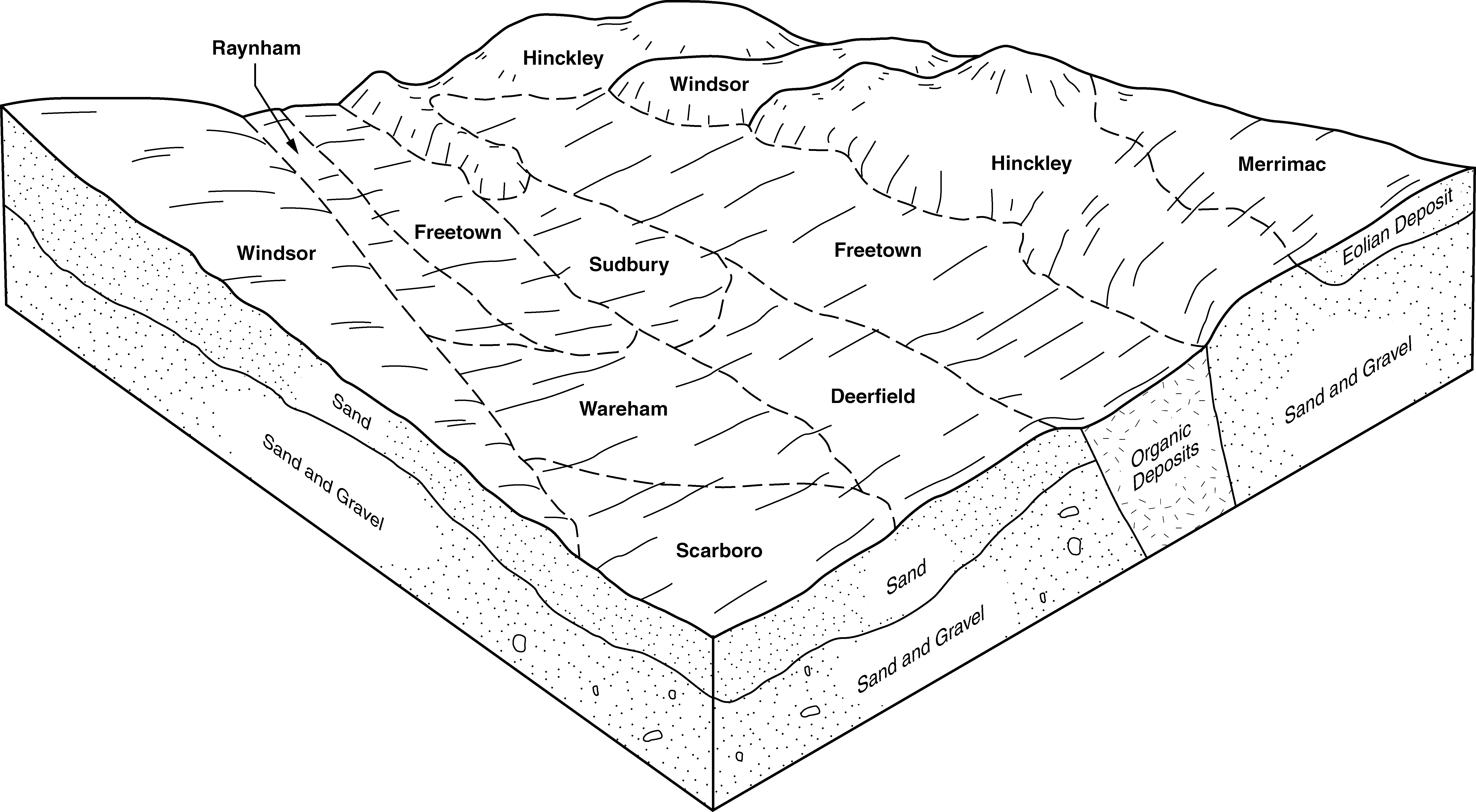
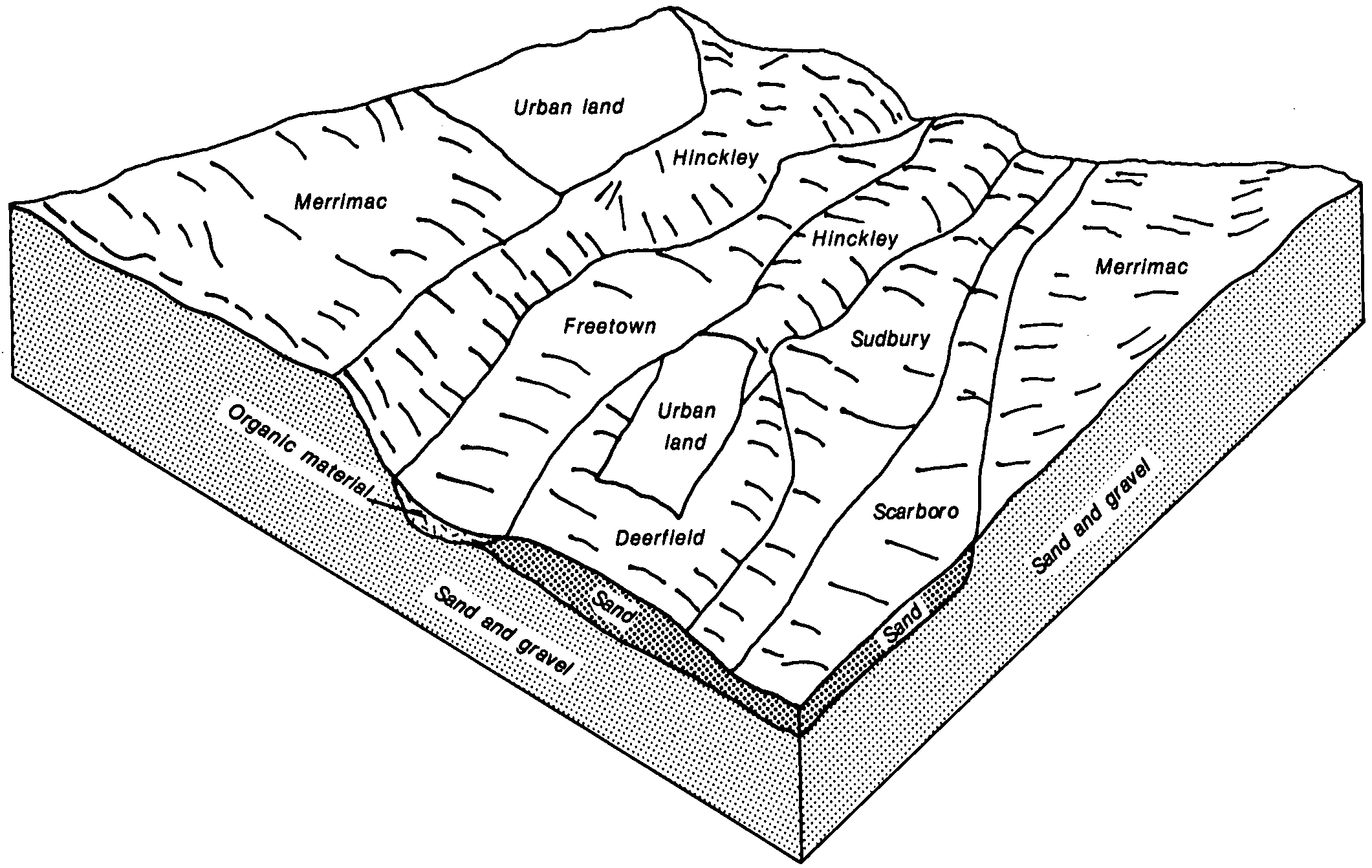
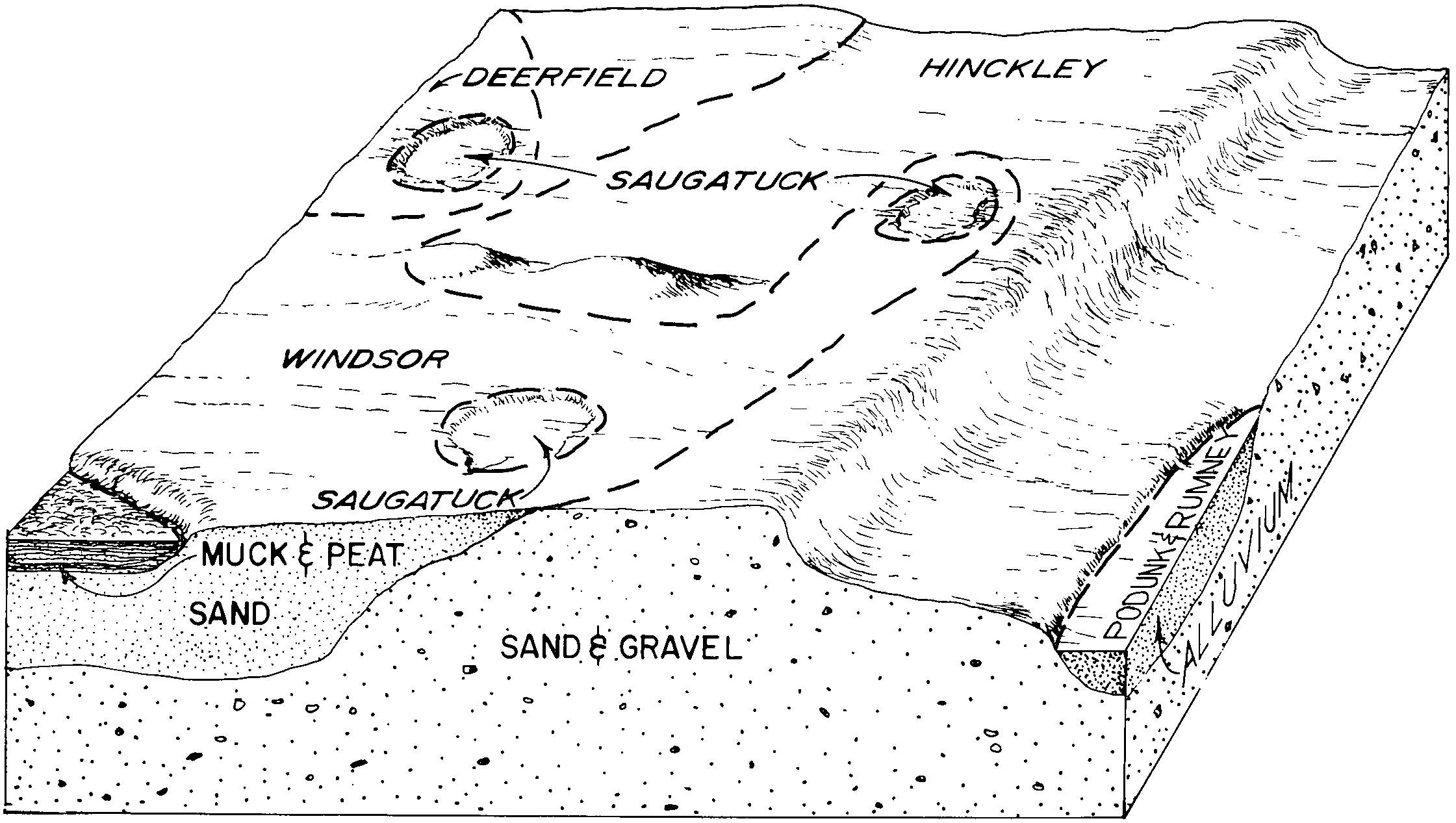
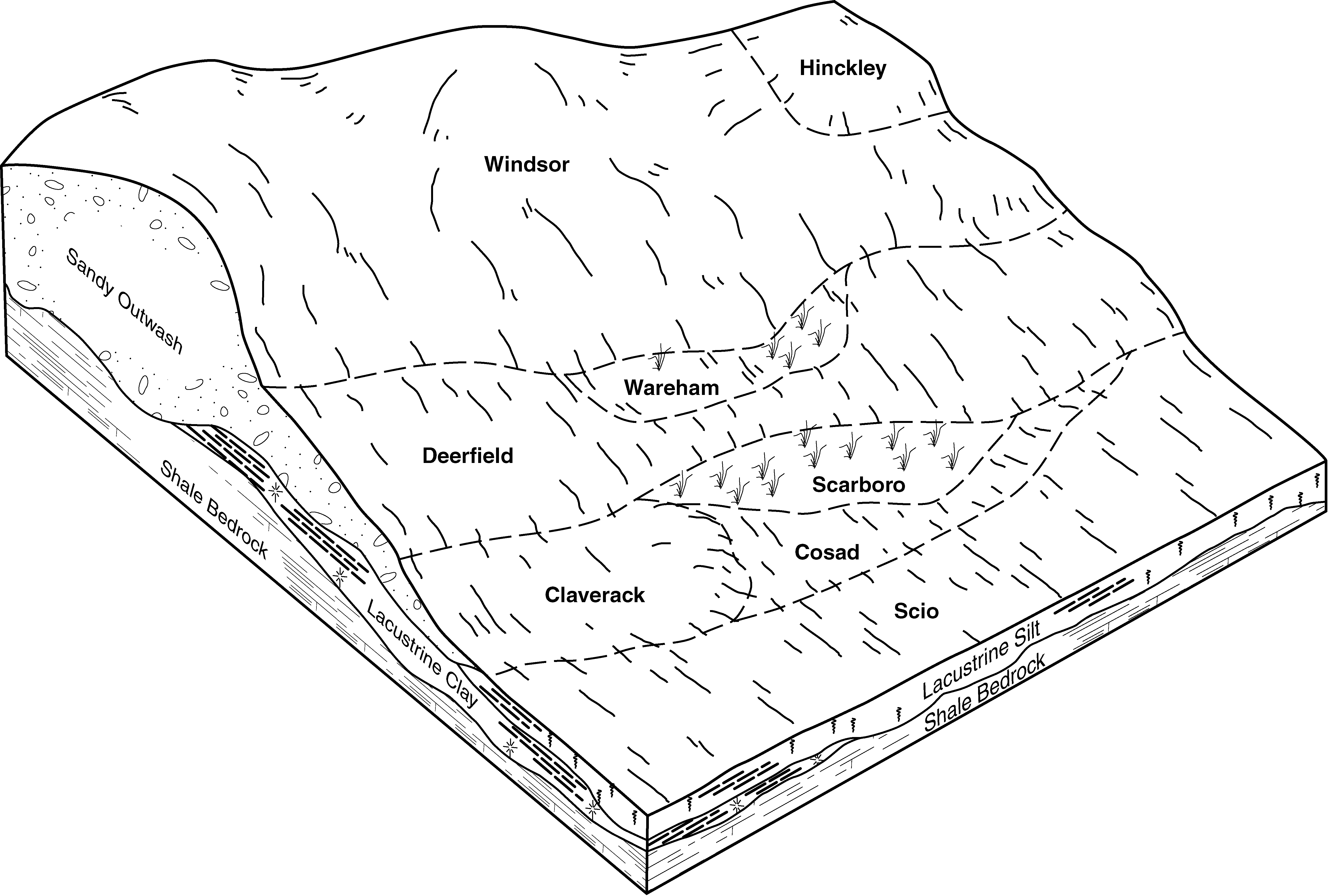
| Deerfield loamy fine sand, 0 to 3 percent slopes | 24A | 989 | 3395679 | 2xfg8 | ct601 | 2003 | 1:12000 |
Deerfield-Urban land complex, 0 to 3 percent slopes | 224A | 293 | 3395655 | 2xfgb | ct601 | 2003 | 1:12000 |
Deerfield loamy fine sand, 0 to 3 percent slopes | 24A | 10 | 3400052 | 2xfg8 | ct602 | 2003 | 1:12000 |
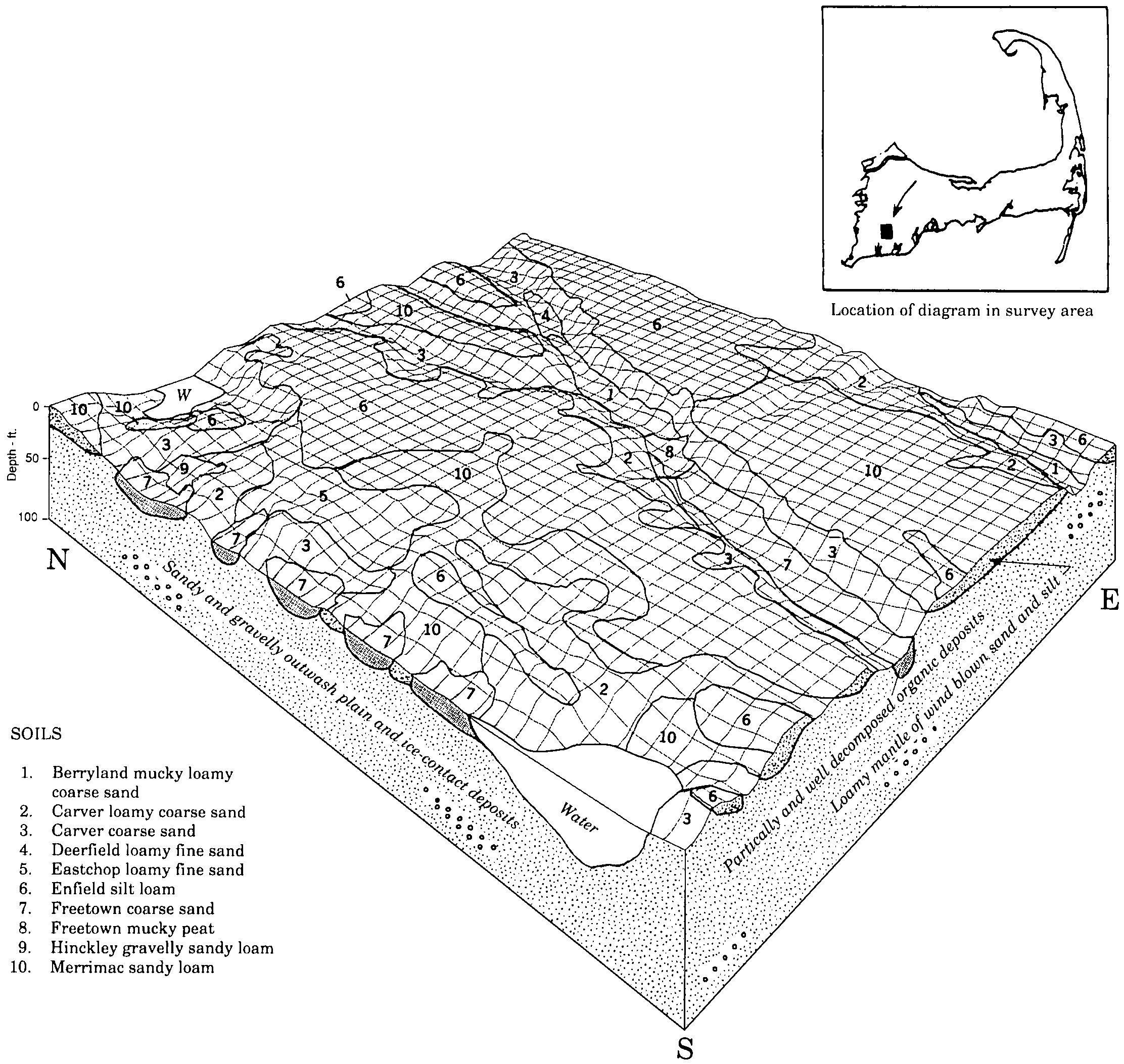
Deerfield loamy fine sand, 0 to 3 percent slopes | 256A | 1048 | 276507 | 2xfg8 | ma001 | 1984 | 1:25000 |
Deerfield loamy fine sand, 0 to 3 percent slopes | 256A | 844 | 276579 | 2xfg8 | ma003 | 1984 | 1:25000 |
Deerfield loamy fine sand, 0 to 3 percent slopes | 256A | 1507 | 278903 | 2xfg8 | ma011 | 2012 | 1:12000 |
Deerfield loamy fine sand, 3 to 8 percent slopes | 256B | 497 | 279063 | 2xfg9 | ma011 | 2012 | 1:12000 |
Deerfield loamy fine sand, 0 to 3 percent slopes | 256A | 6549 | 276797 | 2xfg8 | ma017 | 1991 | 1:24000 |
Deerfield loamy fine sand, 3 to 8 percent slopes | 256B | 5054 | 276798 | 2xfg9 | ma017 | 1991 | 1:24000 |
Deerfield loamy fine sand, 3 to 8 percent slopes | 256B | 8201 | 309346 | 2xfg9 | ma023 | 2010 | 1:12000 |
Deerfield loamy fine sand, 0 to 3 percent slopes | 256A | 7424 | 309345 | 2xfg8 | ma023 | 2010 | 1:12000 |
Deerfield-Urban land complex, 0 to 3 percent slopes | 619A | 545 | 599852 | 2xfgb | ma023 | 2010 | 1:12000 |
Deerfield loamy fine sand, 0 to 3 percent slopes | 256A | 6902 | 277018 | 2xfg8 | ma602 | 1976 | 1:20000 |
Deerfield loamy fine sand, 0 to 3 percent slopes | 256A | 1475 | 779951 | 2xfg8 | ma603 | 1979 | 1:20000 |
Deerfield loamy fine sand, 0 to 3 percent slopes | 256A | 3809 | 790173 | 2xfg8 | ma605 | 1977 | 1:15840 |
Deerfield loamy fine sand, 0 to 3 percent slopes | 256A | 942 | 791051 | 2xfg8 | ma606 | 1981 | 1:15840 |
Deerfield loamy fine sand, 0 to 3 percent slopes | 256A | 1216 | 277413 | 2xfg8 | ma607 | 1975 | 1:15840 |
Deerfield loamy fine sand, 0 to 3 percent slopes | 256A | 1343 | 277719 | 2xfg8 | ma609 | 1980 | 1:15840 |
Deerfield loamy fine sand, 0 to 3 percent slopes | 256A | 353 | 789738 | 2xfg8 | ma610 | 1985 | 1:25000 |
Deerfield loamy fine sand, 0 to 3 percent slopes | 249A | 787 | 807423 | 2xfg8 | ma613 | 1982 | 1:20000 |
Deerfield loamy fine sand, 3 to 8 percent slopes | 256B | 470 | 791701 | 2xfg9 | ma616 | 1985 | 1:25000 |
Deerfield loamy fine sand, 0 to 3 percent slopes | 256A | 245 | 791699 | 2xfg8 | ma616 | 1985 | 1:25000 |
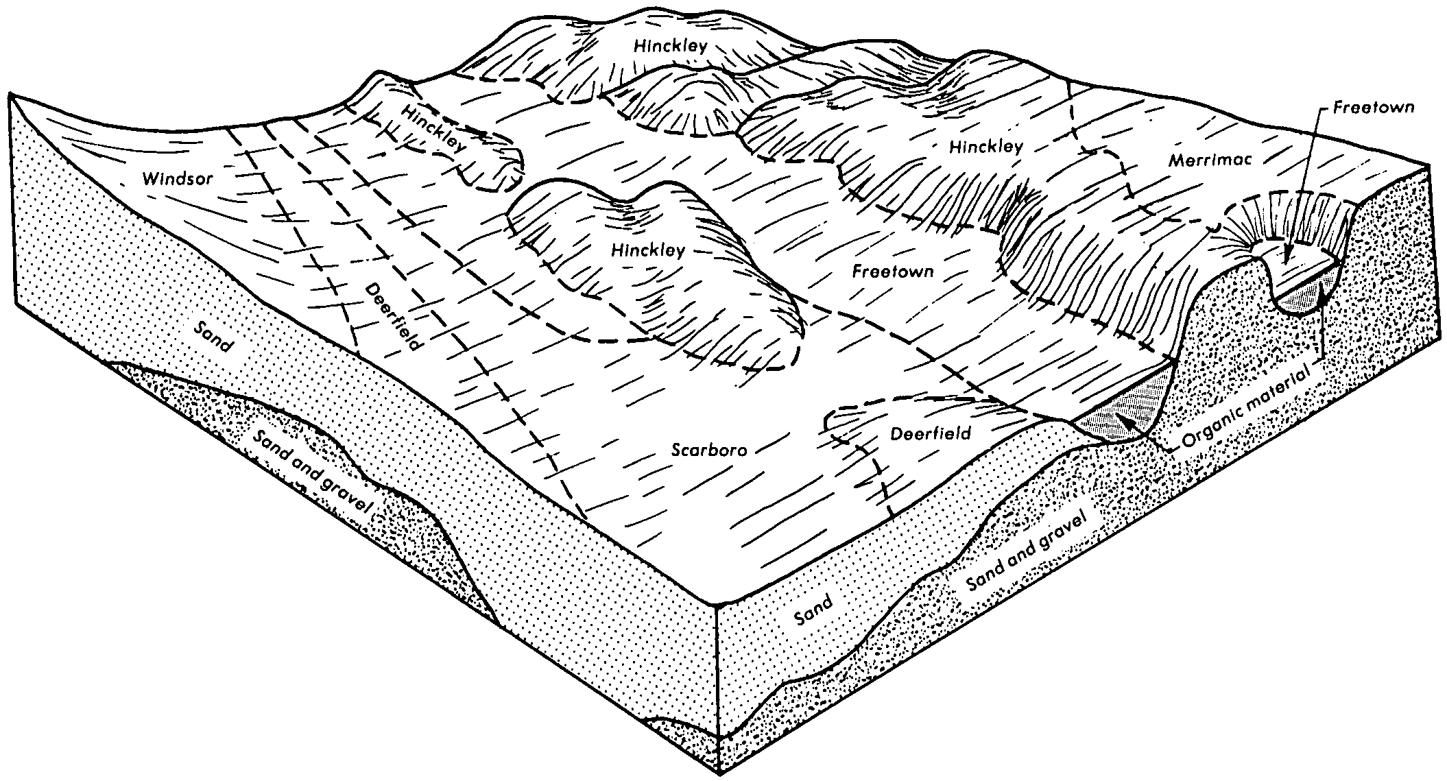
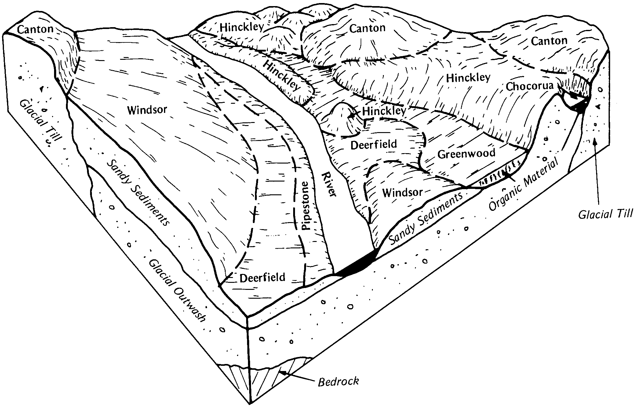
Deerfield loamy fine sand, 3 to 8 percent slopes | DeB | 13966 | 315679 | 2xfg9 | me005 | 1969 | 1:24000 |
Deerfield loamy fine sand, 0 to 3 percent slopes | DeA | 3323 | 315678 | 2xfg8 | me005 | 1969 | 1:24000 |
Deerfield loamy fine sand, 0 to 8 percent slopes | DeB | 2049 | 284457 | 9k01 | me011 | 1974 | 1:20000 |
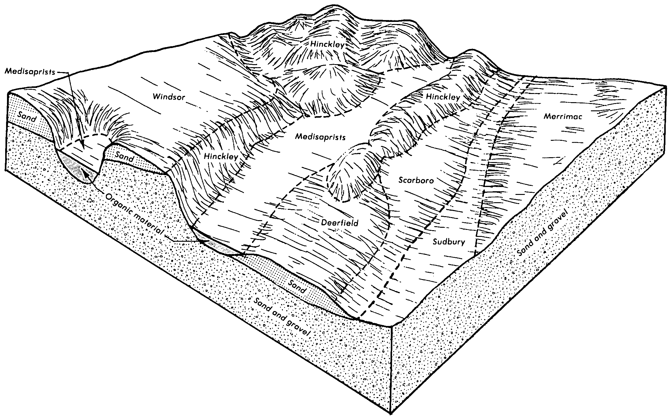
Deerfield loamy fine sand, 0 to 3 percent slopes | 313 | 632 | 281088 | 2xfg8 | nh009 | 1986 | 1:24000 |
Deerfield loamy fine sand, 0 to 3 percent slopes | 313A | 6711 | 279310 | 2xfg8 | nh015 | 1986 | 1:24000 |
Deerfield loamy fine sand, 3 to 8 percent slopes | 313B | 3529 | 279311 | 2xfg9 | nh015 | 1986 | 1:24000 |
Deerfield loamy fine sand, 0 to 3 percent slopes | DeA | 1441 | 279866 | 2xfg8 | nh017 | 1968 | 1:20000 |
Deerfield loamy fine sand, 3 to 8 percent slopes | DeB | 739 | 279867 | 2xfg9 | nh017 | 1968 | 1:20000 |
Deerfield loamy fine sand, 0 to 3 percent slopes | DeA | 3908 | 280968 | 2xfg8 | nh601 | 1980 | 1:20000 |
Deerfield loamy fine sand, 3 to 8 percent slopes | DeB | 912 | 280969 | 2xfg9 | nh601 | 1980 | 1:20000 |
Deerfield loamy fine sand, 0 to 3 percent slopes | 313A | 2206 | 280178 | 2xfg8 | nh609 | 2007 | 1:24000 |
Deerfield fine sand, 0 to 3 percent slopes | DeA | 933 | 290147 | 9qxl | ny019 | 1995 | 1:24000 |
Deerfield fine sand, 3 to 8 percent slopes | DeB | 546 | 290148 | 9qxm | ny019 | 1995 | 1:24000 |
Deerfield loamy sand, 0 to 3 percent slopes | DeA | 1131 | 316475 | bm9w | ny031 | 2007 | 1:24000 |
Deerfield loamy sand, 3 to 8 percent slopes | DeB | 441 | 316476 | bm9x | ny031 | 2007 | 1:24000 |
Deerfield loamy fine sand, 3 to 8 percent slopes | DeB | 2 | 1592668 | 2xfg9 | ny035 | 2007 | 1:24000 |
Deerfield loamy fine sand, 0 to 8 percent slopes | DeB | 9703 | 291811 | 9sn8 | ny045 | 1981 | 1:15840 |
Deerfield loamy fine sand, 0 to 6 percent slopes | DeB | 3350 | 294107 | 9w1b | ny075 | 1973 | 1:15840 |
Deerfield loamy fine sand, 0 to 3 percent slopes | DfA | 185 | 2520531 | 2xfg8 | ny085 | 2014 | 1:12000 |
Deerfield loamy fine sand, 0 to 3 percent slopes | DeA | 5048 | 294370 | 2xfg8 | ny091 | 1993 | 1:24000 |
Deerfield loamy fine sand, 3 to 8 percent slopes | DeB | 4923 | 294371 | 2xfg9 | ny091 | 1993 | 1:24000 |
Deerfield loamy fine sand, 0 to 3 percent slopes | De | 2508 | 295233 | 2xfg8 | ny103 | 1970 | 1:20000 |
Deerfield loamy fine sand, 0 to 3 percent slopes | Dc | 1340 | 286231 | 2xfg8 | ri600 | 1977 | 1:12000 |
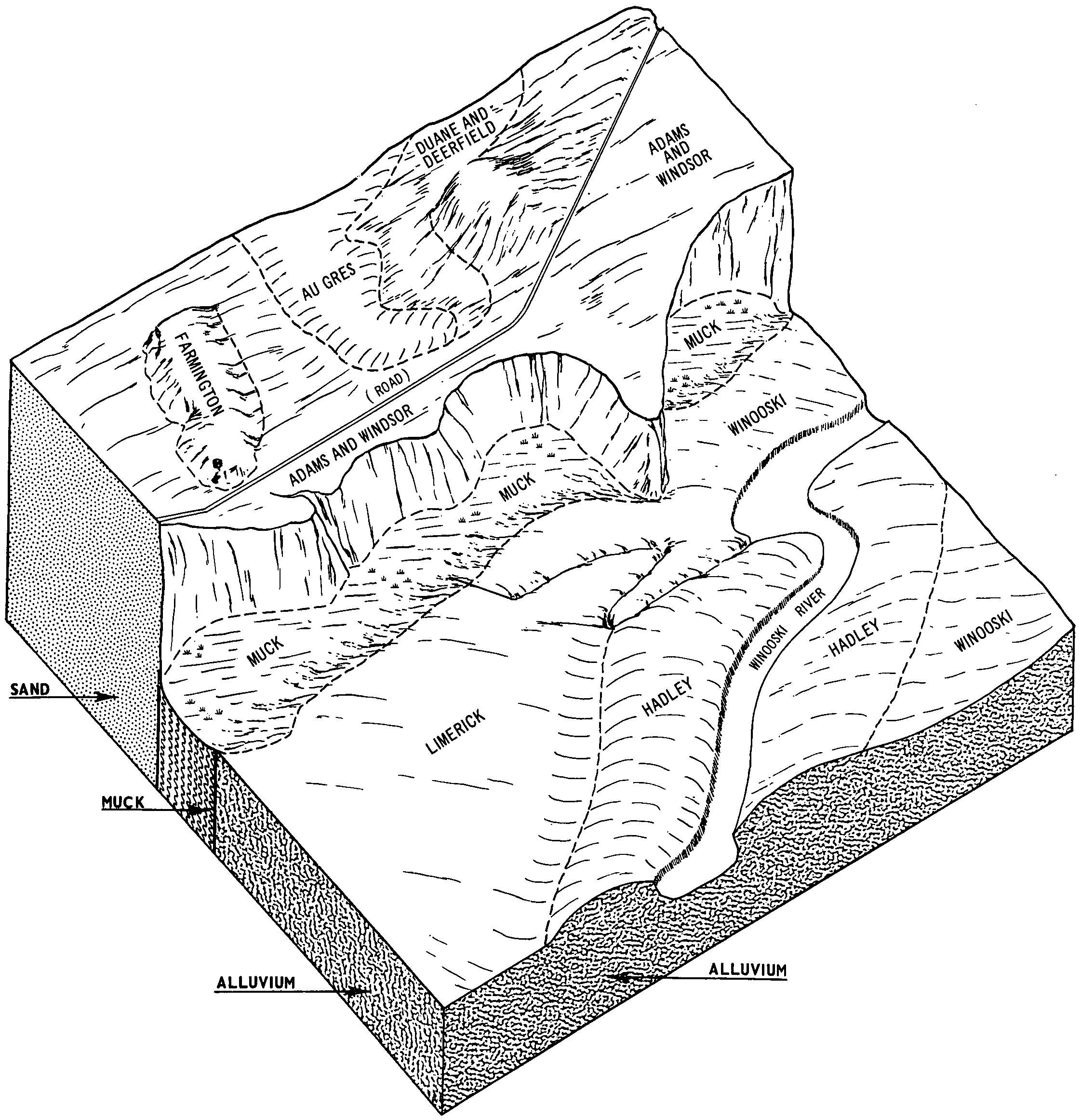
Duane and Deerfield soils, 0 to 5 percent slopes | DdA | 2293 | 281683 | 9g3k | vt007 | 1969 | 1:15840 |
Duane and Deerfield soils, 5 to 12 percent slopes | DdB | 1117 | 281684 | 9g3l | vt007 | 1969 | 1:15840 |
Duane and Deerfield soils, 12 to 20 percent slopes | DdC | 288 | 281685 | 9g3m | vt007 | 1969 | 1:15840 |
Deerfield loamy fine sand, 0 to 8 percent slopes | DeB | 2680 | 281787 | 9g6x | vt011 | 1976 | 1:20000 |
Deerfield loamy fine sand, 8 to 15 percent slopes | DeC | 346 | 281788 | 9g6y | vt011 | 1976 | 1:20000 |
Deerfield loamy fine sand, 0 to 3 percent slopes | 59A | 3089 | 282388 | 2xfg8 | vt021 | 1985 | 1:20000 |
Deerfield loamy fine sand, 3 to 8 percent slopes | 9B | 941 | 282090 | 2xfg9 | vt025 | 1984 | 1:20000 |