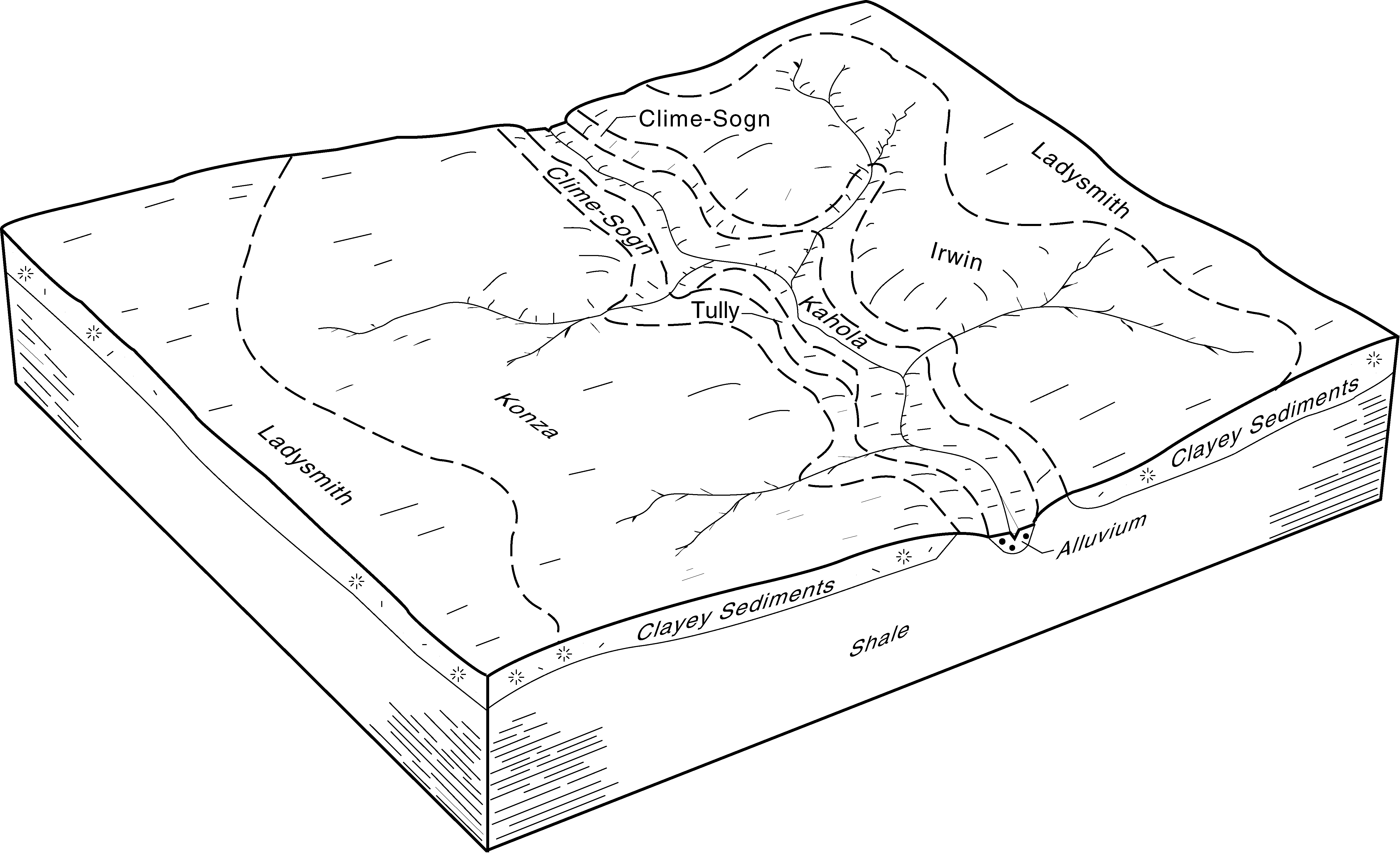
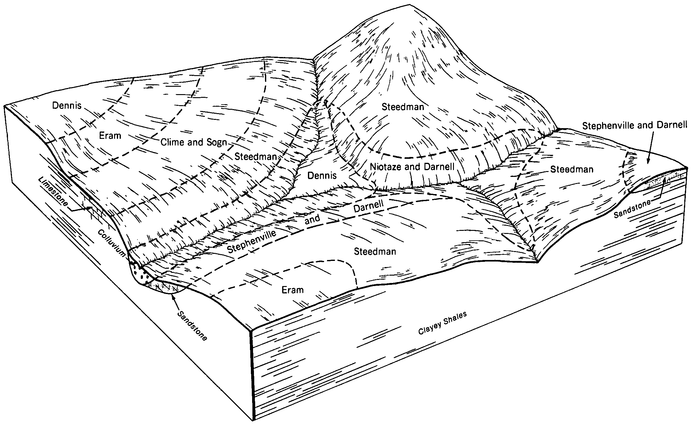
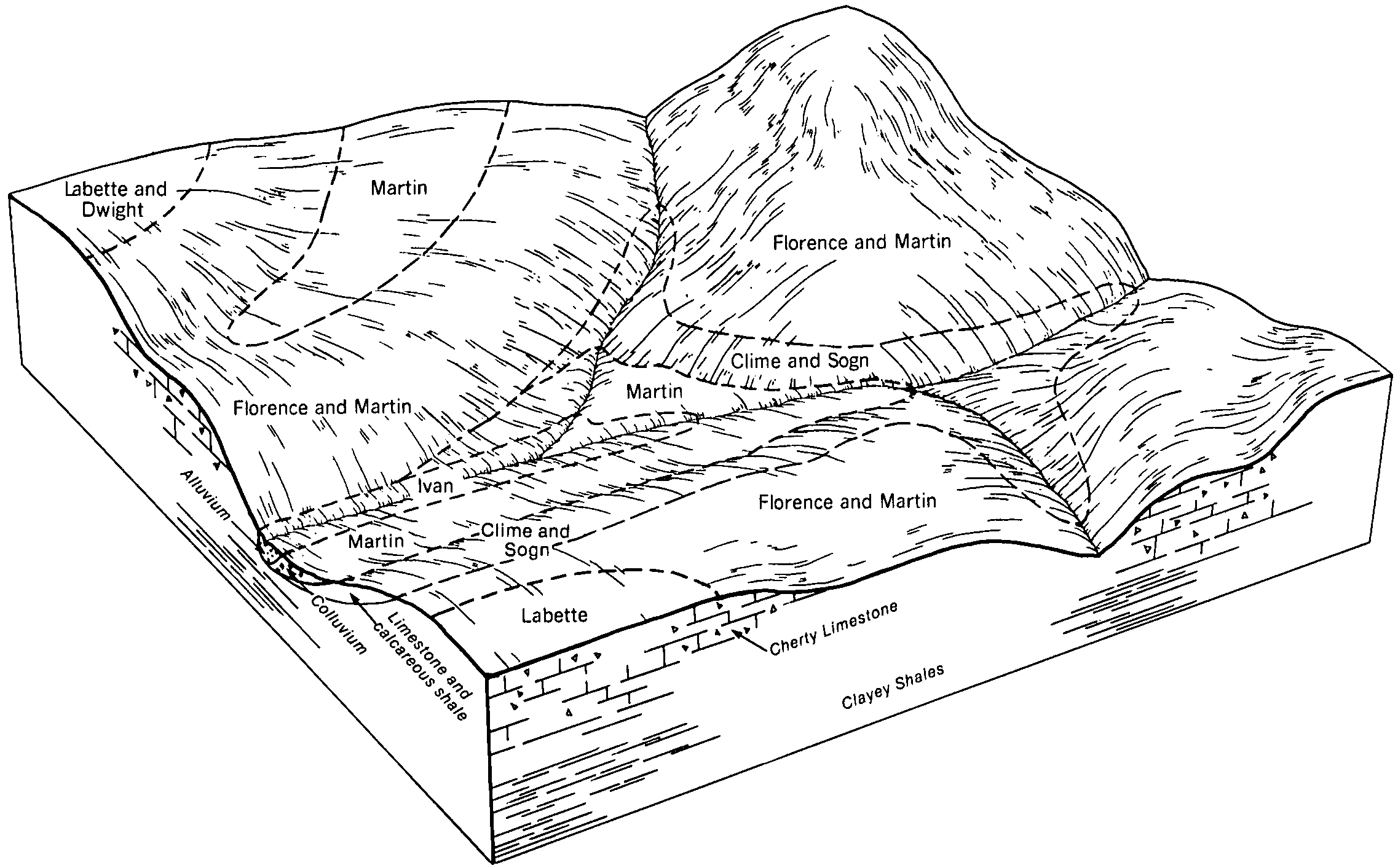
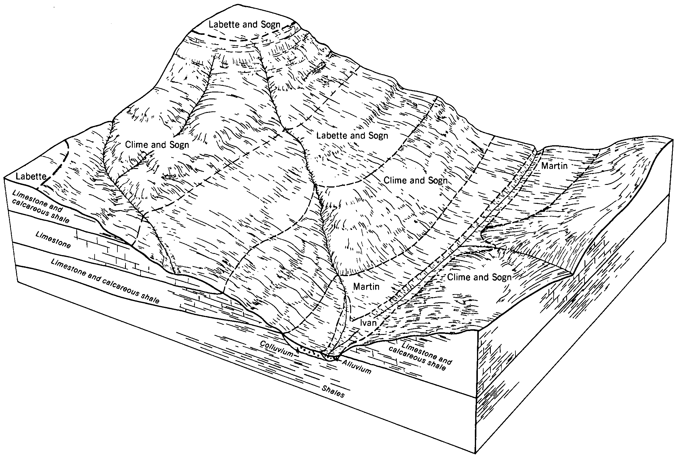
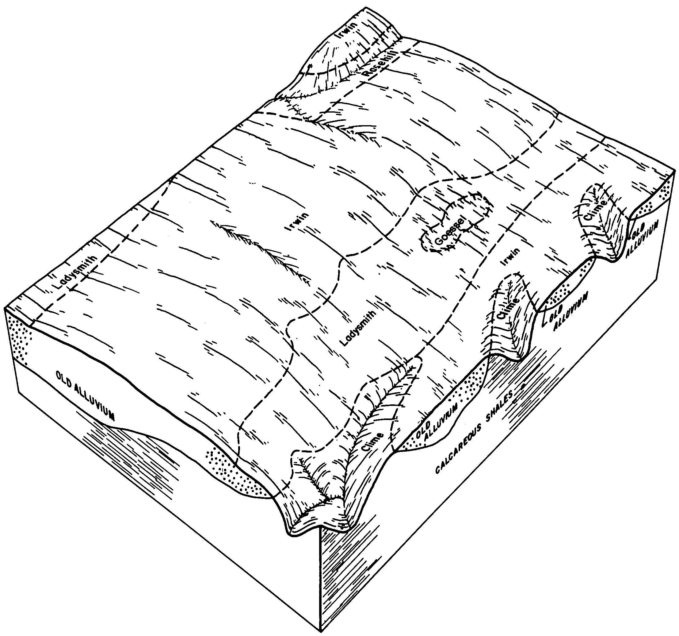
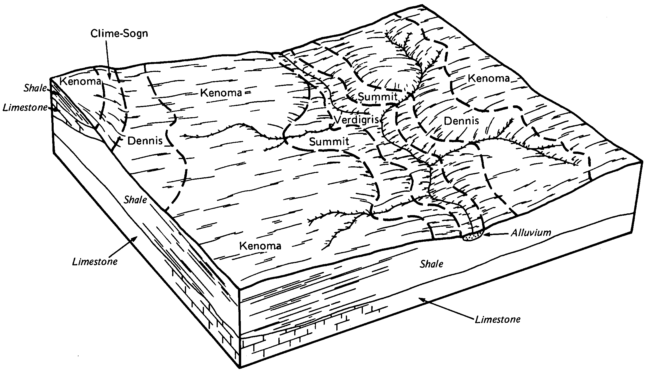
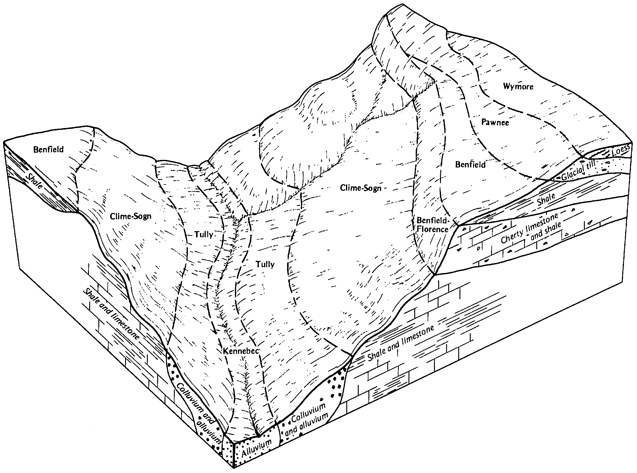
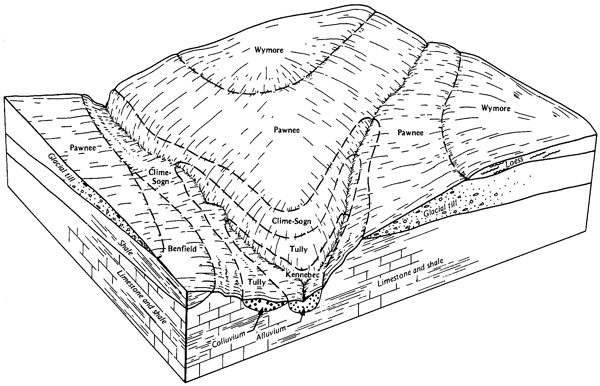
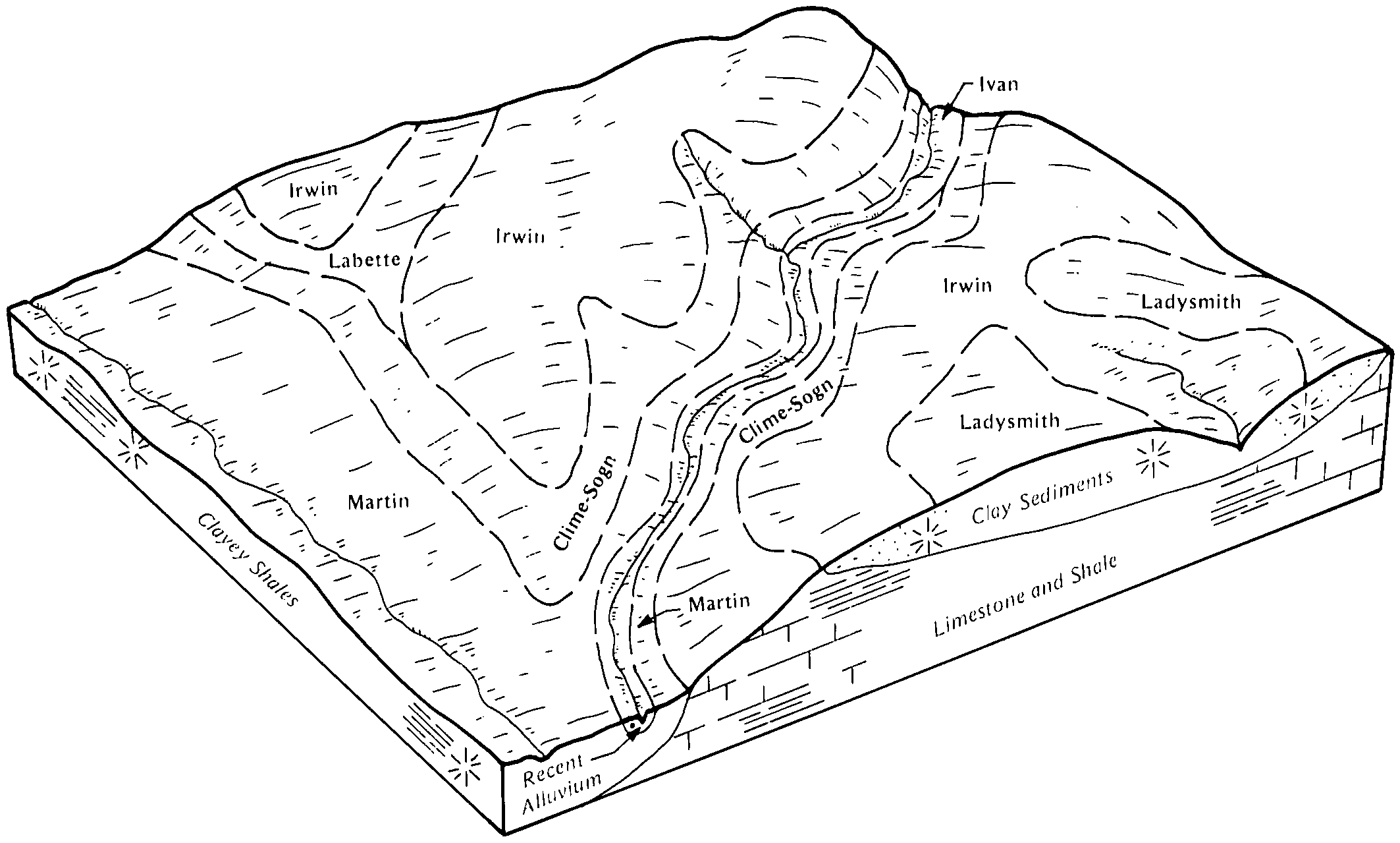
| Clime-Sogn complex, 3 to 20 percent slopes | 4590 | 31421 | 2668658 | 1igwo | ks015 | 1970 | 1:24000 |
Clime stony silty clay loam, 15 to 30 percent slopes | 4580 | 6 | 1382859 | 2tt71 | ks015 | 1970 | 1:24000 |
Clime-Sogn complex, 3 to 20 percent slopes | 4590 | 95886 | 2668660 | 1igwo | ks017 | 1967 | 1:24000 |
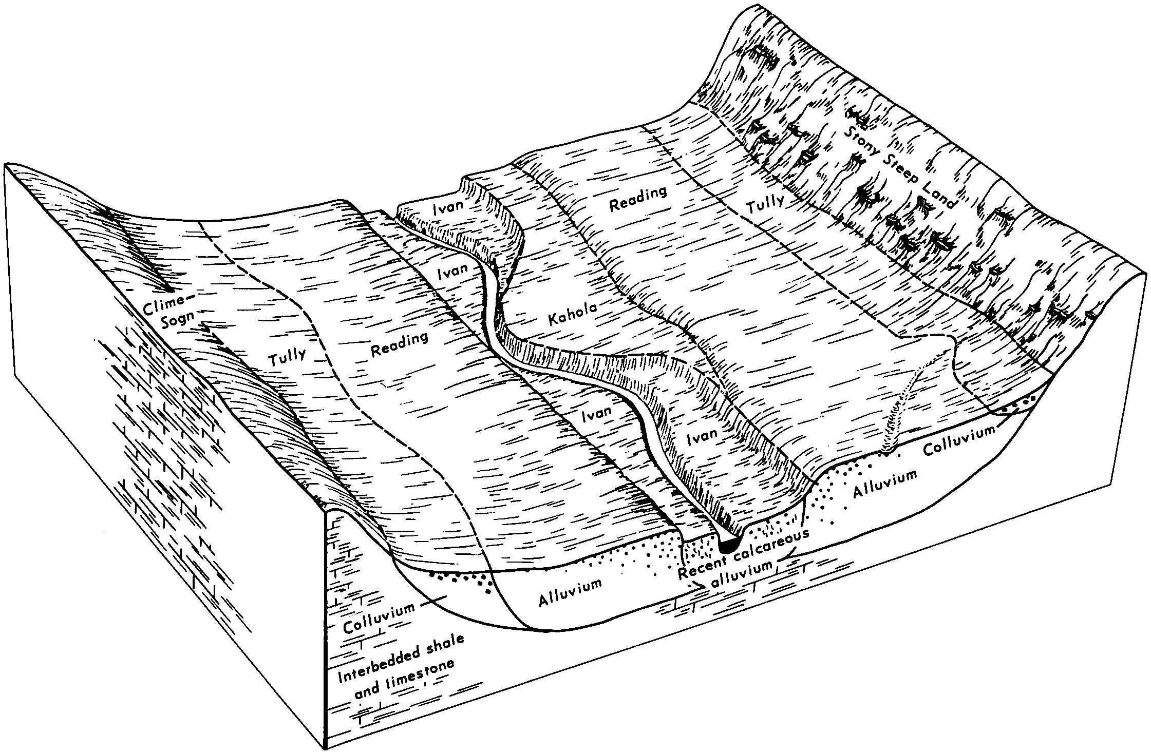
Clime silty clay loam, 20 to 40 percent slopes, stony | 4545 | 4758 | 1382814 | 2tt6h | ks017 | 1967 | 1:24000 |
Clime stony silty clay loam, 15 to 30 percent slopes | 4580 | 119 | 1382815 | 2tt71 | ks017 | 1967 | 1:24000 |
Clime-Sogn complex, 3 to 20 percent slopes | 4590 | 64939 | 2668661 | 1igwo | ks019 | 1972 | 1:24000 |
Clime stony silty clay loam, 15 to 30 percent slopes | 4580 | 43 | 1453367 | 2tt71 | ks019 | 1972 | 1:24000 |
Clime-Sogn complex, 3 to 20 percent slopes | 4590 | 18 | 2668765 | 1igwo | ks027 | 1983 | 1:24000 |
Clime-Sogn complex, 3 to 20 percent slopes | 4590 | 64815 | 2668770 | 1igwo | ks035 | 1977 | 1:24000 |
Clime stony silty clay loam, 15 to 30 percent slopes | 4580 | 16849 | 1382926 | 2tt71 | ks035 | 1977 | 1:24000 |
Clime-Sogn complex, 3 to 20 percent slopes | 4590 | 25451 | 2668774 | 1igwo | ks041 | 1977 | 1:24000 |
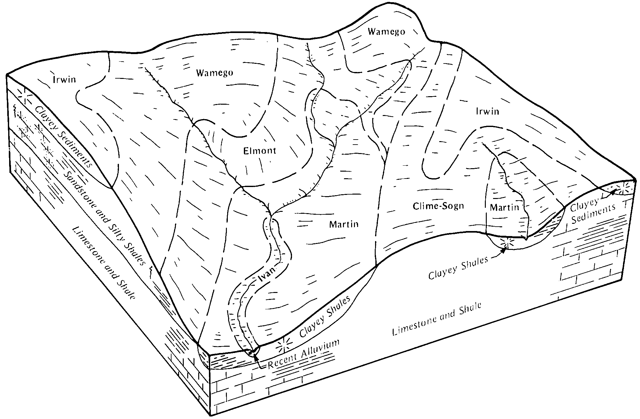
Clime silty clay loam, 3 to 7 percent slopes | 4555 | 14236 | 1454551 | 2tt6k | ks041 | 1977 | 1:24000 |
Clime silty clay loam, 7 to 15 percent slopes | 4560 | 10724 | 1454552 | 2tt6l | ks041 | 1977 | 1:24000 |
Clime silty clay loam, 1 to 3 percent slopes | 4540 | 136 | 1454550 | 2tt6g | ks041 | 1977 | 1:24000 |
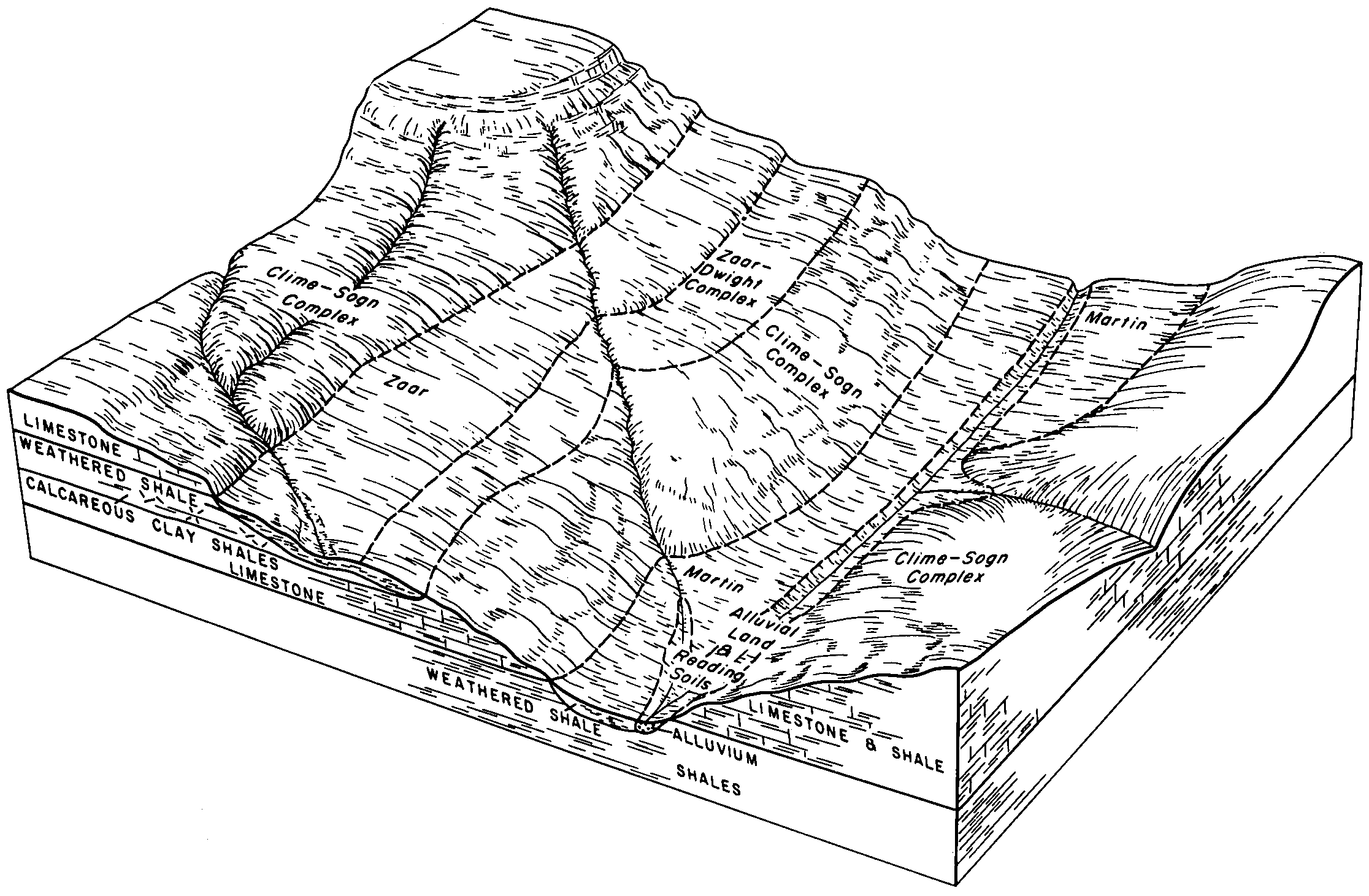
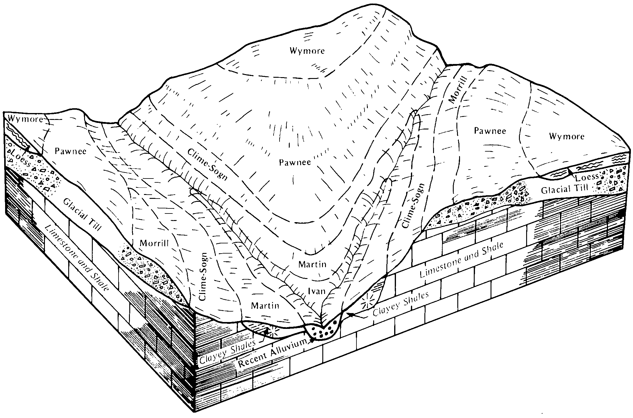
Kipson-Clime complex, 6 to 20 percent slopes | 4720 | 49 | 1454556 | 2ww03 | ks041 | 1977 | 1:24000 |
Clime-Sogn complex, 3 to 20 percent slopes | 4590 | 64182 | 2668776 | 1igwo | ks049 | 1984 | 1:24000 |
Clime stony silty clay loam, 15 to 30 percent slopes | 4580 | 9426 | 1453298 | 2tt71 | ks049 | 1984 | 1:24000 |
Clime silty clay, 3 to 7 percent slopes | 4570 | 970 | 1453297 | 2tt73 | ks049 | 1984 | 1:24000 |
Clime-Sogn complex, 3 to 20 percent slopes | 4590 | 49355 | 2668778 | 1igwo | ks061 | 1991 | 1:24000 |
Clime silty clay loam, 20 to 40 percent slopes, very stony | 4550 | 8386 | 1387182 | 2tt6j | ks061 | 1991 | 1:24000 |
Clime-Sogn complex, 3 to 20 percent slopes | 4590 | 192430 | 2668780 | 1igwo | ks073 | 1981 | 1:24000 |
Clime silty clay, 3 to 7 percent slopes | 4570 | 12804 | 1453642 | 2tt73 | ks073 | 1981 | 1:24000 |
Clime stony silty clay loam, 15 to 30 percent slopes | 4580 | 10339 | 1453643 | 2tt71 | ks073 | 1981 | 1:24000 |
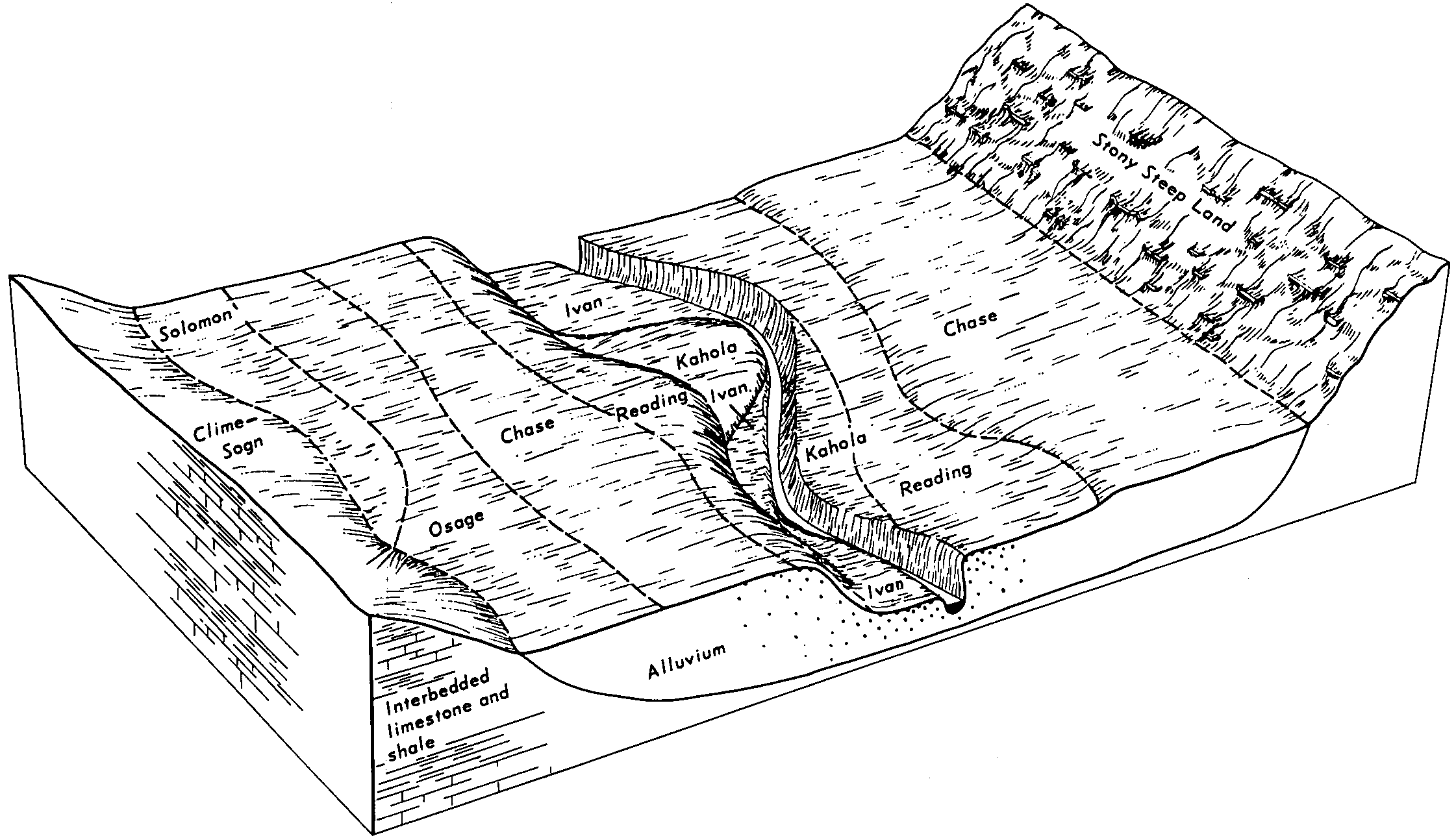
Clime-Hobbs complex, 0 to 20 percent slopes | 4585 | 5356 | 1155425 | 2tt72 | ks079 | 1970 | 1:24000 |
Clime silty clay, 1 to 3 percent slopes | 4565 | 5323 | 1155422 | 2tt6w | ks079 | 1970 | 1:24000 |
Clime silty clay, 3 to 7 percent slopes | 4570 | 4873 | 1155423 | 2tt6x | ks079 | 1970 | 1:24000 |
Clime silty clay loam, 7 to 15 percent slopes | 4560 | 2754 | 1155421 | 2tt6l | ks079 | 1970 | 1:24000 |
Clime silty clay, 3 to 7 percent slopes, eroded | 4575 | 2106 | 1155424 | 2tt74 | ks079 | 1970 | 1:24000 |
Clime silty clay loam, 1 to 3 percent slopes | 4540 | 282 | 1155419 | 2tt6g | ks079 | 1970 | 1:24000 |
Clime silty clay loam, 3 to 7 percent slopes | 4555 | 149 | 1155420 | 2tt6k | ks079 | 1970 | 1:24000 |
Clime-Sogn complex, 3 to 20 percent slopes | 4590 | 18106 | 2668781 | 1igwo | ks085 | 1976 | 1:24000 |
Clime-Sogn complex, 3 to 20 percent slopes | 4590 | 57542 | 2668786 | 1igwo | ks111 | 1977 | 1:24000 |
Clime silty clay, 3 to 7 percent slopes | 4570 | 8412 | 1453703 | 2tt73 | ks111 | 1977 | 1:24000 |
Clime silty clay, 3 to 7 percent slopes, eroded | 4575 | 4096 | 1453704 | 2tt70 | ks111 | 1977 | 1:24000 |
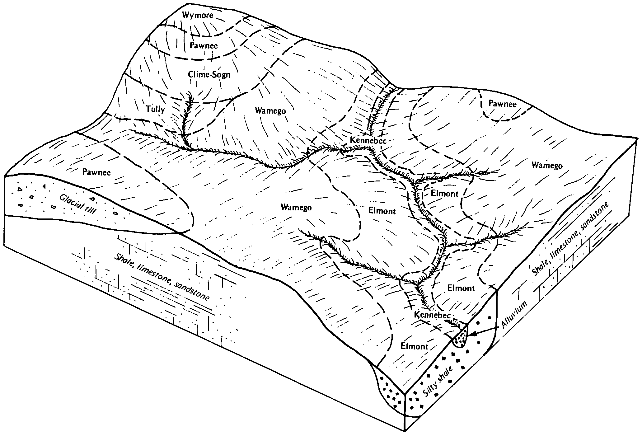
Tully-Clime complex, 7 to 15 percent slopes | 4788 | 3740 | 1453717 | 2tt5l | ks111 | 1977 | 1:24000 |
Clime silty clay loam, 3 to 7 percent slopes | 4555 | 145 | 1453702 | 2tt6k | ks111 | 1977 | 1:24000 |
Clime silty clay, 3 to 7 percent slopes | 4570 | 7529 | 1429230 | 2tt6x | ks113 | 1980 | 1:24000 |
Clime silty clay, 1 to 3 percent slopes | 4565 | 4299 | 1429229 | 2tt6w | ks113 | 1980 | 1:24000 |
Clime silty clay loam, 3 to 7 percent slopes | 4555 | 836 | 1429228 | 2tt6k | ks113 | 1980 | 1:24000 |
Clime silty clay loam, 1 to 3 percent slopes | 4540 | 62901 | 1382764 | 2tt6g | ks115 | 1981 | 1:24000 |
Clime silty clay loam, 3 to 7 percent slopes | 4555 | 28198 | 1382765 | 2tt6k | ks115 | 1981 | 1:24000 |
Clime-Sogn complex, 3 to 20 percent slopes | 4590 | 18075 | 2668789 | 1igwo | ks115 | 1981 | 1:24000 |
Clime stony silty clay loam, 15 to 30 percent slopes | 4580 | 769 | 1382767 | 2tt71 | ks115 | 1981 | 1:24000 |
Clime silty clay loam, 7 to 15 percent slopes | 4560 | 3 | 1382766 | 2tt6l | ks115 | 1981 | 1:24000 |
Clime-Sogn complex, 3 to 20 percent slopes | 4590 | 3850 | 2668792 | 1igwo | ks117 | 1977 | 1:24000 |
Clime-Sogn complex, 3 to 20 percent slopes | 4590 | 15992 | 2668798 | 1igwo | ks127 | 1970 | 1:24000 |
Clime-Sogn complex, 3 to 20 percent slopes | 4590 | 165 | 2668800 | 1igwo | ks131 | 1980 | 1:24000 |
Clime-Sogn complex, 3 to 20 percent slopes | 4590 | 3150 | 2668802 | 1igwo | ks139 | 1983 | 1:24000 |
Clime-Sogn complex, 3 to 20 percent slopes | 4590 | 106911 | 2668743 | 1igwo | ks149 | 1984 | 1:24000 |
Clime silty clay loam, 20 to 40 percent slopes, stony | 4545 | 17655 | 1480692 | 2tt6h | ks149 | 1984 | 1:24000 |
Clime silty clay, 1 to 3 percent slopes | 4565 | 6 | 1433249 | 2tt6w | ks159 | 1971 | 1:24000 |
Clime-Sogn complex, 3 to 20 percent slopes | 4590 | 77486 | 2668810 | 1igwo | ks161 | 1970 | 1:24000 |
Clime silty clay loam, 20 to 40 percent slopes, very stony | 4550 | 17779 | 1472306 | 2tt6j | ks161 | 1970 | 1:24000 |
Elmont-Clime complex, 5 to 15 percent slopes | 7245 | 520 | 1472332 | 2xlgc | ks161 | 1970 | 1:24000 |
Clime silty clay loam, 3 to 7 percent slopes | 4555 | 50 | 1472307 | 2tt6k | ks161 | 1970 | 1:24000 |
Clime silty clay loam, 3 to 7 percent slopes | 4555 | 8441 | 1382157 | 2tt6k | ks169 | 1989 | 1:24000 |
Kipson-Clime complex, 6 to 20 percent slopes | 4720 | 5252 | 1382174 | 2ww03 | ks169 | 1989 | 1:24000 |
Clime silty clay, 3 to 7 percent slopes | 4570 | 48 | 1382158 | 2tt6x | ks169 | 1989 | 1:24000 |
Clime silty clay, 3 to 7 percent slopes | 4570 | 9812 | 1443950 | 2tt6x | ks173 | 1976 | 1:24000 |
Clime-Sogn complex, 3 to 20 percent slopes | 4590 | 139972 | 2668821 | 1igwo | ks197 | 1988 | 1:24000 |
Clime silty clay loam, 20 to 40 percent slopes, stony | 4545 | 9630 | 1472139 | 2tt6h | ks197 | 1988 | 1:24000 |
Clime silty clay loam, 3 to 7 percent slopes | 4555 | 3450 | 1472140 | 2tt6k | ks197 | 1988 | 1:24000 |
Clime silty clay loam, 20 to 40 percent slopes, very stony | 4550 | 234 | 1473019 | 2tt6j | ks197 | 1988 | 1:24000 |
Clime-Sogn complex, 3 to 20 percent slopes | 4590 | 1020 | 2668825 | 1igwo | ks205 | 1985 | 1:20000 |
Clime-Sogn complex, 3 to 20 percent slopes | 4590 | 1123 | 2668827 | 1igwo | ks207 | 1973 | 1:20000 |
Clime silty clay, 3 to 7 percent slopes | 4570 | 411 | 1427154 | 2tt73 | ks207 | 1973 | 1:20000 |


