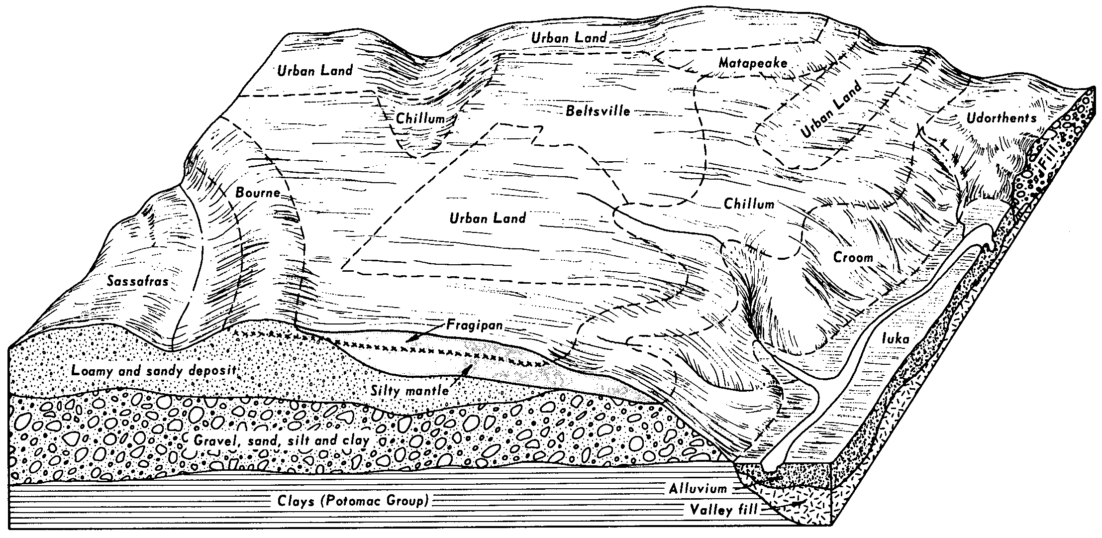
| Urban land-Chillum complex, 0 to 8 percent slopes | UeB | 848 | 128675 | 49wt | dc001 | 1975 | 1:12000 |
Chillum-Urban land complex, 8 to 15 percent slopes | CdC | 814 | 128580 | 49sr | dc001 | 1975 | 1:12000 |
Chillum-Urban land complex, 0 to 8 percent slopes | CdB | 566 | 128579 | 49sq | dc001 | 1975 | 1:12000 |
Urban land-Chillum complex, 8 to 15 percent slopes | UeC | 557 | 128676 | 49wv | dc001 | 1975 | 1:12000 |
Chillum silt loam, 8 to 15 percent slopes | CcC | 189 | 128577 | 49sn | dc001 | 1975 | 1:12000 |
Chillum-Urban land complex, 15 to 40 percent slopes | CdD | 129 | 128581 | 49ss | dc001 | 1975 | 1:12000 |
Chillum silt loam, 15 to 40 percent slopes | CcD | 93 | 128578 | 49sp | dc001 | 1975 | 1:12000 |
Chillum silt loam, 0 to 8 percent slopes | CcB | 39 | 128576 | 49sm | dc001 | 1975 | 1:12000 |
Chillum-Urban land complex, 0 to 5 percent slopes | CbB | 534 | 640615 | phm0 | md003 | 2003 | 1:12000 |
Chillum loam, 5 to 10 percent slopes | CaC | 226 | 137732 | 4m9z | md003 | 2003 | 1:12000 |
Chillum loam, 2 to 5 percent slopes | CaB | 139 | 137550 | 4m43 | md003 | 2003 | 1:12000 |
Chillum-Urban land complex, 0 to 5 percent slopes | CbB | 1623 | 2404168 | 2lpqt | md005 | 2010 | 1:12000 |
Chillum-Urban land complex, 5 to 15 percent slopes | CbD | 1371 | 2404170 | 2lpqw | md005 | 2010 | 1:12000 |
Chillum silt loam, 5 to 10 percent slopes | CaC | 798 | 2404167 | 2lpqs | md005 | 2010 | 1:12000 |
Chillum silt loam, 0 to 5 percent slopes | CaB | 520 | 2404166 | 2lpqr | md005 | 2010 | 1:12000 |
Chillum silt loam, 5 to 10 percent slopes | CbC | 1606 | 2440610 | 2mxnc | md015 | 2009 | 1:12000 |
Chillum silt loam, 2 to 5 percent slopes | CbB | 1259 | 2440609 | 2mxnb | md015 | 2009 | 1:12000 |
Chillum silt loam, 10 to 15 percent slopes | CbD | 1003 | 2440611 | 2mxnd | md015 | 2009 | 1:12000 |
Chillum loam, 2 to 5 percent slopes | CaB | 246 | 2440607 | 2mxn8 | md015 | 2009 | 1:12000 |
Chillum-Urban land complex, 0 to 5 percent slopes | CcB | 217 | 2440619 | 2mxnn | md015 | 2009 | 1:12000 |
Chillum loam, 5 to 10 percent slopes | CaC | 188 | 2440608 | 2mxn9 | md015 | 2009 | 1:12000 |
Chillum-Urban land complex, 5 to 15 percent slopes | CcD | 107 | 2440620 | 2mxnp | md015 | 2009 | 1:12000 |
Urban land-Chillum-Beltsville complex, 0 to 5 percent slopes | UcB | 2463 | 793649 | vmvl | md027 | 2004 | 1:12000 |
Urban land-Chillum-Beltsville complex, 5 to 15 percent slopes | UcD | 887 | 793650 | vmvm | md027 | 2004 | 1:12000 |
Chillum loam, 5 to 10 percent slopes | CeC | 479 | 792806 | vlzd | md027 | 2004 | 1:12000 |
Chillum loam, 2 to 5 percent slopes | CeB | 457 | 792805 | vlzc | md027 | 2004 | 1:12000 |
Chillum-Russett loams, 2 to 5 percent slopes | ChB | 399 | 792807 | vlzf | md027 | 2004 | 1:12000 |
Chillum-Russett loams, 5 to 10 percent slopes | ChC | 380 | 792808 | vlzg | md027 | 2004 | 1:12000 |
Chillum silt loam, 3 to 8 percent slopes | 57B | 1215 | 3098168 | kx9j | md031 | 1989 | 1:15840 |
Chillum silt loam, 8 to 15 percent slopes | 57C | 628 | 533651 | kx9k | md031 | 1989 | 1:15840 |
Chillum-Urban land complex, 0 to 8 percent slopes | 57UB | 428 | 533653 | kx9m | md031 | 1989 | 1:15840 |
Chillum silt loam, 15 to 25 percent slopes | 57D | 145 | 533652 | kx9l | md031 | 1989 | 1:15840 |
Chillum-Urban land complex, 0 to 5 percent slopes | CbB | 550 | 2455248 | 2ndwk | md033 | 2009 | 1:12000 |
Chillum-Urban land complex, 5 to 15 percent slopes | CbD | 222 | 2455249 | 2ndwl | md033 | 2009 | 1:12000 |
Chillum silt loam, 0 to 5 percent slopes | CaB | 192 | 2455245 | 2ndwg | md033 | 2009 | 1:12000 |
Chillum silt loam, 5 to 10 percent slopes | CaC | 82 | 2455246 | 2ndwh | md033 | 2009 | 1:12000 |
Chillum silt loam, 10 to 15 percent slopes | CaD | 63 | 2455247 | 2ndwj | md033 | 2009 | 1:12000 |
Chillum-Urban land complex, 15 to 25 percent slopes | CbE | 62 | 2455250 | 2ndwm | md033 | 2009 | 1:12000 |
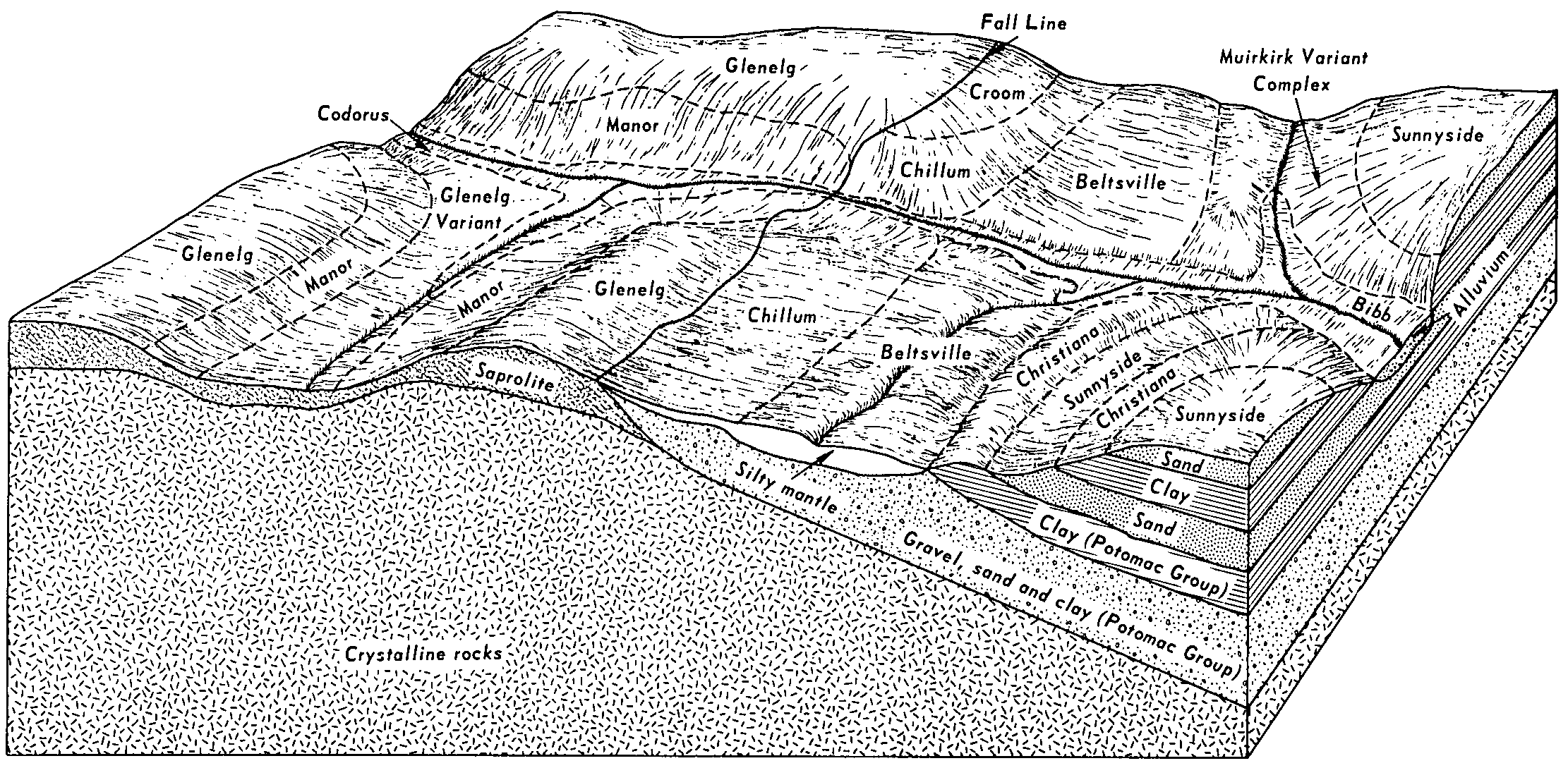
Chillum loam, 2 to 5 percent slopes moderately eroded | ChB2 | 3630 | 128299 | 49hp | md037 | 1975 | 1:20000 |
Sassafras-Chillum complex, 6 to 12 percent slopes, moderately eroded | SmC2 | 1411 | 128352 | 49kd | md037 | 1975 | 1:20000 |
Sassafras-Chillum complex, 6 to 12 percent slopes, severely eroded | SmC3 | 1345 | 128353 | 49kf | md037 | 1975 | 1:20000 |
Chillum loam, 5 to 10 percent slopes, severely eroded | ChC3 | 1221 | 128301 | 49hr | md037 | 1975 | 1:20000 |
Chillum loam, 5 to 10 percent slopes, moderately eroded | ChC2 | 1093 | 128300 | 49hq | md037 | 1975 | 1:20000 |
Chillum loam, 0 to 2 percent slopes | ChA | 674 | 128298 | 49hn | md037 | 1975 | 1:20000 |
Chillum silt loam, 2 to 5 percent slopes, moderately eroded | ChB2 | 1949 | 533368 | kx0f | md600 | 1972 | 1:15840 |
Chillum-Neshaminy silt loams, 5 to 10 percent slopes, moderately eroded | CkC2 | 582 | 533369 | kx0g | md600 | 1972 | 1:15840 |
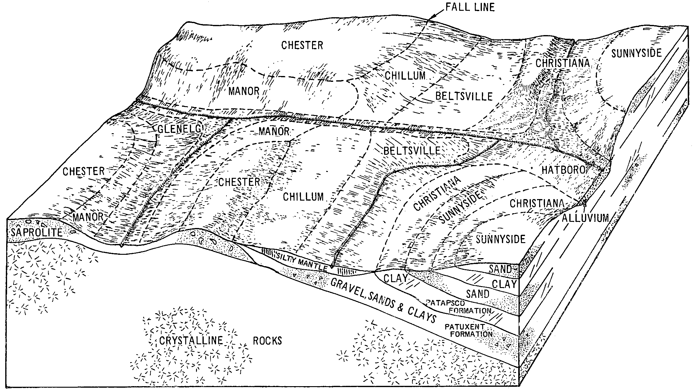
Chillum silt loam, 2 to 5 percent slopes | ChtB | 5312 | 135823 | 4kbd | nj011 | 2003 | 1:24000 |
Chillum silt loam, 0 to 2 percent slopes | ChtA | 1427 | 135822 | 4kbc | nj011 | 2003 | 1:24000 |
Chillum silt loam, 2 to 5 percent slopes | ChtB | 10671 | 135591 | 4k2x | nj033 | 2004 | 1:24000 |
Chillum silt loam, 0 to 2 percent slopes | ChtA | 399 | 135590 | 4k2w | nj033 | 2004 | 1:24000 |