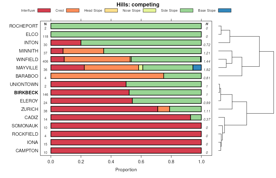
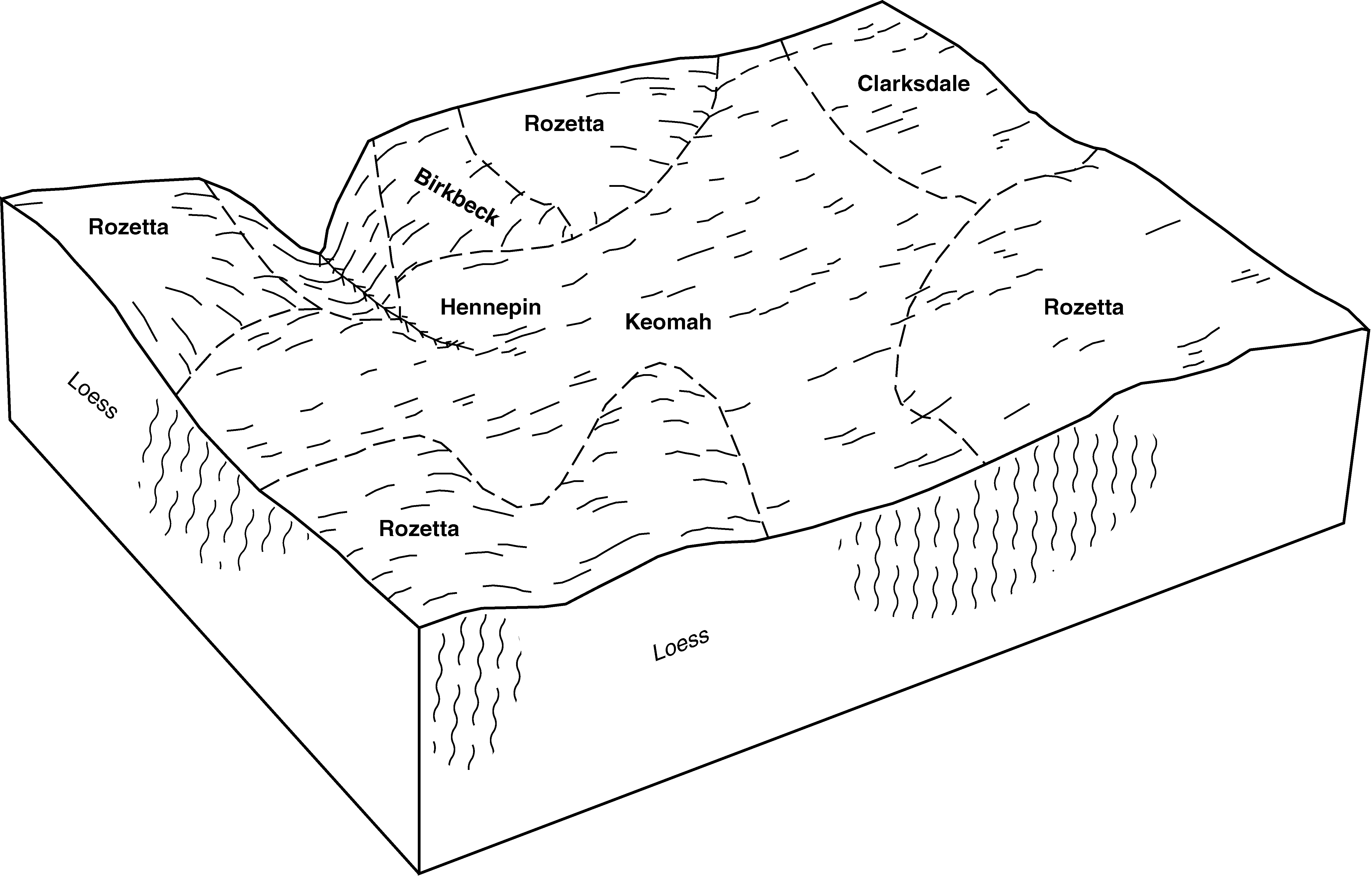
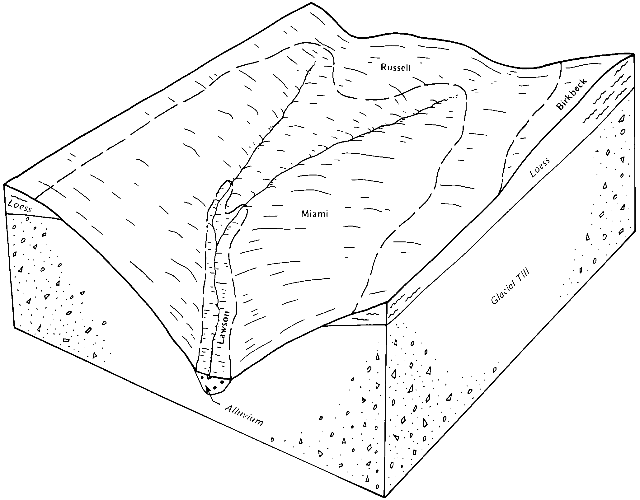
| Birkbeck silt loam, 5 to 10 percent slopes, eroded | 233C2 | 3770 | 1862722 | 2sssd | il011 | 2007 | 1:12000 |
Birkbeck silt loam, 2 to 5 percent slopes | 233B | 2854 | 1862721 | 2sssb | il011 | 2007 | 1:12000 |
Birkbeck silt loam, 10 to 18 percent slopes, eroded | 233D2 | 460 | 1862723 | 2sssf | il011 | 2007 | 1:12000 |
Birkbeck silt loam, 2 to 5 percent slopes | 233B | 2668 | 242981 | 2sssb | il019 | 1999 | 1:12000 |
Birkbeck silt loam, 0 to 2 percent slopes | 233A | 885 | 183890 | 2sss9 | il037 | 1998 | 1:12000 |
Birkbeck silt loam, 2 to 5 percent slopes | 233B | 376 | 183891 | 2sssb | il037 | 1998 | 1:12000 |
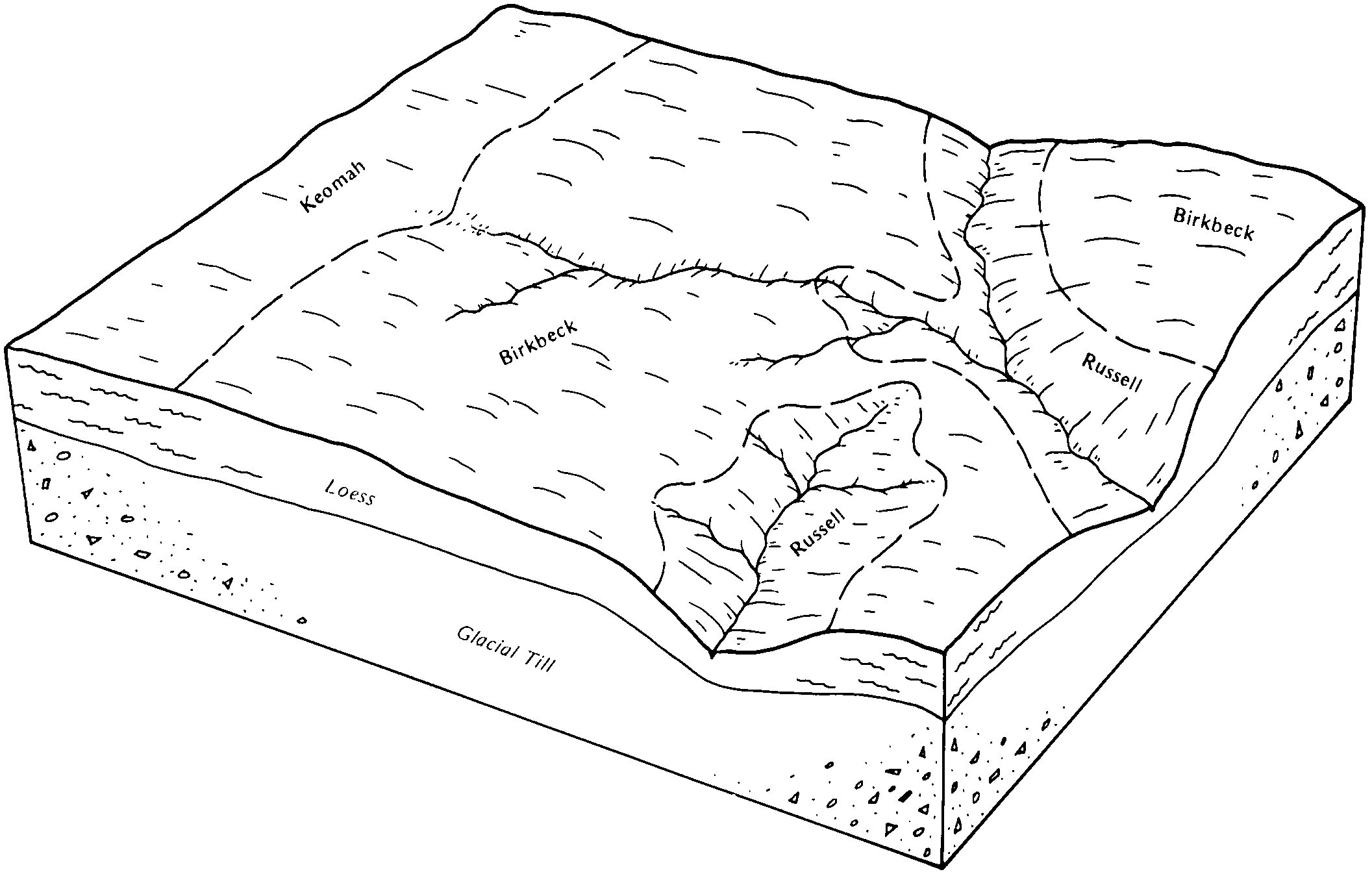
Birkbeck silt loam, 2 to 5 percent slopes | 233B | 17842 | 1531396 | 2sssb | il039 | 2005 | 1:12000 |
Birkbeck silt loam, 5 to 10 percent slopes, eroded | 233C2 | 2056 | 1531420 | 2sssd | il039 | 2005 | 1:12000 |
Birkbeck silt loam, 2 to 5 percent slopes | 233B | 528 | 1019418 | 2sssb | il041 | 2004 | 1:12000 |
Birkbeck silt loam, 2 to 5 percent slopes | 233B | 1163 | 198822 | 2sssb | il089 | 2000 | 1:12000 |
Birkbeck silt loam, 0 to 2 percent slopes | 233A | 522 | 198821 | 2sss9 | il089 | 2000 | 1:12000 |
Birkbeck silt loam, 5 to 10 percent slopes, eroded | 233C2 | 276 | 198823 | 2sssd | il089 | 2000 | 1:12000 |
Birkbeck silt loam, 0 to 2 percent slopes | 233A | 43 | 1718256 | 2sss9 | il093 | 2007 | 1:12000 |
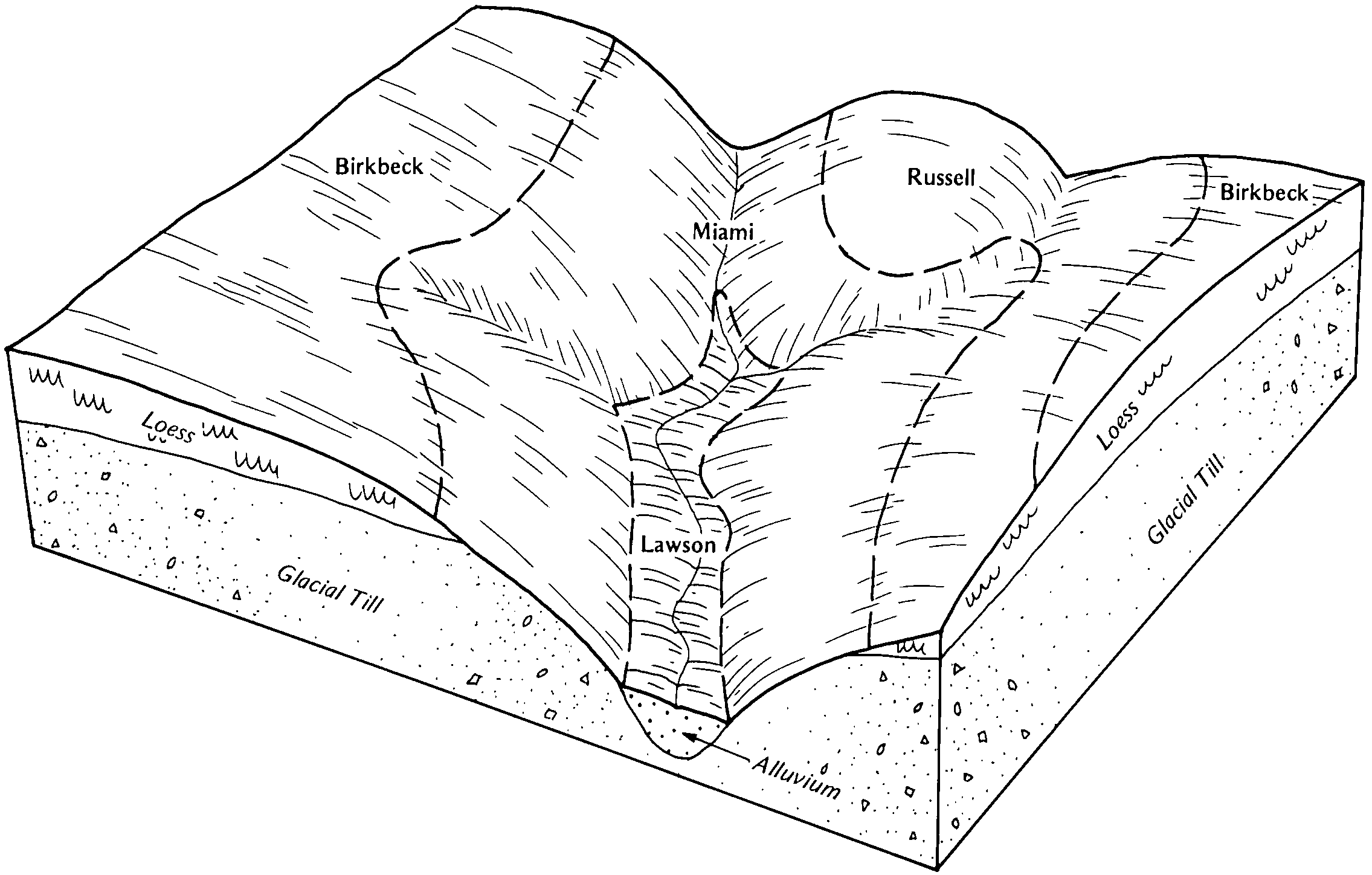
Birkbeck silt loam, 2 to 5 percent slopes | 233B | 5429 | 1029923 | 2sssb | il099 | 2006 | 1:12000 |
Birkbeck silt loam, 5 to 10 percent slopes, eroded | 233C2 | 4458 | 1426141 | 2sssd | il099 | 2006 | 1:12000 |
Birkbeck silt loam, 0 to 2 percent slopes | 233A | 293 | 263432 | 2sss9 | il099 | 2006 | 1:12000 |
Birkbeck silt loam, 5 to 10 percent slopes, eroded | 233C2 | 2672 | 921333 | 2sssd | il103 | 2004 | 1:12000 |
Birkbeck silt loam, 2 to 5 percent slopes | 233B | 1308 | 921332 | 2sssb | il103 | 2004 | 1:12000 |
Birkbeck silt loam, 5 to 10 percent slopes, eroded | 233C2 | 988 | 1596050 | 2sssd | il107 | 2006 | 1:12000 |
Birkbeck-Senachwine complex, 5 to 10 percent slopes, severely eroded | 733C3 | 810 | 1596081 | 1qkvh | il107 | 2006 | 1:12000 |
Birkbeck-Senachwine silt loams, 5 to 10 percent slopes, eroded | 733C2 | 428 | 1596080 | 1qkvg | il107 | 2006 | 1:12000 |
Birkbeck silt loam, 2 to 5 percent slopes | 233B | 211 | 1596049 | 2sssb | il107 | 2006 | 1:12000 |
Birkbeck silt loam, 2 to 5 percent slopes, eroded | 233B2 | 6143 | 199100 | 2sssc | il113 | 2000 | 1:12000 |
Birkbeck silt loam, 2 to 5 percent slopes | 233B | 3342 | 199099 | 2sssb | il113 | 2000 | 1:12000 |
Birkbeck silt loam, 5 to 10 percent slopes, eroded | 233C2 | 1277 | 199101 | 2sssd | il113 | 2000 | 1:12000 |
Birkbeck silt loam, 2 to 5 percent slopes | 233B | 9663 | 1913946 | 2sssb | il115 | 2007 | 1:12000 |
Birkbeck silt loam, 5 to 10 percent slopes, eroded | 233C2 | 4525 | 182120 | 2sssd | il123 | 1997 | 1:15840 |
Birkbeck silt loam, 2 to 5 percent slopes | 233B | 2296 | 182117 | 2sssb | il123 | 1997 | 1:15840 |
Birkbeck silt loam, 2 to 5 percent slopes, eroded | 233B2 | 839 | 182119 | 2sssc | il123 | 1997 | 1:15840 |
Birkbeck silt loam, 5 to 10 percent slopes, eroded | 233C2 | 3204 | 208571 | 7013 | il141 | 2005 | 1:12000 |
Birkbeck silt loam, 2 to 5 percent slopes | 233B | 2416 | 208570 | 7012 | il141 | 2005 | 1:12000 |
Birkbeck silt loam, 2 to 5 percent slopes | 233B | 2264 | 172692 | 2sssb | il155 | 1987 | 1:15840 |
Birkbeck silt loam, 5 to 10 percent slopes, eroded | 233C2 | 1419 | 172695 | 2sssd | il155 | 1987 | 1:15840 |
Birkbeck silt loam, 5 to 10 percent slopes, eroded | 233C2 | 1604 | 1592007 | 1qfm2 | il177 | 2006 | 1:12000 |
Birkbeck silt loam, 10 to 18 percent slopes, eroded | 233D2 | 177 | 1707475 | 1v9rv | il177 | 2006 | 1:12000 |
Birkbeck silt loam, 2 to 5 percent slopes | 233B | 127 | 1592005 | 1qfm0 | il177 | 2006 | 1:12000 |
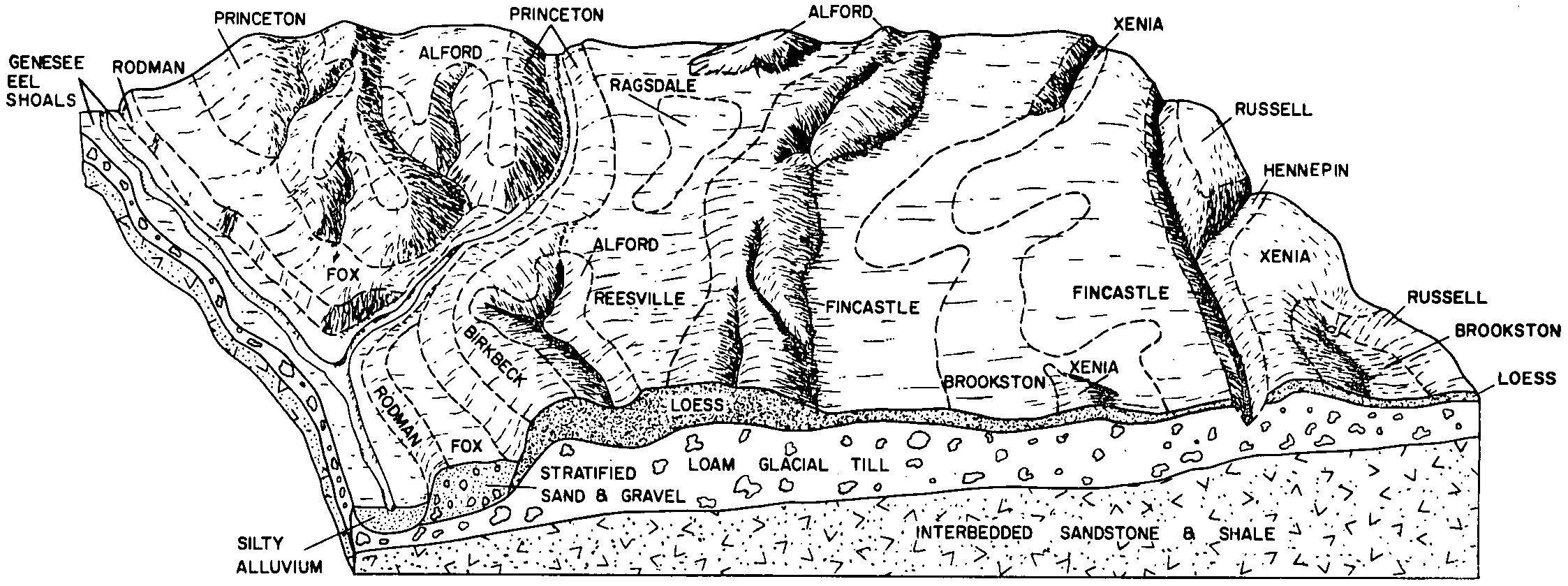
Birkbeck silt loam, 5 to 10 percent slopes, eroded | 233C2 | 10915 | 179379 | 2sssd | il179 | 1991 | 1:15840 |
Birkbeck silty clay loam, 5 to 10 percent slopes, severely eroded | 233C3 | 1632 | 179380 | 60ng | il179 | 1991 | 1:15840 |
Birkbeck silt loam, 10 to 18 percent slopes, eroded | 233D2 | 1147 | 179381 | 2sssf | il179 | 1991 | 1:15840 |
Birkbeck silt loam, 2 to 5 percent slopes | 233B | 2174 | 1613179 | 2sssb | il183 | 2006 | 1:12000 |
Birkbeck silt loam, 5 to 10 percent slopes, eroded | 233C2 | 1070 | 793046 | vm74 | il195 | 2003 | 1:12000 |
Birkbeck silt loam, 5 to 10 percent slopes, eroded | 233C2 | 6527 | 869193 | 2sssd | il203 | 2008 | 1:12000 |
Birkbeck silt loam, 2 to 5 percent slopes, eroded | 233B2 | 5434 | 869192 | 2sssc | il203 | 2008 | 1:12000 |
Birkbeck silt loam, 10 to 18 percent slopes, eroded | 233D2 | 706 | 869194 | 2sssf | il203 | 2008 | 1:12000 |
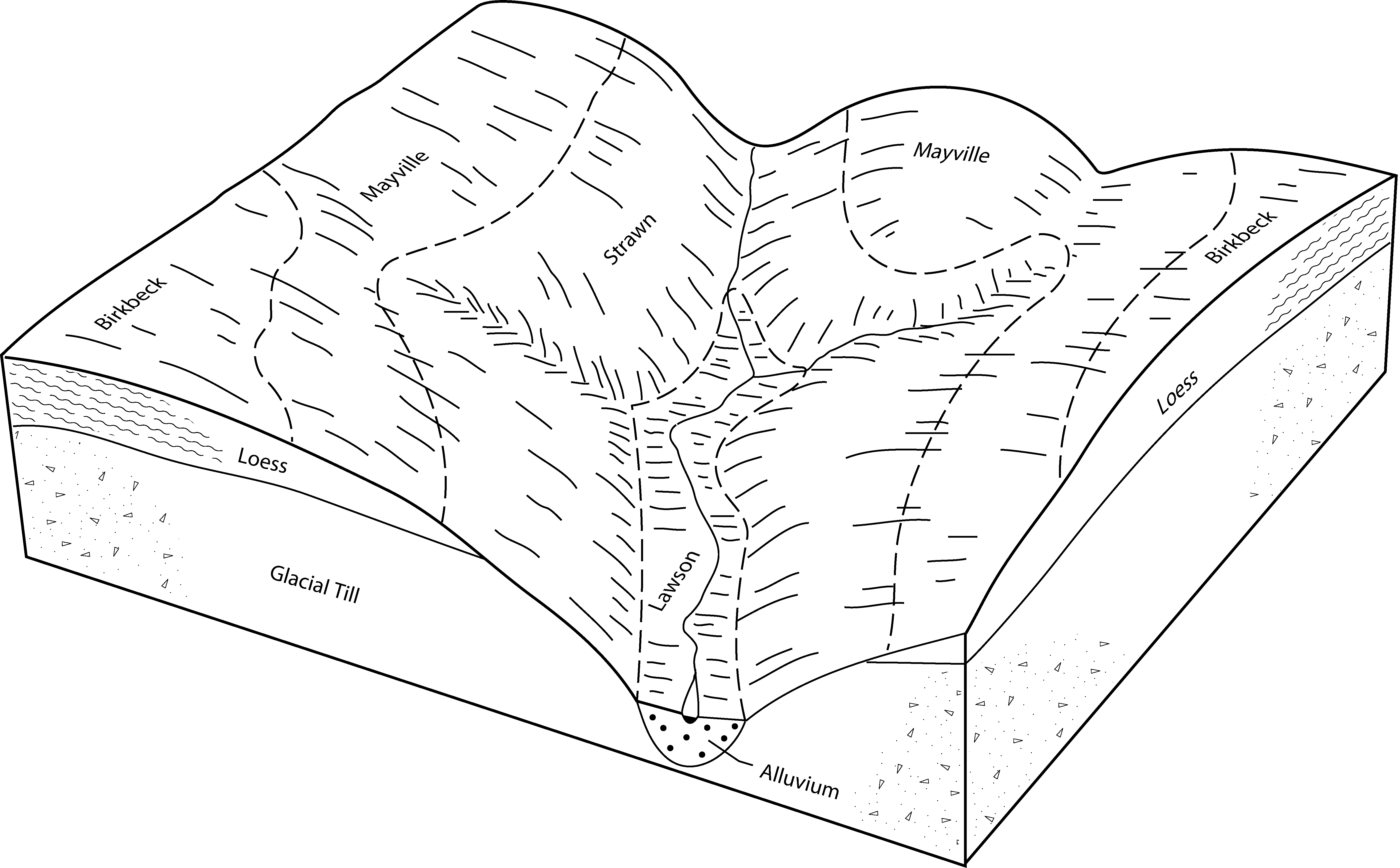
Birkbeck silt loam, 0 to 2 percent slopes | BbA | 1284 | 1612804 | 1r47y | in041 | 1958 | 1:15840 |
Birkbeck silt loam, 2 to 6 percent slopes, moderately eroded | BbB2 | 309 | 1612806 | 1r480 | in041 | 1958 | 1:15840 |
Birkbeck silt loam, 2 to 6 percent slopes, slightly eroded | BbB1 | 118 | 1612805 | 1r47z | in041 | 1958 | 1:15840 |
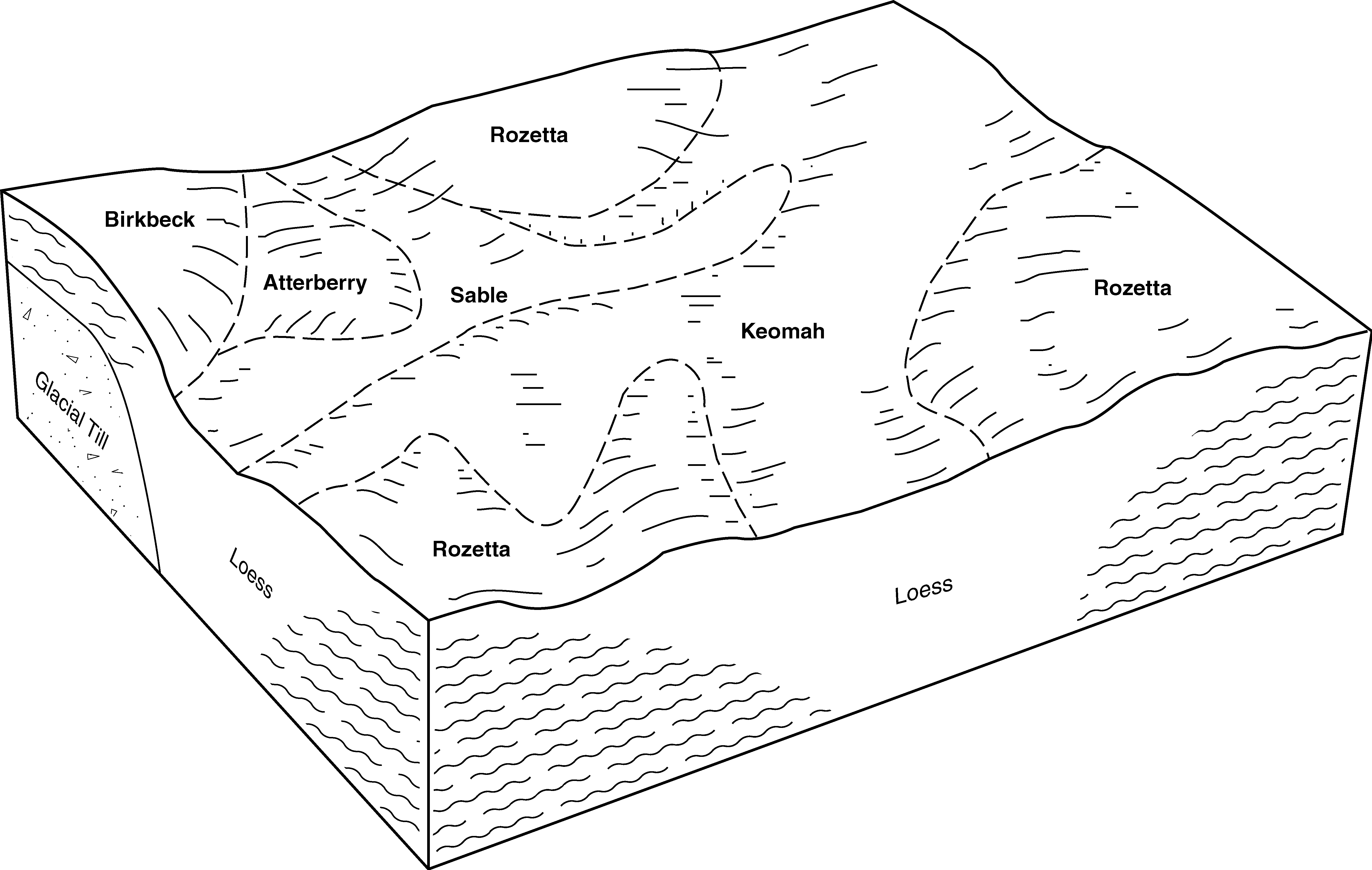
Birkbeck silt loam, 2 to 6 percent slopes, eroded | BhyB2 | 2486 | 242313 | 844k | in045 | 1999 | 1:12000 |
Birkbeck silt loam, 0 to 2 percent slopes | BhyA | 642 | 242310 | 844g | in045 | 1999 | 1:12000 |
Xenia-Birkbeck silt loams, 2 to 6 percent slopes, eroded | XgB2 | 17765 | 163083 | 2w0w5 | in107 | 1984 | 1:15840 |
Birkbeck silt loam, 0 to 2 percent slopes | BbA | 1201 | 1612953 | 1r4dr | in161 | 1958 | 1:15840 |
Birkbeck silt loam, 2 to 6 percent slopes, slightly eroded | BbB1 | 76 | 1612954 | 1r4ds | in161 | 1958 | 1:15840 |
Birkbeck silt loam, 2 to 6 percent slopes, moderately eroded | BbB2 | 13 | 1612955 | 1r4dt | in161 | 1958 | 1:15840 |
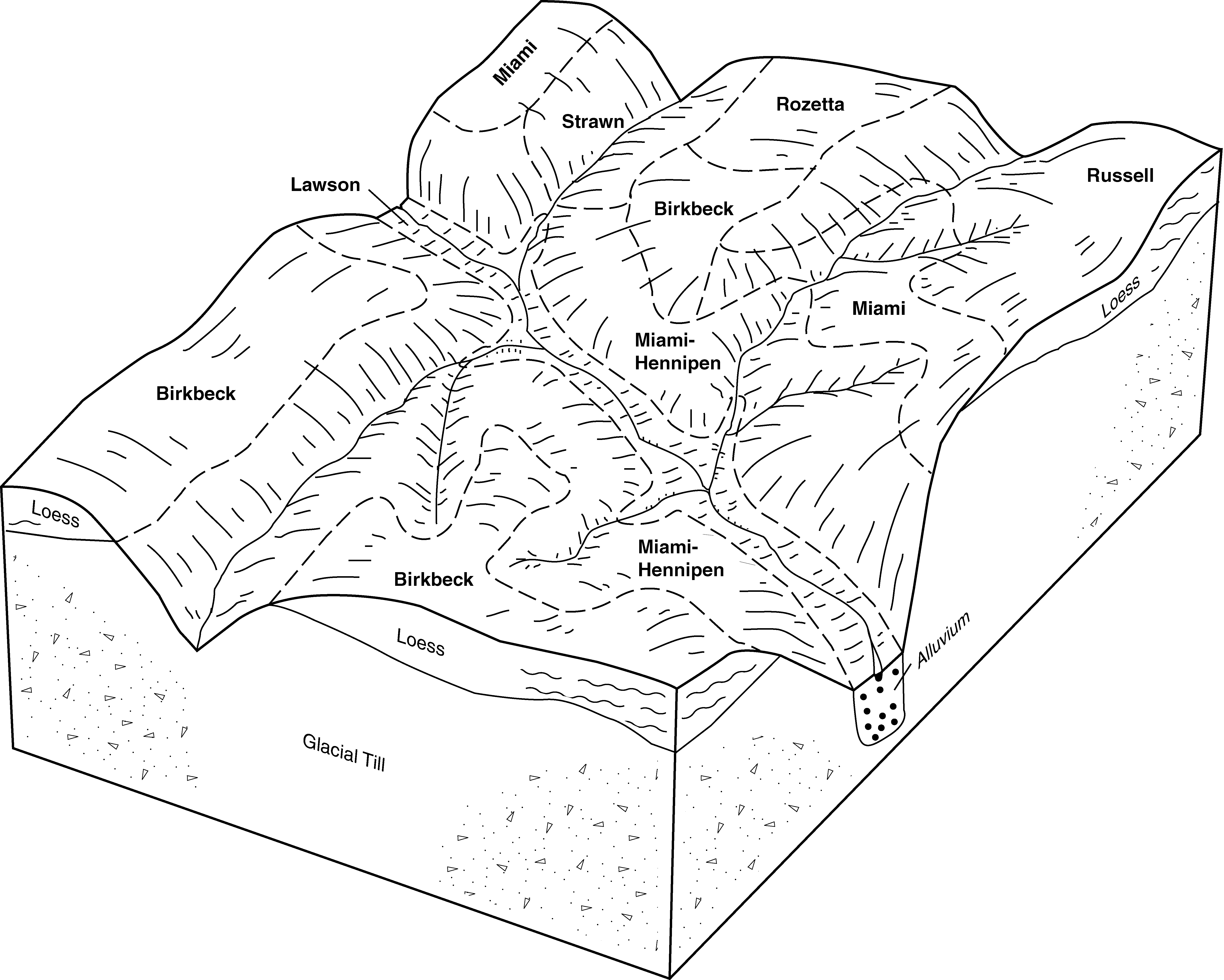
Birkbeck silt loam, 0 to 2 percent slopes | BhA | 927 | 171944 | 5rxl | oh027 | 1999 | 1:12000 |
Birkbeck silt loam, 2 to 6 percent slopes | BhB | 762 | 171945 | 5rxm | oh027 | 1999 | 1:12000 |
Birkbeck silt loam, 1 to 4 percent slopes | BbB | 2207 | 169280 | 5p4n | oh057 | 1974 | 1:15840 |
Birkbeck silt loam, 2 to 6 percent slopes | BcB | 10 | 1857474 | 20bvj | oh057 | 1974 | 1:15840 |
Birkbeck silt loam, 1 to 4 percent slopes | BbB | 408 | 171318 | 5r8d | oh165 | 1967 | 1:20000 |
Birkbeck-Urban land complex, 1 to 4 percent slopes | BbUB | 69 | 3422223 | 31ghc | oh165 | 1967 | 1:20000 |
Urban land-Birkbeck complex, 1 to 4 percent slopes | UBbB | 23 | 3422224 | 31ghd | oh165 | 1967 | 1:20000 |