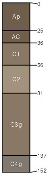
Westerville silt loam, 0 to 2 percent slopes, frequently flooded
Westerville
(100%)
Wet Floodplain Woodland
Aeric Fluvaquents
Somewhat poorly drained
Hydric: No
PAWS: 31 cm
flood plains
SSA
Scale
Published
Export
mo199
1:24,000
1969
2025-09-02