Areas with less stones on the surface (%)
Hydric:
PAWS: NA |

|
|
Less than 35 percent rock fragments in the surface and subso (%)
Hydric:
PAWS: NA |
|
|
|
Bedrock at 10 to 20 inches (%)
Hydric:
PAWS: NA |
|
|
|
Fine sandy loam or loam surface layer (%)
Hydric:
PAWS: NA |
|
|
|
Moderately well drained soils (%)
Hydric:
PAWS: NA |
|
|
|
Castalia (40%)
Shallow Limestone Drift
Inceptic Haprendolls
Well drained
Hydric: No
PAWS: 4 cm |
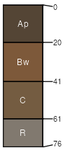
lake plains / Summit lake plains / Shoulder lake plains / Backslope reefs
|
|
Marblehead (30%)
Shallow Limestone Drift
Lithic Hapludolls
Somewhat excessively drained
Hydric: No
PAWS: 3 cm |
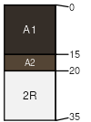
lake plains / Summit lake plains / Shoulder lake plains / Backslope reefs
|
|
Urban land (25%)
Hydric: Unranked
PAWS: NA |
|
|
|
Rock outcrops (5%)
Hydric: Unranked
PAWS: NA |
lake plains / Summit lake plains / Shoulder reefs
|
|