Gilpin-Westmoreland silt loams, 6 to 12 percent slopes, moderately eroded
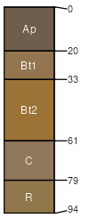
Gilpin
(60%)
Moist Ridge
Typic Hapludults
Well drained
Hydric: No
PAWS: 13 cm
hills / Summit
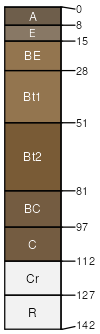
Westmoreland
(30%)
Moist Ridge
Ultic Hapludalfs
Well drained
Hydric: No
PAWS: 19 cm
hills / Summit
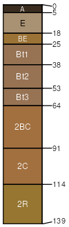
Wellston
(3%)
Hydric:
PAWS: NA
hills
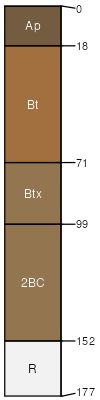
Zanesville
(3%)
Hydric:
PAWS: NA
hills
severely eroded areas
(2%)
Hydric:
PAWS: NA
stones on the surface
(2%)
Hydric:
PAWS: NA
SSA
Scale
Published
Export
oh111
1:16,000
1968
2025-09-02