|
|
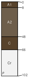
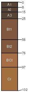
Kernville (30%)
Loamy Low Hills
Typic Xeropsamments
Somewhat excessively drained
Hydric: No
PAWS: 2 cm |
mountain slopes / Backslope
|
|
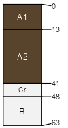
Hogeye (20%)
Thermic Granitic Hills
Typic Xerorthents
Well drained
Hydric: No
PAWS: 7 cm |
mountain slopes / Backslope
|
|
Faycreek (5%)
Psammentic Haploxerolls
Hydric: No
PAWS: NA |
|
|
Rock outcrop (4%)
Hydric: No
PAWS: NA |

|
|
Tweedy (3%)
Typic Argixerolls
Hydric: No
PAWS: NA |
|
|
Unnamed (1%)
Hydric: Yes
PAWS: NA |
flood plains mountain valleys
|
|
Riverwash (1%)
Hydric: Yes
PAWS: NA |
|
|
|
Xerofluvents (1%)
Hydric: No
PAWS: NA |
mountain valleys flood plains
|
|