Lovedale fine sandy loam, 5 to 12 percent slopes, severely eroded
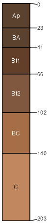
Lovedale
(80%)
Sandy Loam Upland
Udic Argiustolls
Well drained
Hydric: No
PAWS: 25 cm
paleoterraces
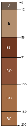
Grant
(5%)
Loamy Upland
Udic Argiustolls
Well drained
Hydric: No
PAWS: 23 cm
paleoterraces
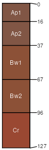
Nobscot
(5%)
Deep Sand Shrubland
Arenic Paleustalfs
Well drained
Hydric: No
PAWS: 17 cm
dunes
dune fields
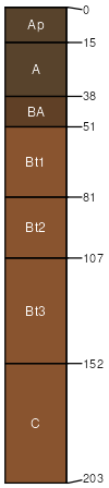
Dill
(5%)
Sandy Loam Upland
Typic Haplustepts
Well drained
Hydric: No
PAWS: 13 cm
hillslopes / Backslope
Teller
(5%)
Loamy Upland
Udic Argiustolls
Well drained
Hydric: No
PAWS: 34 cm
paleoterraces
SSA
Scale
Published
Export
ok011
1:24,000
1965
2025-08-29