Paxton-Charlton-Urban land complex, 3 to 15 percent slopes
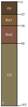
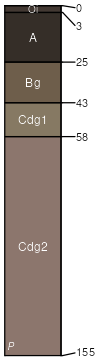
Paxton
(40%)
Well Drained Dense Till Uplands
Oxyaquic Dystrudepts
Well drained
Hydric: No
PAWS: 18 cm
hills / Summit
hills / Shoulder
hills / Backslope
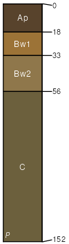
Charlton
(20%)
Well Drained Till Uplands
Typic Dystrudepts
Well drained
Hydric: No
PAWS: 19 cm
hills / Summit
hills / Shoulder
hills / Backslope
Urban land
(20%)
Hydric: Unranked
PAWS: 0 cm
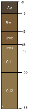
Woodbridge
(9%)
Aquic Dystrudepts
Moderately well drained
Hydric: No
PAWS: 22 cm
hills / Summit
hills / Backslope
hills / Footslope
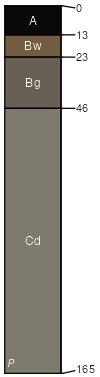
Ridgebury
(6%)
Aeric Endoaquepts
Poorly drained
Hydric: Yes
PAWS: 20 cm
depressions
Whitman
(5%)
Typic Humaquepts
Very poorly drained
Hydric: Yes
PAWS: 17 cm
depressions
SSA
Scale
Published
Export
ma609
1:16,000
1980
2025-09-05