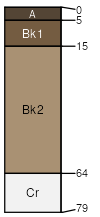
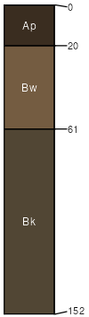
Turnercrest (30%)
Sandy - North
Typic Ustorthents
Well drained
Hydric: No
PAWS: 11 cm |
|
|
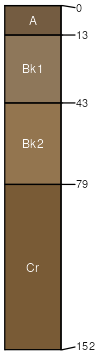
Ucross (25%)
Thin Upland
Typic Ustorthents
Well drained
Hydric: No
PAWS: 10 cm |
|
|
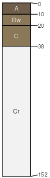
Draknab (15%)
Lowland 22-30 PZ
Typic Ustifluvents
Excessively drained
Hydric: No
PAWS: 11 cm |
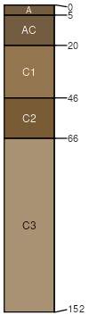
flood plains / Footslope drainageways / Footslope drainageways / Toeslope
|
|
Mittenbutte (9%)
Shallow Loamy - North
Typic Ustorthents
Somewhat excessively drained
Hydric: No
PAWS: 6 cm |
ridges / Summit ridges / Shoulder
|
|
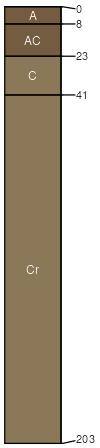
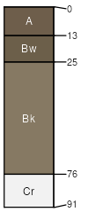
Jayem (8%)
Thin Upland
Typic Haplustolls
Well drained
Hydric: No
PAWS: 22 cm |

|
|
Shingle (6%)
Shallow Loamy - North
Typic Ustorthents
Well drained
Hydric: No
PAWS: 8 cm |
ridges / Summit ridges / Shoulder
|
|
Sodawells (3%)
Lowland 22-30 PZ
Typic Ustifluvents
Well drained
Hydric: No
PAWS: 15 cm |
|
|
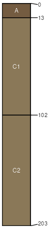
Coaliams (2%)
Lowland 22-30 PZ
Fluventic Haplustolls
Well drained
Hydric: No
PAWS: 26 cm |
|
|
Colsavage (2%)
Clayey - North
Typic Haplustepts
Well drained
Hydric: No
PAWS: 12 cm |
|
|