Burnel-Nythar complex, 2 to 8 percent slopes
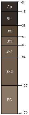
Burnel
(75%)
Upland Sagebrush Shrubland Group
Vertic Argiustolls
Well drained
Hydric: No
PAWS: 24 cm
drainageways
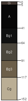
Nythar
(15%)
Bottomland Group
Cumulic Endoaquolls
Very poorly drained
Hydric: Yes
PAWS: 24 cm
drainageways
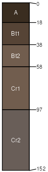
Billman
(5%)
Upland Shrubland Group
Typic Argiustolls
Well drained
Hydric: No
PAWS: 10 cm
plains
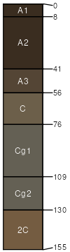
Enbar
(5%)
Subirrigated Grassland
Cumulic Haplustolls
Somewhat poorly drained
Hydric: No
PAWS: 23 cm
flood plains
SSA
Scale
Published
Export
mt637
1:24,000
2014
2025-08-31